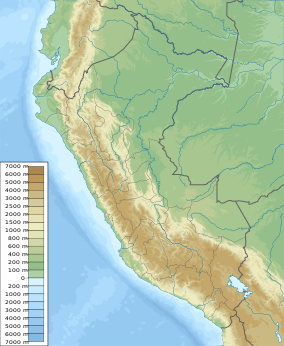
San Matías–San Carlos Protection Forest
This article needs additional citations for verification. (December 2009) |
| San Matías–San Carlos Protection Forest | |
|---|---|
| Bosque de Protección San Matías-San Carlos | |
IUCN category VI (protected area with sustainable use of natural resources) | |
| Location | Pasco Region, Peru |
| Coordinates | 10°33′32″S 74°59′35″W / 10.559°S 74.993°W[1] |
| Area | 1,458 km2 (563 sq mi) |
| Established | 1987 |

The San Matías–San Carlos Protection Forest (Bosque de Protección San Matías-San Carlos) is a national forest situated in Pasco Region, Peru. It is a forest set aside to preserve the soils and to protect infrastructure, towns, and agricultural grounds against the effects of the water erosion, huaycos, streams or floods. It lies within the Peruvian Yungas and Ucayali moist forests ecoregions.[2]
It also allows for the maintenance and development of the cultural values of the native communities, such as the Ashaninkas, and Amueshas.
References[edit]
- ^ "San Matias San Carlos Protection Forest". protectedplanet.net.
- ^ Olson, D. M, E. Dinerstein; et al. (2001). "Terrestrial Ecoregions of the World: A New Map of Life on Earth". BioScience. 51 (11): 933–938. doi:10.1641/0006-3568(2001)051[0933:TEOTWA]2.0.CO;2.
{{cite journal}}: CS1 maint: multiple names: authors list (link)
See also[edit]

