Bosque de Pómac Historic Sanctuary
| Bosque de Pómac Historic Sanctuary | |
|---|---|
| Santuario Histórico Bosque de Pómac | |
 Partial view of the forest with Huaca El Loro archaeological site. | |
| Location | Ferreñafe Province, Lambayeque |
| Nearest city | Ferreñafe |
| Area | 5,887.38 ha (58.87 km2) |
| Established | 2001 |
| Governing body | SERNANP |
| Website | Santuario Histórico Bosque de Pómac |
Bosque de Pómac Historic Sanctuary (Spanish: Santuario Histórico Bosque de Pómac) is a protected area in Peru located in the region of Lambayeque.[1] This area preserves part of the Tumbes-Piura dry forests and several pyramids built by Pre-Columbian cultures.[1][2]
Geography[edit]
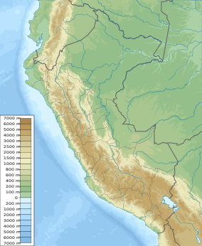
Bosque de Pómac is located in the district of Pitipo, Ferreñafe Province, in the northern Peruvian region of Lambayeque.[1] This area is in a coastal plain, part of the Pacific coast tropical desert, and also in the middle valley of the La Leche river.[1]
Ecology[edit]
The area is densely covered by a tropical dry forest ecosystem, dominated by trees of the genus Prosopis.[1][2] Birds seen in the area include: the Peruvian thick-knee, the burrowing owl, the Amazilia hummingbird, etc.[1]
Archaeology[edit]
There are 36 Pre-Columbian pyramids inside the area, which is an important source of archaeological discoveries, especially from the Sican culture.[1]
References[edit]
See also[edit]
- Batán Grande
- Iperu, tourist information and assistance
- Tourism in Peru
- Natural and Cultural Peruvian Heritage
- Sican culture

