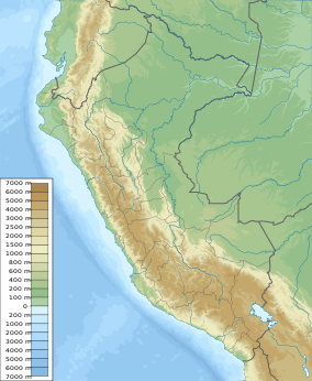
Alto Mayo Protection Forest
| Alto Mayo Protection Forest | |
|---|---|
| Bosque de Protección Alto Mayo | |
IUCN category VI (protected area with sustainable use of natural resources) | |
 Alto Mayo Forest viewed from the Abra Patricia pass. | |
| Location | San Martin and Amazonas |
| Coordinates | 5°38′35″S 77°42′00″W / 5.643°S 77.70°W[1] |
| Area | 1,820 km2 (700 sq mi; 182,000 ha) |
| Established | July 23, 1987 |
| Governing body | SERNANP |
The Alto Mayo Protection Forest (Spanish: Bosque de Protección Alto Mayo) is an area of protected forest land in northern Peru. It is located in Rioja and Moyobamba provinces within the region of San Martin, with a small part in Rodriguez de Mendoza province, in the region of Amazonas.[2] This area preserves a portion of the tropical yungas forest in the upper Mayo River basin, while protecting soil and water from erosion by deforestation, as the area is the water supply of populations in the Mayo valley.[2][3]
History[edit]
In 1963, the Peruvian government granted protection over the area declaring it the Alto Mayo National Forest by Law No 442; however, in the 1970s, many people started to occupy the area and clear the pristine forests.[4] Moreover, workers that build a road across the national forest, began to hunt individuals of yellow-tailed woolly monkey for their meat.[4] The government tried to control the situation by modifying the original law, declaring under protection only the forests in the upper part of the valley; the rest of the former national forest was declared land for free agricultural use.[4]
The rediscovery of the yellow-tailed woolly monkey in 1974 in nearby areas attracted efforts of research and conservation to the national forest.[2][4]
In 1977, the local office of the Ministry of Agriculture attempts to establish boundaries and a protection category for the forest, but the initiative was forgotten.[4]
In 1979, a main road connecting the eastern forest lands with the Pacific coast (Carretera Marginal de la Selva) is opened. The same year, another free use zone is declared in lands proposed for conservation within the national forest.[2][4]
Between 1974 and 1983, several research projects on local fauna and forest ecology were conducted, all reaching the conclusion that the area should be given conservation priority.[4]
The initiative for park delimitation and protection was resumed in 1984; however, it was in 1987 that the forest was protected by a decree.[4]
Geography[edit]
The protected area covers 1,820 square kilometres (450,000 acres) of forest land along the upper River Mayo basin.[2] The protected area also covers part of Moyobamba district within the province of Moyobamba; Rioja, Elias Soplin Vargas, Nueva Cajamarca, Awajun and Pardo Miguel districts within the province of Rioja; and a small part of the Vista Alegre district, within the province of Rodriguez de Mendoza, in the neighboring region of Amazonas.[5]
This is a mountainous area, as it is located in the eastern part of the Andes, featuring slope grades greater than 70% in some parts.[2]
The area and its surroundings are part of the river Mayo upper watershed and eleven of the Mayo's main tributaries originate within the Alto Mayo Protected Forest.[2]
Ecology[edit]
The Alto Mayo Protection Forest protects part of the Peruvian Yungas ecoregion.[2]

Fauna[edit]
Some of the mammals reported in the area are: the yellow-tailed woolly monkey, the spectacled bear, the cougar, the Peruvian night monkey, the Rio Mayo titi and the giant armadillo.[3]
Birds reported in the protection forest are: the Andean cock-of-the-rock, the oilbird, the king vulture, the equatorial greytail, the long-whiskered owlet, the swallow-tailed kite, the razor-billed curassow, the Andean guan, the speckled chachalaca, the blue-grey tanager, the white-throated toucan, etc.[2][3]
Flora[edit]
Among the plant species found in the protected area are trees like: cedro (Cedrela odorata), requia (Guarea trichilioides), rifari (Miconia longifolia), ojé (Ficus insipida), cetico (Cecropia sp.), uvilla (Pourouma cecropiifolia), tornillo (Cedrelinga cateniformis), cascarilla (Cinchona pubescens), palo seco (Alseis peruviana), huamansamana (Dipteryx alata), amasisa (Erythrina fusca), quinilla (Manilkara bidentata), marupa (Simarouba amara), yurac ciprana (Guatteria hyposericea), zapote (Quararibea cordata), guayacán (Tabebuia ochracea), catahua (Hura crepitans), mashonaste (Clarisia racemosa), moena negra (Ocotea sp.); orchids like: Phragmipedium boisserianum, Masdevallia vargasii, etc.[2][6]
Environmental issues[edit]
The main threats to this protected area are: the illegal settlement of farmers inside the forest who clear the land for agriculture; the extraction of wild orchids and animals for sale; timber extraction and unsustainable fishing practices.[2]
References[edit]
- ^ "Alto Mayo Protection Forest". protectedplanet.net.
- ^ a b c d e f g h i j k "Alto Mayo Protection Forest - Park Profile - General information". parkswatch.org. Retrieved 2017-05-11.
- ^ a b c "Alto Mayo - Servicio Nacional de Áreas Naturales Protegidas por el Estado". www.sernanp.gob.pe (in Spanish). Retrieved 2016-01-31.
- ^ a b c d e f g h Plan Maestro del Bosque de Protección Alto Mayo 2008 – 2013 (PDF) (in Spanish). INRENA. 2008. pp. 14–16.[permanent dead link]
- ^ Plan Maestro del Bosque de Protección Alto Mayo 2008 – 2013 (PDF) (in Spanish). INRENA. 2008. p. 24.[permanent dead link]
- ^ "Collections from the Alto Mayo Expeditions". www.sacha.org. Retrieved 2017-05-11.

