
Kellerman, Alabama
Kellerman, Alabama | |
|---|---|
 Workers' housing at the Kellerman mines | |
 Kellerman, Alabama  Kellerman, Alabama | |
| Coordinates: 33°20′26″N 87°18′17″W / 33.34056°N 87.30472°W | |
| Country | United States |
| State | Alabama |
| County | Tuscaloosa |
| Elevation | 538 ft (164 m) |
| Time zone | UTC-6 (Central (CST)) |
| • Summer (DST) | UTC-5 (CDT) |
| ZIP code | 35468 |
| Area code(s) | 205, 659 |
| GNIS feature ID | 121109[1] |
Kellerman is an unincorporated community in Tuscaloosa County, Alabama, United States, six miles (9.7 km) north of Brookwood. The community formed around a coal mining operation owned by the Central Iron & Coal Co. of New York. Kellerman was a company town, and the houses were owned by the company. When mining operations ceased in 1962, almost all of the nearly 5,000 residents eventually moved away leaving less than 10 houses remaining.[citation needed] The Kellerman post office with ZIP code 35468, which opened on August 6, 1902, is now located at the Alabama Mining Museum in Dora, Alabama [2][3] Kellerman was most likely named for a civil engineer with the Kellerman Mine Company.[4]
Notable person[edit]
- Dee Miles, baseball player
References[edit]
- ^ "Kellerman". Geographic Names Information System. United States Geological Survey, United States Department of the Interior.
- ^ United States Postal Service (2012). "USPS - Look Up a ZIP Code". Retrieved February 15, 2012.
- ^ "Postmaster Finder - Post Offices by ZIP Code". United States Postal Service. Archived from the original on October 17, 2020. Retrieved June 5, 2013.
- ^ Foscue, Virginia (1989). Place Names in Alabama. Tuscaloosa: The University of Alabama Press. p. 79. ISBN 0-8173-0410-X.
Municipalities and communities of Tuscaloosa County, Alabama, United States | ||
|---|---|---|
| Cities | 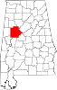 | |
| Towns | ||
| CDPs | ||
| Other unincorporated communities | ||
| Ghost town | ||
| Footnotes | ‡This populated place also has portions in an adjacent county or counties | |
This Tuscaloosa County, Alabama state location article is a stub. You can help Wikipedia by expanding it. |