
Abernant, Alabama
Abernant, Alabama | |
|---|---|
 Abernant, Alabama  Abernant, Alabama | |
| Coordinates: 33°17′25″N 87°11′53″W / 33.29028°N 87.19806°W | |
| Country | United States |
| State | Alabama |
| County | Tuscaloosa |
| Elevation | 466 ft (142 m) |
| Time zone | UTC-6 (Central (CST)) |
| • Summer (DST) | UTC-5 (CDT) |
| ZIP code | 35440 |
| Area codes | 205, 659 |
| GNIS feature ID | 112892[1] |
Abernant is an unincorporated community in Tuscaloosa County, Alabama, United States. Abernant is located along Alabama State Route 216, 3.6 miles (5.8 km) west of Lake View. Abernant has a post office with ZIP code 35440.[2][3]
Shares a name with Welsh settlements of Abernant, Rhondda Cynon Taf, Abernant, Powys and Abernant, Carmarthenshire. In the Welsh language, “Aber” is translated as Estuary and “Nant” is translated as Stream.
History[edit]
Abernant was named for a local family which also lent their name to a nearby coal company.[4] A post office has been in operation at Abernant since 1902.[5]
Demographics[edit]
Abernant Census Division (1960-)[edit]
| Census | Pop. | Note | %± |
|---|---|---|---|
| 1960 | 1,819 | — | |
| 1970 | 1,958 | 7.6% | |
| 1980 | 3,064 | 56.5% | |
| 1990 | 4,398 | 43.5% | |
| 2000 | 7,013 | 59.5% | |
| 2010 | 9,955 | 42.0% | |
| U.S. Decennial Census[6] | |||
Abernant village has never reported a population figure separately on the U.S. Census as an unincorporated community. However, the census division formed in 1960 was named for Abernant (superseding the former name of Parsons-Yolande, Precinct 12 of Tuscaloosa County).[7][8]
References[edit]
- ^ "Abernant". Geographic Names Information System. United States Geological Survey, United States Department of the Interior.
- ^ United States Postal Service (2012). "USPS - Look Up a ZIP Code". Retrieved February 15, 2012.
- ^ "Postmaster Finder - Post Offices by ZIP Code". United States Postal Service. Archived from the original on April 28, 2019. Retrieved June 4, 2013.
- ^ Foscue, Virginia O. (1989). Place Names in Alabama. University of Alabama Press. p. 5. ISBN 978-0-8173-0410-2.
- ^ "Tuscaloosa County". Jim Forte Postal History. Retrieved February 9, 2015.
- ^ "U.S. Decennial Census". Census.gov. Retrieved June 6, 2013.
- ^ Census data
- ^ Census data
Municipalities and communities of Tuscaloosa County, Alabama, United States | ||
|---|---|---|
| Cities | 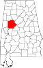 | |
| Towns | ||
| CDPs | ||
| Other unincorporated communities | ||
| Ghost town | ||
| Footnotes | ‡This populated place also has portions in an adjacent county or counties | |
This Tuscaloosa County, Alabama state location article is a stub. You can help Wikipedia by expanding it. |