
Yule Ranch
Yule Ranch | |
|---|---|
| Coordinates: 46°33′34″N 103°48′13″W / 46.55944°N 103.80361°W | |
| Country | |
| State | North Dakota |
| County | Golden Valley and Slope |
Yule Ranch (now Three V Ranch) is a historic property in Golden Valley[1] and Slope counties in North Dakota, United States.[2]
Background[edit]
Founded in 1883 by John Pender[3] as the JXL Ranch or Yule Ranch,[4] historically the ranch was a multi-state cattle operation.[5] After changing hands it was renamed as the VVV Ranch in 1937. The VVV brand had previously been established in 1898 at another ranch.[3] At one time it was home to a small community including a post office bearing the name Yule, a general store, and a stage coach stop. The post office closed in 1910.[6] Today the ranch raises Angus cattle, grows cash crops, and caters to hunters looking for mule and whitetail deer, coyotes and sharptail grouse. Theodore Roosevelt enjoyed staying at the ranch[7] and conducted one of his last bison hunting excursions there.[1][3]
Three V Crossing[edit]
Three V Crossing | |
|---|---|
 Three V Crossing | |
| Coordinates | 46°33′25″N 103°47′33″W / 46.5569°N 103.7925°W |
| Carries | Vvv Road |
| Crosses | Little Missouri River |
| Locale | Slope County, North Dakota. GNIS feature ID 1035208[8] |
| Characteristics | |
| Design | Low-water crossing |
| Material | Concrete |
| Location | |
 | |
A major landmark on the ranch is Three V Crossing, a low-water crossing on the Little Missouri River 19.1 miles (30.7 km) north-northeast of Marmarth and 27 miles (43 km) northwest of Amidon[9] within the Little Missouri National Grassland in an unorganized part of Slope County in T. 135 N R. 105 W.[10]
The construction of the crossing was jointly funded by the National Forest Service program and the county.[9][11] It is part of Forest Development Road (FDR) 7741.[12] Water underneath passes through concrete box culverts.[13] Access across the Missouri River is unreliable when waters are high.[14]
On the east side of the crossing, a geological layer known as the Rhame Bed is characterized by having yellowish sand, with very pale green material underneath.[15]
See also[edit]
References[edit]
- ^ a b "Ranch Favored by Roosevelt is a Cowboy Hall Inductee". The Dickinson Press. August 2, 2006.
- ^ Kopp, Mike (July 21, 2019). "The Little Missouri River is a great challenge to cross". beautifulbadlandsnd.com. Retrieved March 24, 2020.
- ^ a b c "VVV Ranch – Weinreis Brothers entry". North Dakota Cowboy Hall of Fame. 2006.
- ^ "Alex LaSotta entry". North Dakota Cowboy Hall of Fame. 2003. Retrieved November 27, 2020.
- ^ "Open Range Ranching in North Dakota 1870s–1910s" (PDF). history.nd.gov. p. 46.
- ^ Williams, Mary Ann Barnes (1972). "Yule (Slope County) entry". Origins of North Dakota Place Names. McLean County Historical Society. p. 201.
- ^ Hagedorn, Hermann (1921). Roosevelt in the Bad Lands. Vol. 1. Houghton Mifflin. p. 262. ISBN 9780722288740.
- ^ "Three V Crossing". Geographic Names Information System. United States Geological Survey, United States Department of the Interior.
- ^ a b "Slope (newspaper clipping}". The Bismarck Tribune. December 16, 1996.
- ^ "Slope County Map" (PDF). ND DOT website.
- ^ "Golden Valley Board of County Commissioners Minutes". January 3, 2002. pp. 5 and 21.
- ^ "Interactive map of Three V Crossing". Forest Service.
- ^ "Transcript of Alternatives Public Workshop". Little Missouri River Crossing Environmental Impact Statement. July 22, 2008. p. 17.
- ^ Kopp, Mike (October 1, 2015). "No Bridge no problem Just Drive Across the Little Missouri River". beautifulbadlandsnd.com.
- ^ Wehrfritz, Barbara D. (1978). The Rhame bed (Slope Formation, Paleocene), a silcrete and deep weathering profile, in southwestern North Dakota (M.S. Thesis). p. 52.
Municipalities and communities of Slope County, North Dakota, United States | ||
|---|---|---|
| Cities | 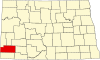 | |
| Unincorporated communities |
| |