
Wikipedia talk:WikiProject Oregon/Archive 26
| This is an archive of past discussions. Do not edit the contents of this page. If you wish to start a new discussion or revive an old one, please do so on the current talk page. |
| Archive 20 | ← | Archive 24 | Archive 25 | Archive 26 | Archive 27 | Archive 28 | → | Archive 30 |
Image request: MLK, Jr. statue by convention center
- The following discussion is closed. Please do not modify it. Subsequent comments should be made in a new section.
If you happen to find yourself near the convention center and have time to photograph the MLK, Jr. statue, I could use a fair use upload for the article The Dream (sculpture). Thanks! ---Another Believer (Talk) 18:07, 16 March 2016 (UTC)
- What do I need to keep in mind for fair use/copyvio? I mean, does it need to be incidental to the overall picture? (see also: Portlandia headaches). I was going to roll out and be near there in the next hour. tedder (talk) 18:37, 16 March 2016 (UTC)
- If you can just take a picture of the front of the statue, we can talk about how to upload it properly. Go here, choose and name/describe the file, then click on "This is a copyrighted, non-free work, but I believe it is Fair Use". Under "This file will be used in the following article", enter "The Dream (sculpture)". Click on "This is a depiction of a copyrighted three-dimensional work or building", then "Other 3-D creative work (sculpture) in the dropbox below. For creator and date, use "Michael Florin Dente" and 1998. Then click on "The article as a whole is dedicated specifically to this work." You can choose what you want to say for the author's (your) name; for source just say "Self". Click on "The author of the image has released the photographic work under a free license, or it is in the public domain". Under "In view of this, please explain how the use of this file will be minimal", says "Only one image will be used once". This should take care of the license. Thank you so much for your assistance! Will be nice to see this good article illustrated with a photo of the work itself. ---Another Believer (Talk) 18:46, 16 March 2016 (UTC)
- Thanks. You can help me defend it if necessary. I suspect Portlandia was downrezzed for that reason. tedder (talk) 18:58, 16 March 2016 (UTC)
- Yeah, sometimes a bot will come by and reduce the size of the image, but it is not something you need to worry about during the upload process. Thanks again! ---Another Believer (Talk) 19:26, 16 March 2016 (UTC)
- three photos here (plus the plaque, for your information). Since I should only upload one under FUR, tell me which you prefer. tedder (talk) 21:21, 16 March 2016 (UTC)
- I prefer the first image. I upload images of plaque to Commons all the time, but I think a couple have been deleted (I guess text on plaques can be copyrighted? *eye roll*). You can try uploading the plaque image to Commons if you want. Otherwise, the first image uploaded locally under fair use would be awesome. Thank you so much for your assistance! Glad it worked out -- I was anticipating an unanswered request for a long time. Much appreciated. ---Another Believer (Talk) 21:40, 16 March 2016 (UTC)
- I was cycling across the river, so it was only about two minutes out of my way to snap the pics. I kinda liked the last photo- the Portland and Oregon flags are at full mast. But the sun was tricky too. I've spent more time editing and uploading than it took to take the photos. I added the image to the article, feel free to adjust as you like. tedder (talk) 21:54, 16 March 2016 (UTC)
- Fantastic! Thanks again. I appreciate your time and willingness to help. ---Another Believer (Talk) 21:58, 16 March 2016 (UTC)
- I was cycling across the river, so it was only about two minutes out of my way to snap the pics. I kinda liked the last photo- the Portland and Oregon flags are at full mast. But the sun was tricky too. I've spent more time editing and uploading than it took to take the photos. I added the image to the article, feel free to adjust as you like. tedder (talk) 21:54, 16 March 2016 (UTC)
- I prefer the first image. I upload images of plaque to Commons all the time, but I think a couple have been deleted (I guess text on plaques can be copyrighted? *eye roll*). You can try uploading the plaque image to Commons if you want. Otherwise, the first image uploaded locally under fair use would be awesome. Thank you so much for your assistance! Glad it worked out -- I was anticipating an unanswered request for a long time. Much appreciated. ---Another Believer (Talk) 21:40, 16 March 2016 (UTC)
- three photos here (plus the plaque, for your information). Since I should only upload one under FUR, tell me which you prefer. tedder (talk) 21:21, 16 March 2016 (UTC)
- Yeah, sometimes a bot will come by and reduce the size of the image, but it is not something you need to worry about during the upload process. Thanks again! ---Another Believer (Talk) 19:26, 16 March 2016 (UTC)
- Thanks. You can help me defend it if necessary. I suspect Portlandia was downrezzed for that reason. tedder (talk) 18:58, 16 March 2016 (UTC)
- If you can just take a picture of the front of the statue, we can talk about how to upload it properly. Go here, choose and name/describe the file, then click on "This is a copyrighted, non-free work, but I believe it is Fair Use". Under "This file will be used in the following article", enter "The Dream (sculpture)". Click on "This is a depiction of a copyrighted three-dimensional work or building", then "Other 3-D creative work (sculpture) in the dropbox below. For creator and date, use "Michael Florin Dente" and 1998. Then click on "The article as a whole is dedicated specifically to this work." You can choose what you want to say for the author's (your) name; for source just say "Self". Click on "The author of the image has released the photographic work under a free license, or it is in the public domain". Under "In view of this, please explain how the use of this file will be minimal", says "Only one image will be used once". This should take care of the license. Thank you so much for your assistance! Will be nice to see this good article illustrated with a photo of the work itself. ---Another Believer (Talk) 18:46, 16 March 2016 (UTC)
Many of these articles are completely outdated. Would someone take the time to go and update them? MB298 (talk) 03:08, 18 March 2016 (UTC)
- I did one. Passing the baton. tedder (talk) 04:00, 18 March 2016 (UTC)
- Finished entries. Feel free to check the numbers! Grand'mere Eugene (talk) 05:13, 18 March 2016 (UTC)
- Make sure to check out the individual articles- mine was well out of date. tedder (talk) 16:10, 18 March 2016 (UTC)
- I've created maps of the results by county of each ballot measure, which will be inserted into their respective articles soon. MB298 (talk) 01:34, 19 March 2016 (UTC)
 Like ---Another Believer (Talk) 01:56, 19 March 2016 (UTC)
- I've created maps of the results by county of each ballot measure, which will be inserted into their respective articles soon. MB298 (talk) 01:34, 19 March 2016 (UTC)
- Make sure to check out the individual articles- mine was well out of date. tedder (talk) 16:10, 18 March 2016 (UTC)
- Finished entries. Feel free to check the numbers! Grand'mere Eugene (talk) 05:13, 18 March 2016 (UTC)
Book grants
Wikimedia DC is offering up to $300 funding for books needed to create and improve Wikipedia articles. Here is a link if you are interested in applying:
I've requested the following, in case anyone wants to borrow:
Books
|
|---|
|
---Another Believer (Talk) 15:10, 29 March 2016 (UTC)
Confession time: I have twice reverted changes to this article from a user with a single-purpose account, but edit warring is above my pay grade. I'd appreciate anyone else's perspective. Cheers! — Grand'mere Eugene (talk) 23:38, 29 March 2016 (UTC)
I haven't seen an official NRHP source yet, but Arleta Branch Library was reportedly added to the National Register of Historic Places. Feel free to help expand, if interested! --Another Believer (Talk) 17:46, 31 March 2016 (UTC)
I know a couple project members enjoy reducing the number of entries at Category:Oregon articles missing geocoordinate data now and then. If requests are appropriate, I'd appreciate coordinates for Dime Store, Mary's Club (![]() Done), and Three Sisters Tavern, each of which were somewhat recently promoted to Good article status. Thanks for your consideration. ---Another Believer (Talk) 17:55, 31 March 2016 (UTC)
Done), and Three Sisters Tavern, each of which were somewhat recently promoted to Good article status. Thanks for your consideration. ---Another Believer (Talk) 17:55, 31 March 2016 (UTC)
- I'll pitch in -- Mary's Club, done. Lockley (talk) 20:35, 31 March 2016 (UTC)
- Thank you! I still don't understand why sometimes articles with coordinates will allow pushpin maps to be displayed in the infobox, while others do not, but I appreciate your assistance. ---Another Believer (Talk) 21:00, 31 March 2016 (UTC)
- Works
- Doesn't Work
Liberty Bell (Portland, Oregon) (if I try adding "| pushpin_map = Portland downtown")(fixed like this)Mary's Club(fixed)Oregon Theatre(fixed)- The Dougy Center (may not be fixable with the current infobox)
Vera Katz (sculpture)(fixed)Woodstock Mural(fixed)Jiggles(fixed)
These are just from my list of GAs. I think at one point I tried to add pushpin maps to all Oregon outdoor sculpture articles. Sometimes the map would display, other times not, and I only tried adding maps for articles with coordinates. ---Another Believer (Talk) 21:47, 31 March 2016 (UTC)
- All of the ones that work are either in the hidden Category:Coordinates on Wikidata or use
|latitude=and|longitude=.
- The ones that don't work either have no coordinates or are in the hidden Category:Coordinates not on Wikidata. Or, in the case of The Dougy Center, the infobox used does not support
|pushpin_map=. – Jonesey95 (talk) 03:51, 1 April 2016 (UTC)- That is tremendously helpful. Thank you. I know very little about adding coordinates or Wikidata, so I am not sure I'll be able to add pushpin maps to articles. But at least now I know the reason why some work and some don't and I can hope Wikidata will get around to tagging these places at some point. Thanks again for looking into this. ---Another Believer (Talk) 04:26, 1 April 2016 (UTC)
- Also, noting this diff for future reference. ----Another Believer (Talk) 04:28, 1 April 2016 (UTC)
- Well, I wasn't able to replicate your example on Mary's Club, but thanks for fixing Liberty Bell. ----Another Believer (Talk) 04:35, 1 April 2016 (UTC)
- If the coordinates are not on Wikidata, it looks like you have to drop the {{coord}} template from the article and replace any lat/long parameters in the infobox with
|latitude=and|longitude=, in decimal format. Remove any empty lat/long parameters (I think you have to do this; I'm not sure). Then add an appropriate pushpin map and caption. Take a look at the diffs above for examples. Post here if you get stuck. Some infoboxes may work differently from others, or not at all. – Jonesey95 (talk) 06:13, 1 April 2016 (UTC)
- If the coordinates are not on Wikidata, it looks like you have to drop the {{coord}} template from the article and replace any lat/long parameters in the infobox with
Well, I've added maps to dozens of articles now. Thanks again for the tutorial, Jonesey95! ---Another Believer (Talk) 22:38, 1 April 2016 (UTC)
Categories for discussion: Category:2016 establishments in Portland, Oregon, et al.
All are invited to contribute to this discussion regarding Category:2016 establishments in Portland, Oregon and similar categories. ---Another Believer (Talk) 01:06, 4 April 2016 (UTC)
Klamath dams
I hear there's some rumblings about removing them Klamath dams again. Seems like a hot topic, and one we could cover better. Where's the best article to do this? Klamath River? Klamath Basin? Or a new article, like Klamath Economic Restoration Act? (Probably not the latter, since that's just one specific effort in the multi-year effort to get the dams removed.)
If we look northward, I've always felt we should do a better job on the similar issue on the Snake River. Anybody? Finetooth? Little Mountain 5? -Pete (talk) 19:51, 7 April 2016 (UTC)
- Good idea! The article Dam removal is in there too; if that's not the proper place for the full discussion of the Klamath agreement, at least it needs to be brought up to date. --Lockley (talk) 19:55, 7 April 2016 (UTC)
- Yes, agreed. I didn't realize that article had such extensive coverage of specific projects in it. That would be a good place to start. I think also articles with titles like Snake River dam removal and Klamath River dam removal (or perhaps variants that include the word "proposed") would be good to have. I don't think the article on each specific dam should go into great detail, as they would become highly redundant. But maybe for the short term, we should focus on dam removal and the article on each river. I'll probably have a bit of time to put into this tomorrow. Thanks for the interest, Lockley! -Pete (talk) 17:49, 8 April 2016 (UTC)
- Great! For anybody else who might be interested, here is a brief background on the years of cooperative work to reach this agreement. @Peteforsyth:, I will see you over at Dam removal..... — Preceding unsigned comment added by Lockley (talk • contribs) 19:33, 8 April 2016 (UTC)
This newly-created article has received quite a bit of IP editing and vandalism, if project members want to help monitor. If vandalism continues, it may be worth protecting temporarily. ---Another Believer (Talk) 07:03, 2 April 2016 (UTC)
- Note that it's been temporarily protected. MB298 (talk) 00:58, 4 April 2016 (UTC)
- Yes, thanks for noting. I had submitted a request. I also added the "one source" template to the top of the article until I have time to expand further. Some additional sources are posted on the talk page. ---Another Believer (Talk) 01:07, 4 April 2016 (UTC)
Update: Name change to British Overseas Restaurant Corporation. ---Another Believer (Talk) 19:52, 8 April 2016 (UTC)
Pushpin maps for Eugene, Salem, etc.
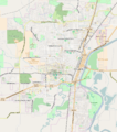
I've been going through articles and adding pushpin maps to Oregon articles with coordinates. We have a pushpin for Oregon, Portland, and downtown Portland, but not (as far as I know) other Oregon cities. This means many non-PDX articles just display a map of Oregon. Does anyone know how to create, or request, pushpin maps for other cities? It would be nice to have one for Eugene and Salem, for starters. --Another Believer (Talk) 19:01, 9 April 2016 (UTC)
- I am submitting a similar note at WikiProject Maps to see if anyone can help or offer a suggestion. ---Another Believer (Talk) 19:04, 9 April 2016 (UTC)
- See Corvallis, Oregon, to see how this can be done. Finetooth (talk) 20:58, 9 April 2016 (UTC)
- I think the fundamental is that we lack a map for e.g. Eugene, Salem, and lack competence / expertise in providing said maps. Were we to have a map, we'd be able to implement it on a known set of waiting articles so that, for instance, the pushpin map on Prometheus (Zach) ends up looking a little more like Stag PDX, providing context atthe city rather than state level. thanks --Tagishsimon (talk) 21:19, 9 April 2016 (UTC)
- The Portland ones are from OpenStreetMap, so maps of Eugene, Salem, Hillsboro, etc. could be obtained the same way, but after that I don't really know what to do. MB298 (talk) 21:32, 9 April 2016 (UTC)
- What to do once you have a map (for which you know the coords of the edges) is easy enough - this. Sadly right now I'm failing to export a map from OpenStreetMap, which either errors (firefox) or returns a blank HTML page (safari). --Tagishsimon (talk) 00:21, 10 April 2016 (UTC)
- The Portland ones are from OpenStreetMap, so maps of Eugene, Salem, Hillsboro, etc. could be obtained the same way, but after that I don't really know what to do. MB298 (talk) 21:32, 9 April 2016 (UTC)
- I think the fundamental is that we lack a map for e.g. Eugene, Salem, and lack competence / expertise in providing said maps. Were we to have a map, we'd be able to implement it on a known set of waiting articles so that, for instance, the pushpin map on Prometheus (Zach) ends up looking a little more like Stag PDX, providing context atthe city rather than state level. thanks --Tagishsimon (talk) 21:19, 9 April 2016 (UTC)
- See Corvallis, Oregon, to see how this can be done. Finetooth (talk) 20:58, 9 April 2016 (UTC)
City boundaries
![]() Question: Would someone more familiar with coordinates and the geography of Eugene and Salem be willing to assist User:Tagishsimon with his goal of defining city maps? Please see this discussion. ---Another Believer (Talk) 03:48, 10 April 2016 (UTC)
Question: Would someone more familiar with coordinates and the geography of Eugene and Salem be willing to assist User:Tagishsimon with his goal of defining city maps? Please see this discussion. ---Another Believer (Talk) 03:48, 10 April 2016 (UTC)


- Per the above conversation, where the pushpin map on Stag PDX is fairly useful, and that on Prometheus (Zach) somewhat useless (it's a blob over the whole of Eugene), the question arises, if I grab a map of Eugene, or Salem, or wherever, what should the bounds of the map be? Downtown? Include the airport? Springfield? So, some guidance as to the location of the top left & bottom right of the map(s) to be produced for each city would be helpful. thanks --Tagishsimon (talk) 03:55, 10 April 2016 (UTC)
- Update: Module:Location map/data/USA Oregon Eugene has been created. Are any editors familiar with Eugene willing to add this map to some articles to see if coordinates work properly? ---Another Believer (Talk) 21:23, 10 April 2016 (UTC)
- @Another Believer: @Tagishsimon: I added it on Autzen Stadium and it seemed to work fine. MB298 (talk) 21:37, 10 April 2016 (UTC)
- Thanks for testing and reporting. ---Another Believer (Talk) 21:38, 10 April 2016 (UTC)
- Excellent. Thanks MB298. I'll doubtless get around to Salem sometime tonight. --Tagishsimon (talk) 21:41, 10 April 2016 (UTC)
- The pin is not on Autzen Stadium. The pin is in Springfield (for me, at least). Autzen Stadium is the green circle above the words "Alton Baker". – Jonesey95 (talk) 11:48, 11 April 2016 (UTC)
- Thanks @Jonesey95:. I think I see what was going on & with luck, now fixed. Please check it again (may need to flush cache) and let me know. Suffice to say, dot now on the left side of the mjor N/S road. --Tagishsimon (talk) 22:51, 11 April 2016 (UTC)
- The pin is not on Autzen Stadium. The pin is in Springfield (for me, at least). Autzen Stadium is the green circle above the words "Alton Baker". – Jonesey95 (talk) 11:48, 11 April 2016 (UTC)
- Excellent. Thanks MB298. I'll doubtless get around to Salem sometime tonight. --Tagishsimon (talk) 21:41, 10 April 2016 (UTC)
- Thanks for testing and reporting. ---Another Believer (Talk) 21:38, 10 April 2016 (UTC)
- @Another Believer: @Tagishsimon: I added it on Autzen Stadium and it seemed to work fine. MB298 (talk) 21:37, 10 April 2016 (UTC)
- Update: Module:Location map/data/USA Oregon Eugene has been created. Are any editors familiar with Eugene willing to add this map to some articles to see if coordinates work properly? ---Another Believer (Talk) 21:23, 10 April 2016 (UTC)
- @Tagishsimon: I added the Eugene map to all articles listed at List of public art in Eugene, Oregon. The pushpins appear to be working correctly. (This file page shows all of the articles using the map.) ---Another Believer (Talk) 21:48, 10 April 2016 (UTC)
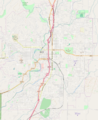
- Good work, AB. So what about bounding coordinates for Salem? 44.9687N to 44.9012N, -123.0754E to -122.9749E? @Jonesey95:, anyone? --Tagishsimon (talk) 22:20, 10 April 2016 (UTC)
- Salem looks like it should be 44.853N to 45.038N, -122.932E to - 123.123E. That will also include the neighboring city of Keizer without stretching the map more than a few percent. – Jonesey95 (talk) 23:43, 11 April 2016 (UTC)
- @Tagishsimon: Suggestion for Salem above (pinging just in case!) :) ---Another Believer (Talk) 23:59, 11 April 2016 (UTC)
- And, per the map to the right, I give you Module:Location map/data/USA Oregon Salem. Good luck. Let me know how it goes. --Tagishsimon (talk) 00:39, 12 April 2016 (UTC)
- Tagishsimon, it looks great on three sides, but one of us must have missed something on the north end. It's cut off. Let me go look at a mapping app.... Yes, I get 45.038N at the north end of Keizer, but the image linked above only goes to 45.005N (according to Google Maps, which worked for Eugene). Did you maybe type "45.0038N"? If so, drop one of the zeros. Can you take one more look please? – Jonesey95 (talk) 00:53, 12 April 2016 (UTC)
- Yup. Was 45.0048. Fixed, I hope, Jonesey95. Flush caches, &c. --Tagishsimon (talk) 01:06, 12 April 2016 (UTC)
- Fixed! I have added the Salem map to a half-dozen articles (check my contributions if you need a list), and it looks like it's working fine. Thanks. – Jonesey95 (talk) 01:07, 12 April 2016 (UTC)
- That's ace. Thanks, Jonesey95. --Tagishsimon (talk) 01:12, 12 April 2016 (UTC)
- Fixed! I have added the Salem map to a half-dozen articles (check my contributions if you need a list), and it looks like it's working fine. Thanks. – Jonesey95 (talk) 01:07, 12 April 2016 (UTC)
- Yup. Was 45.0048. Fixed, I hope, Jonesey95. Flush caches, &c. --Tagishsimon (talk) 01:06, 12 April 2016 (UTC)
- Tagishsimon, it looks great on three sides, but one of us must have missed something on the north end. It's cut off. Let me go look at a mapping app.... Yes, I get 45.038N at the north end of Keizer, but the image linked above only goes to 45.005N (according to Google Maps, which worked for Eugene). Did you maybe type "45.0038N"? If so, drop one of the zeros. Can you take one more look please? – Jonesey95 (talk) 00:53, 12 April 2016 (UTC)
- And, per the map to the right, I give you Module:Location map/data/USA Oregon Salem. Good luck. Let me know how it goes. --Tagishsimon (talk) 00:39, 12 April 2016 (UTC)
- @Tagishsimon: Suggestion for Salem above (pinging just in case!) :) ---Another Believer (Talk) 23:59, 11 April 2016 (UTC)
- Salem looks like it should be 44.853N to 45.038N, -122.932E to - 123.123E. That will also include the neighboring city of Keizer without stretching the map more than a few percent. – Jonesey95 (talk) 23:43, 11 April 2016 (UTC)
- Good work, AB. So what about bounding coordinates for Salem? 44.9687N to 44.9012N, -123.0754E to -122.9749E? @Jonesey95:, anyone? --Tagishsimon (talk) 22:20, 10 April 2016 (UTC)
- @Tagishsimon: I added the Eugene map to all articles listed at List of public art in Eugene, Oregon. The pushpins appear to be working correctly. (This file page shows all of the articles using the map.) ---Another Believer (Talk) 21:48, 10 April 2016 (UTC)
Any more maps?
![]() Question: Are any more maps required for other Oregon cities, or for entities such as University campuses? I'm on a roll. --Tagishsimon (talk) 01:12, 12 April 2016 (UTC)
Question: Are any more maps required for other Oregon cities, or for entities such as University campuses? I'm on a roll. --Tagishsimon (talk) 01:12, 12 April 2016 (UTC)

- @Tagishsimon: I'd like one for the Beaverton/Hillsboro area. MB298 (talk) 02:59, 12 April 2016 (UTC)
- Here's top=45.5761 bottom=45.4216 left=-123.0119 right=-122.7410 ... let me know if you want the bounds amended. I'll let you know when it (or a rebounded successor) is wired up. --Tagishsimon (talk) 03:25, 12 April 2016 (UTC)
- @Tagishsimon: Perfect. MB298 (talk) 03:29, 12 April 2016 (UTC)
- @MB298: - Should now be working, as Module:Location map/data/Hillsboro Beaverton OR ... I've not done the documentation, but I doubt there's a technical dependency on that. Will do so shortly, but if you can get on without it, &c. thanks--Tagishsimon (talk) 03:44, 12 April 2016 (UTC)
- @Tagishsimon: Perfect. MB298 (talk) 03:29, 12 April 2016 (UTC)
- Here's top=45.5761 bottom=45.4216 left=-123.0119 right=-122.7410 ... let me know if you want the bounds amended. I'll let you know when it (or a rebounded successor) is wired up. --Tagishsimon (talk) 03:25, 12 April 2016 (UTC)
- Similar, but different map request. Any possibility you could update this map of Hillsboro. It is 8 years old and showing its age on an FA article. Even at the time it was a bit dated, but now there are some new schools, a few closed schools, road extensions, and annexations. Thanks if you can. Aboutmovies (talk) 03:32, 12 April 2016 (UTC)
- @Aboutmovies: Sadly, not now / not easily / not at all. I'm limited (until I learn new skills) to grabbing OpenStreetMap maps and presenting them in an unmodified state. I don't know whether the Hillsboro Map.svg background comes from OSM, but doubt the forground shading does...the credits say it's a self-made map. If an OSM map - which'll not have the area shading - will suffice, then I'd be glad to provide it. --Tagishsimon (talk) 03:44, 12 April 2016 (UTC)
- OK, well thanks for looking. Aboutmovies (talk) 08:40, 12 April 2016 (UTC)
- @Aboutmovies: Consider posting a request at WikiProject Geographical coordinates or WikiProject Maps? ---Another Believer (Talk) 14:04, 12 April 2016 (UTC)
- OK, well thanks for looking. Aboutmovies (talk) 08:40, 12 April 2016 (UTC)
- @Aboutmovies: Sadly, not now / not easily / not at all. I'm limited (until I learn new skills) to grabbing OpenStreetMap maps and presenting them in an unmodified state. I don't know whether the Hillsboro Map.svg background comes from OSM, but doubt the forground shading does...the credits say it's a self-made map. If an OSM map - which'll not have the area shading - will suffice, then I'd be glad to provide it. --Tagishsimon (talk) 03:44, 12 April 2016 (UTC)

- @Tagishsimon: You've done so much already that I hate asking for more, but if (and only if) you have time and interest, I think maps for Corvallis (home of Oregon State University) and the University of Oregon would be tremendously helpful. If we also had maps for Bend and Medford, then I think we would have maps for all of Oregon's top ten cities based on population. This would allow us to display localized maps for so many articles about historic buildings, NRHPs, public art, businesses, etc. ---Another Believer (Talk) 14:18, 12 April 2016 (UTC)
- University of Oregon, if you're willing: 44.0386 – 44.0603; -123.0581 – -123.0813. That should cover all of the university's buildings that are on or near campus, plus the sports stadiums. – Jonesey95 (talk) 15:18, 12 April 2016 (UTC)
- I'll do all of those tonight - about eight or nine hours hence. --Tagishsimon (talk) 15:50, 12 April 2016 (UTC)
- Like Thanks, Tagishsimon! Pretty sure you're an honorary WikiProject Oregon member at this point... :p ---Another Believer (Talk) 15:55, 12 April 2016 (UTC)
- I'll do all of those tonight - about eight or nine hours hence. --Tagishsimon (talk) 15:50, 12 April 2016 (UTC)
- University of Oregon, if you're willing: 44.0386 – 44.0603; -123.0581 – -123.0813. That should cover all of the university's buildings that are on or near campus, plus the sports stadiums. – Jonesey95 (talk) 15:18, 12 April 2016 (UTC)
A side point, maybe of interest -- have any of you seen the interactive map tool that's been introduced recently at Wikivoyage? Here's an example: wikivoyage:Playa Grande You can create them in the VisualEditor, in the "insert" menu. -Pete (talk) 19:03, 12 April 2016 (UTC)
- Noted & of interest; thanks Pete.
Here are tonight's maps & modules ... module documentation done only for the UofO so far, but they all will work as pushpin maps right now. As normal, if you want to suggest different bounds for any of the maps, let me know here and I'll amend them; is easy to do. --Tagishsimon (talk) 01:08, 13 April 2016 (UTC)
-
 Corvallis - Module:Location map/data/USA Oregon Corvallis
 -
 Oregon State University - Module:Location map/data/Oregon State University OR
 -
-

-
 University of Oregon - Module:Location map/data/University of Oregon Campus


- Stellar! I have only a passing familiarity with Bend, Corvallis, OSU, and Medford, but they look reasonable. We can start using them, and we'll see if any pushpins end up outside the maps. I can't speak to the others, but the UO map, as nice as it is, should probably include Autzen Stadium, which is to the north a bit. I think 44.0603N should work as a northern bound. – Jonesey95 (talk) 03:51, 13 April 2016 (UTC)
- @Tagishsimon: Thank you so much! These maps are going to improve so many articles. ---Another Believer (Talk) 03:58, 13 April 2016 (UTC)
- No probs :). Jonesey, I've amended the University of Oregon Campus map to include Autzen Stadium ... it has the disadvantage of, relatively speaking, making the resolution of the main campus less than it was ... I followed the lead of the University, copying its campus map. But it's your state, not mine, so as you wish. I'm still happy to make further amendments / further maps, should you wish for any. --Tagishsimon (talk) 03:13, 14 April 2016 (UTC)
- @Tagishsimon: I would love maps for Astoria, Gresham, and Portland State University, if you are willing and able. I can't offer coordinate suggestions but would take whatever you think is best. ---Another Believer (Talk) 04:47, 14 April 2016 (UTC)
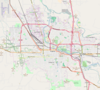
 Spencer ButteSpencer Butte (Eugene OR)
- So adding a pushpin map to Skinner Butte in Eugene was easy, but I'm not sure about placement within the article. Any wiser aestheticians welcome to revise placement...
- There's also a small problem with adding Spencer Butte, the defining geological landmark at the southern end of Eugene, because the pushpin identifier collides with the caption of the map. Suggestions? --Grand'mere Eugene (talk) 04:57, 14 April 2016 (UTC)
- The solution to that is another map, which provides a wee bit more space. I'll be arranging that for you sooner or later. --Tagishsimon (talk) 05:10, 14 April 2016 (UTC)
- Possible Spencer Butte solution... --Tagishsimon (talk) 05:24, 14 April 2016 (UTC)
- @Tagishsimon: I would love maps for Astoria, Gresham, and Portland State University, if you are willing and able. I can't offer coordinate suggestions but would take whatever you think is best. ---Another Believer (Talk) 04:47, 14 April 2016 (UTC)
- No probs :). Jonesey, I've amended the University of Oregon Campus map to include Autzen Stadium ... it has the disadvantage of, relatively speaking, making the resolution of the main campus less than it was ... I followed the lead of the University, copying its campus map. But it's your state, not mine, so as you wish. I'm still happy to make further amendments / further maps, should you wish for any. --Tagishsimon (talk) 03:13, 14 April 2016 (UTC)
- @Tagishsimon: Thank you so much! These maps are going to improve so many articles. ---Another Believer (Talk) 03:58, 13 April 2016 (UTC)

Any more maps (part 2)
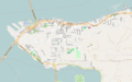
- Indent. For Gresham, do we want the downtown (roughly bounded by 182nd, southeast stark, northeast hogan & US26), or a bigger Gresham to include e.g. Powell Valley and Troutdale? Meanwhile, here's Astoria (and again, too big? I thought I'd give you a bridge or two, but can do smaller...) --Tagishsimon (talk) 05:10, 14 April 2016 (UTC)
- I don't have a strong preference, but I wouldn't mind if the map included Troutdale. ---Another Believer (Talk) 05:35, 14 April 2016 (UTC)
- Big Gresham it is, then. Let me know if Little Gresham's also needed. --Tagishsimon (talk) 05:46, 14 April 2016 (UTC)
- @Tagishsimon: The map you created is great! Thank you. Other Oregon cities with lots of NRHP sites include Ashland, Dayton, Grants Pass, Hood River, Oregon City, and The Dalles, if you are willing. I really could keep going, but I think with these I'll have enough to keep me busy for a while. :) ---Another Believer (Talk) 14:55, 14 April 2016 (UTC)
- Big Gresham it is, then. Let me know if Little Gresham's also needed. --Tagishsimon (talk) 05:46, 14 April 2016 (UTC)
- I don't have a strong preference, but I wouldn't mind if the map included Troutdale. ---Another Believer (Talk) 05:35, 14 April 2016 (UTC)
-
-

-

-
 Eugene and Spencer Butte - Module:Location map/data/USA Oregon Spencer Butte and Eugene


I think it would be nice to have a place to display all of the images that can be used as locator maps. Perhaps WP:ORE graphics or WP:ORE physical geography, or a new page? ---Another Believer (Talk) 05:39, 14 April 2016 (UTC)
- WP:ORE location maps? WP:ORE pushpin maps? --Tagishsimon (talk) 05:49, 14 April 2016 (UTC)
- I created a gallery at Wikipedia:WikiProject Oregon/Graphics for now. I made the image captions the names of the locator map commands for easy reference, though I can't seem to find the module links for 'Portland' and 'Portland downtown'. Am I missing any others in the gallery? ---Another Believer (Talk) 15:34, 14 April 2016 (UTC)
- Not sure what the deal with Portland and Portland downtown is. Still. Here are some you missed ;). I'm not bored yet, so... --Tagishsimon (talk) 16:43, 14 April 2016 (UTC)
- I created a gallery at Wikipedia:WikiProject Oregon/Graphics for now. I made the image captions the names of the locator map commands for easy reference, though I can't seem to find the module links for 'Portland' and 'Portland downtown'. Am I missing any others in the gallery? ---Another Believer (Talk) 15:34, 14 April 2016 (UTC)


Any more maps (part 3)


We now have many maps, catalogued at Wikipedia:WikiProject Oregon/Graphics, and very many articles have now been pushpinned. I'm open for more map suggestions, but equally will work through Oregon categories to identify towns & cities for which there are sufficient articles to warrent map creation, and just get on with it.
A greater concern for me is the quality of the maps we've lashed together over the past few days, in at least two respects:
- whether certain articles would benefit from, in essence, downtown maps, rather than the wider area maps which for the most part have been created. My favourite map is Downtown Portland, and it seems to me to make sense that Downtown locations should be pushpinned on Downtown maps. You, who are implementing these maps on Oregon articles, and who are familiar with the State's cities, are well placed to be dissatisfied with the maps offered, and to wish for more granular replacements. I'd be happy supply these.
- There will be certain locations - like Spencer Butte, discussed above - which do not fit well on existing maps and for which it would be ideal to have one-off maps created. So that'll be locations found on the boundaries of our maps, or else locations (e.g. hills, mountains) outside a city for which we want to create a pushpin map showing the location in relation to the nearest city (as we did for Spencer Butte). If you come across any such cases, again, I'd be happy to supply one-off maps.
thanks --Tagishsimon (talk) 21:06, 14 April 2016 (UTC)
- (edit conflict) Fantastic! How about Albany, Baker City, Forest Grove, Klamath Falls, Lake Oswego, McMinnville, and Tigard and/or Tualatin (these two can be together or separate)? I would also love one for Reed College. It may take some time to update all of the infoboxes with these new maps, but it is so nice having the option! ---Another Believer (Talk) 21:09, 14 April 2016 (UTC)
- Also, if you are volunteering to identify other cities and regions needing maps, List of cities in Oregon may help, as may Category:Regions of Oregon. Really, you've helped so much that at this point anything else is just bonus, and MUCH appreciated. :) My "to do" list includes going back and updating articles with these new maps, and adding new maps to the WP:ORE graphics page, unless you beat me to the punch. ---Another Believer (Talk) 21:11, 14 April 2016 (UTC)
- Yup, I'll do those; maybe not this evening (pooped & have promised to have an early night). More generally, I'll work though whatever queue of maps gets specified here as diligently as I can. And I appreciate that you have say 30 or 50 or more articles to pushpin for every map I create, so I'm under no illusions about who's doing the heavy lifting. Not least, you have a couple of things before you: ensuring that all articles that would benefit from a map have one; but there's also a consistency job to be done: some maps are within infoboxes, some 'merely' right-justified unbordered-images ... I think in many cases articles will be improved if pushpin maps are located within infoboxes. But I don't know the extent of the issue; I've observed it on a few pages, but then, I've only looked at a very few pushpin-mapped articles. --Tagishsimon (talk) 21:19, 14 April 2016 (UTC)
- Yes, unfortunately, there is much inconsistency. Some articles don't have a map, but should; some are displayed in infoboxes, others in stand-alone boxes. I think part of the problem is that not all infobox templates use the same map/pushpin parameters, and some infobox templates don't include the pushpin map parameter by default. My strategy is to tackle related articles, such as public artworks, then NRHP sites, etc. I see another editors is adding maps for bridges and other transit-related articles. But yes, slowly but surely, we will get more maps in infoboxes and work for consistency between articles. ---Another Believer (Talk) 21:51, 14 April 2016 (UTC)
- Yup, I'll do those; maybe not this evening (pooped & have promised to have an early night). More generally, I'll work though whatever queue of maps gets specified here as diligently as I can. And I appreciate that you have say 30 or 50 or more articles to pushpin for every map I create, so I'm under no illusions about who's doing the heavy lifting. Not least, you have a couple of things before you: ensuring that all articles that would benefit from a map have one; but there's also a consistency job to be done: some maps are within infoboxes, some 'merely' right-justified unbordered-images ... I think in many cases articles will be improved if pushpin maps are located within infoboxes. But I don't know the extent of the issue; I've observed it on a few pages, but then, I've only looked at a very few pushpin-mapped articles. --Tagishsimon (talk) 21:19, 14 April 2016 (UTC)
Tagishsimon, thank you for your efforts in creating all these location maps. I'd like to request one for Pendleton, Coos Bay/North Bend, Woodburn, and Redmond. Thanks! MB298 (talk) 23:28, 14 April 2016 (UTC)
- Will do; next 24 hours or so. Thanks MB298 --Tagishsimon (talk) 23:30, 14 April 2016 (UTC)
- Like ---Another Believer (Talk) 23:41, 14 April 2016 (UTC)
- All requests done & available from Wikipedia:WikiProject Oregon/Graphics. As normal, additional & amendment requests welcome. --Tagishsimon (talk) 12:29, 15 April 2016 (UTC)
With this edit I added an infobox to th Spencer Butte article, but can't quite manage to center the pushpin map. Maybe someone with more patience can manage it? Cheers! —Grand'mere Eugene (talk) 23:04, 16 April 2016 (UTC)
- | float=center seems to have done the trick. Documentation for pushpin seems, more or less, to be Template:Location map. (Seems we might have fixed the original Spencers Butte issue with the position parameter.) --Tagishsimon (talk) 00:04, 17 April 2016 (UTC)
- I changed Spencer Butte to use the parameters in the underlying infobox rather than trying to embed another template in there. It seems to work. It's a bit frustrating that different infoboxen use different parameters for map attributes. – Jonesey95 (talk) 01:41, 17 April 2016 (UTC)
- Isn't that crazy? There should definitely be parameter consistency for maps. ---Another Believer (Talk) 17:59, 17 April 2016 (UTC)
- I changed Spencer Butte to use the parameters in the underlying infobox rather than trying to embed another template in there. It seems to work. It's a bit frustrating that different infoboxen use different parameters for map attributes. – Jonesey95 (talk) 01:41, 17 April 2016 (UTC)
Re: Talos No. 2
If anyone has time to spare, I could use a little help with this article, which I hope to promote to Good status. I think the sculpture was completed between 1959 and 1968, but some sources give 1977 as the date. Some sources say the sculpture was first installed in 1968, others say it has been on the Transit Mall since 1977. I am confused as to which dates I should use for the sculpture's completion and installation. If someone has the time, interest, and patience to review this article and poke around some of the sources, I'd appreciate another pair of eyes. It is not a long article, and there are not too many sources to scan. The article should be close to meeting GA criteria once this issue is resolved. ---Another Believer (Talk) 18:53, 20 April 2016 (UTC)
- Thoughts at Talk:Talos No. 2 --Tagishsimon (talk) 22:15, 20 April 2016 (UTC)
No joke, new collaboration of the whatever
In honor of fools everywhere, time for a new collaboration. We are on to Arlene Schnitzer Concert Hall and Missing Coords. The missing coords is a somewhat occasional one that appears to have filled up a bit since last time. The Schnitz is Start class, but with a little work would be B class or better. Aboutmovies (talk) 08:42, 1 April 2016 (UTC)
- Like Note the above section, too, if you want to add coordinates to articles in a way that allows the addition of a pushpin map to the infobox. ---Another Believer (Talk) 14:09, 1 April 2016 (UTC)
- Update: I mentioned our current collaboration at WikiProject Geographical coordinates, so hopefully other contributors will help out. BTW, I don't remember the exact number, but we started with more than 200 entries in the "missing coordinates" category. ---Another Believer (Talk) 00:55, 4 April 2016 (UTC)
- 43 left to do, but they're getting harder: areas; multi-locations; demolished locations, &c. Kind regards from WP:WikiProject Geographical coordinates. --Tagishsimon (talk) 16:45, 9 April 2016 (UTC)
- @Tagishsimon: Thank you so much for your contributions. You greatly reduced our backlog. ---Another Believer (Talk) 17:19, 9 April 2016 (UTC)
- 43 left to do, but they're getting harder: areas; multi-locations; demolished locations, &c. Kind regards from WP:WikiProject Geographical coordinates. --Tagishsimon (talk) 16:45, 9 April 2016 (UTC)
- To help any interested editors who may be confused or unfamiliar with adding coordinates to articles, here are some tips just from my experience:
- A lot of the articles with
{{Coord missing|Oregon}}currently are articles with {{Infobox artwork}}. This infobox comes with a note insistent on either very accurate "known" coords or none at all. But I don't see anything wrong with heading over to https://www.google.com/maps/ and finding coords as accurately as you can if you have reliable info. on the address of the artwork. - With the latest version of Google Maps, just click somewhere on the map and coordinates will pop up. Then copy-paste into the coord template, so for example
{{coord|43.55233|-121.15920|type:landmark_region:US-OR|format=dms|display=inline,title}}. To determine the "type," check Template:Coord#type:T. Remember the region code for Oregon: US-OR (so large numbers of articles can be automatically sorted geographically). - I think coordinates look better displayed as degrees, minutes, seconds (1 minute=1/60 degree, 1 second=1/60 minute=1/3600 degree), so consider adding format=dms if you're entering decimal coords. This is a good tool for easily converting between DMS and DEC if you ever need to do so manually. Coordinates entered directly in DMS format look like
{{coord|43|55|22|N|115|08|27|W|type:landmark_region:US-ID|format=dms|display=inline,title}}(looks like that's in Idaho). - Look out for infoboxes that split up areas for entering the coordinate info., like {{Infobox mountain}}. In this case you indicate north or south and east or west hemisphere instead of using minus signs, and you enter value for degrees, minutes, and seconds for both latitude and longitude separately. (Minus signs are for southern latitudes or western longitudes.) Or of course you could just ignore those template parameters and instead paste the
{{coord|43.55233|-121.15920|type:landmark_region:US-OR|format=dms|display=inline,title}}. - Then remember to remove {{Coord missing|Oregon}}.
- Template:Coord has everything else you may need to know.
- A lot of the articles with
- --Jsayre64 (talk) 05:04, 21 April 2016 (UTC)
- @Jsayre64: Thanks for helping encourage anyone to geotag articles and thank you for the work you have been doing. I see my watchlist light up with all your edits to that effect.
- I disagree with displaying coordinates in DMS instead of a direct signed decimal pair. Decimal-formatted coordinates advantages versus DMS include intuitive precision, easier and less error prone to transcribe (say to a GPS device), easier to use in arithmetic, less undue weight by describing a position using only two data items instead of up to eight, and finer control of precision—every step is 10x instead of mixed steps of 10x and 60x.
- As far as original research concerns identifying a coordinate, the natural verifiability of using a mapping tool to check the location eliminates most of the problem. —EncMstr (talk) 06:54, 21 April 2016 (UTC)
- From a practical perspective, sadly, decimal coordinates seem to be the way to go if you want a coordinate to point to the actual building/statue, rather than somewhere close to it. I've yet to find a mapping service which provides easy access to coordinates which include seconds-with-decimal-places. A coordinate which resolves to merely a second is often a few metres away from the item to which the coordinate should point. DMS is, I think, to be preferred, as there is meaning in all of the D & M & S. But as someone who has hand-coorded thousands of articles, regrettably, decimal it is, and generally to 5dp. --Tagishsimon (talk) 09:20, 21 April 2016 (UTC)
- I like frogs. Aboutmovies (talk) 20:32, 21 April 2016 (UTC)
- From a practical perspective, sadly, decimal coordinates seem to be the way to go if you want a coordinate to point to the actual building/statue, rather than somewhere close to it. I've yet to find a mapping service which provides easy access to coordinates which include seconds-with-decimal-places. A coordinate which resolves to merely a second is often a few metres away from the item to which the coordinate should point. DMS is, I think, to be preferred, as there is meaning in all of the D & M & S. But as someone who has hand-coorded thousands of articles, regrettably, decimal it is, and generally to 5dp. --Tagishsimon (talk) 09:20, 21 April 2016 (UTC)
- To help any interested editors who may be confused or unfamiliar with adding coordinates to articles, here are some tips just from my experience:
Some Performing Frogs in Eugene also need geo-tags... — Grand'mere Eugene (talk) 00:18, 22 April 2016 (UTC)
- Good point. I've looked at every photo of the building I could find, but found nothing which located the frogs pecisely enough. Someone here must have been in the Hult and seen them ... where *exactly* are they in the building? --Tagishsimon (talk) 00:33, 22 April 2016 (UTC)
- The frogs are inside the main lobby, near the stairs leading up to the mezzanine (I think?) level. I remember there was also a ticket box office nearby. That's the best I an offer until someone in Eugene can be even more specific, if needed. ---Another Believer (Talk) 01:34, 22 April 2016 (UTC)
- I got yer frog lats and frog longs right here, buddy. – Jonesey95 (talk) 04:08, 22 April 2016 (UTC)
- Tru dat. Aboutmovies (talk) 04:57, 22 April 2016 (UTC)
- Friday's puzzlement: How can the WP article on Up completely omit any mention of "Squirrel!", one of the best running jokes in movie history? While researching this important question, I happened to come across this piece which is a related distraction from our neighbors in Longview ... Cheers! —Grand'mere Eugene (talk) 01:26, 23 April 2016 (UTC)
- Tru dat. Aboutmovies (talk) 04:57, 22 April 2016 (UTC)
- I got yer frog lats and frog longs right here, buddy. – Jonesey95 (talk) 04:08, 22 April 2016 (UTC)
- The frogs are inside the main lobby, near the stairs leading up to the mezzanine (I think?) level. I remember there was also a ticket box office nearby. That's the best I an offer until someone in Eugene can be even more specific, if needed. ---Another Believer (Talk) 01:34, 22 April 2016 (UTC)
| 80% complete | ||
New COTM
We did good on adding coordinates to articles, so time for the next installment. Two start class articles that with a little help could make it to C or B class: Gov. John Hubert Hall and the Portland Art Museum. Dig in. Aboutmovies (talk) 20:49, 5 May 2016 (UTC)
- Do we know whether the Brief History of the Museum is a mirror site without attribution or the WP article is a copyright vio? – Grand'mere Eugene (talk) 03:32, 6 May 2016 (UTC)
- Not sure it is either. There has been a COI tag on the article for years, and the PAM website page only dates to late 2013 (unsure if there was a similar history under a different URL on PAM's website from pior). It looks like the history was expanded in 2007 to add much of what is there. So without spending an hour on diffs, I'd suspect that either someone related to PAM re-wrote the history section to match their vision, or PAM took from Wikipedia. Best to re-write. Aboutmovies (talk) 03:59, 6 May 2016 (UTC)
- Reminds me of this article. I was really excited about Wikidata when I first heard about it, but now I'm not so sure. Seems like citogenesis could be a real problem. YBG (talk) 04:19, 6 May 2016 (UTC)
- Not sure it is either. There has been a COI tag on the article for years, and the PAM website page only dates to late 2013 (unsure if there was a similar history under a different URL on PAM's website from pior). It looks like the history was expanded in 2007 to add much of what is there. So without spending an hour on diffs, I'd suspect that either someone related to PAM re-wrote the history section to match their vision, or PAM took from Wikipedia. Best to re-write. Aboutmovies (talk) 03:59, 6 May 2016 (UTC)
I don't have time to dig in, because I'm the sort of person who would spend an hour on diffs, but I seem to recall nuking most of the article at one point for copyvio, or driveby-tagging it, or both. There was PAM-connected COI editor with an agenda at one point and all that stuff may still be there today. Agree with the need for a rewrite. Oh, and some of you may know which article I'm talking about, but the Oregon Blue Book once lifted an OR factoid of mine that I had tagged {{cn}} and stated it as fact, so I used the Blue Book as reference. Don't worry it's something harmless. Valfontis (talk) 17:30, 8 May 2016 (UTC)
Announcing project activity statistics
I have enhanced my bot to update WP:WikiProject Oregon/Activity which shows the recent activity of our members and details of how recently they have edited WP:ORE pages. This can be used to easily update the participants page or see who is a sysop. I plan to update it every few weeks. It takes an hour or two to run.
It is meant to be self-explanatory, so give it a look. Your criticism, comments, and ideas for changes are welcome. —EncMstr (talk) 21:49, 7 May 2016 (UTC)
- This is a pretty incredible collection of info, EncMstr -- thank you! The reporting leads to rather strange appearance, until you wrap your head around the idea that it's only considering the most recent
10,0001,000 edits...my first perception was that I hadn't made any WP:ORE edits prior to two years ago, which is a bit odd to see! Even within the 2 year column (still using me as an example), it would be nice to see that the number is potentially incomplete.
- I'm curious -- do you know Erik Zachte, or have you followed his blog or the stats.wikimedia.org site? I expect that each of you might have some interesting perspectives to share with each other, since your efforts overlap so strongly. -Pete (talk) 17:50, 8 May 2016 (UTC)
- It is only the most recent thousand edits per editor (not ten thousand). That was chosen semi-arbitrarily to limit the server impact. I should profile its actual effects and adjust accordingly. The servers did throttle the job twice for a total of ten seconds.
- It is a good suggestion to indicate the cutoff date of the earliest contribution inspected. I'll think about how to report that.
- I did not know of Erik Zachte, but I will have look. Thanks! —EncMstr (talk) 18:16, 8 May 2016 (UTC)
- Sorry, that was a typo -- I did understand that. Corrected now. I highly recommend Erik's work, he is smart and fun to work with, and may have some good insights on these things. Plus, if you ever find yourself in the Netherlands, I highly recommend his impromptu tour of Leiden! -Pete (talk) 20:07, 8 May 2016 (UTC)
- Some suggestions:
- Display only date in the time sapan columns
- Add a "1000 edits back" column as suggested above
- Modify the column order and headers to something like this
- Some suggestions:
- Sorry, that was a typo -- I did understand that. Corrected now. I highly recommend Erik's work, he is smart and fun to work with, and may have some good insights on these things. Plus, if you ever find yourself in the Netherlands, I highly recommend his impromptu tour of Leiden! -Pete (talk) 20:07, 8 May 2016 (UTC)
Editor Registered Total
editsMost
recent
edit1000
edits
backMost recent 1000 edits Non-
WP:OREWP:ORE edits 0-7d 7d-2w 2w-1m 1-3m 3-6m 6m-1y 1-2y 2-3y 3-5y 5-10y
- Yes, I like YBG's layout too. I think showing the cumulative total would be better, though, as it makes it clearer that it's all based on the 1000 edits as you're looking at it -- not relying as heavily on reading that ahead of time and thinking it through. So how about this, for instance, using my (approximate) data as an example? (And, I like the edit of a 1000 edit date stamp too.)
| Editor | Registered | Total edits |
Most recent edit |
1000 edits back |
Most recent 1000 edits | ||||||||||
|---|---|---|---|---|---|---|---|---|---|---|---|---|---|---|---|
| Non- WP:ORE |
WP:ORE edits | ||||||||||||||
| 1w | 2w | 1m | 3m | 6m | 1y | 2y | 3y | 5y | 10y | ||||||
| Peteforsyth | 2006-01 | 24,000 | 2016-05 | 2015-02 | 748 | 2 | 2 | 9 | 33 | 54 | 102 | ≥252 | |||
-Pete (talk) 21:10, 9 May 2016 (UTC)
- A couple of comments
- I've added an as-of timestamp in the header (could be date stamp, but probably not month stamp).
- I've added explanatory text to the WP:OR multi-column header
- I was thinking of date stamps, but Pete's month stamps take up less room. I'm fine either way.
- I like Pete's cumulative, it really goes a long way to making the data more self-explanatory.
- I prefer 252+ to ≥252, but I'm fine either way.
- Need to use {{nts}} or some other trick to make sorting work correctly.
- I moved non-WP:ORE back to the end. With cums, this puts the numbers adding to 1000 adjacent.
- I like using
|colspan=to merge the columns at the end - And finally, I added an extra header row so sort icons don't widen the table. With this, it may be OK to use daystamps instead of monthstamps.
Editor Registered Total
editsMost
recent
edit1000
edits
backMost recent 1000 edits as of yyyy-mm-dd hh:mm (UTC) Cumulative WP:ORE edits in the most recent ... Non-
WP:ORE1w 2w 1m 3m 6m 1y 2y 3y 5y 10y Peteforsyth 2006-01 24,000 2016-05 2015-02 2 2 9 33 54 102 ≥252 748 YBG 2008-11 4,914 2016-05 2015-11 8 8 9 24 96 ≥98 902
- Thanks guys! Those are great suggestions. Of course that will create a lot of work for me, but I asked for it. ;-)
- Doesn't anyone like the microsecond feature of the time the job began to run? Nah, that's silly. I simply used the default python formatting. Having mixed timezones was another oversight: my computer's for the job run time and UTC for the contributions.
- I am surprised by the technique to move the sort icons down! I had no idea it existed and I used to provide a lot of help at HELP:Table.
- The idea of putting most recent 1000 edits in the table header is appealing, but some editors don't have that many. Does anyone have suggestions for how to flag that? —EncMstr (talk) 03:43, 10 May 2016 (UTC)
Gorge oil train fire?
Nobody's created the article? Here I go, 2016 Union Pacific oil train fire. I think the company is more important than the location. tedder (talk) 22:29, 3 June 2016 (UTC)
OGN
{{OGN}} calls for a page number, but it seems to me that it would also be useful to include the name of the OGN article(s) being cited. Anyone else think this might be a good idea? YBG (talk) 23:04, 5 June 2016 (UTC)
- What I'm suggesting is that we add an optional parameter to {{OGN}}, say
|entry=(and maybe|entries=) that would included the entry name to be included. This parameter would be converted into the appropriate parameter for {{cite book}}. There are several possibilities:|at=, more correct but precludes using|page=or|pages=|chapter=, less correct but allows using|page=or|pages=- A combination based on whether
|page=or|pages=are used. If they are, then use|chapter=; if not, then use|at=.
- I'll try to work up some examples to show what the format would look like. YBG (talk) 16:57, 8 June 2016 (UTC)
OGN for Petes Mountain?
Hey, can someone give me a summary of Petes Mountain from their copy of OGN? Type here or send me an email if it's longer. tedder (talk) 03:57, 8 June 2016 (UTC)
- Will do shortly. YBG (talk) 04:00, 8 June 2016 (UTC)
 by e-mail YBG (talk) 04:06, 8 June 2016 (UTC)
- Got it. Thanks! BTW, unrelated, here's my current obsession: SS Robin Moore. tedder (talk) 04:55, 8 June 2016 (UTC)
- Do you mean SS Robin Moor? Fascinating story. – Jonesey95 (talk) 05:35, 8 June 2016 (UTC)
- Got it. Thanks! BTW, unrelated, here's my current obsession: SS Robin Moore. tedder (talk) 04:55, 8 June 2016 (UTC)
Hemispheres Magazine "Dossier" May 2016
If you flew United in May, you may have seen the 24-page "Dossier" on Oregon, with lots of coverage of topics of interest, albeit from an apparent Chamber-of-Commerce-type POV, with factoids on p.20 (with some limited citations to sites like Yahoo). My question: do we consider any of this a reliable source? It's now online, here. I did like the tone of the full-page ad from TravelOregon.com on the last page: "It's just Oregon. No big deal. We like it here. You might too." Cheers! — Grand'mere Eugene (talk) 22:01, 8 June 2016 (UTC)
Question re: images of closed businesses / demolished buildings
There is probably a more appropriate venue for this question, but I am wondering if anyone might know the image policy for a defunct business or demolished space. I was hoping to find an image to illustrate the Red Cap Garage article, which existed in the space now occupied by Union Alley. If I do a Google image search for "Red Cap Garage", I see a couple images hosted at Yelp, one at Pinterest, and another at Clubfly. Does anyone know if these images can be used under fair use, or some similar policy? The business and space are both gone, so there is no way to take a current image, and I am unable to find free images of the venue at Flickr. I am happy to take an image of Union Alley next time I am in the area, to illustrate the current space, but this is not as good as having an image of the original space. Is anyone able to point me in the right direction? ---Another Believer (Talk) 23:01, 18 May 2016 (UTC)
- The same applies to Jiggles, and probably many other articles, but perhaps WP's image policy means many will remain unillustrated. ---Another Believer (Talk) 14:53, 19 May 2016 (UTC)
- Ditto Starky's. ---Another Believer (Talk) 00:29, 15 June 2016 (UTC)
- @Another Believer: I'm not sure a fair use Starky's image is necessary, as there is a freely licensed image of the business here on Flickr (taken in 2009) which can easily be transferred to Wikimedia Commons. MB298 (talk) 01:19, 15 June 2016 (UTC)
- and WP:NFC#UUI states that unacceptable fair use includes "pictures of people still alive, groups still active, and buildings still standing; provided that taking a new free picture as a replacement (which is almost always considered possible) would serve the same encyclopedic purpose as the non-free image." Given that the building is demolished; or the business is closed I would say that fair use would be acceptable for those articles. MB298 (talk) 01:24, 15 June 2016 (UTC)
- @MB298: Thanks so much for your very helpful responses. I had tried searching for an image of Starky's at Flickr, but didn't find one so I must not have been searching properly. I went ahead and transferred the image to Commons. As for the other demolished buildings, I will see if I can get away with uploading images under fair use. Thanks again! ---Another Believer (Talk) 01:57, 15 June 2016 (UTC)
- and WP:NFC#UUI states that unacceptable fair use includes "pictures of people still alive, groups still active, and buildings still standing; provided that taking a new free picture as a replacement (which is almost always considered possible) would serve the same encyclopedic purpose as the non-free image." Given that the building is demolished; or the business is closed I would say that fair use would be acceptable for those articles. MB298 (talk) 01:24, 15 June 2016 (UTC)
- @Another Believer: I'm not sure a fair use Starky's image is necessary, as there is a freely licensed image of the business here on Flickr (taken in 2009) which can easily be transferred to Wikimedia Commons. MB298 (talk) 01:19, 15 June 2016 (UTC)
- Ditto Starky's. ---Another Believer (Talk) 00:29, 15 June 2016 (UTC)
.jpg)
Oregon mountains
The List of mountain peaks of Oregon has been expanded and updated. We need articles for the following mountain peaks:
Aneroid Mountain, Bald Mountain, Beatys Butte, Big Lookout Mountain, Black Mountain, Brandy Peak, Drake Peak, Elkhorn Peak, Gearhart Mountain, Red Mountain, Rock Creek Butte, Roman Nose Mountain, Snow Mountain, Twin Peaks, Vinegar Hill, Warner Peak, and Yainax Butte
Information about these peaks can be found in their references on the List of mountain peaks of Oregon. We also need good mountain photos for the articles and list gallery. Yours aye, Buaidh 23:49, 14 June 2016 (UTC)
- This list is confusing to me. Diamond Peak (Oregon) is listed in its own article as having 946 m of prominence, but it does not appear in the list article. Many peaks appear to be missing, such as Aneroid, Twin Peaks, Red Mountain, and Elkhorn Peak. I was unable to find a reference in the list article showing the Oregon peaks that meet the criteria laid out in the lead. Help me get unconfused, please. Here are some sources that may lead to changes in the article: [1] [2] [3].
- And why was 500 meters chosen as the criterion? Is there a reliable source supporting that choice? Peakbagger.com, for example, uses 500 feet. The 500-meter height excludes Middle Sister, and any list claiming to be the "mountain peaks of Oregon" that does not have Middle Sister on it is just going to mislead and confuse readers. I'm definitely confused. – Jonesey95 (talk) 00:19, 15 June 2016 (UTC)
- Thank you. You are absolutely correct. I will add the five peaks you named to the lists as soon as I can round up additional references. If you find any other peaks that should be on the lists, please send them to me.
- I am surveying all mountain summits of greater North America. The reason for the 500 meter prominence cutoff is the sheer number of summits involved, There are approximately 353 summits with at least 1500 meters of prominence in North America and more 6600 summits with 500 meters of prominence. As the prominence criteria drops, the number of summits increases exponentially. There are a number of summits under 3000 meters of elevation that I have yet to survey. I hope to include them as soon as I can. Your help is greatly appreciated. BTW, peakbagger.com does not use a prominence cutoff for inclusion. See Browne Tower, Alaska for an example.
- Thanks again, Buaidh 02:42, 15 June 2016 (UTC)
- If you wish, we can create a separate list of the highest Oregon summits with a 500-foot, 100-meter, or 300-foot prominence criteria. See the List of Colorado fourteeners for an example. Yours aye, Buaidh 03:27, 15 June 2016 (UTC)
- After a quick survey, it appears the following summits should also be included in the List of mountain peaks of Oregon:
Aspen Butte, Bald Mountain, Beatys Butte, Big Lookout Mountain, Black Butte, Broken Top, Cottonwood Mountain, Drake Peak, Laurel Mountain, Lookout Mountain, Maiden Peak, Mount Ashland, Mount Bachelor, Mount Bailey, Mount Scott, Mount Washington, Paulina Peak, Pearsoll Peak, Pelican Butte, Pueblo Mountain, Roman Nose Mountain, Saddle Mountain, Snow Mountain, Vinegar Hill, Warner Peak, Yainax Butte
- It may take me a while to gather data for these mountains, but I will include them as soon as possible. Yours aye, Buaidh 04:10, 15 June 2016 (UTC)
- Keep up the good work. I'm still concerned about Middle Sister, which has over 1,000 feet of prominence. I understand the technical reasons you are excluding it from this list, but seeing a list of Oregon peaks without her makes me question the usefulness of the criteria. You don't have to include all one hundred 500-foot-prominence peaks over 7,840 feet as peakbagger did, just pick a cutoff point that keeps the list a reasonable length. A 9,000-foot cutoff for 500-foot-prominence peaks gives you 31 peaks, according to peakbagger (the number in the far left column). – Jonesey95 (talk) 05:47, 15 June 2016 (UTC)
- I was confused by this article as well. It seems to me, the most common question for an average reader would be "what are the highest mountains in Oregon?" Yet this article doesn't answer that. I think the article would be more useful if the first table simply listed the highest peaks in Oregon, regardless of their topographic prominence. The second table could add a prominence criterion and the third table could be focused on topographic isolation. Also, it’s worth noting that there is another List of mountains of Oregon. I like the new format better, since it puts the peaks in some kind of order, but the previous list identifies and links to a lot more Oregon peaks.--Orygun (talk) 19:37, 15 June 2016 (UTC)
- Keep up the good work. I'm still concerned about Middle Sister, which has over 1,000 feet of prominence. I understand the technical reasons you are excluding it from this list, but seeing a list of Oregon peaks without her makes me question the usefulness of the criteria. You don't have to include all one hundred 500-foot-prominence peaks over 7,840 feet as peakbagger did, just pick a cutoff point that keeps the list a reasonable length. A 9,000-foot cutoff for 500-foot-prominence peaks gives you 31 peaks, according to peakbagger (the number in the far left column). – Jonesey95 (talk) 05:47, 15 June 2016 (UTC)
I've expanded and updated the List of mountain peaks of Oregon which now includes 49 summits with over 500 meters prominence. The articles begining with "List of mountain peaks of" all use a 500-meter prominence criteria. I would prefer that the names of all these articles were changed to "List of major summits of", but the names of these articles have already been changed many times over the last twelve years.
I would be happy to create an article entitled the List of the highest summits of Oregon (similar to the List of the highest major summits of Colorado) with a 1000-foot (46 peaks over 8000'), 500-foot (98 peaks over 8000'), 100-meter (103 peaks over 2500 m), or 300-foot (140 peaks over 8000') prominence criteria. Yours aye, Buaidh 23:17, 16 June 2016 (UTC)
- The table below shows how the ranking of Oregon's highest summits changes depending on what prominence criteria you use. As the prominence criteria decreases you get more peaks, but those additional peaks may be less important or subpeaks of higher summits. As the prominence criteria decreases the rank of high prominence peaks may also drop. For instance, Strawberry Mountain ranks 16th using the 500-meter prominence criteria, 20th using 1000-foot, 33rd using 500-foot, 41st using 100-meter, and 46th using the 300-foot criteria.
| rank | 300 feet | 100 meters | 500 Feet | 1000 feet | 500 meters |
|---|---|---|---|---|---|
| 1 | Mount Hood | Mount Hood | Mount Hood | Mount Hood | Mount Hood |
| 2 | Mount Jefferson | Mount Jefferson | Mount Jefferson | Mount Jefferson | Mount Jefferson |
| 3 | South Sister | South Sister | South Sister | South Sister | South Sister |
| 4 | North Sister | North Sister | North Sister | North Sister | North Sister |
| 5 | Middle Sister | Middle Sister | Middle Sister | Middle Sister | Sacajawea Peak |
| 6 | Sacajawea Peak | Sacajawea Peak | Sacajawea Peak | Sacajawea Peak | Steens Mountain |
| 7 | Matterhorn | Matterhorn | Hurwal Divide | Steens Mountain | Aneroid Mountain |
| 8 | Hurwal Divide | Hurwal Divide | Steens Mountain | Aneroid Mountain | Twin Peaks |
| 9 | Steens Mountain | Steens Mountain | Aneroid Mountain | Petes Point | Red Mountain |
| 10 | Aneroid Mountain | Aneroid Mountain | Petes Point | Twin Peaks | Mount McLoughlin |
| 11 | Petes Point | Petes Point | Twin Peaks | Red Mountain | Elkhorn Peak |
| 12 | Twin Peaks | Twin Peaks | Chief Joseph Mountain | Eagle Cap | Mount Thielsen |
| 13 | Hurricane Divide North | Hurricane Divide North | Red Mountain | Mount McLoughlin | Broken Top |
| 14 | Chief Joseph Mountain | Chief Joseph Mountain | Eagle Cap | Elkhorn Peak | Rock Creek Butte |
| 15 | Red Mountain | Red Mountain | Cusick Mountain | Mount Thielsen | Mount Bachelor |
| 16 | Eagle Cap | Eagle Cap | Mount McLoughlin | Broken Top | Strawberry Mountain |
| 17 | Cusick Mountain | Cusick Mountain | Aneroid Mountain North | Rock Creek Butte | Mount Scott |
| 18 | Hurwal Divide Southwest | Hurwal Divide Southwest | Sentinel Peak | Krag Peak | Diamond Peak |
| 19 | Mount McLoughlin | Mount McLoughlin | Hurricane Divide South | Mount Bachelor | Pueblo Mountain |
| 20 | Glacier Peak | Aneroid Mountain North | Steens Mountain-North Peak | Strawberry Mountain | Crane Mountain |
| 21 | Aneroid Mountain North | Sentinel Peak | Elkhorn Peak | Needle Point | Drake Peak |
| 22 | Sentinel Peak | Petes-Sentinel Ridge | Craig Mountain | Traverse Lake East Peak | Gearhart Mountain |
| 23 | Petes-Sentinel Ridge | Hurricane Divide South | Mount Thielsen | Mount Scott | Mount Bailey |
| 24 | Hurricane Divide South | East Peak | Peak 9160 | Red Mountain | Aspen Butte |
| 25 | East Peak | Steens Mountain-North Peak | Broken Top | Twin Mountain | Yamsay Mountain |
| 26 | Steens Mountain-North Peak | Razzberry Mountain | Glacier Mountain | Lookout Mountain | Vinegar Hill |
| 27 | Razzberry Mountain | Elkhorn Peak | East McCully Basin Peak | Diamond Peak | Pelican Butte |
| 28 | Peak 9275 | Peak 9213 | Rock Creek Butte | Van Patten Butte | Lookout Mountain |
| 29 | Elkhorn Peak | Craig Mountain | Krag Peak | Pueblo Mountain | Warner Peak |
| 30 | Peak 9230 | Mount Thielsen | Dollar Lake Peak | Crane Mountain | Paulina Peak |
| 31 | Peak 9213 | Peak 9160 | Traverse Ridge | Central Pueblo Mountains Peak | Cougar Peak |
| 32 | Craig Mountain | Broken Top | Mount Bachelor | Drake Peak | Beatys Butte |
| 33 | Mount Thielsen | Glacier Mountain | Strawberry Mountain | Gearhart Mountain | Bullrun Rock |
| 34 | Peak 9160 | East McCully Basin Peak | Needle Point | Mount Bailey | Three Fingered Jack |
| 35 | Broken Top | Rock Creek Butte | Traverse Lake East Peak | Mount Ireland | |
| 36 | Glacier Mountain | Krag Peak | Cougar Pond Southwest | Aspen Butte | |
| 37 | Peak 9160 | Dollar Lake Peak | Echo Lake Northwest Peak | Yamsay Mountain | |
| 38 | East McCully Basin Peak | Broken Top-South Peak | Elkhorn Peak | Hillman Peak | |
| 39 | Peak 9120 | Traverse Ridge | Mount Scott | Dutton Cliff | |
| 40 | Rock Creek Butte | Mount Bachelor | Red Mountain | Vinegar Hill | |
| 41 | Krag Peak | Strawberry Mountain | Eagle Lake East | Deadhorse Rim | |
| 42 | Dollar Lake Peak | Glacier Pass Peak | Marble Mountain | Applegate Peak | |
| 43 | Broken Top-South Peak | Needle Point | Twin Mountain | Pelican Butte | |
| 44 | Traverse Ridge | Peak 8987 | Ruby Peak | Lookout Mountain | |
| 45 | Mount Bachelor | Traverse Lake East Peak | Blue Lake Southwest | Oregon Canyon Mountains Peak | |
| 46 | Strawberry Mountain | Cougar Pond Southwest | Lookout Mountain | Warner Peak | |
| 47 | Glacier Pass Peak | Echo Lake Northwest Peak | Long Lake South | Paulina Peak | |
| 48 | Wing Ridge | Elkhorn Peak | Diamond Peak | Mount Harriman | |
| 49 | Needle Point | Mount Scott | Peak 8721 | Cougar Peak | |
| 50 | Peak 8987 | Red Mountain | Van Patten Butte | Beatys Butte | |
| 51 | Traverse Lake East Peak | Eagle Lake East | Granite Butte | Bullrun Rock | |
| 52 | Cougar Pond Southwest | Marble Mountain | Culver Lake South | Three Fingered Jack | |
| 53 | Echo Lake Northwest Peak | Peak 8910 | Chimney Lake North | ||
| 54 | Elkhorn Peak | Twin Mountain | China Cap | ||
| 55 | Mount Scott | Ruby Peak | Angell Peak | ||
| 56 | Red Mountain | Cougar Pond Southeast | Pueblo Mountain | ||
| 57 | Eagle Lake East | Peak 8861 | Granite Creek East | ||
| 58 | Peak 8923 | Blue Lake Southwest | Jackson Peak | ||
| 59 | Marble Mountain | Lookout Mountain | Mount Ruth | ||
| 60 | Peak 8910 | Long Lake South | Cached Lake South | ||
| 61 | Twin Mountain | Diamond Peak | Graham Mountain | ||
| 62 | Ruby Peak | Peak 8721 | Indian Spring Butte | ||
| 63 | Cougar Pond Southeast | Minam-Mirror Peak | Dutch Flat Saddle South | ||
| 64 | Peak 8861 | Van Patten Butte | Graham Mountain-West Peak | ||
| 65 | Blue Lake Southwest | Nip Pass Peak | Jackson Peak-South | ||
| 66 | Lookout Mountain | Granite Butte | Crane Mountain | ||
| 67 | Long Lake South | Culver Lake South | Arrow Lake Peak | ||
| 68 | Diamond Peak | Chimney Lake North | Lostline River-Moccasin Lake | ||
| 69 | Peak 8721 | China Cap | Peak 8428 | ||
| 70 | Minam-Mirror Peak | Angell Peak | Central Pueblo Mountains Peak | ||
| 71 | Van Patten Butte | Cornucopia Peak | Drake Peak | ||
| 72 | Nip Pass Peak | Pueblo Mountain | Howlock Mountain | ||
| 73 | Peak 8684 | Granite Creek East | Gearhart Mountain | ||
| 74 | Granite Butte | Jackson Peak | Mount Bailey | ||
| 75 | Culver Lake South | Mount Ruth | North Minam Creek-Bear Creek | ||
| 76 | Chimney Lake North | Cached Lake South | Hidden Lake North | ||
| 77 | China Cap | Graham Mountain | Light Peak | ||
| 78 | Angell Peak | Chloride Ridge West | Mount Ireland | ||
| 79 | Cornucopia Peak | Slide Mountain | Aspen Butte | ||
| 80 | Pueblo Mountain | Peak 8520 | Yamsay Mountain | ||
| 81 | Granite Creek East | Dutch Flat Saddle North | Mount Thielsen-East Peak | ||
| 82 | Peak 8614 | Indian Spring Butte | Hillman Peak | ||
| 83 | Jackson Peak | Dutch Flat Saddle South | Dutton Cliff | ||
| 84 | Mount Ruth | Graham Mountain-West Peak | Twelvemile Peak | ||
| 85 | Cached Lake South | Jackson Peak-South | Vinegar Hill | ||
| 86 | Graham Mountain | Tombstone Butte | Peak 8120 | ||
| 87 | Chloride Ridge West | Burger Butte | Deadhorse Rim | ||
| 88 | Slide Mountain | Crane Mountain | Applegate Peak | ||
| 89 | Peak 8520 | Arrow Lake Peak | Columbia Hill | ||
| 90 | Dutch Flat Saddle North | Lostline River-Moccasin Lake | Peak 8080 | ||
| 91 | Indian Spring Butte | Peak 8428 | Ball Butte | ||
| 92 | Dutch Flat Saddle South | Central Pueblo Mountains Peak | Llao Rock | ||
| 93 | Graham Mountain-West Peak | Drake Peak | Pelican Butte | ||
| 94 | Jackson Peak-South | Howlock Mountain | Lookout Mountain | ||
| 95 | Tombstone Butte | Gearhart Mountain | Oregon Canyon Mountains Peak | ||
| 96 | Burger Butte | Mount Bailey | Berry-Norton Peak | ||
| 97 | Crane Mountain | North Minam Creek-Bear Creek | Warner Peak | ||
| 98 | Arrow Lake Peak | Hidden Lake North | Crown Point | ||
| 99 | Lostline River-Moccasin Lake | Light Peak | Paulina Peak | ||
| 100 | Peak 8428 | Mount Ireland | Sugarloaf Mountain |
I would appreciate your comments. Yours aye, Buaidh 03:14, 18 June 2016 (UTC)
Anybody have any idea of the origin of the term Portland Orange? The article is crying out for this project to contribute a history section. YBG (talk) 07:44, 20 June 2016 (UTC)
Photo for Broadway Theatre and Carriage Room
If anyone stumbles upon one, I'm on the lookout for an image to illustrate the Carriage Room and non-existent (but hopefully soon-to-be-created) Broadway Theatre (Portland, Oregon) articles. ---Another Believer (Talk) 17:10, 21 June 2016 (UTC)
Wiki Loves Pride 2016
I created Wikipedia:Wiki Loves Pride 2016/Portland as a space to collaborate on LGBT-related content this month as part of the annual Wiki Loves Pride campaign. I plan to take pictures at Portland's pride parade and festival to document local LGBT culture, and hope to create/improve a few Wikipedia articles this month. If anyone is interested in collaborating on an article or two, I'm game! ---Another Believer (Talk) 14:37, 2 June 2016 (UTC)
- Dirty Duck (Portland, Oregon) looks interesting. I didn't know about this building or bar until today. Thanks to Tedder for updating LGBT culture in Portland, Oregon, along with a few other red links. ---Another Believer (Talk) 05:05, 3 June 2016 (UTC)
- Yeah, I'm learning a lot. Which is why this kind of thing is so cool. tedder (talk) 16:45, 3 June 2016 (UTC)
- Talk:Dirty Duck (Portland, Oregon) displays relevant sources based on my scroll through the first 10 pages of Google search returns. No doubt a little diving through the Oregonian archives would provide additional references, but those posted on the talk page should be a great start. I hope I have more time this month to work on the Dirty Duck article! ---Another Believer (Talk) 18:40, 3 June 2016 (UTC)
- BTW, I called the article "Dirty Duck (Portland, Oregon)" because I assumed the building, which earned its nickname after the bar, were not independently notable. Perhaps over time the article could be split into one about the building and another about the bar itself, but for now, "Dirty Duck" seemed like the best common term for discussing both. I am open to comments and alternative titles. ---Another Believer (Talk) 18:42, 3 June 2016 (UTC)
- Yeah, I'm learning a lot. Which is why this kind of thing is so cool. tedder (talk) 16:45, 3 June 2016 (UTC)
![]() Red Cap Garage and Starky's are both awaiting GA reviews, if anyone cares to take a gander beforehand. --Another Believer (Talk) 19:07, 17 June 2016 (UTC)
Red Cap Garage and Starky's are both awaiting GA reviews, if anyone cares to take a gander beforehand. --Another Believer (Talk) 19:07, 17 June 2016 (UTC)
- Both have been promoted to GA status. ---Another Believer (Talk) 17:11, 21 June 2016 (UTC)
Welcome to the Hall of Fame!
 | |
|---|---|
|
Women in Halls of Fame worldwide online edit-a-thon
| |
--Ipigott (talk) 07:01, 25 June 2016 (UTC)
(To subscribe, Women in Red/Invite list. Unsubscribe, Women in Red/Opt-out list)
Stubs?
More thinking out loud here. I wonder if there should be articles for any of the following. Perhaps editors with more knowledge about geography and water systems have an opinion?
- Couch Lake (ref, ref)
- Paradise Springs (ref)
---Another Believer (Talk) 17:28, 14 July 2016 (UTC)
If you happen to find yourself staring at the large herons on the side of the funeral home near Oaks Bottom, care to snap a photo for me? :) ---Another Believer (Talk) 19:00, 21 July 2016 (UTC)
Racism in Oregon
![]() Question: I assume there should be an article about Racism in Oregon? ---Another Believer (Talk) 21:58, 12 July 2016 (UTC)
Question: I assume there should be an article about Racism in Oregon? ---Another Believer (Talk) 21:58, 12 July 2016 (UTC)
- Here's what I would ask myself before embarking on such a project: Are there comparable articles (by U.S. state) to use as models? Is Oregon special in some way? It seems like something that could go sideways rather easily, which may be why I was unable to find comparable articles. I have some thoughts below that may be helpful, and that I expect will lead you to topics that interest you.
- There is some good food for thought at Vanport, Oregon; Native American peoples of Oregon; History of Oregon#Racial discrimination; Racism in the United States; Segregation in Seattle (a stub); Hells Canyon Massacre (an article begging to be expanded).
- I would also look through Category:Racism and Category:Racism in the United States and Category:History of racial segregation in the United States and especially Category:History of racism in the United States to see if there are similar articles and to see how they are organized.
- Based on an initial look through those articles and categories, it seems like the practice has been to build articles related to a topic like "Racism in [state or country]" and then create a category like "History of racism in [state or country]" for those articles to live in, rather than building a "Racism in X" article.
- I also got distracted by this article about Japanese immigrants in Oregon. There is probably more good stuff on race relations, and references to sources, at the Oregon Encyclopedia. This article on Japantown in Portland, for example, is right up your alley! – Jonesey95 (talk) 22:37, 12 July 2016 (UTC)
![]() Question: I've not even fully read through User:Jonesey95's reply above, but I ran across this article, in which someone describes "Portland's African-American culture -- a black culture distinct from ones found in the Bay Area and Chicago". Of course, this article alone does not justify the need for any specific article, but it does have me wonder if there is enough content and research to have an article dedicated to African Americans in Oregon, or even African Americans in Portland, Oregon. Thoughts? ---Another Believer (Talk) 22:58, 12 July 2016 (UTC)
Question: I've not even fully read through User:Jonesey95's reply above, but I ran across this article, in which someone describes "Portland's African-American culture -- a black culture distinct from ones found in the Bay Area and Chicago". Of course, this article alone does not justify the need for any specific article, but it does have me wonder if there is enough content and research to have an article dedicated to African Americans in Oregon, or even African Americans in Portland, Oregon. Thoughts? ---Another Believer (Talk) 22:58, 12 July 2016 (UTC)
- Clearly there are a lot of neglected topics here. This exploration will keep you busy for a while. Take a look at Category:African-American history of Oregon and Category:African-American history by state to see if you can detect a pattern of typical articles of the type you think need to be created. I find that it is usually easier (i.e. less friction from other editors in the topic area) to create articles that follow an established pattern, including the format of the article title, the category structure, and the scope of the article (not too big or too small). – Jonesey95 (talk) 23:24, 12 July 2016 (UTC)
- A good topic...I thought we had already started something basic, but I may have been thinking of the tiny section in History in Oregon referenced above. I prefer the format Ethnic groups in.. which would permit framing issues of racism in the context of what racial groups (have) exist(ed) in the state to begin with. There are a handful of such articles relating to cities, but unfortunately Racism in... seems to be the common format for states. If we do this, an important angle not mentioned thus far is Chinese Americans especially in the building of the railroads. -Pete (talk) 21:02, 21 July 2016 (UTC)
- I have a feeling there could be articles about multiple ethnic groups in Portland and/or Oregon, but I wonder if they best route is to start with separate articles, or start with one and fork accordingly... ---Another Believer (Talk) 22:47, 21 July 2016 (UTC)
- Makes sense to split off articles if/when we have substantive content on each, but I'd start with building a single survey article. Today, the Atlantic published a great (and depressing) article. Also, some other useful links:
- The Racist History of Portland, the Whitest City in America
- Oregon Encyclopedia on Black Exclusion Laws
- We should make at least a stub on Oregon ballot measure 14 (2002) which finally removed racist language from the constitution
- Willamette Collegian article
- -Pete (talk) 01:54, 23 July 2016 (UTC)
- Makes sense to split off articles if/when we have substantive content on each, but I'd start with building a single survey article. Today, the Atlantic published a great (and depressing) article. Also, some other useful links:
- I have a feeling there could be articles about multiple ethnic groups in Portland and/or Oregon, but I wonder if they best route is to start with separate articles, or start with one and fork accordingly... ---Another Believer (Talk) 22:47, 21 July 2016 (UTC)
- A good topic...I thought we had already started something basic, but I may have been thinking of the tiny section in History in Oregon referenced above. I prefer the format Ethnic groups in.. which would permit framing issues of racism in the context of what racial groups (have) exist(ed) in the state to begin with. There are a handful of such articles relating to cities, but unfortunately Racism in... seems to be the common format for states. If we do this, an important angle not mentioned thus far is Chinese Americans especially in the building of the railroads. -Pete (talk) 21:02, 21 July 2016 (UTC)
Strange Things in the Woods
Is it just me, or does this look like a circle in the middle of the woods? Google's 3D makes it look slightly like a depression, making me wonder if we have Mayan ruins in the Cascades. Unfortunately no Street View there yet. Aboutmovies (talk) 02:02, 3 August 2016 (UTC)
- That's 43°49′45″N 121°58′26″W / 43.82923°N 121.97397°W for users of other map services. It's certainly a thing. I think it might be a rounded hill, part of a north-south chain of hills. This terrain view might help. --Tagishsimon (talk) 02:24, 3 August 2016 (UTC)
- The Lane/Deschutes County border goes right through that circle, taking a very strange turn right in the middle of it! Take a look on Google Earth with borders turned on. Curiouser and curiouser.... – Jonesey95 (talk) 02:40, 3 August 2016 (UTC)
- The contour lines show a hill, but that would be weird given there is a small lake on the side and those tend to not be on the sides of hills due to gravity and whatnot. The satellite image makes it look more like a depression. I'm just gonna start claiming it is the D.B. Cooper burial mound or a Cold War underground missile complex. Aboutmovies (talk) 03:20, 3 August 2016 (UTC)
- Geez, I was just going to offer the prosaic explanation that it's probably a Lahar. – Grand'mere Eugene (talk) 03:31, 3 August 2016 (UTC)
- It probably is (or was) a volcanic vent which made a small hill: 140 feet high on the east side and 100 feet on the west side. It looks like the county boundary is trying to respect drainage basins. Here is the topographic map. It is exactly in line with the other peaks of the Cascades. —EncMstr (talk) 04:04, 3 August 2016 (UTC)
- I'm sure is volcanic in nature, it just seemed a little too round, and the satellite imaging makes it appear to be more of a depression at the top than the old topo map shows. Aboutmovies (talk) 17:15, 3 August 2016 (UTC)
- It probably is (or was) a volcanic vent which made a small hill: 140 feet high on the east side and 100 feet on the west side. It looks like the county boundary is trying to respect drainage basins. Here is the topographic map. It is exactly in line with the other peaks of the Cascades. —EncMstr (talk) 04:04, 3 August 2016 (UTC)
- Geez, I was just going to offer the prosaic explanation that it's probably a Lahar. – Grand'mere Eugene (talk) 03:31, 3 August 2016 (UTC)
- The contour lines show a hill, but that would be weird given there is a small lake on the side and those tend to not be on the sides of hills due to gravity and whatnot. The satellite image makes it look more like a depression. I'm just gonna start claiming it is the D.B. Cooper burial mound or a Cold War underground missile complex. Aboutmovies (talk) 03:20, 3 August 2016 (UTC)
- The Lane/Deschutes County border goes right through that circle, taking a very strange turn right in the middle of it! Take a look on Google Earth with borders turned on. Curiouser and curiouser.... – Jonesey95 (talk) 02:40, 3 August 2016 (UTC)
Sort of early, but also late depending on you perspective - Next COTM
Missed updating for July (and June too), so starting early for August. Some progress was made on John Hubert Hall and Portland Art Museum.
This time it is the stubby Peter Stott Center at PSU and a redlink drive on the List of newspapers in Oregon. Have fun, but be safe. Aboutmovies (talk) 17:55, 27 July 2016 (UTC)
- Am I helping or hurting? I added a bunch more redlinks from Pamplin Media Group § Newspapers. In the process, I noticed that List of newspapers in Oregon includes the redlink Clackamas Review, but Pamplin Media Group includes the bluelink The Clackamas Review, which is actually a redirect back to Pamplin. We could make turn a lot of the redlinks blue by creating similar redirects, but I hardly think that would be very useful. YBG (talk) 05:20, 30 July 2016 (UTC)
- There were three more redlinks at PMG that I didn't add 'cause I didn't know the location: Boom! Boomers and Beyond (which doesn't really sound like a newspaper), North Willamette News, and South County Spotlight. YBG (talk) 05:40, 30 July 2016 (UTC)
- More: The Spotlight is in Columbia County, not sure where. And the Bee is listed as a SE Portland newspaper, but historically (ie, pre-Pamplin) it is associated specifically with Sellwood. YBG (talk) 05:47, 30 July 2016 (UTC)
- I did a micro-stub for the Portland Observer (Oregon). Thanks for your efforts, YBG -- I'll try to join in for a few more. -Pete (talk) 03:54, 6 August 2016 (UTC)
- Thanks, Peteforsyth. And congratulations (and thanks) for your recently assumed editorship. YBG (talk) 06:27, 6 August 2016 (UTC)
- I did a micro-stub for the Portland Observer (Oregon). Thanks for your efforts, YBG -- I'll try to join in for a few more. -Pete (talk) 03:54, 6 August 2016 (UTC)
OGN for Nyssa?
Can someone look in OGN for Nyssa, Oregon? The article doesn't talk about the source for the name, and given the WW2 sugar beet campaign, I wonder if it's a misspelling of Nisei. (related) tedder (talk) 21:17, 8 August 2016 (UTC)
- A realtor website says they don't know, but offer three theories:
- Some believe it is an acronym for “New York Sheep Shearing Association”, or N.Y.S.S.A., since large flocks of sheep were raised here early in the towns history.
- Some say the railroad named the town: The engineer who named this town had his daughter with him on the train and he asked her to pick out a name. She was studying ancient history at the time; her book was open to St. Gregory of Nyssa. She picked Nyssa as the town's name.
- Others still say the town was named for a Native American word meaning “sagebrush”.
- Good stuff, eh? —EncMstr (talk) 22:01, 8 August 2016 (UTC)
- I'd guess this as the namesake as it was mentioned in Homer's (not Simpson) Iliad. Given some of the other names in Eastern Oregon (Rome, Athena, Sparta, Cairo, Troy) I'm thinking it was like the thing to do when you had nothing else to do cause there were no smart phones and dinosaurs were everywhere. Aboutmovies (talk) 23:37, 8 August 2016 (UTC)
- <rant>Before smart phones and hyperlinks reduced the attention span of the general population to that of a 3rd grader, even the relatively uneducated had the time to read (and enjoy) the classics.</rant> YBG (talk) 23:52, 8 August 2016 (UTC)
- Can someone summarize what YBG said? I got distracted while reading it and started playing Pokemon Go. tedder (talk) 03:22, 9 August 2016 (UTC)
- Growly-faced emoji. — Grand'mere Eugene (talk) 06:12, 9 August 2016 (UTC)
- Too funny! I will e-mail the complete entry from OGN. YBG (talk) 06:22, 9 August 2016 (UTC)
 Done Short answer: OGN offers several explanations, including all of the above (but without mentioning the engineer or his daughter), plus an explanation involving a Greek section hand and another (which 'the compiler feels should be given considerable weight' involving the geographical similarities between Nyssa and Messene in Messenia, which was once known as Nissi.
- Gotta go now. Must complete more entries in the comprehensive encyclopedia everyone can
playedit. YBG (talk) 06:41, 9 August 2016 (UTC)
- Growly-faced emoji. — Grand'mere Eugene (talk) 06:12, 9 August 2016 (UTC)
- Can someone summarize what YBG said? I got distracted while reading it and started playing Pokemon Go. tedder (talk) 03:22, 9 August 2016 (UTC)
- <rant>Before smart phones and hyperlinks reduced the attention span of the general population to that of a 3rd grader, even the relatively uneducated had the time to read (and enjoy) the classics.</rant> YBG (talk) 23:52, 8 August 2016 (UTC)
- I'd guess this as the namesake as it was mentioned in Homer's (not Simpson) Iliad. Given some of the other names in Eastern Oregon (Rome, Athena, Sparta, Cairo, Troy) I'm thinking it was like the thing to do when you had nothing else to do cause there were no smart phones and dinosaurs were everywhere. Aboutmovies (talk) 23:37, 8 August 2016 (UTC)
Double Mountain Brewery
I created a stub for Double Mountain Brewery. It was tagged for deletion, so I expanded with some more content and sources, and posted a note on the talk page. I don't think it is canvassing (please correct me if I'm wrong) to notify a WikiProject so an uninvolved editor can offer additional feedback or remove the contested deletion template, so here I am. ---Another Believer (Talk) 22:48, 9 August 2016 (UTC)
Eh, content was moved to Draft:Double Mountain Brewery. ---Another Believer (Talk) 01:31, 10 August 2016 (UTC)- Double Mountain Brewery. ---Another Believer (Talk) 16:55, 10 August 2016 (UTC)
Hands Across Hawthorne, featured article?
I might fall flat on my face, but I'm taking the plunge and nominating Hands Across Hawthorne for featured article status. Here is a link to the review if you have any interest in following along. Of course, all are welcome to offer comments or help improve the article. ---Another Believer (Talk) 22:26, 11 August 2016 (UTC)
Please See - Submissions
https://wikiconference.org/wiki/Submissions
--RightCowLeftCoast (talk) 00:45, 6 August 2016 (UTC)
- I am on the Scholarship Committee and plan to attend the conference. Hope to see others there! ---Another Believer (Talk) 22:35, 11 August 2016 (UTC)
If anyone happens to be in the Alberta area, the article The Know (Portland, Oregon) could use a picture or two before the venue shutters. ---Another Believer (Talk) 17:29, 4 July 2016 (UTC)
- Is your writing an article about a venue always a death-knell, AB ;) --Tagishsimon (talk) 17:31, 4 July 2016 (UTC)
- @Tagishsimon: What can I say? I like writing about the quirky, the ephemeral, and the forgotten (or possibly-soon-to-be-forgotten). :p ---Another Believer (Talk) 22:37, 11 August 2016 (UTC)
O-Live and our pictures
With the continued downsizing at The Oregonian, and then transformation into more clickbait, they are using more and more images from Wikipedia/Commons for slideshow "articles" (hospitals and historic places). In addition to the usual ones. Aboutmovies (talk) 17:15, 3 August 2016 (UTC)
- Keep in mind the O was a big target on Last Week Tonight with John Oliver on 7 August; I'll start watching the article in case there are problems. tedder (talk) 21:18, 8 August 2016 (UTC)
Grand Street Bridge
Related to the above discussion, does anyone know more about the Grand Street Bridge? There is a photo at Commons (File:1907 Grand Street Bridge Portland, Oregon.jpeg) but I am not familiar with Sullivan's Gulch. Wondering if there should be an article about this bridge, too. ---Another Believer (Talk) 16:53, 15 August 2016 (UTC)
- After searching for a few minutes, I came across this, it seems the Grand Street Bridge currently functions as an overpass over I-84, which generally wouldn't warrant an article unless it is on NRHP. MB298 (talk) 19:26, 15 August 2016 (UTC)
- Sullivan's Gulch is the small-canyon/gorge where the west end of I-84 comes out from near the Willamette to about E. 90th. The gulch also has main freight rail tracks, and Max runs in part of it. Surrounding is a Portland neighborhood named after it. That could well be where Grand Avenue crosses it, but it sure looks a lot different 110 years ago. —EncMstr (talk) 21:17, 15 August 2016 (UTC)
Tangentially related to all this bridge stuff, I've recently been transcribing Frederick Van Voorhies Holman's 1910 Address at Oregon Bar Association annual meeting, an interesting doc that has a lot to say about the Initiative & Referendum system, and also about...jurisdiction (state vs. county vs. city) over bridge construction. -Pete (talk) 01:34, 16 August 2016 (UTC)
- The bridge in that photo is what's nowadays most commonly referred to as the Grand Avenue viaduct (over Sullivan's Gulch and I-84), and as MB298 said, it does not warrant its own article on WP. It is also almost identical to the parallel viaduct on MLK Blvd. (ex-Union Avenue). The photo of the bridge under construction is looking northeast. The Vintage Portland blog (by the City of Portland Archives and Records Center) has a couple of photos, including this one from 1958, with the same bridge at bottom of the frame, and this one showing the two parallel bridges (with the one on Union Avenue, now MLK, being slightly wider). Also one photo taken underneath one of the two bridges. Anyway, neither of these bridges/viaducts is on the NRHP, and I've seen very little written about them, even in books specifically about Portland bridges, so I'd say they do not meet notability requirements for a Wikipedia article. – SJ Morg (talk) 08:56, 16 August 2016 (UTC)
Thank you, all, for helping to solve this mystery! ---Another Believer (Talk) 14:43, 16 August 2016 (UTC)
 Photo request: mosaic at the Oregon Zoo
If a project member happens to visit the Oregon Zoo, I'm in need of a photograph of the mosaic at the conservation education center for the article The Continuity of Life Forms. Thanks! ---Another Believer (Talk) 17:52, 17 August 2016 (UTC)
I had no idea! I created a stub for now, but in terms of article structure, I'm wondering if there should be separate sections (and separate infoboxes) for the two bridges? Unfortunately, Commons only has one image of the bridge and it is unclear if it depicts the first or second. ---Another Believer (Talk) 17:04, 14 August 2016 (UTC)
- OK first, very cool, and second, should we list this bridge in a separate section at List of crossings of the Willamette River? – Jonesey95 (talk) 17:45, 14 August 2016 (UTC)
- I added a subsection for the bridge(s) at that list. If someone knows how to fix the column width so the table looks nicer, that would be great. Jsayre64 (talk) 01:58, 15 August 2016 (UTC)
- The table-width issue, which might not have been visible to some readers, depending on their browser or user settings, was being caused by the inclusion of the photo at the top of the page. Although the photo was kind of interesting, I feel it's not worth keeping there in light of this discovery (that it's negatively affecting the table's appearance for some readers), so I have removed it. – SJ Morg (talk) 09:07, 16 August 2016 (UTC)
- That's not what I meant, but it is a helpful change. Sorry I wasn't very clear – the table I just made here doesn't take up the full width of the page like the tables in the other sections do, even though I used the same code as in the first section of the list. Also, I think it would look good for corresponding columns in all sections to have the same width. Jsayre64 (talk) 18:57, 16 August 2016 (UTC)
- That's a mystery to me, too. I cannot figure out why that table acts differently from the others. SJ Morg (talk) 17:07, 17 August 2016 (UTC)
- The tables each took up the least width they could, dependent upon the content within their cells. The first four tables had enough content to push them wider, although they were all of different widths and with different column widths. I've aligned the table and columns widths (diff), though whether that's a good thing to do, I'm not entirely sure: depends whether it makes it better or worse across the range of devices that'll look at it. So, revert away should you wish. Help:Table is your friend in these matters. --Tagishsimon (talk) 17:54, 17 August 2016 (UTC)
- So it's about using wiki code to partition the width percentages, I see. Well, it looks a lot better on my laptop, so thank you. Jsayre64 (talk) 00:36, 18 August 2016 (UTC)
- Yup. Specify the table width, and the cell widths, either as percentiles or (probably bad) as pixels. Glad you find it improved :) --Tagishsimon (talk) 00:52, 18 August 2016 (UTC)
- So it's about using wiki code to partition the width percentages, I see. Well, it looks a lot better on my laptop, so thank you. Jsayre64 (talk) 00:36, 18 August 2016 (UTC)
- The tables each took up the least width they could, dependent upon the content within their cells. The first four tables had enough content to push them wider, although they were all of different widths and with different column widths. I've aligned the table and columns widths (diff), though whether that's a good thing to do, I'm not entirely sure: depends whether it makes it better or worse across the range of devices that'll look at it. So, revert away should you wish. Help:Table is your friend in these matters. --Tagishsimon (talk) 17:54, 17 August 2016 (UTC)
- That's a mystery to me, too. I cannot figure out why that table acts differently from the others. SJ Morg (talk) 17:07, 17 August 2016 (UTC)
- That's not what I meant, but it is a helpful change. Sorry I wasn't very clear – the table I just made here doesn't take up the full width of the page like the tables in the other sections do, even though I used the same code as in the first section of the list. Also, I think it would look good for corresponding columns in all sections to have the same width. Jsayre64 (talk) 18:57, 16 August 2016 (UTC)
- The table-width issue, which might not have been visible to some readers, depending on their browser or user settings, was being caused by the inclusion of the photo at the top of the page. Although the photo was kind of interesting, I feel it's not worth keeping there in light of this discovery (that it's negatively affecting the table's appearance for some readers), so I have removed it. – SJ Morg (talk) 09:07, 16 August 2016 (UTC)
- I added a subsection for the bridge(s) at that list. If someone knows how to fix the column width so the table looks nicer, that would be great. Jsayre64 (talk) 01:58, 15 August 2016 (UTC)
- Agreed, very cool. Was it at the same location as the Hawthorne? Its name suggests it might have been slightly north of where the Hawthorne is now. Actually, as I look at the map the west end is aligned with Madison and the east end is aligned with Hawthorne. Maybe the Madison went from Madison to Madison? —EncMstr (talk) 19:22, 14 August 2016 (UTC)
- I have checked a 1901 map, from the Sanborn historical maps available here to holders of a Multnomah County Library card, and confirmed that the alignment was the same as that of the present-day bridge: From Madison Street in downtown to Hawthorne on the east side. SJ Morg (talk) 17:07, 17 August 2016 (UTC)
Looks like Ballot Measure 97's gonna be a doozy
Anybody want to help work on an article? Oregon ballot measure 97 (2016)
Here's the latest article to cross my desk: http://www.oregonlive.com/politics/index.ssf/2016/08/state_officials_decline_to_cha.html
-Pete (talk) 06:29, 23 August 2016 (UTC)
WP:ORE activity statistics
As previously discussed here, I have revised the format of the project activity statistics to the last as was suggested by YBG, and upped the coverage to the last 5,000 edits. See Wikipedia:WikiProject Oregon/Activity. It took 3 hours 6 minutes for the task to complete.
Everyone knows how to read ISO 8601 timestamps, right? —EncMstr (talk) 15:56, 17 August 2016 (UTC)
As no one has reported any errors to the activity summary, I have updated Wikipedia:WikiProject Oregon/Participants according to the analysis of recent activity. 20 members are resurrected from being inactive since they have made WP:ORE edits in the last two years. 46 others are now inactive.
For the resurrected people, I made an attempt to find the date of original signups, but the participant history only goes back to 2009-11-16 and there are no log entries of moves or anything. Usually the history page has a previous 250 entries link, so I am stumped. Maybe there is a software bug? —EncMstr (talk) 16:43, 22 August 2016 (UTC)
- I went to figure it out, saw that I was the first editor, so I went to my edit history around then. Looks like it used to be on the main project page, which also explains why it was a copy-and-paste creation of the new page. tedder (talk) 22:46, 22 August 2016 (UTC)
- Ah! That explains it. For some reason I did not believe that the edit history actually began at that time, but was instead simply not being shown or not accessible. Did you really split the page without giving hint on the new article edit summary? :-) That is a good edit summary in WP:ORE btw. —EncMstr (talk) 00:17, 23 August 2016 (UTC)
Re: Harrison Court Apartments
Someone (or multiple people) keep trying to change the content and name of the Harrison Court Apartments article (see history). The NRHP database clearly says "Harrison Court Apartments", but am I being out of line when I keep reverting changes, or is there another solution here? ---Another Believer (Talk) 16:27, 2 September 2016 (UTC)
- No-one has provided a citation for another name. The article has two for the existing name. The URL offered by a recent IP points to the Tower, and thus is of no use. Stick to your guns. I'll watch the article lest you be concerned about 3RR. --Tagishsimon (talk) 16:36, 2 September 2016 (UTC)
- I am concerned about 3RR, but I did add the "distinguish" note to the top of the article, which may help. ---Another Believer (Talk) 16:43, 2 September 2016 (UTC)
- I left a note on the IP page asking them to talk about it first. We'll see what happens. --Tagishsimon (talk) 16:45, 2 September 2016 (UTC)
- I am concerned about 3RR, but I did add the "distinguish" note to the top of the article, which may help. ---Another Believer (Talk) 16:43, 2 September 2016 (UTC)