Wikipedia:Today's featured list/September 11, 2020

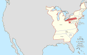
The territorial evolution of the United States began with the Declaration of Independence of thirteen British colonies in North America on July 4, 1776. In the Lee Resolution of July 2, 1776, the colonies resolved that they were free and independent states. Their independence was recognized by Great Britain in the Treaty of Paris of 1783, which concluded the American Revolutionary War. This effectively doubled the size of the colonies, now able to stretch west past the Proclamation Line to the Mississippi River. The first great expansion of the country came with the Louisiana Purchase of 1803, which doubled the country's territory. The country's expansion beyond North America began in 1856 with the passage of the Guano Islands Act, causing many small and uninhabited, but economically important, islands in the Pacific Ocean and Caribbean Sea to be claimed. Through the Spanish–American War in 1898, the United States gained Guam, Puerto Rico, and the Philippines. Following World War II, many islands were entrusted to the U.S. by the United Nations. (Full list...)
