
Wikipedia:Graphics Lab/Map workshop/Archive/Nov 2020
| This page is an archive. Do not edit the contents of this page. Please direct any additional comments to the current main page. |

Anglicize Bismarckian map

Could someone please anglicize the labels for country names and bodies of water on File:Map of Bismarcks alliances-fr.svg? Suggested new name is File:Map of Bismarcks alliances-en.svg.
Here are the translations for the Legend:
- title of Legend: 'Bismarck's Alliance Policy'
- Dreikaiserabkommen -> League of the Three Emperors
- zweibund -> Dual Alliance (1879)
- dreibund -> Triple Alliance (1882)
- Traité de Réassurance -> Reinsurance Treaty
I'm not sure how svg's work, but if they allow simple text links, the English names to the right of the arrows correspond to the article titles on en-wiki, so they could be wikilinked, if that works in maps, but that's very low priority, since most won't readers click through the thumbnail to the large map, so 99.9% of the time they wouldn't be used. (please ![]() mention me on reply; thanks!) Thanks! Mathglot (talk) 18:28, 19 December 2020 (UTC)
mention me on reply; thanks!) Thanks! Mathglot (talk) 18:28, 19 December 2020 (UTC)
- Discussion
![]() Request taken by DutchTreat (talk) 16:08, 20 December 2020 (UTC).
Request taken by DutchTreat (talk) 16:08, 20 December 2020 (UTC).
- @Mathglot: I will work the English translation in SVG. After that is done, I'll see how your idea about wikilinking the labels works out. DutchTreat (talk) 16:08, 20 December 2020 (UTC)
- First version available for review. A few minor changes required for word wrap in Legend. - DutchTreat (talk) 17:29, 20 December 2020 (UTC)
- @DutchTreat: thanks! As far as the links, I would say, only do the links if it is as easy as adding four brackets around some text; not worth doing if you have to figure out hot spots and coordinates of the text on the image. Would it help if I listed all the country names and bodies of water, so you don't have to search for them? Reading in a clockwise spiral starting from far left: Atlantic Ocean, United Kingdom, North Sea, Baltic Sea, Russia, Black Sea, Turkey, Greece, Italy, Mediterranean Sea, Spain, Portugal, France, Germany, Austria-Hungary, Romania, Bulgaria, Turkey [again; European part], Serbia. I think that's everything, and, thanks again! Mathglot (talk) 20:55, 20 December 2020 (UTC)
- Oh wow, you already did it, that was fast! It looks great, I don't know if the 'Three Emperors' legend caption can be folded so it fits better? Alternately, I think it would be fine to extend the left border of the Legend box further left (closer to the 'Y' in "Turkey") so the label fits better. Also, if it was extended left, the legend title might fit without folding as well, and if it did, the vertical height could be shortened a bit so the top border, which at that point would be sitting under 'Black Sea', would have a bit more clearance between it and the 'Black Sea' caption. Only if it's easy to do that. Mathglot (talk) 21:04, 20 December 2020 (UTC)
- @Mathglot: Improved version uploaded with adjustments to the Legend. For wikilinks, the {{Overlay legend}} works best. See changes on Draft:War guilt question#Pre-war policy. Being outside the map the SVG may be used on other non-English WP where different article names can be used. If you like the changes, please add {{resolved}} in your reply. Anything else, let me know!
 Done DutchTreat (talk) 12:59, 21 December 2020 (UTC)
- Outstanding! Thanks, DutchTreat. Mathglot (talk) 16:02, 21 December 2020 (UTC)
- Oh, there's one tiny typo: the "Dual" Alliance is spelled with an 'a' not an 'e'. Mathglot (talk) 16:04, 21 December 2020 (UTC)
Sabah districts map
-
 Districts of Sabah map
.svg)
- Article(s)
- Sabah
- Request
- Need a redraw of this SVG map where the numbers, colours, borders and the cities/towns dot can be edited for update since there is recent addition of a new district by the government. Ṉight Ḻantern 🏮 09:02, 7 November 2020 (UTC)
- Discussion
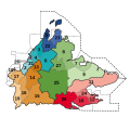
Request:British Columbia Parks and Protected Areas System Map
-
 Original BC Parks map by User:Qyd
 -
 Example A (Canadian National Parks)


- Article(s)
- BC Parks, List of British Columbia Provincial Parks, List of protected areas in British Columbia
- Request
- Hello, this is a map of BC Parks-managed protected areas that was made by User:Qyd back in April 2006. It's a well-used map in need of updating both in information and visual style. I am requesting the map be updated to include all current BC Parks-managed protected areas. Ideally the map would reflect the style of Example A (flat, good contrast, conical projection), though the inclusion of cities and road/rail infrastructure are not necessary. However, inclusion of major water bodies would be greatly appreciated given that many protected areas surround major water bodies such as lakes and rivers.
- The Government of British Columbia already has a map featuring various provincial parks and protected areas, though it is not visually simple like Qyd's image, is a PDF, and has a large file size. This map can be found here: B.C. Parks Protected Areas Reference Map. A link to the BC Parks website can be found here: BC Parks.
- My sincerest thanks! Ponderosapine210 (talk) 08:34, 11 October 2020 (UTC)
- Discussion
Ponderosapine210 I would be happy to take this but I want to ensure that you will be there to help me with your knowledge and information. One problem which you have to decide on is if you promptly want a conical projection as openstreetmap (which I will use for base) uses Spherical Mercator projection. If that is okay with you I can help, please always ping me. --Goran tek-en (talk) 18:07, 10 November 2020 (UTC)
Request: Combined British and Mongol Empire map
-
 The British Empire at its greatest extent
 -
 The Mongol Empire at its greatest extent


- Article(s)
- List of largest empires
- Request
- Hello! I was thinking a single map showing both the British and Mongol Empires at their respective maximum extents would be a nice fit for List of largest empires. I wasn't able to find a map like that over at WP:COMMONS, and I don't have the skills to make one myself, so I figured I'd ask here. I was thinking of something along the lines merging the above two maps (or whichever the two most accurate maps happen to be). The map should not include Britain's Antarctic claims for the purposes of the List of largest empires article. I'm unsure if a plain map without borders or one with modern-day borders would be better. There is some overlap between the two empires, but not much, so I figure that can be solved with shading (or stripes?) of some kind. I was thinking red for the British Empire and green or blue for the Mongol Empire, but it's not terribly important (as long as the respective colours are easily distinguishable and easy to refer to in text). Thanks in advance! TompaDompa (talk) 12:08, 25 October 2020 (UTC)
- Discussion
- Just a comment: if it were me, I'd just present two maps side-by-side as you've done above. Superimposing both empires on one map will probably just be harder to read, since there are overlapping areas. – Joe (talk) 12:18, 25 October 2020 (UTC)
- I'm wary of cluttering the article with too many images (the map would either be placed in the WP:LEAD or next to a table, so multiple images is not ideal), which is something that has been a major problem in the past. I don't want to invite the addition of even more maps (not least because that would almost certainly result in WP:Nationalist editing, WP:POV pushing, and WP:Edit warring). I've seen combined maps with both empires that have solved it with shading (such as this one and this one, both of which have other issues that make them unsuitable), and I think that works pretty well since the overlap is minimal. TompaDompa (talk) 12:35, 25 October 2020 (UTC)
- Map done
- See your talk page. Amitchell125 (talk) 16:02, 18 November 2020 (UTC)
Request:Only color Scotland
-
 EFNYO Members

- Article(s)
- European Federation of National Youth Orchestras
- Request
- Hi, can someone help me remove the coloring from Great Britain, only coloring in Scotland? Also Greenland can be uncolored as well. Thanks! intforce (talk) 23:53, 18 December 2020 (UTC)
- Discussion
{{resolved}}