
West Harbour, Auckland
West Harbour | |
|---|---|
 Luckens Road, looking north-east towards Hobsonville and Greenhithe | |
 Map | |
| Coordinates: 36°48′34″S 174°38′30″E / 36.8094°S 174.6418°E | |
| Country | New Zealand |
| City | Auckland |
| Local authority | Auckland Council |
| Electoral ward | |
| Local board | |
| Area | |
| • Land | 427 ha (1,055 acres) |
| Population (June 2023)[2] | |
| • Total | 11,680 |
| Postcode(s) | 0618 |
| Ferry terminals | West Harbour Ferry Terminal |
| Kumeū | Whenuapai | Hobsonville |
| Westgate, New Zealand |
|
(Waitematā Harbour) |
| Massey | Royal Heights | Te Atatū Peninsula |
West Harbour is an affluent suburb of Auckland, located to the west of the Auckland isthmus and CBD. It is named for its location on the western side of the Waitematā Harbour. West Harbour is under the governance of Auckland Council after the amalgamation of district councils in 2010.
Local features include many public reserves (the most prominent being Luckens Reserve, which in 2014 received a basketball court), tennis courts, two local primary schools, West Harbour School and Marina View School, a Church, and farm land. West Harbour is home to Hobsonville Marina, a large marina catering to around 600 of private leisure boats and yachts, which was part of the route the Royal Family took during their 2014 visit. As the unique terrain of West Harbour, most of the houses have a magnificent sea view and city view, which makes the suburb one of the exclusive suburbs in Auckland City and home to hundreds of multi-million dollar houses and mansions. West Harbour has the highest median house price in Waitakere City.
Demographics[edit]
West Harbour covers 4.27 km2 (1.65 sq mi)[1] and had an estimated population of 11,680 as of June 2023,[2] with a population density of 2,735 people per km2.
| Year | Pop. | ±% p.a. |
|---|---|---|
| 2006 | 10,827 | — |
| 2013 | 10,851 | +0.03% |
| 2018 | 11,373 | +0.94% |
| Source: [3] | ||
West Harbour had a population of 11,373 at the 2018 New Zealand census, an increase of 522 people (4.8%) since the 2013 census, and an increase of 546 people (5.0%) since the 2006 census. There were 3,468 households, comprising 5,643 males and 5,730 females, giving a sex ratio of 0.98 males per female, with 2,445 people (21.5%) aged under 15 years, 2,349 (20.7%) aged 15 to 29, 5,331 (46.9%) aged 30 to 64, and 1,251 (11.0%) aged 65 or older.
Ethnicities were 58.8% European/Pākehā, 11.7% Māori, 10.5% Pacific peoples, 28.9% Asian, and 3.6% other ethnicities. People may identify with more than one ethnicity.
The percentage of people born overseas was 37.5, compared with 27.1% nationally.
Although some people chose not to answer the census's question about religious affiliation, 49.4% had no religion, 34.6% were Christian, 0.9% had Māori religious beliefs, 3.1% were Hindu, 1.6% were Muslim, 2.3% were Buddhist and 1.5% had other religions.
Of those at least 15 years old, 2,292 (25.7%) people had a bachelor's or higher degree, and 1,218 (13.6%) people had no formal qualifications. 1,887 people (21.1%) earned over $70,000 compared to 17.2% nationally. The employment status of those at least 15 was that 4,737 (53.1%) people were employed full-time, 1,200 (13.4%) were part-time, and 336 (3.8%) were unemployed.[3]
| Name | Area (km2) | Population | Density (per km2) | Households | Median age | Median income |
|---|---|---|---|---|---|---|
| West Harbour West | 1.96 | 4,332 | 2,210 | 1,272 | 30.5 years | $34,300[4] |
| West Harbour Clearwater Cove | 1.36 | 4,344 | 3,194 | 1,371 | 41.2 years | $39,200[5] |
| West Harbour Luckens Point | 0.98 | 2,697 | 2,752 | 825 | 37.8 years | $37,700[6] |
| New Zealand | 37.4 years | $31,800 |
Education[edit]
Local State secondary schools are Hobsonville Point Secondary School, Massey High School, Rutherford College, Henderson High School, Liston College, Waitakere College and St Dominic's College.
Amenities[edit]
The Manutewhau Walk Reserve is an area of native bush reserve found in West Harbour, along the banks of the Manutewhau Stream. The reserve is adjacent to Moire Park, a large public park and sportsfield.[7]
Gallery[edit]
-
 The Hobsonville Marina and West Harbour Ferry Terminal
 -
 Luckens Reserve
 -
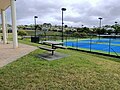 West Harbour Tennis Centre


References[edit]
- ^ a b "ArcGIS Web Application". statsnz.maps.arcgis.com. Retrieved 19 November 2023.
- ^ a b "Population estimate tables - NZ.Stat". Statistics New Zealand. Retrieved 25 October 2023.
- ^ a b "Statistical area 1 dataset for 2018 Census". Statistics New Zealand. March 2020. West Harbour West (119800), West Harbour Clearwater Cove (120300) and West Harbour Luckens Point (120700).
- ^ 2018 Census place summary: West Harbour West
- ^ 2018 Census place summary: West Harbour Clearwater Cove
- ^ 2018 Census place summary: West Harbour Luckens Point
- ^ Janssen, Peter (January 2021). Greater Auckland Walks. New Holland Publishers. p. 62-63. ISBN 978-1-86966-516-6. Wikidata Q118136068.