
User:Mitternacht90/Mitternacht90 gallery
ALL PICS ARE DOMAIN BUT PLEASE PUT MY NAME OR MY FORUM'S NAME (BLACKBIRD GARDEN)
THANKS!,
- --Mitternacht90 01:26, 5 August 2006 (UTC)
Oklahoma[edit]
OKC Zoo[edit]
These pics were taken at my house, the OKC Zoo and the Shedd Aquarium
-

-

-
-

-

-
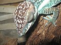 ? Anole
 -

-

-

-
-

-

-

-
-

-

-

-

-

-
 Eclectus Parrot, female
 -

-

-

-

-

-

-
-

-

-
-

-
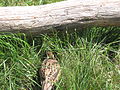
 A sign bout why you shouldn't kill rattlesnakes
 -

-

-
-

-

-

-

-

-
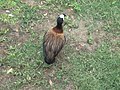
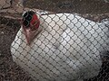 White-eared Pheasant stupid fence...
 -
-

-

-

-
 Wompoo Fruit Dove I got it to say its name!! LOL
 -
 Another Wompoo Fruit Dove
 -
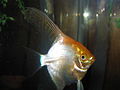
 Rainbow Trout stupid water got in the way!!


.jpg)


_-Oklahoma_City_Zoo-4a.jpg)


Oklahoma Aquarium[edit]
These pics were taken at the OK Aquarium
-

-

-
 Drums: Red and Black
 -

-

-

-

-
 Dwarf Seahorses. (Hippocampus zosterae? maybe)
 -

-
-

-
 Yellow Seahorse, Hippocampus kuda. (Can be Yellow or Black)


Sam Noble Museum[edit]
-
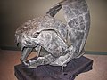
 Angisorhinus (sp?)
 -
-

-

-
-
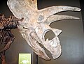
A Dunkleosteus shadow! LOL! Sorry bout the quality.
-
-

-
-

-

-

-
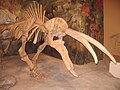
 Thalassomedon tail


My house[edit]
These pics were taken at my house.
-

-
-

-
 Double Black-eyed Susan
 -

-

-

-

-

-
Cockatiel under a blacklight.
-

-

-

-
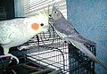 Cockatiels (Sunny and Dexie)
 -
-

-

-

-
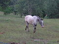 Someone else's horse
 -
 Sierra, a Morgan
 -

-

-
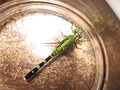
 There are: 2 Citrine Forktails, an Eastern Amberwing, and some female Familiar Bluets and the biggest one I think it's a Common Spreadwing.
 -
 A Plains Coreopsis that's red!!!
 -
 Red and black beans...
 -

-
 Lot's of Selenite!!
 -

-

-

-


.jpg)


Other Places in OK[edit]
-
 Great Blue Heron - its there somewhere!
 -


Illinois[edit]
Shedd Aquarium[edit]

Brookfield Zoo[edit]
-

-
 Blue Peafowl displaying
 -

-

-
 A Grey Gull at the Brookfield Zoo
 -


Field Museum[edit]
These pics were taken at the Field Museum and Sam Noble Museum
-
 Preserved Blue-and-white Mockingbird
 -
-

-
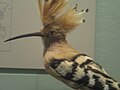 Preserved Hoopoe
 -
 Oilbird (sorry bout the quality, I think its the glass!!)
 -

-
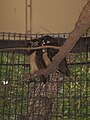
 This could very well be a Qinling Panda


Other countries[edit]
Costa Rica & France


Pics not by me[edit]
I just had to put them here... :)

John Rocque's maps of London were published in 1746. A French-born British surveyor and cartographer, John Rocque produced two maps of London and the surrounding area. The better known of these, depicted here, is a 24-sheet map of the City of London and the surrounding area, surveyed by Rocque and engraved by John Pine and titled A Plan of the Cities of London and Westminster, and Borough of Southwark. Rocque combined two surveying techniques: he made a ground-level survey with a compass and a physical metal chain – the unit of length also being the chain. Compass bearings were taken of the lines measured. He also created a triangulation network over the entire area to be covered by taking readings from church towers and similar high places using a theodolite made by Jonathan Sisson (the inventor of the telescopic-sighted theodolite) to measure the observed angle between two other prominent locations. The process was repeated from point to point. This image depicts all 24 sheets of Rocque's map.Map credit: John Rocque and John Pine
-
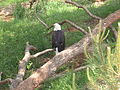
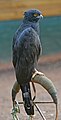
 African Fish Eagle: January 08
 -
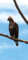
 African Hawk-eagle: February 08
 -
 Bateleur: April 08
 -
 Black Eagle: May 08
 -
 Black Hawk-eagle: June 08
 -
 Black-and-White Hawk-eagle: July 08
 -
 Black-chested Eagle-buzzard: August 08
 -
 Bonelli's Eagle: September 08
 -
 Booted Eagle: October 08
 -
 Brown Snake-Eagle: November 08
 -
 Changeable Hawk-eagle: December 08
 -
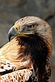 Eastern Imperial Eagle, Jan. 09.
 -

-

-
 WOW!!
WOW!! -

-
 PRETTY! :D


.jpg)
.jpg)
Featured pics[edit]
-
-

-
-

-
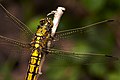 Black-tailed Skimmer - how come this pic ain't featured?!
 -
 Despite what the author says, IT DESERVES TO BE FEATURED
 -
 :O
:O


