Tracy Glacier (Greenland)
| Tracy Glacier | |
|---|---|
| Tracy Gletscher | |
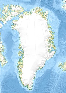
 Map of Northwestern Greenland | |
| Type | Tidal outlet glacier |
| Location | Greenland |
| Coordinates | 77°39′N 66°2′W / 77.650°N 66.033°W |
| Width | 4 km (2.5 mi) |
| Terminus | Inglefield Fjord Baffin Bay |
| Status | Retreating[1] |
Tracy Glacier (Danish: Tracy Gletscher), is a glacier in northwestern Greenland.[2] Administratively it belongs to the Avannaata municipality.
This glacier was named by Robert Peary after Benjamin F. Tracy (1830 – 1915), United States Secretary of the Navy, who granted him three years' leave in order to engage in Arctic explorations.[3]
Geography[edit]
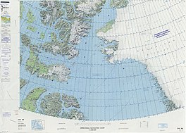
The Tracy Glacier discharges from the Greenland Ice Sheet into the head of the Inglefield Fjord just east of Josephine Peary Island. Its terminus lies between two nunataks. Mount Lee, the northern one, separates it from the Farquhar Glacier to the northwest and a larger nunatak, the Smithson Range, separates it from the Heilprin Glacier to the south.[2]
Although the Tracy Glacier is contiguous to the Heilprin Glacier, both glaciers have a different nature, a fact which has been a source of puzzlement for scientists for over a century.[4]
 |
See also[edit]
References[edit]
- ^ Tracy Gletscher Retreat 1987-2013, Northwest Greenland
- ^ a b "Tracy Gletscher". Mapcarta. Retrieved 30 March 2019.
- ^ PEARY MAY SEEK THE POLE.; SECRETARY TRACY DECIDES TO GRANT THE REQUEST OF THE SCIENTISTS. - NY Times, 1892
- ^ "NASA Discovered Why Greenland's Glaciers Are Melting at Different Speeds". Inverse. 23 June 2018. Retrieved 30 March 2019.
External links[edit]
- Identifying Spatial Variability in Greenland's Outlet Glacier Response to Ocean Heat
- The recent regimen of the ice cap margin in North Greenland

