
Sveti Ožbolt
Sveti Ožbolt
Ožbolt nad Zmincem (1955–1997) | |
|---|---|
 | |
 Sveti Ožbolt Location in Slovenia | |
| Coordinates: 46°6′53.71″N 14°17′5.31″E / 46.1149194°N 14.2848083°E | |
| Country | |
| Traditional region | Upper Carniola |
| Statistical region | Upper Carniola |
| Municipality | Škofja Loka |
| Area | |
| • Total | 7.72 km2 (2.98 sq mi) |
| Elevation | 847.3 m (2,779.9 ft) |
| Population (2002) | |
| • Total | 78 |
| [1] | |
Sveti Ožbolt (pronounced [ˈsʋeːti ˈoʒːbɔlt]; German: Sankt Oswald[2]) is a settlement in the Municipality of Škofja Loka in the Upper Carniola region of Slovenia.
Name[edit]
The name of the settlement was changed from Sveti Ožbolt (literally, 'Saint Oswald') to Ožbolt nad Zmincem (literally, 'Oswald above Zminec') in 1955. The name was changed on the basis of the 1948 Law on Names of Settlements and Designations of Squares, Streets, and Buildings as part of efforts by Slovenia's postwar communist government to remove religious elements from toponyms.[3][4][5] The name Sveti Ožbolt was restored in 1997.[6] In the past the German name was Sankt Oswald.[2]
Church[edit]

The local church, built on a hill above the settlement, is dedicated to Saint Oswald and is Late Gothic with the date 1527 in its vaulted sanctuary. The nave dates to 1644 and originally had a flat ceiling but was vaulted in 1849. Frescos on the arch leading to the sanctuary were painted by Jernej of Loka in 1534.[7]
Gallery[edit]
-
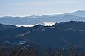 Sveti Ožbolt from the north

References[edit]
- ^ Statistical Office of the Republic of Slovenia
- ^ a b Leksikon občin kraljestev in dežel zastopanih v državnem zboru, vol. 6: Kranjsko. 1906. Vienna: C. Kr. Dvorna in Državna Tiskarna, p. 64.
- ^ Spremembe naselij 1948–95. 1996. Database. Ljubljana: Geografski inštitut ZRC SAZU, DZS.
- ^ Premk, F. 2004. Slovenska versko-krščanska terminologija v zemljepisnih imenih in spremembe za čas 1921–1967/68. Besedoslovne lastnosti slovenskega jezika: slovenska zemljepisna imena. Ljubljana: Slavistično društvo Slovenije, pp. 113–132.
- ^ Urbanc, Mimi, & Matej Gabrovec. 2005. Krajevna imena: poligon za dokazovanje moči in odraz lokalne identitete. Geografski vestnik 77(2): 25–43.
- ^ "Naselje Sv. Ožbolt". Statistični urad Republike Slovenije. Retrieved 26 March 2021.
- ^ Škofja Loka Municipality declaration of local churches as cultural monuments, 23 May 2007 Archived 11 August 2011 at the Wayback Machine
External links[edit]
 Media related to Sveti Ožbolt at Wikimedia Commons
- Sveti Ožbolt on Geopedia

This article about the Municipality of Škofja Loka in Slovenia is a stub. You can help Wikipedia by expanding it. |