
San Miguel District, Lima
Saint Michael District
Distrito de San Miguel (Spanish) | |
|---|---|
 Plaza San Miguel, a mall in San Miguel | |
.png) Flag  Coat of arms | |
 Location of San Miguel in the Lima province | |
| Coordinates: 12°4′38″S 77°5′34″W / 12.07722°S 77.09278°W | |
| Country | Peru |
| Region | Lima |
| Province | Lima |
| Founded | October 5, 1920 |
| Government | |
| • Mayor | Eduardo Bless (2023-2026) |
| Area | |
| • Total | 10.72 km2 (4.14 sq mi) |
| Population (2023)[1] | |
| • Total | 183,597 |
| • Demonym | San miguelino/a |
| Time zone | UTC-5 (PET) |
| UBIGEO | 150136 |
| Website | www |
San Miguel is one of the 43 districts that are part of the Lima province and of the urban area of Lima, Peru. It is bordered by the districts of Bellavista and downtown Lima on the north; Pueblo Libre, Magdalena del Mar and downtown Lima on the east; the Pacific Ocean on the south; and the La Perla district on the west.
San Miguel is an upper-class (65% of its population) and upper-middle class (35%) district with a very high HDI.[2]
Gallery[edit]
-
 Parque de Las Leyendas, the city's zoo
 -
 A view of San Miguel towards the west at sunset
 -
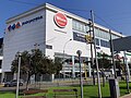 The Wong supermarket, Plaza San Miguel


See also[edit]
References[edit]
- ^ "Estadística Poblacional - Ministerio de Salud del Perú".
- ^ Instituto Nacional de Estadística e Informática (2020). Planos estratificados de Lima Metropolitana a nivel de manzanas 2020 (PDF). Lima. p. 52.
{{cite book}}: CS1 maint: location missing publisher (link)
External links[edit]
- (in Spanish) Municipalidad de San Miguel Archived 2006-12-24 at the Wayback Machine - San Miguel district council official site
You can help expand this article with text translated from the corresponding article in Spanish. (February 2024) Click [show] for important translation instructions.
|
Places adjacent to San Miguel District, Lima | |
|---|---|