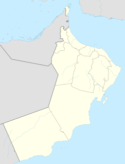
Rabkut
Rabkut
ربكوت Rabkot | |
|---|---|
Village | |
 U.S. Marines firing a mortar as part of a military exercise with Omani soldiers in Rabkut. | |
| Coordinates: 17°28′19″N 54°07′32″E / 17.47194°N 54.12556°E | |
| Country | Oman |
| Governorate | Dhofar Governorate |
| Wilayat (province) | Thumrait |
| Area | |
| • Total | 14.95 km2 (5.77 sq mi) |
| • Land | 14.95 km2 (5.77 sq mi) |
| • Water | 0 km2 (0 sq mi) |
| Elevation | 525 m (1,722 ft) |
| Population (2020) | |
| • Total | 931 |
| • Density | 62.29/km2 (161.3/sq mi) |
| Time zone | UTC+4 (Oman Standard Time) |
Rabkut (Arabic: ربكوت) is a village in Thumrait, Dhofar Governorate, in southwestern Oman.[1] In 2020, it had a population of 931.[2] It has been the site of Sea Soldier 2017, an annual military exercise conducted to keep regional stability, in addition to showing the cooperative skills of the United States with other countries.[3] Exercises include counter-improvised explosive device training, live-fire ranges, operations on urban terrain, and building clearing among others.
Demographics[edit]
| Year | Pop. | ±% |
|---|---|---|
| 2003 | 316 | — |
| 2010 | 505 | +59.8% |
| 2020 | 931 | +84.4% |
According to the 2020 census, there were 505 males (54.5%) and 424 females (45.5%). 806 people (86.6%) had Omani citizenship. 359 people (59%) were ages 0-14, 549 () were 15-64, and 23 (2.5%) were 65+.
References[edit]
- ^ National Geospatial-Intelligence Agency. GeoNames database entry. (search) Accessed 12 May 2024.
- ^ https://ecensus.gov.om/ecen-portal/?lang=en
- ^ "U.S. Marines, Omani Soldiers Begin Exercise Sea Soldier 17". Defense.gov. February 24, 2017. Retrieved May 13, 2024.
{{cite web}}: CS1 maint: url-status (link)

