Quảng Nam province

Coordinates: 15°33′N 108°03′E / 15.55°N 108.05°E / 15.55; 108.05
From Wikipedia, the free encyclopedia
Quảng Nam province
tỉnh Quảng Nam
Quảng Origin
Quảng Nam province
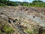
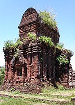
Hội An wreck  • Mỹ Sơn Tower  • Chiên Đàn Tower  • Khương Mỹ Tower  • Cù Lao Chàm Marine Park  • Phú Ninh Lake  • Tam Kỳ River  • Bằng An Tower
Official seal of Quảng Nam province
Nickname(s): 
Quảng Origin, the land of Ngũ Phụng Tề Phi, the land of UNESCO world cultural heritages in Vietnam, the land of outstanding spiritual people.
Location of Quảng Nam within Vietnam
Map
Coordinates: 15°33′N 108°03′E / 15.55°N 108.05°E / 15.55; 108.05
CountryVietnam Vietnam
RegionSouth Central Coast
Founded as Quảng Nam1471
Split from Quảng Nam – Đà Nẵng province (or Quảng Đà province)1471
CapitalTam Kỳ
Divisions2 provincial cities, 1 town, 15 counties
Government
 • Typesingle-party system
 • Secretary of Communist PartyLương Nguyễn Minh Triết
 • Chairman of the People's CouncilNo information
 • Chairman of the People's CommitteeLê Trí Thanh
Area
 • Total10,575 km2 (408,298 sq mi)
Population
 (2021)[1]
 • Total1,945,812
 • Density180/km2 (4.8/sq mi)
Demographics
 • EthnicitiesVietnamese, Hoa, Cơ Tu, Xơ Đăng, Giẻ Triêng, Co
GDP[2]
 • TotalVND 91.677 trillion
US$ 3.915 billion
Time zoneUTC+7 (ICT)
Postal code
56xxxx
Area codes235
GeocodeVN-27
ISO 3166 codeVN-27
Websitewww.quangnam.gov.vn

Quảng Nam (Vietnamese: [kwaːŋ˧˩ naːm˧˧] ) is a coastal province located in the northernmost coastal region of South Central and Central Vietnam. Quang Nam is located in the key economic region of the Central region. In 1997, the province was re-established on the basis of separating Quang Nam - Da Nang province (also known as Quang Da province) into two administrative units, Quang Nam province and Da Nang city. Currently, the province has two cities: Tam Ky city (provincial capital) and Hoi An city. Quang Nam province is home to the most world cultural heritages in the country with two world cultural heritages recognized by UNESCO: Hoi An ancient town and My Son temple relic area. In addition, Quang Nam province is also a land of outstanding people, where many outstanding, talented and outstanding people are born for the country. This is also the only province in the South Central region that borders the East Sea, borders the Lao People's Democratic Republic and has an international border.

In 2022, Quang Nam will be the 19th largest administrative unit in Vietnam in terms of population, ranked 17th in terms of Gross Regional Product (GRDP), ranked 17th in terms of GRDP per capita, ranked 27th in terms of growth rate. Head of GRDP. With 1,519,400 people, GRDP reached 115.883 billion VND (equivalent to 5.04 billion USD), GRDP per capita reached 76.6 million VND (equivalent to 3,161.34 USD), GRDP growth rate reached 10 .3%.

In the first 6 months of 2021, Quang Nam is in the group of 9 provinces in the country with an economic growth rate (GRDP) of over 2 digits (up 11.7%), ranking 5th in the country and the highest in the region. Central region's key economy. The economic scale is nearly 51,973 billion VND, ranking 2nd after Da Nang.

Quang Nam has Chu Lai Open Economic Zone, famous for its THACO factory, which is an important lever of the Central Key Economic Region. In 2018, the largest and most modern Thaco Mazda automobile factory in Southeast Asia was inaugurated in Quang Nam.

Etymology[edit]

Throughout the history of Vietnam, the province has been known by many names: From Dao Thua Quang Nam to Quang Nam land, Quang Nam Town, Quang Nam Palace in ancient times, then Quang Da Special Zone during the Vietnam War, Quang Nam - Da Nang province (Quang Da province) after reunification and returned to the old name of Quang Nam province when the province was re-established in 1997 on the basis of separation of Quang Nam - Da Nang province (also known as Quang Da province) is divided into two administrative units: Quang Nam province and Da Nang city. In 1471, with King Le Thanh Tong establishing Thua Tuyen Quang Nam, the king affirmed Dai Viet's territorial sovereignty over this land and gave its current name. "Quang" means expansion, "Nam" means to the South, so the name called "Quang Nam" means "expanding to the South".

History[edit]

Quang Nam is a land rich in cultural traditions and the most world cultural heritages in the country with two world cultural heritages recognized by UNESCO: Hoi An ancient town and My Son holy land. Quang Nam is also a land of outstanding people, where many outstanding, talented and outstanding people are born for the country. In 2008, Quang Nam was the first province in the South Central Coast region to have 2 cities under the province (Tam Ky, Hoi An). This is also the only province of the South Central Coast region that borders both the sea and the border (special is an international border).

Tran Dynasty

Previously, Quang Nam was the land of the Kingdom of Champa. In 1306, according to the agreement between King Che Man of Champa and King Tran Nhan Tong of Dai Viet, King Che Man offered two continents, namely: Chau O or Thuan Chau (south of Quang Tri, Hue) and Chau Ly or Hoa Chau (Southern Quang Tri, Hue). part of Hue, north of the Thu Bon River) as a bride price to marry King Tran Nhan Tong's daughter, Princess Huyen Tran. Vietnamese people gradually settled in two new lands; The Champa people gradually retreated to the remaining lands in the south of the kingdom.

In 1400, the Ho Dynasty replaced the Tran Dynasty. The Ho Dynasty divided Hoa Chau into four smaller continents: Thang Chau, Hoa Chau, Tu Chau and Nghia Chau and placed An Phu Su to rule.

In 1407, Tran Ngoi rose up in Nghe An and proclaimed himself Gian Dinh Emperor of the Later Tran Dynasty. There were two former Ho Dynasty officials, Dang Tat in Hoa Chau (now Thua Thien - Hue) and Nguyen Canh Chan in Thang Hoa (now Thua Thien - Hue). Quang Nam) followed and helped. In the first lunar month of 1408, Tran Ngoi and Dang Tat commanded the Later Tran army to destroy 40,000 Ming troops led by Moc Thanh at the battle of Bo Co.

Le Dynasty

In 1471, after occupying the land south of Thuan Hoa up to Cu Mong pass, King Le Thanh Tong established a 13th administrative unit - Thua Tuyen Quang Nam including 3 districts: Thang Hoa, Tu Nghia and Hoai Nhon (now known as Thua Tuyen). Da Nang, Quang Nam, Quang Ngai, Binh Dinh). The name Quang Nam appeared from here.

Map of Quang Nam province in 1909
Map of La Qua (Quảng Nam) citadel during the Nguyễn dynasty

During the reign of Lord Nguyen

During the Trinh - Nguyen war, Quang Nam was under the control of Lord Nguyen (since 1570). Hoi An was chosen by the lord as the only trading point with the world at that time, so many foreign merchants often called this land "Quang Nam Quoc". Chronicles of the Nguyen Dynasty wrote about this period as follows: "The Lord stayed in the town for more than 10 years, (Lord Nguyen Hoang) was generous, the military orders were solemn, the people were all peaceful and prosperous, the market was not double-priced. There were no robbers or robbers. There were many merchant ships from different countries. The town became a large metropolis."

Tay Son Dynasty

By the mid-17th century, the dynasties of Dang Trong were in decline. Taxes are heavy; Mandarins take advantage of their positions and create trouble to make people suffer. Faced with that situation, when the Tay Son movement broke out, the people of Quang Nam also rebelled. In the fall of 1773, when the Tay Son army pulled out to Quang Nam, the people of Quang Nam coordinated with the insurgents to ambush Ben Da (Thach Tan, Thang Hoa, Quang Nam) to defeat Lord Nguyen's army led by generals Nguyen Cuu Thong, Nguyen Huu Sach commanded. However, the Tay Son Dynasty only existed for a short time.

Nguyen Dynasty

In 1806, King Gia Long unified the country. Administratively, the king divided the country into 23 towns and 4 camps in the capital including Truc Le-Quang Duc, Quang Binh, Quang Tri and Quang Nam camp.

In 1831, King Minh Mang changed the town and camp into a province. Quang Nam officially became a province this year. Quang Nam province is divided into two districts: Thang Binh (升平) (formerly Thang Hoa) (including the districts of Le Duong (醴陽), Tam Ky (三岐), Ha Dong (河東), Que Son (桂山)) and Dien Ban (奠磐) (including the districts of Hoa Vang (和榮), Duy Xuyen (濰川), Dien Phuc (延福) (later renamed Dien Phuoc), Dai Loc (大祿)).

French colonial period

In 1888, under the reign of King Thanh Thai, Da Nang was separated from Quang Nam to become a concession land of the French colonialists.

Republic of Vietnam period

After the Geneva Agreement, Quang Nam province during the Republic of Vietnam in 1956 was divided into two new provinces with the Ru Ri River (another name for the Ly Ly River) as the boundary: Quang Nam in the North including nine districts and Quang Tin in the South includes six districts.

The nine districts of Quang Nam are:

  • Hoa Vang (now Cam Le, Lien Chieu, Ngu Hanh Son districts and part of Hoa Vang district in Da Nang city).
  • Dai Loc
  • Dien Ban
  • Duy Xuyen
  • Duc Duc (now Nong Son district and parts of Dai Loc and Duy Xuyen districts).
  • Hieu Nhon (now Hoi An city and part of Dien Ban town).
  • Que Son
  • Hieu Duc (now part of Hoa Vang district of Da Nang city and Dong Giang district).
  • Thuong Duc (now Nam Giang, Tay Giang districts and part of Dai Loc and Dong Giang districts).
  • The provincial capital is located in Hoi An in Hieu Nhon district (Hoi An).

Quang Tin province, from Ly Ly river to Doc Soi (border between Quang Nam and Quang Ngai), includes 6 districts:

  • Thang Binh
  • Tam Ky (now Tam Ky city, Phu Ninh district and part of Nui Thanh district)
  • Ly Tin (now part of Nui Thanh district)
  • Tien Phuoc
  • Hau Duc (now part of Bac Tra My district)
  • Hiep Duc (now Hiep Duc and Phuoc Son districts).

Quang Tin's population at that time was 353,752 people; The provincial capital is located in Tam Ky.

Democratic Republic of Vietnam (now is: Socialist Republic of Vietnam) period

Quang Nam - Da Nang province (or Quang Da province)

After unifying the country, the government of the Socialist Republic of Vietnam decided to merge 3 provinces: Quang Nam, Quang Tin and Da Nang city to form Quang Nam - Da Nang province (Quang Da) with Da Nang. Nang is a provincial city.

After the establishment of the province, there were the following administrative changes: changing Da Nang town into Da Nang city, merging Tam Ky town and 2 districts North Tam Ky and Nam Tam Ky into Tam Ky district.

By 1980, Quang Nam - Da Nang province had Da Nang city (provincial city), Hoi An borough, 12 districts: Dai Loc, Dien Ban, Duy Xuyen, Giang, Hien, Hoa Vang, Phuoc Son, Que Son, Tam Ky, Thang Binh, Tien Phuoc, Tra My.

On February 4, 1982, Hoang Sa island district was established.

On December 3, 1983, Tam Ky district was divided into Tam Ky borough and Nui Thanh district.

On December 31, 1985, Hiep Duc district was established on the basis of separating 2 communes of Thang Binh district, 4 communes of Que Son district and 2 communes of Phuoc Son district.

By 1991, Quang Nam - Da Nang province included: Da Nang city (provincial capital), 2 borough: Tam Ky, Hoi An and 14 districts: Dai Loc, Dien Ban, Duy Xuyen, Giang, Hien, Hiep Duc, Hoa Vang, Hoang Sa, Nui Thanh, Phuoc Son, Que Son, Thang Binh, Tien Phuoc, Tra My.

Quang Nam province

In 1997, according to the Resolution issued at the 10th session of the National Assembly, Quang Da province was divided into two independent administrative units including Da Nang city and Quang Nam province. Quang Nam province has 14 districts including Dai Loc, Dien Ban, Duy Xuyen, Giang, Hien, Hiep Duc, Nui Thanh, Phuoc Son, Que Son, Thang Binh, Tien Phuoc, Tra My and 2 borough: Tam Ky (province capital), Hoi An.

On August 16, 1999, Giang district was renamed Nam Giang district.

On June 20, 2003, Tra My district was divided into two districts: Bac Tra My district and Nam Tra My district; Divide Hien district into 2 districts: Dong Giang district and Tay Giang district.

On January 5, 2005, Tam Ky town was divided into Tam Ky town and Phu Ninh district.

On September 29, 2006, Tam Ky borough was converted into Tam Ky city.

On January 29, 2008, Hoi An borough was transformed into Hoi An city.

In 2008, Quang Nam was the first province in the South Central region to have two cities under the province, Tam Ky city and Hoi An city, respectively.

On April 8, 2008, Que Son district was divided into two districts: Que Son district and Nong Son district.

On March 11, 2015, Dien Ban district was changed to Dien Ban borough.

Quang Nam province has 2 cities, 1 borough and 15 districts as of today.

Geography[edit]

Location

Quang Nam province belongs to the South Central region of the Central region of Vietnam, 820 km north of Hanoi capital, 235 km north of Hue city, bordering Da Nang city in the north and 235 km north of Thanh Hoa. Ho Chi Minh City 900 km south along National Highway 1A, geographical location:

The north borders Thừa Thiên Huế province and Đà Nẵng city.

The south borders Quảng Ngãi province and Kon Tum province.

The west borders Sekong province of Laos.

East sea bordering the South China sea.

The provincial capital of Quang Nam is located in Tam Ky city, with the ancient town of Hoi An. Quang Nam is located about halfway between Hanoi and Ho Chi Minh City along National Highway 1A.

Quang Nam province has an area of 10,574.86 km², the 6th largest in Vietnam, the population in 2022 is 1,519,400 people[5], the population density reaches 144 people/km².

Topographic

The terrain gradually lowers from west to east and is divided into 3 regions: the mountains in the west, the midlands in the middle and the coastal plain in the east. Quang Nam is located in the tropical monsoon climate zone, the average annual temperature is above 25 °C, the average annual rainfall reaches 2,000-2,500mm with more than 70% concentrated in the 3 months of the rainy season (October, November and December). twelfth). Vu Gia - Thu Bon and Tam Ky are two main river basins.

In general, Quang Nam's natural conditions (weather-climate, terrain, water and sea resources) have many advantages and potential for developing diverse and unique cultural careers (developing small and medium-sized cities). cultural areas), developing the tourism industry (cultural tourism, eco-tourism).

Quang Nam's terrain tilts gradually from West to East, forming three distinct types of ecological landscapes: high mountains in the West, midlands in the middle and coastal plains. Hilly areas account for 72% of the natural area with many peaks over 2,000m high such as Lum Heo mountain 2,045m high, Tion mountain 2,032m high, Gole - Lang mountain 1,855m high (Phuoc Son district). Ngoc Linh Mountain, 2,598m high, located between the border of Quang Nam and Kon Tum, is the highest peak of the Truong Son range. In addition, the coastal area east of the Truong Giang River is a long sand dune running from Dien Ngoc, Dien Ban to Tam Quang, Nui Thanh. The terrain surface is divided by a fairly developed river system including Thu Bon River, Tam Ky River and Truong Giang River.

Quang Nam has a 125 km long coastline, with many beautiful and famous beaches, such as: Ha My (Dien Ban), Cua Dai (Hoi An), Binh Minh (Thang Binh), Tam Thanh (Tam Ky). , Bai Rang (Nui Thanh),... Cu Lao Cham is a coastal island cluster with a rich ecosystem recognized as a world biosphere reserve.

Climate

Quang Nam is located in a tropical climate zone, with only two seasons: the rainy season and the dry season, influenced by the cold winter in the North. The average annual temperature is 25.6 °C. In winter, the temperature in the plains can drop below 12 °C and the temperature in the mountains is even lower. The average humidity in the air reaches 84%. Average rainfall is 2000-2500mm. The rainy season usually lasts from October to December, the dry season lasts from February to August, January and September are transition months characterized by turbulent weather and quite a lot of rain. Rain is unevenly distributed in space, with more rain in mountainous areas than in the plains. The Northwest region of the Bung River basin (Dong Giang, Tay Giang and Nam Giang districts) has the lowest rainfall while the Southwest mountainous region of the Thu Bon River basin (Nam Tra My, Bac Tra My, Tien Phuoc and Hiep Duc) have the highest rainfall. Tra My is one of the heaviest rainfall centers in Vietnam with an average annual rainfall exceeding 4,000 mm. Heavy rain concentrates in a short period of time during the 3 months of the rainy season on a narrow, steep terrain, creating favorable conditions for rivers to flood rapidly.

There are currently two meteorological stations in the province that have fully monitored meteorological factors for a long time (starting from 1976), Tam Ky station and Tra My station. Tam Ky station located in Hoa Thuan ward, Tam Ky city is used to calculate relevant meteorological factors for the eastern plain of the province. Tra My station located in Tra My town, Bac Tra My district is used to calculate relevant meteorological factors for the western mountainous region of the province.

Water Resources

Quang Nam has two large river systems: Vu Gia - Thu Bon (VG-TB) and Tam Ky. The VG-TB basin area (including part of the basin in Kon Tum province, Quang Ngai, and Da Nang city is 10,350 km², one of the 10 river systems with the largest basin area in Vietnam and the largest river basin in Vietnam). Tam Ky is 735 km². The rivers originate from the eastern slope of the Truong Son range, flow mainly in the West-East direction and flow into the East Sea at Han estuary (Da Nang), Dai estuary (Hoi An) and An Hoa (Mountain Thanh). In addition to the above two river systems, Truong Giang River has a length of 47 km flowing along the coast in the North - South direction connecting the VG-TB and Tam Ky river systems.

Due to steep hilly terrain and heavy rainfall, the river network of Quang Nam province is quite dense. The average river density is 0.47 km/km² for the VG - TB system and 0.6 km/km² for other river systems.

The rivers have a large flow and are full of water all year round. The average annual flow of the Vu Gia river (up to Thanh My town with a basin area of 1,850 km²) is 127 m³/s, of the Thu Bon river (up to Nong Son with a basin area of 3,130 km²) is 281 m³/s. The flow regime of rivers has clear seasonal divisions. The flow in the 3 months of the flood season (October, November, December) accounts for 65 - 70% of the total yearly flow while the flow in the dry season (from February to August) is very low. January and September are transitional months with erratic flows. The maximum flow of Thu Bon at Nong Son is 10,600 m³/s and the minimum flow measured is 15.7 m³/s while the maximum flow of Vu Gia at Thanh My is 4,540 m³/s and the minimum flow is 10.5 m³/s. High flow in the rainy season and low flow in the dry season are the main causes of floods and droughts in the region.[6]

Rich water resources are the premise for hydropower development in the area. As of 2015, in Quang Nam there are 8 hydropower projects with large capacity (over 100 MW) and 35 hydropower projects with small capacity. Many large capacity hydropower plants such as Song Tranh 2, Dak Mi 4, A Vuong, Song Bung 2, Song Bung 4, Song Kon 2... have been and are being built, contributing to supplying electricity to the growing demand. increase of the whole country.

Land resources

Land use: According to statistical data, land inventory on January 1, 2010, out of the total natural area of 1,043,836 hectares, agricultural land area accounts for 798,790 hectares, non-agricultural land area is 87,765 hectares and Unused land area is 157,281 hectares.

The total natural area of Quang Nam is 1,043,803 hectares, formed from nine different types of soil including sand dunes and coastal sandy soil, river alluvial soil, sea alluvial soil, infertile gray soil, red yellow soil, valleys, degraded soils, eroded rocks, etc. Alluvial soils along rivers are the most important soil group in the development of food crops and short-term industrial crops. The yellow-red soil group in mountainous areas is favorable for growing forests, industrial crops and long-term fruit trees. The coastal sandy soil group is being exploited for aquaculture purposes.

Forest resources

Quang Nam province has 425,921 hectares of forest, the coverage rate is 40.9%; The province's wood reserves are about 30 million m3. The area of natural forest is 388,803 hectares, planted forest is 37,118 hectares. Rich forests in Quang Nam currently have about 10 thousand hectares, distributed in high mountain peaks. The remaining forest areas are mainly poor forests, medium forests and regenerated forests, with wood reserves of about 69 m3/ha. The nature reserves in the province are located on the Thanh River in Nam Giang district.

In April 2011, authorities of Quang Nam province established the Saola Nature Reserve (English: Saola Nature Reserve), opening a corridor for mountainous creatures between Laos and Vietnam, especially the saola species. threatened.

Evergreen broadleaf tropical forests are the main ecological type of Quang Nam. Quang Nam is a province rich in forest potential, but due to overexploitation for a long time, the area of primary forests is still small. The promotion of afforestation in recent years has increased Quang Nam's forested land area by more than 55% in 2014. This is one of the localities with the highest forested land area in the country. Thanh River special-use forest is the largest conservation area in the province, where wild animals in the Central Truong Son area are being preserved. Ngoc Linh ginseng is a precious medicinal plant distributed mainly at altitudes of over 1,000 m of Ngoc Linh mountain.

Administration map of Quangnam province

Administrative divisions[edit]

Quảng Nam subdivided into 18 district-level sub-divisions:

They are further subdivided into 13 commune-level towns (or townlets), 213 communes, and 18 wards.

Economy[edit]

Quang Nam province strives to become an industrial province before 2020.

In 2018, the Province had an economic structure: Industry and services accounted for 88%, Agriculture-Forestry-Fisheries accounted for 12%. The province has a high economic growth rate, the average in the period 2010-2015 is 16.3% (In 2015 it was 11.53%). Quang Nam has 13 industrial and open economic zones (Chu Lai Open Economic Zone). Therefore, Quang Nam is currently lacking a lot of labor - a paradox when the rate of unemployed students across the country is very large, the Gross Domestic Product in 2010 was about more than 23,000 billion VND, increasing to more than 89,900 billion VND in 2018. .State budget revenue increased, in 2018 wet budget revenue reached approximately VND 20,000 billion (ranked 10/63 provinces and cities, ranked 2nd in the central provinces from Thanh Hoa to Binh Thuan, only after Thanh Hoa and Da Nang. 2018 witnessed the economy growing strongly in just the first 9 months of the year, wet budget revenue reached 16,300 billion VND, equal to 103.5% of the 2018 estimate. It is expected that 2018 budget revenue will be approximately approximately 26,000 billion VND. However, revenue The budget mainly relies on the Truong Hai automobile manufacturing and assembly complex. 2018 wet exports reached over 700 million USD. The province has Ky Ha port and Chu Lai international airport. Striving for average GDP by 2020 per capita from 3,400-3,600 USD (75-80 million VND). In 2018, this province welcomed nearly 5.4 million tourists (ranked 2nd in the Central region after Da Nang City with nearly 6.1 million).

In 2022, the economic growth rate will reach 10.3%. Economic structure includes:

Agriculture, forestry and fisheries account for 13.9%.

Industry and construction account for 34.4%.

Services account for 30.1%.

Product tax minus product subsidies accounts for 18.6%.

State budget revenue in the province in 2022 will reach 26,000 billion VND.

In 2022, Quang Nam will be the 19th largest administrative unit in Vietnam in terms of population, ranked 27th in Gross Regional Product (GRDP), ranked 17th in GRDP per capita, ranked 27th in terms of growth rate. Head of GRDP. With 1,519,400 people,[21] GRDP reached 115.883 billion VND (corresponding to 5.04 billion USD), GRDP per capita reached 76.6 million VND (corresponding to 3,161.34 USD), the growth rate GRDP reached 10.3%.[22]

Potential for hydropower development

Quang Nam has a dense river and stream system with great hydroelectric potential. The Vu Gia - Thu Bon river system with most of the basin located within the province's boundaries is considered to have the fourth largest hydroelectric potential in the country, which is being invested and exploited.[23] Currently, the province has hydropower plants that have been and are being built such as A Vuong Hydropower Plant (210 MW - Tay Giang), Song Bung 2 (100 MW), Song Bung 4 (220 MW), Song Giang (60 MW), Dak Mi 1 (255 MW), Dak Mi 4 (210 MW), Kon River 2 (60 MW), Song Tranh 2 (135 MW),... Most hydropower plants are located in the Vu Gia river basin where there are Steep terrain and great hydroelectric potential.

The construction of hydroelectric projects upstream of Vu Gia - Thu Bon greatly affects the downstream flow. The Dak Mi 4 hydropower plant transfers water from Vu Gia to Thu Bon, significantly reducing the flow downstream of Vu Gia. During the dry season from February to August, the Vu Gia riverside area often faces a lack of water for living and farming. Reduced flow is the main cause of saltwater intrusion downstream into Vu Gia, Thu Bon and Vinh Dien.

Culture[edit]

Festival

  • Ba Thu Bon Festival is a folk festival of residents along the Thu Bon River, Quang Nam province with the purpose of praying for a new year of harmony, prosperity, and happiness for the people. The festival is held every year on the 12th day of the second lunar month.[24] Interspersed with folk music performances are the cheers and cheers of festivalgoers on both sides of the river. The most important rituals are the Ba offering ceremony and the water procession to the temple. Ba Thu Bon Temple is located in a river delta in Duy Xuyen district. The most important festival is the Le Ba boat racing festival (Men and Women), the festival of releasing flower lanterns and lighting sacred fires on the mudflats of the Thu Bon river.
  • Ba Chiem Son Festival is a festival of residents working in silkworm farming and weaving in Duy Trinh commune, Duy Xuyen district. The ceremony is held on the 10th-12th day of the first lunar month at Ba Chiem Son Palace. The festival is an opportunity to express respect to the person who gave birth to the silkworm rearing and weaving profession for the locality. Festival participants have the opportunity to enjoy typical dishes of Quang Nam people. The festival is also an opportunity to participate in folk games such as cockfighting, throwing balls into baskets, and singing choi songs.
  • Carneval Hoi An is a street festival held for the first time in Hoi An city on New Year's Eve 2009 (solar calendar). The festival is modeled after the street Carnival festivals that are very famous in European and Latin American countries
  • Ba Cho Duoc Communion Festival is held annually on January 11 (lunar calendar) in Binh Trieu commune, Thang Binh district. This is a type of spiritual festival to pay homage to Mrs. Nguyen Thi Cua. According to the document "Goddess Linh Ung Truyen", she was born in 1799 in Dai Loc district, Quang Nam province. She died in 1817, at the age of 18. According to local residents, she is very sacred. During a trip to Phuoc Am village (now Cho Duoc, Binh Trieu commune, Thang Binh district, Quang Nam province), seeing the charming river scene, she chose this place to hold a market to help residents have a prosperous life. than. She transformed into a beautiful young woman about 18 years old who worked as a seller of water and betel. Gradually, surrounding residents focused on trading, Duoc Market was formed and developed. To remember her gratitude, residents in the area built a temple to worship "Lang Ba" and were awarded the title "Nguyen Thi Dang Than-Nguyen Thi Dang Than" by the royal court.
  • Nguyen Tieu Festival is a festival of overseas Chinese in Hoi An. The ceremony is held at the Chaozhou and Quang Trieu Assembly Halls on January 16 (lunar calendar) every year.
  • The Old Town Hoi An Full Moon Night Festival is held on the 14th day of the lunar month every month in the ancient town of Hoi An. At that time, residents in the city will turn off all lighting, replacing it with bright light from lanterns. The city lives in the quiet space of the past. Motor vehicles are not allowed to participate in traffic. The street is reserved for pedestrians to enjoy.
  • ...

Traditional villages

  • Thanh Ha Pottery Village (Thanh Ha Ward, Hoi An City)
  • Kim Bong Carpentry Village (Cam Kim Commune, Hoi An City)
  • Phuoc Kieu bronze casting village (Dien Phuong ward, Dien Ban town)
  • Ma Chau weaving village (Nam Phuoc town, Duy Xuyen district)
  • Dong Yen - Thi Lai mulberry village (Duy Trinh commune, Duy Xuyen district)
  • Ban Thach sedge mat weaving village (Duy Vinh commune, Duy Xuyen district)
  • Tra Que vegetable village (Cam Ha commune, Hoi An city)
  • Lam Yen drum village (Dai Minh commune, Dai Loc district)
  • Vermicelli making village (Tan Thanh ward, Tam Ky city)
  • Cua Khe Fish Sauce Traditional Craft Village (Binh Duong commune, Thang Binh district)
  • Tam Thanh mural village (Tam Thanh commune, Tam Ky city)
  • ...

Religion[edit]

In 2019 the whole province has 11 different religions reaching 78,977 people, the largest is Catholicism with 37,526 people, followed by Buddhism with 22,670 people, Protestantism with 11,730 people, Cao Dai religion with 6,970 people. The remaining other religions such as Baha'i religion has 36 people, Hoa Hao Buddhism has 17 people, Minh Su religion has 13 people, Brahmanism has seven people, Islam has five people, Minh Ly religion has two people and 1 person follows Buu Son Ky Huong.

Education[edit]

Academy

Branch of (Vietnam) National Academy of Public Administration Centralern region - NAPA

University

Quang Nam University - QNU

Phan Chau Trinh University - PCTU

College

Quang Nam College

Dong A College

Central of Technology, Economics and Irrigation College

Central Electricity College

Central College

Quang Nam Medical College

Quang Nam Vocational College

Phuong Dong College

Dong A College of Technology

Thaco College

Intermediate level

Quang Nam Intermediate School of Culture, Arts and Tourism

Quang Nam Polytechnic Intermediate School

Guangdong Secondary School

Bac Quang Nam Vocational College

Southern Vocational School of Quang Nam

Quang Nam Ethnic Youth Vocational School - Mountainous Areas

Intermediate School of Economics and Technology in the Central Region - Central Highlands

ASEAN Intermediate School

Transportation[edit]

Quang Nam has a fairly developed transportation system with many types such as roads, railways, rivers, airports and seaports. Quang Nam has National Highway 1A passing through.

Road

The system of national highways and provincial roads in the province is built in the North - South and East - West directions. National Highway 1A and the Eastern North-South Expressway pass through districts, towns and cities: Nui Thanh, Tam Ky, Phu Ninh, Thang Binh, Que Son, Duy Xuyen and Dien Ban. National Highway 14 passes through the districts of Phuoc Son, Nam Giang, Dong Giang and Tay Giang. National Highway 14B passes through Dai Loc and Nam Giang districts. National Highway 14E passes through the districts of Thang Binh, Hiep Duc and Phuoc Son. In addition, the province also has a road system including provincial roads such as 604, 607, 609, 610, 611, 614, 615, 616, 617, 618 (new and old), 620 and many hometown roads and commune roads.. ..

  • National Highway 1A: Starting point at km 942 is the boundary between Da Nang city and Quang Nam province. The end point at km 1027 is the boundary between Quang Nam province and Quang Ngai province.
  • Eastern North-South Expressway: Starting point at the border between Da Nang and Quang Nam. The end point is at the border between Quang Nam and Quang Ngai.
  • Ho Chi Minh Road: Start point at A Tep, border between Thua Thien Hue province and Quang Nam province, End point at Dac Zon bridge, border between Quang Nam province and Kon Tum province.
  • National Highway 14B: The starting point at km 32 is the boundary between Da Nang city and Quang Nam province in Hoa Vang and Dai Loc districts. The end point is at km 74, intersection with Ho Chi Minh road in Nam Giang district.
  • National Highway 14D: Starting point at km 0 at Ben Giang connecting with Ho Chi Minh Highway, ending point at km 74.4 at Dac Oc border gate (Nam Giang district) border between Quang Nam province - Vietnam and Xe province Kong - Laos.
  • National Highway 14E: Starting point at km 0 at Cay Coc intersection (Thang Binh district) intersecting with National Highway 1 (km 972 + 200). The end point of route km 78 + 432 intersects with Ho Chi Minh Road in Kham Duc town (Phuoc Son district).
  • National Highway 40B
  • National Highway 24C

Airline

In 1965, the Americans built Chu Lai airport, aiming to serve military activities in the Central region and Central Highlands. 40 years later, on March 2, 2005, Chu Lai airport welcomed the first commercial flight from Ho Chi Minh City, marking a historic event for the province. In 2010, Vietnam Airlines launched the Chu Lai - Hanoi flight route. Chu Lai airport's commercial operation will strongly promote the development not only of Quang Nam (with Chu Lai industrial park) but also of Quang Ngai province (with Dung Quat industrial park). Further, Chu Lai airport will be developed into an international airport to serve the transit of passengers and goods in the region. In addition, putting Chu Lai airport into operation will make it easier for tourists to visit two world cultural heritages, Hoi An Ancient Town and My Son Sanctuary.

River road

Quang Nam has 941 km of natural rivers, managing and exploiting 307 km of rivers (accounting for 32.62%), including 11 main rivers. The main active river system includes two systems: Thu Bon River and Truong Giang River, these two river systems flow into the East Sea through three estuaries: Han River, Cua Dai and Ky Ha.

Centrally managed river: 132 km long, including: Section 1 of Thu Bon river, Truong Giang river.

The entire river route currently in use for waterway transport in Quang Nam province is 207 km long, including 11 routes: Thu Bon River, Truong Giang River, Vu Gia River, Yen River, Vinh Dien River, Hoi An River, Co Co River, Duy Vinh, Ba Ren River, Tam Ky River and An Tan River.

Rail

The Vietnam railway axis passes through this province:

No. Station name Station area passing through
1 Nông Sơn La Hoa village, Dien Phuoc commune, Dien Ban borough, Quang Nam province
2 Trà Kiệu Duy Son commune, Duy Xuyen district, Quang Nam province
3 Phú Cang Quy Phuoc village, Binh Quy commune, Thang Binh district, Quang Nam province
4 An Mỹ Tam An commune, Phu Ninh district, Quang Nam province
5 Tam Kỳ An Xuan ward, Tam Ky city, Quang Nam province
6 Diêm Phổ Diem Pho village, Tam Anh commune, Nui Thanh district, Quang Nam province
7 Núi Thành Nui Thanh town, Nui Thanh district, Quang Nam province

License plates

Tam Ky City 92-B1 XXX.XX 92-L8 XXXX 92-L9 XXXX;

Hoi An City 92-C1 XXX.XX 92-H1 XXXX;

Dien Ban Borough 92-D1 XXX.XX 92-H2 XXXX, 92-S2 XXXX;

Dai Loc District 92-E1 XXX.XX 92-EA XXX.XX 92-H3 XXXX 92-S3 XXXX 92-K7 XXXX;

Bac Tra My District 92-V1 XXX.XX 92-L6 XXXX;

Nam Tra My District 92-X1 XXX.XX 92-L7 XXXX;

Nui Thanh District 92-N1 XXX.XX 92-R1 XXXX;

Phuoc Son District 92-P1 XXX.XX. 92-L2 XXXX;

Tien Phuoc District 92-M1 XXX.XX. 92-H9 XXXX;

Hiep Duc District 92-K1 XXX.XX 92-H7 XXXX;

Nong Son District 92-Y1 XXX.XX;

Dong Giang District 92-T1 XXX.XX;

Nam Giang District 92-S1 XXX.XX;

Thang Binh District 92-H1 XXX.XX 92-H6 XXXX 92S5 XXXX;

Phu Ninh District 92-L1 XXX.XX 92-H8 XXXX;

Tay Giang district 92-U1 XXX.XXX;

Duy Xuyen District 92-F1 XXX.XX 92-H4 XXXX;

Que Son District 92-G1 XXX.XX 92-H5 XXXX.

Places of interest[edit]

The province has two UNESCO World Heritage Sites: the ancient town of Hội An and the Mỹ Sơn temple complex. It also lies on the World Heritage Road which connects different World Heritage Sites in Central Vietnam.

Another popular tourist site is Cu Lao Cham (Cham Islands).[3]

Culinary specialties[edit]

Quang Nam is a province with many delicious specialties and cuisine imbued with the culture and traditions of the province's people such as: seafood, Quang noodles, Hoi An Cao Lau, Cau Mong steamed veal, Tra My cinnamon, Hoi An cake, Nui Thanh flying fish, Nam Tra My ginseng, Nam cake, Quang Nam sugar bowl, Tien Phuoc bon salad, Hong Dao wine, Dai Loc rice paper, wild bamboo shoots, Northwest bamboo rice, compressed tubers , banh beo, Dong Giang chili pepper, Tay Nguyen can wine, Tam Ky chicken rice, Hoi An sausage, banh chung, Dai Binh plum pomelo, wild vegetables, purple tripe, sesame dried cake, Tra Que tamarind, Quang sweet potatoes, Deo Le bamboo chicken, Dong Giang raden tea, Dien Ban sugarcane, Northwest insects, bitter melon and banana salad, lotus vegetables cooked with Nong Son mussels, rice paper rolled with pork, Tien Phuoc pepper, cake bao - cauldron cake, Tam Ky jackfruit, salty green bean cake, cactus vegetables, Hoi An sweet soup, Co Tu croissants, mussel dish, rice paper dipped in sugar, Thang Binh melon, Tien river stone snail, peanut candy (cu de cake), Tay Giang orange, Hoi An bread, Co Tu zucchini, banh xeo, Tam Thanh fish sauce, wild honey, Phu Triem rice paper, sugar sticky rice, Tien Phuoc moldy banana, Hoi An dam cake, mixed mountain bamboo shoots, Ngang rice squid, Dai Loc pineapple, Tay Giang tr'din wine, green eel porridge, tapioca cake, Western bee pupa, yearling fish, Nam Tra My cat apple, Hoi An wonton, Eastern cassava pho Phu, ta lat wine, shrimp ramen, Loc Dai bitter sticky rice, Cua Khe fish sauce, green lim mushroom, Cu Lao Cham bird's nest,...

References[edit]

  1. ^ Statistical Handbook of Vietnam 2014 Archived 2015-07-06 at the Wayback Machine, General Statistics Office Of Vietnam
  2. ^ "Tình hình kinh tế, xã hội Quảng Nam năm 2018". Cục Thống kê tỉnh Quảng Nam. Retrieved 10 May 2020.
  3. ^ Vu, The Binh (2007). Vietnam Travel Atlas. Bui Viet Bac - The cultural Information Publishing House.

External links[edit]