
Puerto Rico Highway 15
Highway 15 | ||||
|---|---|---|---|---|
| Ruta 15 | ||||
| Route information | ||||
| Maintained by Puerto Rico DTPW | ||||
| Length | 25.80 km[1] (16.03 mi) | |||
| Existed | 1953[2]–present | |||
| Major junctions | ||||
| South end | ||||
| ||||
| North end | ||||
| Location | ||||
| Country | United States | |||
| Territory | Puerto Rico | |||
| Municipalities | Guayama, Cayey | |||
| Highway system | ||||
| ||||
Carretera #4 | ||||
 | ||||
| Location | Cayey and Guayama | |||
| Coordinates | 18°01′48″N 66°03′53″W / 18.0301°N 66.0648°W | |||
| Built | 19th-century | |||
| NRHP reference No. | 100005741 | |||
| Added to NRHP | October 30, 2020 | |||


Puerto Rico Highway 15 (PR-15), formerly Road No. 4 (Carretera #4),[3] is a main highway connecting the municipalities of Guayama and Cayey in Puerto Rico.[4] With a length of 25.80 km (16.03 mi), it extends from PR-3 in downtown Guayama to PR-14 in downtown Cayey.[1]
Route description[edit]
This highway consists of one lane in each direction for most of its length due to its rural characteristics. In Guayama, PR-15 begins at PR-3 junction in the city center. Then, it leaves the urban area and heads to the north, where meets with PR-179 and crosses the Río Guamaní though the Cayey Bridge before climbing the Sierra de Cayey mountains.[5] In this municipality, PR-15 makes its way though Caimital, Palmas and Guamaní barrios before entering Cayey.[6]
In Cayey, PR-15 makes its way though Jájome Alto barrio after crossing the Guayama municipal limit in the Sierra de Cayey. From this point, the highway continues to the north towards the urban area. Between Jájome Alto and Culebras Bajo barrios, PR-15 meets with the Ruta Panorámica, of which is part from PR-741 intersection to PR-7737 junction.[7] After that, the road goes down the mountains through Quebrada Arriba and Monte Llano barrios until its junction with PR-1, where PR-15 enters the city center for make its final length until PR-14 intersection.[8]
-
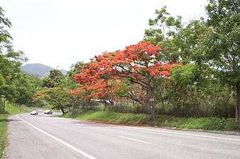 Flamboyant on PR-15 in Cayey
 -
 PR-15 in Guayama, heading north


History[edit]
Originally, PR-15 was identified as Road No. 4, a spur route of the Carretera Central from Cayey to Guayama. As Road No. 4, Puerto Rico Highway 15 was built between 1886 and 1897, and changed its number to the current designation after the 1953 Puerto Rico highway renumbering, a process implemented by the Puerto Rico Department of Transportation and Public Works (Spanish: Departamento de Transportación y Obras Públicas) that increased the insular highway network to connect existing routes with different locations around Puerto Rico.[2] The entire length of PR-15 was listed on the National Register of Historic Places in 2020.[3]
-
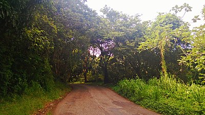
 PR-15 in Cayey, heading south
 -
 Cayey Bridge over the Guamaní River in Guayama


Major intersections[edit]
| Municipality | Location | km[9] | mi | Destinations | Notes |
|---|---|---|---|---|---|
| Guayama | Guayama barrio-pueblo | 0.0 | 0.0 | Southern terminus of PR-15 | |
| Caimital | 1.6– 1.7 | 0.99– 1.1 | |||
| Río Guamaní | 1.7 | 1.1 | Puente de Cayey[10] | ||
| Palmas | 1.8 | 1.1 | |||
| 6.4– 6.5 | 4.0– 4.0 | ||||
| Cayey | Jájome Alto | 13.3 | 8.3 | ||
| Jájome Alto–Culebras Bajo line | 18.5 | 11.5 | Southern terminus of the Ruta Panorámica concurrency; the Ruta Panorámica continues toward Guayama | ||
| Culebras Bajo | 20.0 | 12.4 | Northern terminus of the Ruta Panorámica concurrency; the Ruta Panorámica continues toward Aibonito | ||
| Quebrada Arriba–Monte Llano line | 24.8 | 15.4 | |||
| Monte Llano–Quebrada Arriba– Cayey barrio-pueblo tripoint | 25.1 | 15.6 | |||
| Cayey barrio-pueblo | 25.80 | 16.03 | Northern terminus of PR-15 | ||
1.000 mi = 1.609 km; 1.000 km = 0.621 mi
| |||||
See also[edit]
References[edit]
- ^ a b Puerto Rico Department of Transportation and Public Works. "Datos de Transito 2000-2009" (in Spanish). Archived from the original on 1 April 2019. Retrieved 29 March 2019.
- ^ a b "Cayey, Memoria Núm. 42" (PDF). Puerto Rico Planning Board (in Spanish). 1955. Retrieved 3 August 2020.
- ^ a b "Carretera #4 (PR-15), Cayey/Guayama, Puerto Rico" (PDF). Retrieved 30 July 2023.
- ^ National Geographic Maps (2011). Puerto Rico (Map). 1:125,000. Adventure Map (Book 3107). Evergreen, Colorado: National Geographic Maps. ISBN 978-1566955188. OCLC 756511572.
- ^ Press, Detroit Free. "PR 15 over GUAMANI RIVER Guayama Municipio, Puerto Rico Bridge Inspection Report". Detroit Free Press. Retrieved 10 August 2023.
- ^ "PR-15, Guayama, Puerto Rico". pr.geoview.info. Retrieved 10 August 2023.
- ^ "Adoptando trazado de la Ruta Panorámica" (PDF) (in Spanish). Junta de Planificación de Puerto Rico. p. 2. Archived from the original (PDF) on 27 December 2016. Retrieved 10 August 2023.
- ^ "PR-15, Cayey, Puerto Rico". pr.geoview.info. Retrieved 10 August 2023.
- ^ Google (28 February 2020). "PR-15" (Map). Google Maps. Google. Retrieved 28 February 2020.
- ^ Luis F. Pumarada O’Neill (1991). "Los Puentes Históricos de Puerto Rico" (PDF) (in Spanish). pp. 79–80. Retrieved 10 March 2020.
External links[edit]
 Media related to Puerto Rico Highway 15 at Wikimedia Commons