
Pika Fire
| Pika Fire | |
|---|---|
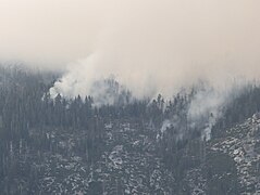
 Smoke from the Pika Fire rises from the left and goes above North Dome and Basket Dome on July 15, 2023 | |
| Date(s) |
|
| Location | North Dome, Yosemite National Park |
| Coordinates | 37°45′47″N 119°33′35″W / 37.76306°N 119.55972°W |
| Statistics | |
| Burned area | 818 acres (331 ha) |
| Ignition | |
| Cause | lightning |
| Map | |
 Perimeter of Pika Fire (map data) | |
 The fires location in east central California | |
The Pika Fire was a wildfire near North Dome in Yosemite National Park. It began at about 3:00 PM PT on June 28, 2023. The fire burned 841 acres (340 ha).[1] Yosemite Fire crews used a strategy to allow the fire to move naturally across the landscape while also minimizing the risk to people and infrastructure.[2]
History[edit]
The fire began near North Dome in Yosemite National Park at around 3:00 PM PT on June 28, 2023. As of July 17, 2023[update], the fire had burned 818 acres (331 ha) and was 0% contained.[3][4] By July 28, 2023[update] the fire had grown to 841 acres (340 ha) and was 40% contained.[1]
Cause[edit]
The cause of the fire is due to lightning.[3][4]
Impact[edit]
No evacuations have so far been ordered, and no structures and communities are currently threatened.[3]
-
The Pika Fire as seen from Glacier Point
-
 Flames from the Pika Fire on July 15, 2023
 -
 Flames from the Pika Fire on July 16, 2023
 -
 Pika Fire from Stoneman Meadow, Yosemite, CA
 -
 Origin of Pika Fire on the Evening of June 28th at 6:30 PM after the storm had passed


References[edit]
- ^ a b "Yosemite Fire Update for July 28, 2023". National Park Service. July 28, 2023. Retrieved August 8, 2023.
- ^ "Pika Fire Update, July 13, 2023". National Park Service. July 13, 2023. Retrieved July 20, 2023.
- ^ a b c "Caynp Pika Fire Information". InciWeb. July 17, 2023. Retrieved July 17, 2023.
- ^ a b SFGATE, Amy Graff (July 17, 2023). "Pika Fire in Yosemite National Park balloons to 650 acres". SFGATE. Retrieved July 17, 2023.
| Pre-2000 |
|
|---|---|
| 2000 | |
| 2001 | |
| 2002 | |
| 2003 | |
| 2004 | |
| 2005 | |
| 2006 | |
| 2007 | |
| 2008 | |
| 2009 | |
| 2010 | |
| 2011 | |
| 2012 | |
| 2013 | |
| 2014 | |
| 2015 | |
| 2016 | |
| 2017 | |
| 2018 | |
| 2019 | |
| 2020 | |
| 2021 | |
| 2022 | |
| 2023 | |
This wildfire-related article is a stub. You can help Wikipedia by expanding it. |