
Perkinsville, Mississippi
Perkinsville, Mississippi | |
|---|---|
 Perkinsville, Mississippi Location within the state of Mississippi | |
| Coordinates: 33°06′04″N 88°51′50″W / 33.10111°N 88.86389°W | |
| Country | United States |
| State | Mississippi |
| County | Winston |
| Elevation | 486 ft (148 m) |
| Time zone | UTC-6 (Central (CST)) |
| • Summer (DST) | UTC-5 (CDT) |
| GNIS feature ID | 710063[1] |
Perkinsville is a ghost town in Winston County, Mississippi, United States.
Perkinsville was located approximately 10 mi (16 km) east of Louisville.
A fraternal lodge, No. 331, was located in Perkinsville in 1891.[2]
The population of Perkinsville was 44 in 1900. The settlement had a post office, as well as "a church and a good school".[3]: 395
All that remains is the Perkinsville Cemetery, located on Perkinsville Road.[4]
References[edit]
- ^ U.S. Geological Survey Geographic Names Information System: Perkinsville (historical)
- ^ Biographical and Historical Memoirs of Mississippi: Embracing an Authentic and Comprehensive Account of the Chief Events in the History of the State and a Record of the Lives of Many of the Most Worthy and Illustrious Families and Individuals. Goodspeed. 1891. pp. 233.
- ^ Rowland, Dunbar (1907). Mississippi: Comprising Sketches of Counties, Towns, Events, Institutions, and Persons, Arranged in Cyclopedic Form. Vol. 2. Southern Historical Publishing Association. p. 395.
- ^ U.S. Geological Survey Geographic Names Information System: Perkinsville Cemetery
Municipalities and communities of Winston County, Mississippi, United States | ||
|---|---|---|
| Cities | 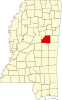 | |
| Towns | ||
| Unincorporated communities | ||
| Ghost towns | ||
| Indian reservation | ||
| Footnotes | ‡This populated place also has portions in an adjacent county or counties | |
This United States ghost town-related article is a stub. You can help Wikipedia by expanding it. |