
Old Princes Highway (Victoria)
Old Princes Highway (numerous constituent roads) | |
|---|---|
.jpg) | |
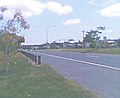
| Old Princes Highway, Footscray | |
| General information | |
| Type | Road |
| Opened | 10 August 1920 |
| Route number(s) |
|
| Former route number | see Former route allocations |
| Tourist routes | (Belmont–Corio) |
| Major junctions | |
| West end | Waurn Ponds, Victoria |
| East end | Morwell, Victoria |
| Location(s) | |
| Major suburbs | Belmont, Geelong, Corio, Werribee, Hoppers Crossing, Beaconsfield, Pakenham, Drouin, Warragul, Moe, Morwell |
Old Princes Highway is a collection of roads, described as any part of an earlier route designated as Princes Highway, located in Victoria, Australia. Sections of the road run through Geelong, Werribee, and through the outer fringes of south-eastern Melbourne eventually to Morwell East. In the time since their de-listing as Princes Highway, many former sections have since been renamed, or have devolved to their original names.
Route[edit]
West[edit]
Princes Highway (West) runs from the interstate border with South Australia through western Victoria all the way to the western suburbs of Melbourne, with some towns along this route later bypassed. Old Princes Highway, consisting of former sections of Princes Highway, include: through greater Geelong (from Waurn Ponds to Corio), bypassed by Geelong Ring Road and now allocated route A10; and through Werribee (from Cocoroc to Hoppers Crossing), bypassed by Maltby Bypass and now allocated route C109. One last section runs through western suburban Melbourne, from the interchange with West Gate Freeway and Western Ring Road in Laverton North to Flemington, signposted as both Princes Highway and Geelong Road, but this is still officially gazetted as Princes Highway (West), and the former alignment through central Melbourne was eventually re-declared as their own separate constituent parts.
East[edit]
Princes Highway (East) runs from central Melbourne through eastern Victoria all the way to the interstate border with New South Wales, with many of the towns along this route, particularly through Gippsland, later bypassed by sections of Princes Freeway. This first section runs through south-eastern suburban Melbourne, from the intersection with King and Flinders Streets in the Melbourne CBD to the interchange with Monash and Princes Freeways in Narre Warren, signposted as both Princes Highway and Dandenong Road, but is still officially gazetted as Princes Highway (East). Old Princes Highway includes: from Berwick through Beaconsfield and Pakenham to Nar Nar Goon and now allocated route C101; through Drouin and Warragul and more commonly known as Princes Way, now allocated route C102; through Moe and Newborough (along what is now Lloyd Street and Narracan Drive) as route C103, then descending into the La Trobe Valley through the Haunted Hills, along what is now Haunted Hills Road, passed almost due west through what is now the Yallourn Open Cut Mine to join today's Morwell Bridge Road at the Morwell River, and from there, through Morwell along what is now Princes Drive and now allocated route C104.
The first improvements to the route came in the late 1950s when the expansion of the Yallourn open cut necessitated the relocation of the highway. The CRB took this opportunity to provide a high standard access-controlled alignment as well as a bypass of Moe. The first section of the new highway opened in 1959/60 as a single carriageway super-2 expressway between Hernes Oak and the Morwell River. Following in December 1964 was a westerly extension of the super-2 highway from Hernes Oak to Gunns Gully (Newborough) and the Moe Bypass completed the new route - opening in early 1967. The section between Gunns Gully and Hernes Oak inherited the "Haunted Hills" nickname that applied to the original highway between Newborough and Hernes Oak. Duplication of the Moe-Morwell section was commenced after the opening of the Moe Bypass and completed west to Gunns Gully in 1971 and to the western side of Moe in 1979.[1]
It is anticipated that with the future completion of the Traralgon bypass that a new section of the highway will become superseded from the original Highway 1.
History[edit]
As a named route, the highway came into being when pre-existing roads were renamed Prince's Highway after the planned visit to Australia by the Prince of Wales (later to become king Edward VIII and, after abdicating, the Duke of Windsor) in 1920. The original submissions in January 1920 were in order for the Prince to have the opportunity during his visit to make the trip from Melbourne to Sydney overland along the route. That idea never came to fruition, but the prince did give his permission for the naming.[2] The Victorian section of the highway had an opening ceremony when the first section of road from Melbourne was opened on 10 August 1920 in Warragul.[2]
Approval was later given by the Victorian executive in January 1922 to extend the highway west from Melbourne through Geelong, Camperdown, Warrnambool and Portland to the South Australian border.[3] The passing of the Highways and Vehicles Act of 1924[4] through the Parliament of Victoria provided for the declaration of State Highways, roads two-thirds financed by the State government through the Country Roads Board (later VicRoads). Prince's Highway was declared a State Highway on 1 July 1925, traversing the whole length of the State from its western boundary near Mount Gambier in South Australia, through Port Fairy, Warrnambool, Geelong to Melbourne, through Dandenong, Warragul, Sale, Bairnsdale and Orbost to the eastern boundary of the state towards Eden in New South Wales (for a total of 540 miles).[5]
The passing of the Road Management Act 2004[6] through the Parliament of Victoria granted the responsibility of overall management and development of Victoria's major arterial roads to VicRoads: VicRoads re-declared the road in 2010 as Princes Highway West (Arterial #6500), beginning at the state border with South Australia to Geelong, then from Altona North to Parkville;[7] and in 2008 as Princes Highway East (Arterial #6510), beginning at the Melbourne CBD to Narre Warren, then through Yarragon, Trafalgar and Morwell, the from Morwell to the state border with New South Wales.[8]
Portions of both the western and eastern section of Princes Highway have further devolved with their own classification and names: the section through Geelong (from Waurn Ponds to Corio) was re-declared in 2012 as Corio–Waurn Ponds Road (Arterial #6800)[9] (following the opening of Geelong Ring Road); the section through Werribee (from Cocoroc to Hoppers Crossing) was re-declared in 2004 as Werribee Main Road (Arterial #5445);[10] the section through outer south-eastern Melbourne (from Berwick to Nar Nar Goon) was re-declared in 2004 as Berwick-Beaconsfield Road (Arterial #5163)[11] and in 2007 as Beaconsfield-Nar Nar Goon Road (Arterial #6460);[12] the section through Drouin and Warragul (signposted as Princes Way) was re-declared in 2004 as Drouin–Warragul Road (Arterial #5594);[13] the section through Moe (signposted as Lloyd Street and Narracan Drive) was re-declared in 2004 as part of Moe-Glengarry Road (Arterial #5539);[14] and the section through Norwell (signposted as Princes Drive) was re-declared in 2004 as part of Morwell-Traralgon Road (Arterial #5921).[15]
The former alignment of Princes Highway through central Melbourne from Parkville to the southern border of the CBD – along Flemington Road (Arterial #5044),[16] Harker Street (Arterial #5026),[17] Curzon Street (Arterial #5027),[18] and King Street (Arterial #5041),[19] – devolved back to their own identities in 2004, no longer part of Princes Highway but not referenced as Old Princes Highway.
Former route numbers[edit]
Old Princes Highway has many former route allocations including former National Route 1; its routing through Melbourne and along present sections of Princes Highway have been included for sake of completion. Where and when the former route numbers were implemented are stated below.
through Waurn Ponds:
 National Route 1 (1955–1997)
 A1 (1997–2013)
- unallocated: (2013–present)
Waurn Ponds – Corio:
- National Route 1 (1955–1997)
 M1 (1997–2009)
 A10 (2009–present)
Cocoroc – Hoppers Crossing:
- National Route 1 (1955–1961)
- unallocated: (1961–1998)
 C109 (1997–present)
Brooklyn – North Melbourne:
- National Route 1 (1955–1978)
 Alt National Route 1 (1978–1988)
 Metro Route 83 (1988–present)
North Melbourne – Parkville:
- National Route 1 (1955–1978)
- Alt National Route 1 (1978–1988)
 National Route 79 (1988–2013)
 Metro Route 60 (2013–present)
Parkville – Hallam:
- National Route 1 (1955–1988)
- Alt National Route 1 (1988–present)
Hallam – Narre Warren:
- National Route 1 (1955–1997)
- M1 (1997–2003)
- Alt National Route 1 (2003–present)
Berwick – Beaconsfield:
- National Route 1 (1955–1983)
- unallocated: (1983–1997)
 C101 (1997–present)
Beaconsfield – Nar Nar Goon:
- National Route 1 (1955–1997)
- M1 (1997–2007)
- C101 (2007–present)
Drouin – Nilma:
- National Route 1 (1955–1981)
- unallocated: (1981–1997)
 C102 (1997–present)
Moe – Newborough:
- National Route 1 (1955–1969)
- unallocated: (1969–1997)
 C103 (1997–present)
Morwell – East Morwell:
- National Route 1 (1955–1992)
- unallocated: (1992–1997)
 C104 (1997–present)
Major intersections[edit]
Waurn Ponds–Corio[edit]
| Location | km | mi | Destinations | Notes | |
|---|---|---|---|---|---|
| Corio | |||||
| Corio–Norlane boundary | St. Georges Road (east) | ||||
| Norlane | |||||
| North Geelong | |||||
| Geelong CBD | |||||
| South Geelong | |||||
| Belmont | |||||
| Highton–Grovedale boundary | |||||
| Highton–Grovedale–Waurn Ponds tripoint | |||||
| Waurn Ponds | |||||
1.000 mi = 1.609 km; 1.000 km = 0.621 mi
| |||||
Cocoroc–Hoppers Crossing[edit]
| LGA | Location | km | mi | Destinations | Notes |
|---|---|---|---|---|---|
| Sneydes Road – Point Cook | |||||
| Tarneit Road – Tarneit | |||||
1.000 mi = 1.609 km; 1.000 km = 0.621 mi
| |||||
Berwick–Nar Nar Goon[edit]
| LGA | Location | km | mi | Destinations | Notes |
|---|---|---|---|---|---|
| Cardinia | Nar Nar Goon | 0 | 0.0 | ||
| Pakenham | 6.1 | 3.8 | |||
| 8.6 | 5.3 | ||||
| Officer | 11.4 | 7.1 | |||
| Beaconsfield | 16.5 | 10.3 | |||
| 18.3 | 11.4 | ||||
| Casey | Berwick | 20.8 | 12.9 | ||
| 22.8 | 14.2 | ||||
1.000 mi = 1.609 km; 1.000 km = 0.621 mi
| |||||
Drouin–Nilma[edit]
| LGA | Location | km | mi | Destinations | Notes |
|---|---|---|---|---|---|
1.000 mi = 1.609 km; 1.000 km = 0.621 mi
| |||||
Moe–Newborough[edit]
| LGA | Location | km | mi | Destinations | Notes |
|---|---|---|---|---|---|
| Old Gippsland Drive – Melbourne via | |||||
1.000 mi = 1.609 km; 1.000 km = 0.621 mi
| |||||
Morwell[edit]
| LGA | Location | km | mi | Destinations | Notes |
|---|---|---|---|---|---|
| Concurrency with C474 | |||||
1.000 mi = 1.609 km; 1.000 km = 0.621 mi
| |||||
Gallery[edit]
-
 Old Princes Highway, Officer
 -
 Old Princes Highway, Beaconsfield
 -
 Old Princes Highway, Beaconsfield
 -
 Old Princes Highway, Windsor
 -
 Old Princes Highway, St Kilda
 -
 Old Princes Highway, South Melbourne


.jpg)
See also[edit]
References[edit]
- ^ [1], M1 Princes Hwy/Fwy East, Former Alignments: Moe to Morwell. Retrieved on 15 October 2012.[self-published source]
- ^ a b "PRINCE'S HIGHWAY". The Argus. Melbourne: National Library of Australia. 11 August 1920. p. 9. Retrieved 8 September 2011.
- ^ "PRINCE'S HIGHWAY". The Argus. Melbourne: National Library of Australia. 25 January 1922. p. 12. Retrieved 8 September 2011.
- ^ State of Victoria, An Act to make further provision with respect to Highways and Country Roads Motor Cars and Traction Engines and for other purposes 30 December 1924
- ^ "Country Roads Board Victoria. Twelfth Annual Report: for the year ended 30 June 1925". Country Roads Board of Victoria. Melbourne: Victorian Government Library Service. 31 December 1925. p. 3.
- ^ State Government of Victoria. "Road Management Act 2004" (PDF). Government of Victoria. Archived (PDF) from the original on 18 October 2021. Retrieved 19 October 2021.
- ^ VicRoads. "VicRoads – Register of Public Roads (Part A) 2015" (PDF). Government of Victoria. pp. 976–8. Archived from the original on 1 May 2020. Retrieved 19 October 2021.
- ^ VicRoads. "VicRoads – Register of Public Roads (Part A) 2015" (PDF). Government of Victoria. pp. 979–83. Archived from the original on 1 May 2020. Retrieved 19 October 2021.
- ^ VicRoads. "VicRoads – Register of Public Roads (Part A) 2015" (PDF). Government of Victoria. pp. 1034–5. Archived from the original on 1 May 2020. Retrieved 19 October 2021.
- ^ VicRoads. "VicRoads – Register of Public Roads (Part A) 2015" (PDF). Government of Victoria. p. 514. Archived from the original on 1 May 2020. Retrieved 19 October 2021.
- ^ VicRoads. "VicRoads – Register of Public Roads (Part A) 2015" (PDF). Government of Victoria. p. 278. Archived from the original on 1 May 2020. Retrieved 19 October 2021.
- ^ VicRoads. "VicRoads – Register of Public Roads (Part A) 2015" (PDF). Government of Victoria. p. 975. Archived from the original on 1 May 2020. Retrieved 19 October 2021.
- ^ VicRoads. "VicRoads – Register of Public Roads (Part A) 2015" (PDF). Government of Victoria. p. 623. Archived from the original on 1 May 2020. Retrieved 19 October 2021.
- ^ VicRoads. "VicRoads – Register of Public Roads (Part A) 2015" (PDF). Government of Victoria. p. 623. Archived from the original on 1 May 2020. Retrieved 19 October 2021.
- ^ VicRoads. "VicRoads – Register of Public Roads (Part A) 2015" (PDF). Government of Victoria. p. 876. Archived from the original on 1 May 2020. Retrieved 19 October 2021.
- ^ VicRoads. "VicRoads – Register of Public Roads (Part A) 2015" (PDF). Government of Victoria. p. 157. Archived from the original on 1 May 2020. Retrieved 19 October 2021.
- ^ VicRoads. "VicRoads – Register of Public Roads (Part A) 2015" (PDF). Government of Victoria. p. 138. Archived from the original on 1 May 2020. Retrieved 19 October 2021.
- ^ VicRoads. "VicRoads – Register of Public Roads (Part A) 2015" (PDF). Government of Victoria. p. 139. Archived from the original on 1 May 2020. Retrieved 19 October 2021.
- ^ VicRoads. "VicRoads – Register of Public Roads (Part A) 2015" (PDF). Government of Victoria. pp. 153–4. Archived from the original on 1 May 2020. Retrieved 19 October 2021.
- Highways in Victoria (state)
- Transport in the City of Wyndham
- Transport in the City of Hobsons Bay
- Transport in the City of Maribyrnong
- Transport in the City of Brimbank
- Transport in the City of Melbourne (LGA)
- Transport in the City of Port Phillip
- Transport in Geelong
- Transport in the City of Stonnington
- Transport in the City of Glen Eira
- Transport in the City of Monash
- Transport in the City of Casey
- Transport in the Shire of Cardinia
- Shire of Baw Baw
- City of Latrobe
- Transport in Barwon South West (region)