Oentsjerk
Oentsjerk
Oenkerk | |
|---|---|
Village | |
 St Mary's Church | |
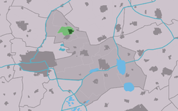
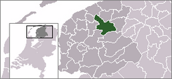
 Location of the village in Tytsjerksteradiel | |
| Coordinates: 53°15′12″N 5°53′54″E / 53.25333°N 5.89833°E | |
| Country | |
| Province | |
| Municipality | |
| Area | |
• Total | 3.81 km2 (1.47 sq mi) |
| Elevation | 0.7 m (2.3 ft) |
| Population (2021)[1] | |
• Total | 1,995 |
| • Density | 520/km2 (1,400/sq mi) |
| Postal code | 9062[1] |
| Dialing code | 058 |
Oentsjerk (Dutch: Oenkerk) is a village in Tytsjerksteradiel in the province of Friesland, the Netherlands. It had a population of around 1,784 in January 2017.[3] Oentsjerk is known for its agricultural practical training centre and large elderly care facility, the two largest employers of the town.
History
[edit]The village was first mentioned in 1408 as Ontzerka, and means "church of Oene (person)".[4] Oentsjerk developed in the middle ages on a sandy ridge. Later, it was extended along the Leeuwarden to Dokkum road.[5]
The Protestant church was built in 1230 as a replacement of a 12th century predecessor. It has been enlarged and altered multiple times and restored between 1974 and 1976.[5]
Several estates were built near Oentsjerk, however only Stania State has remained. Eysinga State has become a retirement home.[6] The stins Stania State was probably built in the 16th century. The current estate dates from 1843. Around 1520, it was turned into a castle-like building. In 1546, it became a property of the van Heemstra family who owned it for two centuries, but let it deteriorate. In 1738, it was demolished. In 1843, a new manor house by Looxma who had made a fortune in oil mills. A large garden designed by Lucas Roodbaard is laid out. In the 1930s, it became a youth hostel, conference centre and contained an outpost of the Fries Museum. In the 1970s, it was bought by the municipality who later sold it a company as an office building.[7]
Oentsjerk was home to 441 people in 1840.[6] In the late-20th century it became a commuter's village.[8]
Notable buildings
[edit]Gallery
[edit]-
Pub in Oentsjerk
-
House in Oentsjerk
-
Stania State
-
Agricultural training centre
References
[edit]- ^ a b c "Kerncijfers wijken en buurten 2021". Central Bureau of Statistics. Retrieved 5 April 2022.
two entries
- ^ "Postcodetool for 9062AA". Actueel Hoogtebestand Nederland (in Dutch). Het Waterschapshuis. Retrieved 5 April 2022.
- ^ Overzicht inwonersaantal Tytsjerksteradiel - Tytsjerksteradiel
- ^ "Oentsjerk - (geografische naam)". Etymologiebank (in Dutch). Retrieved 5 April 2022.
- ^ a b Ronald Stenvert & Sabine Broekhoven (2000). "Oentsjerk" (in Dutch). Zwolle: Waanders. ISBN 90 400 9476 4. Retrieved 5 April 2022.
- ^ a b "Oentsjerk". Plaatsengids (in Dutch). Retrieved 5 April 2022.
- ^ "Stania State". Stinsen in Friesland (in Dutch). Retrieved 5 April 2022.
- ^ "Oentsjerk". Friesland Wonderland (in Dutch). Retrieved 5 April 2022.
External links
[edit]![]() Media related to Oentsjerk at Wikimedia Commons
Media related to Oentsjerk at Wikimedia Commons


