Oberaarrothorn
| Oberaarrothorn | |
|---|---|
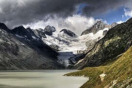
 Oberaarrothorn from Oberaarsee (center-left) | |
| Highest point | |
| Elevation | 3,477 m (11,407 ft) |
| Prominence | 184 m (604 ft)[1] |
| Parent peak | (Vorderes) Galmihorn |
| Coordinates | 46°31′13.4″N 8°10′51.3″E / 46.520389°N 8.180917°E |
| Geography | |
| Location | Valais/Bern, Switzerland |
| Parent range | Bernese Alps |
The Oberaarrothorn is a mountain of the Bernese Alps, on the border between the Swiss cantons of Valais and Bern. It is south of the Oberaarjoch, between the Fiescher Glacier and the Oberaar Glacier.
References[edit]
External links[edit]

