
Libertad station
Libertad | |||||||||||
|---|---|---|---|---|---|---|---|---|---|---|---|
 | |||||||||||
| General information | |||||||||||
| Other names | Antonio Arnaiz Arnaiz | ||||||||||
| Location | Taft Avenue, Santa Clara Pasay, Metro Manila, Philippines | ||||||||||
| Owned by | Department of Transportation – Light Rail Transit Authority | ||||||||||
| Operated by | Light Rail Manila Corporation | ||||||||||
| Line(s) | Line 1 | ||||||||||
| Platforms | 2 (2 side) | ||||||||||
| Tracks | 2 | ||||||||||
| Construction | |||||||||||
| Structure type | Elevated | ||||||||||
| Parking | Yes (Victory Pasay Mall / Pasay City Mall & Public Market) | ||||||||||
| Other information | |||||||||||
| Station code | LI | ||||||||||
| History | |||||||||||
| Opened | December 1, 1984 | ||||||||||
| Services | |||||||||||
| |||||||||||
| Location | |||||||||||
 Libertad Location within Metro Manila | |||||||||||
Libertad station is an elevated Light Rail Transit (LRT) station located on the LRT Line 1 (LRT-1) system in Pasay. It is situated at the intersection of Taft Avenue and Arnaiz Avenue. The station is named after the former Libertad (Spanish for "liberty") Street, now a part of Arnaiz Avenue. The name Libertad survives as an area name after the old street.
Libertad station is the third station for trains headed to Fernando Poe Jr., the eighteenth station for trains headed to Baclaran, and is one of the four stations serving Pasay, the others are Gil Puyat, EDSA, and Baclaran.
Transportation links[edit]
There are bus terminals for some bus lines near the station, while jeepneys, taxis, and tricycles stop at and around the station entrance. However, buses also stop near the station, for those riding buses that do not stop at the nearby bus terminals. Jeepneys that leave adjacent to the station head along Arnaiz Avenue for various parts of Caloocan, Makati, Manila, and Pasay.[1]
Nearby landmarks[edit]
The station is adjacent to retail establishments especially the Pasay City Mall and Public Market and Wellcome Plaza (also known as Masagana Citimall, which houses a Puregold branch).
Gallery[edit]
-
 Exterior
 -
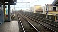 The rails
 -
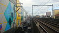 View of nearby malls


See also[edit]
References[edit]
- ^ "Comprehensive Land Use Plan of Pasay City" (PDF). Pasay City Government.