Korbeek-Lo, Leuven
Korbeek-Lo | |
|---|---|
Part of Leuven | |
 Aerial view of Korbeek-Lo, Leuven | |
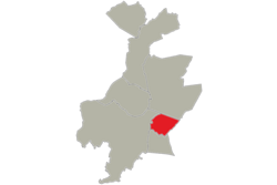
 Location of Korbeek-Lo in Leuven | |
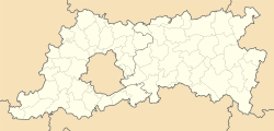
| Coordinates: 50°52′00″N 4°44′00″E / 50.86667°N 4.73333°E | |
| Country | |
| Community | |
| Region | |
| Province | |
| Arrondissement | Leuven |
| Municipality | Leuven |
| Area | |
| • Total | 2.2 km2 (0.8 sq mi) |
| Population (2012-01-01) | |
| • Total | 3,010 |
| • Density | 1,400/km2 (3,500/sq mi) |
| Postal codes | 3000 |
| Area codes | 016 |

The western part of the former municipality of Korbeek-Lo (Dutch pronunciation: [ˈkɔrbeːkˌloː]) is now a part of the city of Leuven, Belgium. According to the official website of Leuven, Korbeek-Lo is a part of the sub-municipality of Leuven.[1]
As a result of extensive local government boundary changes in 1977 Korbeek-Lo, as a municipality, was abolished. Since then the more built up western part of Korbeek-Lo has been subsumed into Leuven while the more rural eastern part of the former municipality is now part of Bierbeek.[2]
References[edit]
- ^ "Deelgemeenten | Stad Leuven". leuven.be (in Dutch). 2019-09-09. Retrieved 2024-01-23.
- ^ "Geschiedenis van Bierbeek". Gemeente Bierbeek (in Flemish). Retrieved 2024-01-19.
Wikimedia Commons has media related to Korbeek-Lo (Leuven).


