Helperby
| Helperby | |
|---|---|
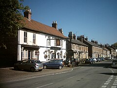
 Golden Lion on Main Street | |
Location within North Yorkshire | |
| Population | 520 (2011 census)[1] |
| OS grid reference | SE439698 |
| Civil parish | |
| Unitary authority | |
| Ceremonial county | |
| Region | |
| Country | England |
| Sovereign state | United Kingdom |
| Post town | YORK |
| Postcode district | YO61 |
| Dialling code | 01423 |
| Police | North Yorkshire |
| Fire | North Yorkshire |
| Ambulance | Yorkshire |
| UK Parliament | |
Helperby is a village and former civil parish, now in the parish of Brafferton and Helperby, in the Hambleton District of North Yorkshire, England, about five miles west of Easingwold.[2] Over the years it has joined onto Brafferton. On 1 April 2019 the parish was merged with Brafferton to form "Brafferton and Helperby".[3]
Helperby has the Millennium Village Hall, a butcher's shop, a doctor's surgery and a mobile bakery and post office (open only on specific days). There are two pubs, one a restaurant with rooms, one a village inn, and a disused Methodist Chapel which is now a house. In 2008 Helperby had a new pavilion at the football and cricket pitch. There is also a war memorial, in memory of war soldiers in World War One
There is also an annual beer festival held in September to raise funds for future development of a Children's play area.

The film The Life and Crimes of William Palmer was filmed in the village in 1998.
There is now a Children's play area, located outside the Millennium Village Hall, next to the post office.

In 2022 a Wedding Event venue was opened, located in the gardens of Helperby Hall.
Governance[edit]
An electoral ward in the same name exists. This ward had a total population of 1,922 at the Census 2011.[4]
See also[edit]
References[edit]
- ^ UK Census (2011). "Local Area Report – Helperby Parish (1170216852)". Nomis. Office for National Statistics. Retrieved 26 April 2018.
- ^ Ordnance Survey: Landranger map sheet 99 Northallerton & Ripon (Pateley Bridge & Leyburn) (Map). Ordnance Survey. 2013. ISBN 9780319231593.
- ^ "The Hambleton District Council (Reorganisation of Community Governance) (Brafferton and Helperby) Order 2019" (PDF). Local Government Boundary Commission for England. Archived from the original (PDF) on 19 March 2022. Retrieved 20 May 2019.
- ^ UK Census (2011). "Local Area Report – Helperby 2011 Census Ward (1237325067)". Nomis. Office for National Statistics. Retrieved 26 April 2018.
External links[edit]
![]() Media related to Helperby at Wikimedia Commons
Media related to Helperby at Wikimedia Commons

