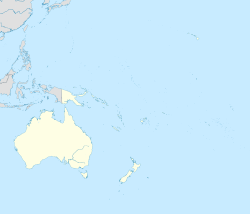
Flowerpot Bay
Flowerpot Bay | |
|---|---|
 Flowerpot Bay in 1877 | |
 Pitt Island, Flowerpot Bay is located on the north coast | |
| Coordinates: 44°14′24″S 176°16′54″W / 44.24000°S 176.28167°W | |
| Country | New Zealand |
| Territorial authority | Chatham Islands |
| Island | Pitt Island |
| Time zone | Chatham Standard Time Zone |
Flowerpot Bay, also spelt Flower Pot Bay, is a small bay, some 250 m across, on the north coast of Pitt Island in the Chatham Islands group of New Zealand. With a jetty at its western end, it is the main point of access by sea to the island.
The vicinity of the bay also holds the island's primary school, its church and its only tourist accommodation – the Flowerpot Bay Lodge.[1] The site has been identified as an Important Bird Area by BirdLife International because it supports a breeding colony of endangered Pitt shags, with 75 nests recorded in 1998.[2][3]
References[edit]
- ^ "Flowerpot Bay Lodge". Homepage. Flowerpot Bay Lodge. Retrieved 17 November 2012.
- ^ "Chatham Islands (Flowerpot)". BirdLife data zone: Important Bird Areas. BirdLife International. 2012. Archived from the original on 10 July 2007. Retrieved 17 November 2012.
- ^ Debski, Igor; Bell, Mike; Palmer, Dan. "MCSPOP2010-02 Chatham Island and Pitt Island Shag census 2011" (PDF). Department of Conservation, New Zealand. Retrieved 16 November 2012.


