
Cove River
| Cove River | |
|---|---|
 Cove River in West Haven, Connecticut. | |
| Location | |
| Country | United States |
| State | Connecticut |
| County | New Haven |
| Physical characteristics | |
| Source | Orange, Connecticut |
| Mouth | Long Island Sound |
• location | West Haven, Connecticut |
• coordinates | 41°15′09″N 72°57′35″W / 41.2525971°N 72.9598251°W |
The Cove River is a stream in New Haven County in the U.S. state of Connecticut.[1] It rises in Orange and flows through West Haven before discharging into Long Island Sound at Sea Bluff Beach by Bradley Point. Dams along the river form the Maltby Lakes, reservoirs of the South Central Connecticut Regional Water Authority, as well as Phipps Lake. A project was initiated in 2021 to replace the flood gates near the mouth to regulate water flow into the salt march upstream.[2] This project also includes a new aluminum truss pedestrian bridge at the mouth to connect Bradley Point Park and Sea Bluff Beach.[2]
-
 Bridge at river mouth
 -
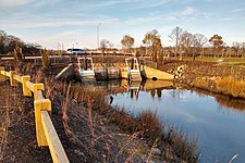 Flood gates


See also[edit]
References[edit]
- ^ "Cove River". Geographic Names Information System. United States Geological Survey, United States Department of the Interior. Retrieved November 15, 2021.
- ^ a b "West Haven to replace Cove River tide gates, $3.9 million project includes new pedestrian bridge". New Haven Register. New Haven. 2021-02-25. Retrieved 2021-11-19.
External links[edit]