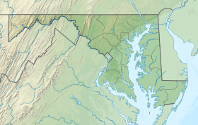
Cedar Island Wildlife Management Area
| Cedar Island Wildlife Management Area | |
|---|---|
IUCN category V (protected landscape/seascape)[1] | |
| Location | Somerset, Maryland, United States |
| Coordinates | 37°55′45.5″N 75°52′30″W / 37.929306°N 75.87500°W |
| Operator | Maryland Department of Natural Resources |
| Website | Cedar Island WMA |
Cedar Island Wildlife Management Area is a Wildlife Management Area in Somerset County, Maryland near Crisfield. The area is almost 3,000 acres (1,200 ha) in extent on Tangier Sound in Chesapeake Bay. The area was primarily established to protect black duck habitat and is notable for its concentration of the species.[2]
References[edit]
- ^ "Cedar Island Wildlife Management Area". Protected Planet. IUCN. Retrieved 2 May 2018.
- ^ "Cedar Island WMA". Maryland Department of Natural Resources. Retrieved 2 May 2018.
External links[edit]

