Bolton Notch State Park
| Bolton Notch State Park | |
|---|---|
| Saqumsketuck | |
 Drawing of Squaw's Cave of Bolton Notch State Park from the book The Story of Wunnee-Neetunah, or The Life of an Indian Princess of Connecticut by Mathia Spiess c. 1934 | |
| Type | Protected area |
| Location | Bolton, Connecticut, United States |
| Nearest city | Hartford, Connecticut |
| Coordinates | 41°47′24″N 72°26′53″W / 41.79000°N 72.44806°W[1] |
| Area | 95[2] |
| Elevation | 636 ft (194 m)[1] |
| Established | 1918 |
| Etymology | A land or place of hard rock (Saqumsketuck) |
| Administered by | Connecticut Department of Energy and Environmental Protection |
| Open | Dusk to dawn |
| Status | Open all year |
| Hiking trails |
|
| Terrain | Forested |
| Water | Salmon River |
| Designation | Connecticut state park |
| Parking | Free |
| Website | Official website |
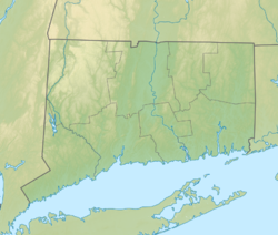
Bolton Notch State Park is a public Protected recreation area located in the town of Bolton, Connecticut, on the boundary between the Thames River and Connecticut River watersheds.[3] The state park's 95 acres (38 ha) offer opportunities for hiking, climbing, and cave exploration.[4] Bolton Notch is located at the junction of U.S. Route 44 and U.S. Route 6 in Bolton, CT.
History[edit]
Pre-human[edit]
25,000 years ago all of New England, including Connecticut, was covered by the massive Laurentide Ice Sheet. Climate change forced the sheet of ice to start receding, with the last of the glacial ice disappearing from Connecticut by 10,000 years ago.[5]
Large sand dunes accumulated in this glacial period as winds picked up outwash sand forming river valleys. As the climate warmed, the modern stream and river network was soon established, such as the Connecticut River. The formation of Bolton Notch consists of schist, Quartzite and Gneiss, as well as the minerals biotite, muscovite, quartz, garnet and staurolite[5]
Indigenous peoples[edit]
Native Americans are believed to have used the major trails crossing through Bolton Notch, which they called Saqumsketuck,[6] for at least 10,000 years. The notch is thought to have created the boundary between the Mohegan and Podunk territories.[7]
Folklore[edit]
The park grounds include Squaw's Cave, where according to legend, a Dutch cabin boy by the name of Peter Hager and his Podunk bride, Wunnee-Neetunah (US: /ˈwʌn.niːtunə/One Nee-TUNA) lived as outcasts around the year 1640. Hager came to the New World on a ship captained by Adriaen Block, the Onrust.[8][9]
Modern History[edit]
Prior to becoming a protected state park, the area was used for a railroad from the 1850s through the 1950s. The railroad carried both passengers and freight. A crucial use for the railroad was transporting rock from the historic Bolton Notch quarry located east of the park.[10]
The state purchased the park's first 70 acres in 1918 in anticipation of developing a Wayside Park.[11]
Activities and amenities[edit]
The park offers rock climbing and hiking[4] as well as "several caves large enough to accommodate a human."[12] It is crossed by both the Hop River Trail and Shenipsit Trail.
Further reading[edit]
- Spiess, Mathias (1934). The Story of Wunnee-Neetunah, or The Life of an Indian Princess of Connecticut; a Tale of Truth (PDF). Manchester, Connecticut: Meador publishing Company.
References[edit]
- ^ a b "Bolton Notch State Park". Geographic Names Information System. United States Geological Survey, United States Department of the Interior.
- ^ "Appendix A: List of State Parks and Forests" (PDF). State Parks and Forests: Funding. Staff Findings and Recommendations. Connecticut General Assembly. January 23, 2014. p. A-3. Retrieved September 11, 2017.
- ^ "Bolton Lakes Watershed: An Update" (PDF). Eastern Connecticut Resource Conservation & Development Area, Inc. April 2014. Retrieved September 11, 2017.
- ^ a b "Bolton Notch State Park". State Parks and Forests. Connecticut Department of Energy and Environmental Protection. Retrieved February 5, 2013.
- ^ a b "Bedrock Geology". Publius Research. Retrieved September 21, 2022.
- ^ DePold, Hans. "Ancient Days in Bolton Notch". Bolton Historical Society. Retrieved March 22, 2014.
- ^ "Bolton 2015 Plan of Conservation and Development" (PDF). Town of Bolton. November 26, 2015. Retrieved September 11, 2017.
- ^ Marteka, Peter (August 16, 2009). "Bolton Notch State Park contains a state rarity: a cave". Hartford Courant. Retrieved March 22, 2014 – via Newspapers.com.
- ^ Spiess, Mathias (1934). The Story of Wunnee-Neetunah, or The Life of an Indian Princess of Connecticut; a Tale of Truth (PDF). Manchester, Connecticut: Meador publishing Company. p. Forward from the Manchester, Connecticut Historical Society:
Mathias Spiess called his 1934 book about Wunnee-Neetunah "A Tale of Truth," so right from the title page there is the duality of fiction and fact.
- ^ Belliveau, Lindsey C. (2014). "The Mohegan Trail at Bolton Notch State Park" (PDF). portal.ct.gov. Connecticut Department of Energy and Environmental Protection. Retrieved June 11, 2023.
- ^ Report of the State Park Commission to the Governor 1918 (Report). Hartford, Conn.: State of Connecticut. December 24, 1918. p. 26. Retrieved December 5, 2017.
- ^ "The Geology of Bolton Notch State Park". Connecticut Department of Energy and Environmental Protection. Retrieved March 22, 2014.
External links[edit]
- Bolton Notch State Park Connecticut Department of Energy and Environmental Protection


