
Antkalnis
Antkalnis | |
|---|---|
Village | |
.JPG) | |
 Antkalnis Location in Lithuania  Antkalnis Antkalnis (Lithuania) | |
| Coordinates: 55°26′55″N 23°39′05″E / 55.44861°N 23.65139°E | |
| Country | |
| County | |
| Municipality | Kėdainiai district municipality |
| Eldership | Krakės Eldership |
| Population (2011) | |
| • Total | 11 |
| Time zone | UTC+2 (EET) |
| • Summer (DST) | UTC+3 (EEST) |
Antkalnis ('a place on a hill') is a village in Kėdainiai district municipality, in Kaunas County, in central Lithuania. According to the 2011 census, the village had a population of 11 people.[1] It is located 9 kilometres (5.6 mi) from Krakės, 1 kilometre (0.62 mi) from Ažytėnai, at the confluence of the Šušvė and Ažytė rivers, in front of Barkūniškis village.
Formerly it was a folwark.
Demography[edit]
|
| |||||||||||||||||||||||||||
| Source: 1902, 1923, 1959 & 1970, 1979, 1989, 2001, 2011 | ||||||||||||||||||||||||||||
Images[edit]
-
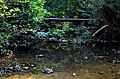 The bridge over the Ažytė in Antkalnis

References[edit]
- ^ "2011 census". Statistikos Departamentas (Lithuania). Retrieved August 21, 2017.
