1737 Valdivia earthquake
| Local date | December 24, 1737 |
|---|---|
| Magnitude | 7.5 Mw[1] |
| Epicenter | 39°48′50″S 73°14′45″W / 39.813889°S 73.245833°W |
| Areas affected | Chile |
| Tsunami | no |
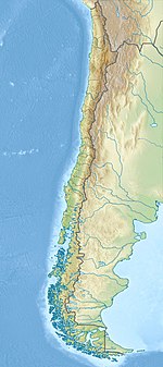
The 1737 Valdivia earthquake struck south-central Chile on December 24 with an estimated moment magnitude of 7.5.[2][3] Together with earthquakes in 1575 and 1837 the earthquake is among the historical predecessors to the great 1960 earthquake.[2] While the overlap in affected areas is significant relative to the 1837 earthquake, the 1737 earthquake may have occurred slightly more to the north.[2]
The earthquake was felt in Concepción but most damage occurred in the towns of Valdivia and Castro, Chiloé Archipelago.[2] In both of these locations churches were destroyed by the earthquake. In addition the Valdivian Fort System and the Royal Storehouse of Valdivia took heavy damage.[2] Landslides occurred next to Villarrica, Calafquén, and Riñihue lakes.[2] Over all this indicates the rupture zone was about 640 km long, with most damage being concentrated in the middle section (Valdivia).[2]
There is no evidence the earthquake would have produced a tsunami.[2]
See also[edit]
- Huilliche uprising of 1712
- Mapuche uprising of 1723
- 1730 Valparaíso earthquake
- 1741 wreckage of HMS Wager
- 1751 Concepción earthquake
- Mapuche uprising of 1766
References[edit]
- ^ Lomnitz, C. (1 May 2004). "Major Earthquakes of Chile: A Historical Survey, 1535-1960". GeoScienceWorld. Retrieved 8 August 2022.
- ^ a b c d e f g h Cisternas, M.; Carvajal, M.; Wesson, R.; Ely, L.L.; Gorigoitia, N. (2018). "Exploring the Historical Earthquakes Preceding the Giant 1960 Chile Earthquake in a Time-Dependent Seismogenic Zone". Bulletin of the Seismological Society of America. 107 (6): 2664–2675. Bibcode:2017BuSSA.107.2664C. doi:10.1785/0120170103.
- ^ Lomnitz, C. (1 May 2004). "Major Earthquakes of Chile: A Historical Survey, 1535-1960". GeoScienceWorld. Retrieved 8 August 2022.


