
Zayeltsovsky District, Novosibirsk
Zayeltsovsky District | |
|---|---|
 | |
 Coat of arms | |
 Location of Zayeltsovsky City District | |
| Coordinates: 55°2′30″N 82°55′0″E / 55.04167°N 82.91667°E | |
| Country | Russia |
| Federal subject | Novosibirsk |
| Established | 25 March 1940 |
| Area | |
| • Total | 83 km2 (32 sq mi) |
Zayeltsovsky District (Russian: Заельцовский район) is an administrative district (raion) of Central Okrug, one of the 10 raions of Novosibirsk, Russia. The area of the district is 83 km2 (32 sq mi). Population: 149, 100 (2017).[1]
History[edit]
Zayeltsovsky City District was established March 25, 1940.[2]
Streets[edit]
-

-
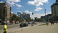 Planovaya Street
 -
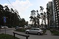 Sukharnaya Street
 -
 Galushchak Street
 -
 Dachnaya Street
 -
 Timiryazev Street


Architecture[edit]
-
 Siberian Transport University (1955)
 -
 Severny Airport Building (1957)
.jpg)
_AN0758548.jpg)
Religion[edit]
Christianity[edit]
-

-

-
 Armenian Apostolic Church


Zayeltsovsky Bor[edit]
Zayeltsovsky Bor is a pine forest. Its territory covers 3,100 hectares.[3]
Tourist attractions in The Zayeltsovsky Bor[edit]
Novosibirsk Zoo[edit]
Novosibirsk Zoo is located in the Zayeltsovsky Bor. The zoo has around 11,000 animals (738 species).[4]


.jpg)
.jpg)


Zayeltsovsky Park[edit]
The Zayeltsovsky Park was opened in 1932.[5]


Small West Siberian Railway[edit]
The Small West Siberian Railway or Novosibirsk Children's Railway is a children's railway, opened on 4 June 2005.


Zayeltsovskoye Cemetery[edit]
The Zayeltsovskoye Cemetery is a cemetery in the Zayeltsovsky Bor. The area of the graveyard is about 200 hectares.
-

-

-
 Yanka Dyagileva's grave


Economy[edit]
Industry[edit]
- Ekran Plant
- Novosibirsk Electrovacuum Plant (NEVZ-Soyuz)
- Novosibirsk Instrument-Building Plant
- Novosibirsk Meat Canning Plant
- Novosibirsk Plant of Semiconductor Devices
Education[edit]
- Novosibirsk State Medical University
- Siberian State Transport University
- Siberian Cadet Corps
- Siberian Independent Institute
- Novosibirsk Medical College
Medicine[edit]
- City Hospital No. 1
- Novosibirsk gerontological center
- Novosibirsk TB Research Institute
Transportation[edit]
Railway[edit]
One railway stations is located in the district (Gagarinskaya Railway Station).
-
 Gagarinskaya Railway Station

Metro[edit]
Two Novosibirsk Metro stations are located in the district: Gagarinskaya and Zayeltsovskaya.
-
 Gagarinskaya Station
 -
 Zayeltsovskaya Station
.jpg)

References[edit]
- ^ Novosibirsk Oblast Territorial Branch of the Federal State Statistics Service. Численность населения по муниципальным районам и городским округам Новосибирской области на 1 января 2018 года и в среднем за 2017 год
- ^ The Novosibirsk government. Official site.
- ^ Zayeltsovsky Bor: the heart of Novosibirsk. Vseon.com. Заельцовский бор: сердце Новосибирска. Всё о новостройках.
- ^ Official site of the Novosibirsk Zoo.
- ^ The Zayeltsovsky Park. Official Site.