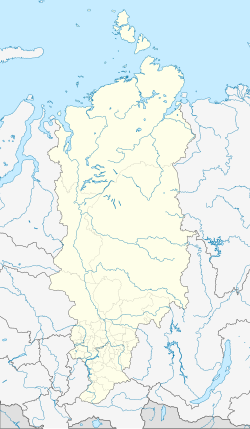
Yermakovo, Krasnoyarsk Krai
Appearance
This article needs additional citations for verification. (February 2017) |
Yermakovo
Ермаково | |
|---|---|
| Coordinates: 66°35′N 86°11′E / 66.583°N 86.183°E | |
| Country | Russia |
| Federal subject | Krasnoyarsk Krai |
| Administrative district | Turukhansky District |
| Founded | 1949 |
| Population | |
| • Total | 12 |

Yermakovo (Russian: Ермако́во) is an urban-type settlement in Krasnoyarsk krai near the town of Igarka in Siberia. It was built in 1949 as a gulag to house the prisoners constructing the Salekhard–Igarka Railway. By 1955 it was abandoned. It was revitalised in the 2000s as a tourist town. The population in 2011 was 12. The main attraction for the town is a unique gulag museum.
References[edit]
- ^ Russian Federal State Statistics Service (2011). Всероссийская перепись населения 2010 года. Том 1 [2010 All-Russian Population Census, vol. 1]. Всероссийская перепись населения 2010 года [2010 All-Russia Population Census] (in Russian). Federal State Statistics Service.
External links[edit]


