
User:Steverelei/sandbox
Some Famous Classical Works by French Composers:[edit]
(Composer:Work)
Paul Dukas:The Sorcerer's Apprentice (L'apprenti sorcier)
Camille Saint-SäensCarnival of the Animals]]--including The Swan (Carnaval des animaux--Le cygne):Danse Macabre Symphony No.3 Organ
Émile Waldteufel: The Skater's Waltz (Les Patineurs)
Claude Debussy: Prélude à l'après-midi d'un faune Reverie, Arabesque #1, The Girl with the Flaxen Hair (La Fille aux Cheveux de lin), The Sunken Cathedral (La Cathedral engloutie)
Jacques Offenbach: Can-can (Infernal Gallop from Orpheus in the Underworld)
Some Famous Passenger trains serving Oregon
Spokane, Portland and Seattle (SP&S)
The Spokane, Portland and Seattle (SP&S) was the gateway for Great Northern's (GN) Empire builder and Northern Pacific's (NP) North Coast Limited in and out of Portland (Union Station). From Portland, they operated as one train, traveling from Vancouver (WA) eastward along the north bank of the Columbia River.
At Pasco(WA), NP cars were switched onto the Seattle section of the North Coast (the Seattle section traveled over Stampede Pass through the Cascades). The combined (NP-Seattle and Portland sections)train went on to Spokane (WA), using the NP depot, and on through Sandpoint (ID) and southern Montana (including Missoula, Butte, bozeman, Livingston, Billings, etc.), North Dakota (including Bismarck and Fargo), and Minnesota. At St. Paul (MN), the train switched to the Chicago, Burlington and Quincy (the Burlington or CB&Q) for the rest of the trip to Chicago.
The Empire Builder went all the way to Spokane to the GN station where it switched cars onto the Seattle section (which had used the Stevens Pass line through the Cascades) for the rest of the way east. The (combined) Builder would then travel through Sandpoint, northern Montana (Whitefish, Glacier National Park, Havre. etc.) North Dakota (including Williston, Minot, and Fargo). At St. Paul, the Builder also used the Burlington for the rest of the way to Chicago. In later years, the Builder and North Coast operated as a combined train between St. Paul and Chicago.
Amtrak's Empire Builder
Since 1981, Amtrak has operated the Portland section of the Empire Builder, which travels along the north bank of the Columbia to Pasco and on to Spokane (using the former NP depot). At Spokane, the Portland section is combined with the Seattle section (which uses the Stevens Pass line) for the rest of the trip east. At St. Paul, the Builder now switches to the Canadian Pacific (CP), which previously belonged to the Soo Line, and before that the Milwaukee Road, into Chicago. As of May 2014, (for the first time since 1971) passengers were allowed to use St. Paul Union Terminal.
The 'Pool' Trains
GN, NP, and Union Pacific (UP) each operated one roundtrip train between Portland and Seattle. With the combined route and ticketing, they became known as the "pool" trains. GN and NP trains used Seattle's King Street Station, while the UP used Union Station, which was across the street.
Cascades/Talgo trains
The Pacific Northwest Rail Corridor extends from Eugene to Portland, OR to Seattle, WA, to Vancouver, BC Canada and stations in between. Amtrak uses Talgo trains on this route. Most of these "natural tilting" trains were built in Spain. Two were built in the United States. These sleek trains can go around curves at higher speeds with greater safety and comfort, and they offer passengers many modern amenities including high speed Wi-Fi, reclining seats and a full service bistro and lounge car.
Southern Pacific (SP)
The Cascade was an overnight train between Portland, OR, and Oakland {San Francisco), CA. Originally, the train was all-pullman (sleeping cars) but by 1950, coaches (chair cars) were included. The train operated up until the formation of Amtrak in 1971.
The Shasta Daylight was a train that left Portland in the morning and arrived in Oakland in rhe evening on a 15 hour 30 minute. This allowed passengers to view some of the most beautiful scenery in the country in daylight hours including the passage over Willamette Pass and its namesake peak--Mount Shasta. The train operated from 1949 to 1966.
Amtrak's Coast Starlight.
When this train began in 1971, it was the first time a passenger could go all the way from Los Angeles to Seattle on a single train. Previously, it took at least three different trains. The Starlight continues to be one of Amtrak's most popular trains as it travels one of the country's most scenic routes. Two highlights include the passage over Willamette Pass (out of Eugene) and the 111-mile ride along the Pacific Ocean between San Luis Obispo and Ventura, California.
Union Pacific (UP)
The Union Pacific operated two famous trains out of Portland going east. According to the Union Pacific Railroad, the Portland Rose entered service on September 12, 1930, and was the premiere train on the Portland route. The name Portland Rose lasted right up until Amtrak. However, the train did not operate as a single train from Chicago to Portland; instead, when the City of Portland began daily service in 1947, the Rose went only from Denver to Portland, picking up cars from Chicago from the Pacific Limited in Green River, Wyoming. In 1954, UP extended the train to Kansas City, replacing a previous Kansas City-Denver train called the Pony Express.
The City of Portland started in June 1935, using the refurbished M-10001 streamliner trainset; with only one set of equipment the train left each of its terminals five times a month (or six, for the first few months).
It was the first streamliner with sleeping cars and the first streamliner running from Chicago to the Pacific coast; its 39 hour 45 minute schedule became the standard. About 1955 the City of Portland was re-equipped with new baggage, coach, and sleeping cars, as well as an Astra Dome dome coach, dome observation lounge and dome dining car. The dome dining cars were unique to Union Pacific and were only operated on this train and the City of Los Angeles. The City of Portland operated along the south side of the Columbia River (Hood River and The Dalles), through Pendleton, over the Blue Mountains, La Grande, into Idaho (Boise and Pocatello), Wyomming, Nebraska, Iowa, and Illinois. The train lasted until the formation of Amtrak in 1971.
Amtrak's Pioneer
Amtrak's Pioneer began service in 1977 from Seattle and Portland to Odgen, Utah, and later to Salt Lake City. East of Portland, it followed the same route as the Portland Rose and City of Portland trains along the Columbia River, Blue Mountains, etc. to Pocatello. At Ogden (and Salt Lake) train passengers could connect with the San Francisco Zephyr--east to Denver and Chicago, west to Reno (NV) and into California. Beginning in 1990, the Pioneer was rerouted through Wyoming (including Green River, Rawlins, Laramie, and Cheyenne) to Denver (CO). At Denver, a through coach and sleeper would cennect to the California Zephyr for the rest of the way to Chicago. The Pioneer was discontinued in May 1997.
For More Information, See (On line): Streamliner Memories Wikipedia

Jasper Lake Alberta  [edit]

Jasper Lake is a lake located in the Rockies of Jasper National Park in Alberta, Canada. It is actually a part of the Athabaska, where the river broadens out. Its westernmost shore lies about 15 miles northeast from the town of Jasper along the Yellowhead Highway (Highway #16) and stretches farther east for about 6 miles.
Jasper Lake Sand Dunes
One unique feature of the lake is what is known as the Jasper Lake Sand Dunes. In fact, it is the only sand dune eco-system in the entire Canadian Rockies. The dunes were formed at the edge of the lake during the last ice age and have been constantly re-shaped by wind and water ever since. Acting as a kind of sieve, the lake removes silt and sand from the river, allowing it to sink to the lake bed. When the water level recedes in the fall, vast sand flats are exposed and dry out, becoming vulnerable to the strong westerly winds that sweep through the lower Athabasca Valley. In winter, these winds blow the sand and silt down the valley, forming two large dune islands near the northwest shore of Jasper Lake. In the lee of the dunes, mature clumps of spruce and balsam poplar have gained a stronghold, while colonizing grasses, rose bushes and willows wage a constant war against the winds and migrating sands. Nowhere else in the park is the balance of nature so apparent – or so fragile – as in the Jasper Lake sand dunes. As water from the river flows into the lake, silt and sand sink down to the lake bed. In the fall, when the water level goes down, the silt and sand are exposed and become dry, and are then swept up by the strong westerly winds of the Athabasca Valley.[1]
Surrounded by Mountains[edit]
The lake is surrounded by mountain ranges, many of which can be seen from various parts along the lake. From southeast to southwest:
- Miette Range. Most prominent peaks include Utopia Mountain and Roche Miette.
- Jacques Range. Prominent peaks: Cinquefoil Mountain (92259m/7412ft.), Roche Jacques (2603m/8540ft.), and Mount Merlin (2711m/ 8894ft.).
- Colin Range: Peaks include Mount Colin (2687m/8816ft.)
Northwest to northeast:
- Victoria Cross Ranges--so named because six of the peaks are named after Canadian recipients of the Victoria Cross.
- De Smet Range. Prominent peaks include:Roche de Smet,
(2539m/8330ft.) and Mount Greenock 2065m(6775ft.).
- Bosche Range: Mount Aeolus (92643m/8672ft.) and Roche a Bosche (2123m/ 6966ft.)
52.916667,-118.3
Transportation Corridors[edit]

TheCanadian National Railroad skirts the northern shore of the lake. Parts of its mainline have been built on causeways away from the shore, which have created several mini lakes. VIA Rail's passenger train the Canadian uses this same CN line as part of its journey from Toronto to Vancouver, giving train passengers up-close views of the lake, Sand Dunes, and surrounding mountains.
The Yellowhead Highway (Highway #16) skirts the southern shore of the lake, and it too has segments of its route built out on causeways, which have created Edna and Talbot lakes. This highway is the main east-west route between Winnipeg and Edmonton and other points east and Jasper and points farther west.
Photo Gallery[edit]
-
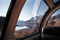
 Jasper Lake with marshes and the Miette Range from train
 -
 Jasper Lake with mountains from train.
 -
 Jasper Lake and mountains as seen from the train.


http://www.jaspernationalpark.com/activities/jasper-national-park-jasper-lake-sand-dunes.html
http://www.pc.gc.ca/docs/v-g/pm-mp/lhn-nhs/jasperhouse_e.asp
Vancouver skybridge.jpg
Jasper lake with mountains from train.jp
-
 Here is a little glimpse of the town of Jasper,
 -
 From the dome car, one can see a CN 4-8-2 steam engine on display
 -
 Canadian National 4-8-2 steam locomotive...with the present-day streamlined Canadian train
 -
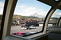
 The train station at Jasper, Alberta,
 -
 The train station at Jasper, Alberta,


|}
Coast Starlight Seattle-Portland[edit]
Prior ro Amtrak in 1971 and Burlington Northern in 1970, the line from Seattle to Portland was owned and operated by the Northern Pacific with the Great Northern and Union Pacific having trackage rights. Each railroad provided one train a day each way; these were known as the coast pool trains.[2]NP and GN trains used King Street Station, while the UP used Union Station, which is across the street.
The train begins its journey from King Street Station, heading south past CentryLink Field (Seattle Seahawks) and Safeco Field(Seattle Mariners)and past a rail mainenence facility for Amtrak and Sounder commuter rail trains. After passing through south Seattle's industrial area, the train curves to the southeast, passing by UP's Argo Yard, leavng Seattle and entering Renton and past the sprawling Boeing Field (King County International Airport). Facilities include The Museum of Flight--some of its exhibits can be seen from the train. Weather permitting, 14,410-ft Mount Rainier should be visible to the southeast. The train curves to the south, passing through Tukwila. The Union Pacific has its own tracks between Seattle and Tacoma, and its tracks can be seen from the train to the west (right). Amtrak Cascades trains stop at the Tukwila station. Amtrak shares this line with BNSF freights and Sounder commuter rail trains; the train will pass several stations that are stops for the commuter service but not for the Coast Starlight. These stations include Kent, Auburn, Sumner, and Puyallup.
At Auburn, the tracks that divert from the mainline (to the left/east of the train) go east over Stampede Pass. The route was once operated by the Northern Pacific Railway, the route of its famed North Coast Limited. The line became part of the Burlington Northern (BN) in 1970. From 1971 to 1981, it was the route of Amtrak's Empire Builder. The route is now normally freight only and is operated by the BNSF as part of its transcontinental routes to Pasco, Spokane, and beyond.
The train crosses the Green River near Auburn and the Puyallup River near Sumner and has been passing through the Puyallup Valley. It makes for contrasting scenes: cities and towns, warehouses and storage areas, large railyards, golf courses, and sprawling farms and pastures. It is also near Sumner that the mainline rounds a big curve and goes from heading due south to compass northwest. It passes through the city of Puyallup. The Puyallup Fairgrounds (Washington State Fair) can be seen to the south (left). At Reservation, the UP tracks join with the BNSF tracks, as the UP has trackage rights all the way into Portland. Soon the train curves to the south (left) and stops at the Tacoma Amtrak station. The Tacoma skyline can be seen to the right (south). To the southeast of the station is the Tacoma Dome. The Tacoma station sits neas the large railyards, while cranes and ships can be seen aound and on Commencement Bay (Port of Tacoma). Tacoma Union Station was once a major passenger train hub, surving into the Amtrak era (until 1984). It is now A US federal courthouse.
After leaving the station, the train once again makes a sharp turn to the northwest (according to the compass). The skyline is to the south (left); the train passes under the Lyons Bridge. The train passes the Museum of Glass (to the right) and glides along Commencement Bay which is an arm of the Puget Sound, with its views of the water, piers, restaurants, mountain and communities off in the distance. The passes through two tunnels underneath Point Defiance Park. Upon exiting the yunnel the train continue its scenic ride along the Puget Sound. TheOlympic Mountains with Mt. Olympus 7,980 ft (2,432 m) across the water to the west. The Tacoma Narrows Bridge can be seen for a number of miles as the train nears and eventually passes under it. There are presently two separate spans. The original bridge-known as "Galloping Gertie," was built in April 1840 but collapsed in November of the same year. A new bridge opened in October 1950. The second span opened in July 2007. Along the way, Water scenes include houseboats, ferries oand arious other watercraft, beaches, parks,and other sights, and mMany species of water birds--sometimes bald eagles. The train passes the Chambers Bay Golf Courses (to the left/east, going south) before crossing a short drawbridge and passing through Steilacoom,the train passes a ferry terminal. Steilacoom to Anderson Island Ferry takes passengers o Anderson Islandand is is operated by Pierce County. All too soon the train reaches the southernmost poit of its ridge allow the Puget Sound, crosses over I-5, the Nissqually River before arriving at Olympia-Lacy Amtrak Centennial Station.
The train contnues southward, passing through lush farmlands and forests, Mount Rainier is usually visible to the east (left going south). The train passes through a railyard before arriving at the Centralia Amtrak depot. A few minutes after departing the station, the train passes through Chehalis. Just souh of downtown is one of the few places where passengers can get a good, but quick view of Mount St. Helens--8,365 ft (2,550 m--from the train. Toledo, Napavine, and Winlock are some of the smallcomunies the train passes through. Winlock boasts he world's largest egg. Near Castle Rock is where motorists turn of I-5 ad head toward the Mount St. Helens National Volcanic Monument and its nameake peak. The train has been following the Cowlitz River and crosses thr Toutle River. Passengers here cannot see Mount Saint Helens, but they can see ome ofits affects: mountins , hi9lls, and other piles of volcanic ash can be see on both sides of the track. The train passes through a tunnel--one of only three tunnels on the Srattle-Portland route--before arriving at the Kelso station in Kelso.
After leaving the station, the train continues along the Cowlitz River and soon meets with the
. The Cowlitz meets with the Columbia out of view of train passengers. Here, th river is lon and wide. The state of Oregon is on the other side. Large ocean-going ships can be seen on the river as well as many other types of smaller vesels--tug boats,trawlers, and various kinds of pleasure craft. Just south of Kalama, the tracks ride in the middle of the freeway (I-5): northbound lanes are on the left (east) side of the intertate; the southbound lanes are on the right (west) side. The train crosses the Kalama and Lewis Rivers and passes through Woodland and Ridgefield including the RRidgefield National Wildlife Refuge. As the train skirts Lake Vancouver, some of the tall buildings of Portland can sometimes be seen. The Ridgefield Refuge and Lake Vancouver--actually along much of the route, various kinds of birds--including bald eagles-- and other wildlife can often be seen. The train passes through the Vancouver railyards before arriving for a short stop at the Vancouver Amtak depot. The station sits within a wye. goes east through the [[Columbia River Gorge|Columbia Gorge]. South of the station, tracks divert from the Seattle-Portland (Seattle Subdivision) onto the Fallbridge division route to go east This is the route of Amtrak's
Empire Builder takes to go east to Spokane and beyond from Portland.
After a brief stop,the train continues southward across the Columbia River via the Burlington Northern Railroad Bridge 9.6, leaving the state of Washington and entering the state of Oregon, Mount Hood-- 11,249 feet (3,429 m)--is usually visibleto the east. As it enters Oregon, the train is crossing over Hayden Island and crosses another arms of the Coumbia River knnown as the Columbia Slough over the Oregon Slough Railroad Bridge(BNSF Railway Bridge 8.8). Soon after, the BNS mainline is joined (or has tracks diverting from) the Union Pacific, Northbound, the UP uses the BNSF tracks as far as Tacoma). South and eastbound, the UP leaves the BNSF line on its own routes east and south of the city. South the train whizes through the north Potland neiborhood of St.Johns, crosses the Willamette River over the Burlington Northern Railroad Bridge 5.1 and is now on the west side of the river. After pasing through several railyards and industrial areas, the train pases under the Fremont Bridge and arrives at Portland Union Station.
all Oregon Slough Railroad Bridge
Coast Starlight south of Portland[edit]
Standing at the Eugene station, the train is facing east. Skinner's Butte is to the north (left); downtown is to the south (right). The %th Street Market is to the right. As the train leaves the station, it is traveling more in an easterly/southeasterly direction rather than due south. Autzen Stadium is across the Willamette River to the left. The train soon passes the main campus of the University of Oregon then passes underneath I=5 and enters the city of Springfield. Springfield Junction )to the right), where the original Southern Pacific line(now it belongs to the Central Oregon and Pacific) line branches off to go due south through Medford and Ashland and into California. That line was completed in 1887; ours--the Natron Cutoff line--was opened in 1929 (Construction on the Cascade Line--More information). We cross the Willamette River, following the primarily the Middle Fork; the South Fork, as its name implies, comes more from the southern areas of Lane County.
South of Portland, The Starlight travels the route onc e used by Southern Pacific's Shasta Daylight and Cascade crack passenger trains. Standing at Union Station, going south, the train is actually facing southeast. As it leaves the station, it curves around toward the north and northeast and crosses the Willamette River over the Steel Bridge. As the train crosses, passengers can see the Broadway Bridge and Fremont Bridge toward the northwest (to the left) and the Burnside Bridge to the south. Tracks going west/north head into UP's Albina Yard and beyond. Also to the south areTom McCall Waterfront Park and the Eastside Esplande, a popular hike/bike path. The train passes under a bridge allowing access to the pathway. Passengers may also be able to see from the train the top of the Rose Garden Arena (now known as the Moda Center)and the twin towers of the Oregon Convention Center, both of which are on the east side of the river. The train also passes under Interstate 5 near exit and entrance ramps to/from Interstate 84. The railorad line going east (along I-84) is Union Pacific's Graham line heading east toward the Columbia Gorge and farther east. This was the route of Amtrak's Pioneer and Union Pacific's City of Portland and Portland Rose passenger trains.
Continuing southward, the train passes under the Burnside Bridge along then the Morrison and Hawthorne bridges. [Portland-Milwaukie_Light_Rail_Bridge|Portland-Milwaukie Light Rail Bridge]] and the Oregon Museum of Science and Industry(OMSI) as the train curves toward the southeast. The Marquam(I-5) and Ross Island bridges can be seen. Passengers can also see the new Oregon Rail Heritage Center, and the new Portland-Milwakie light-rail (MAX Orange Line route begins paralleling the route and does so for a few miles. The train passes through UP's Brooklyn Yard and and southeast Portland. Westmoreland Park will be to the right (west), while the Eastmoreland Golf Courses are to the Left (east), which include the Crystal Springs Rhododendron Garden. The Broolyn Neighborhood. The tracks also parallel McLoghlin Blvd, also known asHJighway 99 East. Highway 99 will follow the train all the way to Junction City, a city just north of Eugene.
The train soon leaves Portland and Multnomah County and enters the city of Milwaukie and Clackamas County. The Willsburg Junction begins the start of the so-called Tillamook Branch, which was once part of the Southern Pacific's route from Portland to Tillamook on the Pacific coast. The line is now operated by the Portland and Western Railroad. The curves farther to the southeast, passes through Milwakie, near Happy Valley, underneath I-205, (this is onw place where passengers can get a quick look at Mount Hood) and around and through the city of Clackamas as it curves back, now going in a southwesterly direction. It soon crosses the Clackamas River and the Oregon City Amtrak station. The Amtrak Cascades Talgo trains stop here, but the Coast Starlight normally does not. It just passes by. That is the End of the Oregon Trail Interpretive Center across the street, the structures that look like three giant covered wagons. After passing through Oregon City, the train once again meets up with the Willamette River, paralleling it for several miles, including past the Willamette Falls.
The railroad and river seen part ways (they will meet up again later on) as the train enters the Willamette Valley, a broad fertile valley bordered on the east by the Cascade Range--Mount Hood, Mount Jefferson and possibly The Three Sisters (North Sister at 10,085 feet, Middle Sister at 10,047 feet, and South Sister at 10,358 feet)[3] should be visible. To the west is the Oregon Coast Range. The valley produces many types of crops, some of which may be seen from the train, including but not limited to: Christmas trees, hops, vineyards, grass seed, various types of flowers and ornamental shrubs, fruits and vegetables. There are also dairy farms and pastures with horses and/or other types of animals.
The Salem Airport (McNary Field) can be seen to the east (left) as the train continues southward, glides through Turner and at Jefferson rounds a curve--now going due west-- and crosses the Santiam River and then slides under I-5. A large oil refinery lies to the west (right) as the train enters the city of Albany and rounds a curve, heading farther west. Those are the tracks of the Portland and Western Railroad to the right. They connect with the UP mainline and at Albany with Corvallis, other Willamette Valley communities and Toledo and Port of Toledo on the Oregon coast. Rounding another curve (southward) southward, the train arrives at the Albany Amtrak station--the westernmost Amtrak station.[4]. The P&W railyards and maintenaince shops.
Leaving the Albany station (the platform is on a curve), the train heads south on one of the longest stretches of single track on the line--more than 20 miles without a curve. Linn-Benton Community College is to the west (right). About midway is the town of Tangent , named for this long stretch of straight track. There are a number of businesses selling feed and grass seed, as the Willamette Valley is one of the largest producers of grass seed in the nation.
Soon, the tangent gives way to more curving track as the train curves (again) westward and meets up with and crosses the Willamette River on an old drawbridge. The P&W Railroad bridge is close by. The train speeds through Harrisburg--with its noted water tower--and then Junction City, where the train is jnow paralleled by Highway 99 West, which follows it all the way into Eugene). Incidentally, Junction City is the farthest west that the Union Pacific (ex-SP) gets and is the westernmost point that any Amtrak train gets. The train heads due south for a few miles, passing the Eugene Airport (which has major airline service), and then heads southeast toward the city limits and Eugene Amtrak station in Eugene. At the station, the train is actually facing east. Skinner's Butte to the north (left); downtown Eugene is to the south (right). The Eugene stop is a designated smoke stop, so passengers can take advantage of the moment to get off and stretch one's legs and get some fresh air. The county jail and the Eugene Hilton hotel are nearby.
https://en.wikipedia.org/wiki/Mount_Jefferson_(Oregon) https://en.wikipedia.org/wiki/Mount_Hood https://en.wikipedia.org/wiki/Willamette_valley http://en.wikipedia.org/wiki/Cascade_(train) https://en.wikipedia.org/wiki/Shasta_Daylight https://en.wikipedia.org/wiki/Marquam_Bridge https://en.wikipedia.org/wiki/Ross_Island_Bridge
Standing at the Eugene station, the train is facing east and departs the station traveling in an east/southeasterly direction, rather than due south. After passing hunder the I-5 overpass, that's Autzen Stadium across the Willamette River to the north(left). Franklin Park can also be seen. The train soon and then the main campus of the University of Oregon across the street to the south (right). The train enters the city of Springfield and goes through the Springfield Junction (to the right), where the original Southern Pacific (now it belongs to the Central Oregon and Pacific) line branches off to go due south through Medford and Ashland and into California. That line was completed in 1887; ours--the Natron Cutoff line--was opened in 1929 (Construction on the Cascade Line--More information). We cross the Willamette River, following the primarily the Middle Fork; the South Fork, as its name implies, comes more from the southern areas of Lane County. Some of the information contained below was taken from http://spcascades.railfan.net/aboutcas.html, written by Joel Ashcroft and is taken from his Web site. All rights may be reserved. So far, since leaving Seattle, we have gone from the big city, gone through fertile valleys, snaked along bays and rivers, now the railroading gets tougher and more scenic and spectacular. There may also be differences in weather and temperature from down on the floor at Eugene than at the Cascade Summit at more than 4,000 feet above sea level.The landscape becomes increasingly mountainous and the grade steeper as the train begins to climb. The train will climb more than 44 miles at a steady 1.8 percent grade (it is said to be the longest continuous climb on the entire Southern Pacific system), a mainline with 19 tunnels, numerous snowsheds, several high trestles, and several miles of riding along a precarious shelf thousands of feet above the valley floor.
Still along the Willamette River, we can see a dam (to the left) in the distance--the Lookout Reservoir. The train in fact passes it and then glides along the long shores of the lake--the reservoir--behind the dam. During the winter and early spring, the waterlevel can be pretty high, yet during the high summer and fall seasons, and/or if there has been a drier than usual rainy season, the waterlevel can be pretty low, and you can see the results.
After leaving the lake, the river is a smaller stream, which we cross before entering the first of the Cascades tunnel through which we will pass. The canyon made by the river is also quite scenic. There are the communities of Lookout, https://en.wikipedia.org/wiki/Westfir,_Oregon, and Oakridge,_Oregon. For many years, Oakridge was an important point on the railroad as it was the bottom of the hill; it is still important as a place for helpers--extra locomotives to help long, heavy freight trains up and down the grades to the summit. And not just up! Helpers also help with braking the long, heavy trains coming downgrade. Fortunately, the Coast Starlight has at least two powerful locomotives on it, so it doesn't normally need helpers. Also, passenger train speeds are faster (usually an average of 35 mph) than are the freight train speeds.
Leaving Oakridge (See Willamette Pass Map One), the tracks begin the heavy (heavier than it has been) climb to Cascade Summit. The train crosses Salmon Creek on a horseshoe curve and winds it's way toward the Dunning Road grade crossing. The tracks make another horseshoe curve and enter the Salt Creek Canyon and approach Pryor. (Joel Ashcroft) Near this location was where the last spike was driven, closing the gap between Kirk and Natron. A few miles past Pryor is the next short tunnel. Beginning at about McCredie Springs, if you look up (to the right), you may be able to see the track (line) your train is about to take. Finally at Heather, the train crosses on a horseshoe curve Salt Creek Trestle over Salt Creek and Highway #58, doubling back as it gains elevation. As the train climbs, you can often look down and see where you have just been--through the trees, that is. This is the heavily forested Willamette National Forest, and all those tall trees will affect how much you can see. But, they are pretty, aren't they? Image people from Los Angeles or other large cities where such forests are uncommon. The forests here are dense due to the large amounts of rain each year. In winter, snowfall can be heavy also, which can affect railroad operations. That's why you will pass through several long snowsheds--structures built to keep snow off the tracks, especially in the more precipitous spots.
The tracks then pass through tunnels 18 and 17 and cross "The Slide." The area around the slide is slipping down the mountain. The railroad has a 20 MPH slow order here and the tracks have been moved several times because of it. You will pass through a total of five tunnels before the train passes through a horseshoe tunnel, coming out near Fields; you have once again reversed directions. You started at Eugene going southeast, then at Salt Creek you reversed directions and went northwest, now you are once again going in a southeasterly direction, and you are much, much higher. Careful as you look down, especially if you have acrophobia. The view is quite spectacular!
From Fields to Frazier to Cruzatte to Abernethy, the train clings precariously to the mountainsides, crossing over high trestles and through tunnels. There is one place where the train enters a tunnel, crosses Noisy Creek Bridge, and immediately enters another tunnel--without a break. Leaving Fields the tracks pass through tunnel 15, shortest on the line at 150 feet, and travel some distance before arriving tunnel 14. At this location, the tracks cross over Steep Canyon Bridge and a shorter ballasted deck plate girder bridge before entering the tunnel.
Tunnel 12 (See Willamette Pass Map Two), another short tunnel, is just around the corner from the rockshed. From here on, a good pair of hiking boots is necessary. The next accessible point is between tunnels 7 and 6. Passing through tunnel 12 the tracks cling to the side of the mountain. The terrain is extremely rugged and it's a long way down! Because of this, the tracks are buttressed from underneath and a 90' deck plate girder bridge, Side Canyon Bridge, was built to cross this area.
The east portal of tunnel 11 is protected by a rockshed on top and a buttress underneath. Passing through tunnel 11 the tracks enter another rockshed and immediately into tunnel 10 and through another rockshed. Basically, when entering the east portal of tunnel 11, a train is not yet out in the open until exiting the rockshed protecting the west portal of tunnel 10! Noisy Creek bridge joins the rockshed and tunnel 9 at this point.
Exiting tunnel 9 is another short rockshed. Winding around the side of the mountain the tracks enter tunnel 8 and cross Shady Creek Bridge. In the canyon below the bridge, there is an old boxcar that did not make it! This was caused by an avalanche. The train had been stalled when the avalanche came down on the train. Fortunately, only some of the train was damaged, not the locomotives, and there were no injuries among the train's crew. Tunnel 7 is just over 3100 feet in length, one of the longer tunnels on the hill. Tunnel 5 turns into a very long rockshed that can be viewed from Highway 58. At this point the tracks travel through thick stands of Douglas Fir and pass through tunnel 4. Abernethy is the last siding before Cascade Summit. After passing through tunnel 3, the line quickly arrives at Cascade Summit at elevation 4,840 ft. in elevation.
Shortly after your train emerges from the Cascade Summit tunnel, you'll get beautiful views of Odell Lake. The lake's depth (2,000 feet in places) gives it a wonderful blue color which sets off Maiden Peak in the distance. The train follows the lake for about 4 miles and then travels along the shores of Crescent Lake. You should also be able to see (to the right) the remains of Mt. Mazama now forms the rim of Crater Lake. This lake lies in the center of an extinct volcano 6,177 feet above sea level. Six miles long and four miles wide, its precipitous walls rise 1,000 feet from the water's edge to the rim. It's not too much longer that the train arrives at the Chemult station. For most of the year, southbound, it should be dark by now. However, you may still have some lingering daylight left in June, and northbound the journey will be in daylight the entire way from about Dunsmuir. Near Chemult, from the left, the BNSF Oregon Trunk Line will join with our route for the rest of the way to Klamath Falls. Oh, and don't expect the rail line to descend to a much lower elevation until well into California; we will remain at an elevation of more than 4,000 feet above sea level. Soon enough, finally, the train arrives at the Chemult station, where there is a bus connection to Bend and other Central Oregon Points. You may also notice a change of vegetation on this side of the Cascades divide. Conditions are much drier, and the forests will become thinner, and the landscapes more barren.
CHEMULT, OR CHEMULT STATION (CMO) Chemult Weather As we leave the Chemult station, you should be able to see (to the right) Mount Scott (9,128 ft) and Mt. Theilsen (9,178 ft) and are in the vicinity of the remains of Mt. Mazama, which now forms the rim of Crater Lake. This lake lies in the center of an extinct volcano 6,177 feet above sea level. Six miles long and four miles wide, its precipitous walls rise 1,000 feet from the water's edge to the rim. It is Oregon's only national park and one of the state's natural jewels. The lake is the deepest in North America. Klamath Falls is one of the gateways to it. (Crater Lake National Park)
Between Kirk (el. 4,533 ft) and Yamsay (el. 4,651 ft), we cross and follow the course of the Williamson River. We climb once more this time over "Calimus Hill" before reaching the shores of Upper Klamath Lake, which the train follows for several miles into its namesake city, one of the largest bodies of fresh water in the West. The lake is also wildlife sanctuary, including for many species of birds such as the snow-white pelicans you are likely to see. (some information from:Trainweb.com). The lake has been too low lately, and there has been considerable controversy. This is farming country but the arid landscape requires extensive irrigation for many crops (potatoes, etc.) to grow. Wildlife and fish need the water for their survival, and environmentalists are screaming about that.
We arrive at the Klamath Falls (City Map) station. This is a servicing stop and a chance to step off the train for a smoke, stretch one's legs, and get a breath of fresh air. Again, don't wander off too far! By now, it should be dark (southbound) and will remain that way until about Sacramento.
- ^ "Jasper National Park.com".
- ^ Northern Pacific Railway
- ^ The Three Sisters
- ^ "ALBANY OREGON (ALY)". TrainWeb. Retrieved August 1, 2010.