
Tchula, Mississippi
Tchula, Mississippi | |
|---|---|
 Location of Tchula, Mississippi | |
 Tchula, Mississippi Location in the United States | |
| Coordinates: 33°10′51″N 90°13′21″W / 33.18083°N 90.22250°W | |
| Country | United States |
| State | Mississippi |
| County | Holmes |
| Area | |
| • Total | 1.44 sq mi (3.73 km2) |
| • Land | 1.41 sq mi (3.65 km2) |
| • Water | 0.03 sq mi (0.09 km2) |
| Elevation | 112 ft (34 m) |
| Population (2020) | |
| • Total | 1,652 |
| • Density | 1,173.30/sq mi (452.90/km2) |
| Time zone | UTC-6 (Central (CST)) |
| • Summer (DST) | UTC-5 (CDT) |
| ZIP code | 39169 |
| Area code | 662 |
| FIPS code | 28-72440 |
| GNIS feature ID | 0678607 |
Tchula is a town in Holmes County, Mississippi, United States. The population was 1,650 at the 2020 census,[2] down from 2,332 in 2000.
A 2015 article in The Guardian described it as the poorest community in the United States.[3]
History[edit]
The first permanent settlement at Tchula was made in the 1830s. The community takes its name from Tchula Lake.[4]
In the 1960s most residents were farmworkers; the properties they worked on belonged to people living in other communities in the area. Mississippi columnist Sid Salter stated that the Tchula area had "Some of the best farmland in America" and "some of the most successful plantations".[5]
In 1982, the city's first Black mayor, Eddie James Carthan, was incarcerated. Chris McGreal of The Guardian stated that the criminal charges were "trumped-up".[3][6]
In the 2000s the community elected Yvonne Brown as mayor. She was a Republican, and the community hoped this would convince George W. Bush, the President of the United States, to provide additional funding. She was the first black Republican woman to be elected as a mayor in the country.[3]
By 2015 many of the jobs in the area had vanished, partly due to increased use of machines in agriculture. Many businesses formerly in the town had disappeared.[3]
Geography[edit]
Tchula is in western Holmes County along Tchula Lake, an old river channel in the Mississippi Delta region of the state. U.S. Route 49E passes through the center of town, leading north 25 miles (40 km) to Greenwood and southwest 27 miles (43 km) to Yazoo. Mississippi Highway 12 leads southeast from Tchula 11 miles (18 km) to Lexington, the Holmes County seat.
According to the United States Census Bureau, the town has a total area of 1.4 square miles (3.7 km2), of which 0.04 square miles (0.1 km2), or 2.31%, is water.[2]
Demographics[edit]
| Census | Pop. | Note | %± |
|---|---|---|---|
| 1880 | 90 | — | |
| 1900 | 398 | — | |
| 1910 | 478 | 20.1% | |
| 1920 | 550 | 15.1% | |
| 1930 | 907 | 64.9% | |
| 1940 | 861 | −5.1% | |
| 1950 | 927 | 7.7% | |
| 1960 | 882 | −4.9% | |
| 1970 | 1,729 | 96.0% | |
| 1980 | 1,931 | 11.7% | |
| 1990 | 2,186 | 13.2% | |
| 2000 | 2,332 | 6.7% | |
| 2010 | 2,096 | −10.1% | |
| 2020 | 1,652 | −21.2% | |
| U.S. Decennial Census[7] | |||
2020 census[edit]
| Race | Num. | Perc. |
|---|---|---|
| White | 20 | 1.21% |
| Black or African American | 1,607 | 97.28% |
| Native American | 5 | 0.3% |
| Other/Mixed | 10 | 0.61% |
| Hispanic or Latino | 10 | 0.61% |
As of the 2020 United States Census, there were 1,652 people, 735 households, and 400 families residing in the town.
2000 census[edit]
As of the census[9] of 2000, there were 2,332 people, 724 households, and 524 families residing in the town. The population density was 1,683.6 inhabitants per square mile (650.0/km2). There were 772 housing units at an average density of 557.4 per square mile (215.2/km2). The racial makeup of the town was 3.43% White, 95.93% African American, 0.09% Native American, and 0.56% from two or more races. Hispanic or Latino of any race were 0.47% of the population.
There were 724 households, out of which 38.1% had children under the age of 18 living with them, 21.4% were married couples living together, 45.4% had a female householder with no husband present, and 27.5% were non-families. 25.1% of all households were made up of individuals, and 8.8% had someone living alone who was 65 years of age or older. The average household size was 3.22 and the average family size was 3.92.
In the town, the population was spread out, with 37.9% under the age of 18, 13.0% from 18 to 24, 25.1% from 25 to 44, 14.7% from 45 to 64, and 9.4% who were 65 years of age or older. The median age was 24 years. For every 100 females, there were 80.6 males. For every 100 females age 18 and over, there were 71.5 males.
The median income for a household in the town was $11,571, and the median income for a family was $14,773. Males had a median income of $22,250 versus $16,310 for females. The per capita income for the town was $6,373. About 49.4% of families and 54.4% of the population were below the poverty line, including 66.6% of those under age 18 and 55.8% of those age 65 or over.
In 2010, Tchula had the fifth-lowest median household income of all places in the United States with a population over 1,000.[10]
Government and infrastructure[edit]
In 2015 McGreal stated that the police forces were under-equipped. The police chief himself had a second job.[3]
Transportation[edit]
Amtrak’s City of New Orleans, which operates between New Orleans and Chicago, passes through the town on CN tracks, but makes no stop. The nearest station is located in Greenwood, 25 miles (40 km) to the north.
Education[edit]
The town of Tchula is served by the Holmes County School District.
Current schools in the area include S.V. Marshall Elementary School and Holmes County Central High School.
The Holmes County Learning Center is in Tchula itself.[11][12]
Previously Marshall's campus housed S.V. Marshall High School.
Mississippi Blues Trail marker[edit]

Notable people[edit]
- Woodrow Adams, Delta blues guitarist and harmonica player[13]
- Yvonne Brown (1952–2012), politician elected in Tchula as the first black Republican female mayor in Mississippi, serving from 2001 to 2009. She was the Republican nominee for Mississippi's 2nd congressional district in 2006.
- Jimmy Dawkins (1936–2013), blues guitarist and singer,[5] who moved to Chicago at 18 or 19
- Bess Phipps Dawson, painter and gallerist[14]
- Lester Davenport (1932–2009), blues musician[5]
- Chris Epps, former commissioner of the Mississippi Department of Corrections,[15] pleaded guilty to corruption-related charges[16]
- Addison Grace Hadley - Miss United States 2023
- Johnny Mitchell, former National Football League tight end[17]
- Little Smokey Smothers (1939–2010), blues guitarist and singer
- Hartman Turnbow (1905–1988), first black person in Mississippi to register to vote in the 1960s, following disfranchisement in 1890[18]
References[edit]
- ^ "2020 U.S. Gazetteer Files". United States Census Bureau. Retrieved July 24, 2022.
- ^ a b "Geographic Identifiers: 2010 Census Summary File 1 (G001): Tchula town, Mississippi". American Factfinder. U.S. Census Bureau. Archived from the original on February 13, 2020. Retrieved August 18, 2017.
- ^ a b c d e McGreal, Chris (November 15, 2015). "Poorest town in poorest state: Segregation is gone but so are the jobs". The Guardian. Retrieved July 9, 2017.
- ^ Baca, Keith A. (2007). Native American Place Names in Mississippi. University Press of Mississippi. p. 108. ISBN 978-1-60473-483-6.
- ^ a b c Samaha, Albert (December 5, 2014). "The Prison Reform Blues". BuzzFeed. Retrieved May 26, 2017.
- ^ Jarvie, Jenny (May 3, 2019). "He's a felon and a politician. Mississippi says he can't be both, and wants him to pay up". Los Angeles Times. Retrieved May 3, 2019.
- ^ "Census of Population and Housing". Census.gov. Retrieved June 4, 2015.
- ^ "Explore Census Data". data.census.gov. Retrieved December 7, 2021.
- ^ "U.S. Census website". United States Census Bureau. Retrieved January 31, 2008.
- ^ "US Census". Archived from the original on February 12, 2020. Retrieved January 18, 2014.
- ^ "2010 CENSUS - CENSUS BLOCK MAP: Tchula town, MS." U.S. Census Bureau. Retrieved on July 9, 2017.
- ^ "Schools." Holmes County School District. Retrieved on July 9, 2017. "Holmes County Learning Center 32 School Street Tchula, Mississippi 39169"
- ^ Colin Larkin, ed. (1995). The Guinness Who's Who of Blues (Second ed.). Guinness Publishing. pp. 11/12. ISBN 0-85112-673-1.
- ^ Black, Patti Carr (2007). The Mississippi Story. Oxford, Mississippi: University Press of Mississippi. p. 37. ISBN 9781887422147.
- ^ Pettus, Emily Wagster. "Epps’ star falls in Miss. after federal indictment" (Archive). Washington Times. November 8, 2014. Retrieved on February 27, 2015.
- ^ Blinder, Alan (February 25, 2015). "Former Mississippi Officials Plead Guilty in a Graft Case Involving Private Prisons". The New York Times. Retrieved February 27, 2015.
- ^ Smith, Timothy W. (April 28, 1992). "Mitchell is Part City and Part Country". New York Times. Retrieved May 30, 2021.
- ^ "Hartman Turnbow – Mississippi Civil Rights Project". mscivilrightsproject.org. Retrieved February 28, 2015.
External links[edit]
- McGreal, Chris (November 15, 2015). "Poorest town in poorest state: segregation is gone but so are the jobs". The Guardian. Retrieved November 16, 2015.
Municipalities and communities of Holmes County, Mississippi, United States | ||
|---|---|---|
| Cities | 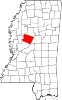 | |
| Towns | ||
| Unincorporated communities | ||
| Ghost town | ||
| International | |
|---|---|
| National | |