
Benslie: Difference between revisions
Rosser1954 (talk | contribs) |
Rosser1954 (talk | contribs) |
||
| Line 49: | Line 49: | ||
== Benslie wood and the Baroque deer park or garden == |
== Benslie wood and the Baroque deer park or garden == |
||
This '[[Baroque]]' or 'Celtic Cross' feature is what is now known as Benslie Wood, part of the extensive Eglinton Castle historic landscape, located outside of the formal 'Pleasure Gardens.<ref name="Roy"> General Roy's Military Survey of Scotland 1747 - 52.</ref> Much of this landscape feature's outline survives except on the Benslie village side of the present wood, with the present road cutting through the extreme edge of the feature. The 'outline' is formed from linear earth banks which contain a quantity of stone and shows signs of being originally planted up with beech and sycamore trees as evidenced from the remains of old tree stumps or surviving old tree specimens. With no evidence of a boundary wall, it is possible that a pale existed to make the enclosure stockproof. The linear bank is mostly curved, except for short sections where 'right angle' bends were required to form the desired 'baroque' shape. It may have had a pale or fence on top of it to make it stockproof, in addition to the boundary ditch. |
This '[[Baroque]]' or 'Celtic Cross' feature is what is now known as Benslie Wood, part of the extensive Eglinton Castle historic landscape, located outside of the formal 'Pleasure Gardens' on Benslie farm.<ref name="Roy"> General Roy's Military Survey of Scotland 1747 - 52.</ref> Much of this landscape feature's outline survives except on the Benslie village side of the present wood, with the present road cutting through the extreme edge of the feature. The 'outline' is formed from linear earth banks which contain a quantity of stone and shows signs of being originally planted up with beech and sycamore trees as evidenced from the remains of old tree stumps or surviving old tree specimens. With no evidence of a boundary wall, it is possible that a pale existed to make the enclosure stockproof. The linear bank is mostly curved, except for short sections where 'right angle' bends were required to form the desired 'baroque' shape. It may have had a pale or fence on top of it to make it stockproof, in addition to the boundary ditch. |
||
{|style="float:left; margin:1em 1em 1em 1em; width:27em; border: 1px solid #a0a0a0; padding: 10px; background-color: #F5F5F5; text-align:left;" |
{|style="float:left; margin:1em 1em 1em 1em; width:27em; border: 1px solid #a0a0a0; padding: 10px; background-color: #F5F5F5; text-align:left;" |
||
|- style="text-align:center;" |
|- style="text-align:center;" |
||
| Line 59: | Line 59: | ||
The 1747 Roy's map is a 'snapshot' in time and does not necessarily represent the completed feature. It does not appear as an extension of the extensive Eglinton 'pleasure gardens', however it does appear to align with the large rond-point still known as 'The Circle'. As a feature it is unlikely that the entire 'baroque' shape could be seen from any nearby location, but it may have been discernable from the upper areas of the castle. The original feature appears to have had open launds, delineated by sycamore and beech planting on the outer boundary and possibly the aforementioned holly planting in the interior. |
The 1747 Roy's map is a 'snapshot' in time and does not necessarily represent the completed feature. It does not appear as an extension of the extensive Eglinton 'pleasure gardens', however it does appear to align with the large rond-point still known as 'The Circle'. As a feature it is unlikely that the entire 'baroque' shape could be seen from any nearby location, but it may have been discernable from the upper areas of the castle. The original feature appears to have had open launds, delineated by sycamore and beech planting on the outer boundary and possibly the aforementioned holly planting in the interior. |
||
Andrew Armstrong's 1775 , ''A new map of Ayrshire...'' shows a circular woodland on the borders of the Doura estate, open apart from what appears to be a single tree in its centre. |
|||
[[Image:Benslie wood baroque.jpg|thumb|right|<Center>The appearance of the landscape feature in 1747]] |
[[Image:Benslie wood baroque.jpg|thumb|right|<Center>The appearance of the landscape feature in 1747]] |
||
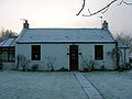
[[Image:Benslie Fauld farm.JPG|thumb|left|<Center>Benslie Fauld farm.]] |
[[Image:Benslie Fauld farm.JPG|thumb|left|<Center>Benslie Fauld farm.]] |
||
Revision as of 21:15, 28 January 2008
Benslie is a small village in North Ayrshire, in the parish of Kilwinning, Scotland. Map reference NS 336 429.
History

This village, previously Benislay (1205),[2], Beinslay (Timothy Pont 1604 - 08),[3] Benslee or Benslee square on the 1860 OS map, is situated next to Benslie wood. The village sits on the B 785 Fergushill Road and on the junction of the road to Montgreenan and Torranyard on the Lochlibo Road. The OS maps show that it was named 'Montgreenan' up until at least 1938, with the name Benslie given to the wood, the old house on the 'island' created by the three roads and the term Benslie Square. A Mission hall is marked as being at Benslie square on the 1910 OS map. The postal address may have been the direct cause of the name change, preventing confusion with the nearby Montgreenan estate.
Some dwellings were also present at Rosebank or Woodneuk (1858 OS map), situated just before the bridge that crossed the railway at Montgreenan station. A small fire clay was developed here and only a brick tower and bing remain in 2007. The village had a small wooden community hall which was used for indoor bowls and other activities. This building was demolished in the 1980s. A tennis court also existed at one time, next to the community hall. A number of new houses have been constructed since 1990; transforming the size and nature of this rural settlement.
A Chapel Hill cottage existed at one time,[4] suggesting that the chapel existed on the 'hill', possibly within what is now Benslie Wood. A small mound existed in the wood near Wood Neuk Cottage, but this may have been removed during the building of the new houses. The 1774 Ayr Roads Act names a Corsehill Chapel on the Toll Road from Kilwinning to Dreghorn via Milnburn.[5] A statement to the effect that a chapel existed in the middle of the 'feature;' has been made, however details are lacking.[6]
The local farms include Benslie Fauld, as well as North and South Millburn. A lane connected Laigh Patterton Farm with the old Netherfield farm and Benslie. The exit is preserved between the two modern buildings, Benslie House and Kinnouli, near the old fireclay mine.
The Millburn 'Crossing Keeper's' cottage
Opposite the old South Millburn farm is a ruined cottage with some highly unusual features. The gable ends both held rectangular windows with an elongated vertical axis, these were not set centrally, but were offset towards the front of the building which itself faces South Millburn. These would have given a clear view to anyone within the building of any features to the sides of the building. The old Ordnance Survey maps indicate that this building sat just behind and parallel to the horse drawn tramway, opened in 1834, which ran up to Fergushill and Doura, ending at the coal pit. Later the building had the Perceton / Doura Branch of the Glasgow and South Western Railway located on the other side. A door was set into the gable end on the Millburn Drive side. The fireplace was set in the gable end, despite the odd position of the windows.[1]
This building may have been a tramway crossing keeper's cottage, controlling rail traffic crossing the Eglinton castle estate's Millburn Drive and the nearby 1774 Toll Road[7]; it may also have acted as a sort of signal-box and station combined. Millburn drive was also part of the old 1774 Toll Road to Kilwinning from Irvine,[8] running across the Redburn at the Drucken Steps and through the Draughtburn Gates.[9] The quality of the 'build' suggests that it was constructed for or by the Earl of Eglinton to be in keeping with other buildings on the estate. The building does not seem to have been close enough to the road to have acted as a toll house.
Mr. Robert McGill remembers that these cottages were in use as a pigsty when he was a child, passing the site regularly on his way to school at the old Annick Primary.[10] Previously they had been used as cottages, latterly only one was occupied.
Millburn cottage gallery - 2007
-
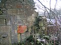
The gable end of a building at Millburn. Note the very unusual elongated window set towards the front of the house and the old bricked up doorway. -
The side of the building facing Benslie Wood. -

The highly unusual elongated window in the 'Auchenwinsey' facing end of the ruined building. -
The pig pens within the old 'cottage'. -
Detail of the high quality stonework on window facing towards Eglinton Country Park. -

The Millburn Drive facing gable end and old apple tree.


The 1774 Toll Road
-
![The site of the Drucken Steps on the 1774 Toll road to Milnburn via Hygenhouse.[7]](//upload.wikimedia.org/wikipedia/commons/thumb/a/a0/Drucken_steps.JPG/120px-Drucken_steps.JPG)
The site of the Drucken Steps on the 1774 Toll road to Milnburn via Hygenhouse.[7] -

The old well at the Draughtburn gate. -

Ruins at the Draughtburn Gate. -

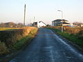
The course of the toll road from Daughtburn Bridge.
![The site of the Drucken Steps on the 1774 Toll road to Milnburn via Hygenhouse.[7]](./wiki.php?slug=File:Drucken_steps.JPG)


The Drucken Steps were stepping stones on the course of the old Toll Road which ran from the west end of Irvine through the Eglinton policies to Kilwinning via Milnburn or Millburn;[11] crossing the Redburn near Knadgerhill.
Miner's Rows
A number of Miner's houses once existed at nearby North Fergushill, a shown by the various OS maps of the late 20th-century. Benslie itself was made up of 57 stone built miners houses, owned by A. Finnie and Son. Coalmasters. In 1913 the village was said to be 67 years old.[12] At first the houses only existed at the 'Square' and then later the village was extended towards the road which runs up passed the church. A number of coal pits were in the area as shown by the first edition OS map, one pit being close to the 'Millburn Cottage' opposite South Millburn.
The Coup


The coup for the 'old' miner's rows or village was just to the right of the entrance to Millburn Drive and was excavated circa 2006 by enthusiasts who retrieved many bottles and other items from the 'heyday' of the miner's rows.[1] The original 4 foot 6 inches waggonway ran along one side of this coup and a small stone fronted 'dock' or loading platform wall still stands.
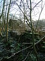
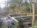
Benslie wood and the Baroque deer park or garden
This 'Baroque' or 'Celtic Cross' feature is what is now known as Benslie Wood, part of the extensive Eglinton Castle historic landscape, located outside of the formal 'Pleasure Gardens' on Benslie farm.[13] Much of this landscape feature's outline survives except on the Benslie village side of the present wood, with the present road cutting through the extreme edge of the feature. The 'outline' is formed from linear earth banks which contain a quantity of stone and shows signs of being originally planted up with beech and sycamore trees as evidenced from the remains of old tree stumps or surviving old tree specimens. With no evidence of a boundary wall, it is possible that a pale existed to make the enclosure stockproof. The linear bank is mostly curved, except for short sections where 'right angle' bends were required to form the desired 'baroque' shape. It may have had a pale or fence on top of it to make it stockproof, in addition to the boundary ditch.
| Etymology |
| The meaning of Benslie is most likely to be the shelter or grassland / lea (Lee) on the hill (Ben).[14] |
Considerable skill would have been necessary to accurately lay out this complex shape. A cross-shape and peripheral 'path' network appears to have been created of which no definite sign remains. The extensive earth movements associated with the 'rig and furrow' works appear to pre-date the feature, the same works being visible in the surrounding fields as well.[1] The position of the older holly trees is suggestive of their being in lines as if they are the remains of an internal 'hedge' planting. These old holly trees were a feature of the wood as far back as the 1930s.[1] Rackham has shown that holly trees can live for three to four hundred years and therefore the old hollies could date from 1747. A few show clear signs of long predating the birch trees, their present stunted growth only occurring once the birch trees were mature and cast significant shade. [15] Holly is fairly resistant to cattle and deer, indeed it was deliberately planted because its foliage was cut as iron rations for deer and other stock in winter.[16]
The 1747 Roy's map is a 'snapshot' in time and does not necessarily represent the completed feature. It does not appear as an extension of the extensive Eglinton 'pleasure gardens', however it does appear to align with the large rond-point still known as 'The Circle'. As a feature it is unlikely that the entire 'baroque' shape could be seen from any nearby location, but it may have been discernable from the upper areas of the castle. The original feature appears to have had open launds, delineated by sycamore and beech planting on the outer boundary and possibly the aforementioned holly planting in the interior.
Andrew Armstrong's 1775 , A new map of Ayrshire... shows a circular woodland on the borders of the Doura estate, open apart from what appears to be a single tree in its centre.


The name 'fauld' may hold a clue to the purpose or use of this landscape feature as this is Scots for an area manured by sheep, cattle or possibly deer.[17] At this time the main estate 'pleasure gardens' did not include a deer park.
The present wood is largely composed of Silver Birch trees which have grown naturally. The wood was felled in the 1940s by a foundry owner in Kilwinning and the ground was regularly burned until about forty years ago to keep it clear of brambles, trees, etc.[1] Downy birch, oak, sycamore and willow are also present. An unusually predominant presence of holly trees, especially old holly trees, has already been remarked upon and may reflect a feature of the planting of the original 'Baroque' feature.
The 'Baroque' or 'Celtic cross' layout is said to be similar to that which existed at the Optagon Park, Alloa Estate, Clackmannanshire; which in turn was modelled after the Dutch taste and based upon Hampton Court, the favourite home of King William; a Dutchman.[18] It is possible that this area was incomplete when mapped by Roy in the 1750s.
Mr.Robert McGill of North Millburn Farm recalls that local lore has it that after a 'plague' in the 19th-century a large number of people from the local miner's rows were buried in a mass grave in Benslie Wood.[19] Another local tradition is that the bodies were buried in the nether fields of Soth Millburn, close to the old Doura coal pit.[20]
Baroque Deer park / Benslie Wood gallery
-

Benslie wood on the site of the old Baroque feature. -
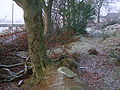
The 'park' outline where it diverges from the hedge bordering Fergushill Road. -
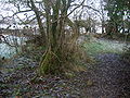
A 'right angle' turn on the 'Doura' side of the wood. -
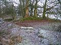
A double 'right angle' turn on the 'Doura' side of the wood. -

A view in the wood with birch and holly on the 'rigs' of the drainage system. -
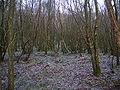
A view of the 'rig & furrow' style drainage and the dominant planted birch composition of the woodland.


The Benslie wood mound
A Moot hill usually existed within each barony in feudal times, such as the surviving 'Court Hill' near Beith and the now destroyed example at Greenhills near Barmill in the Barony of Giffen. Fergushill was a barony, as was Montgreenan. It is not known where the moot hills were for these. A fair sized mound is shown on several OS maps as existing within Benslie Wood close behind Wood Neuk cottage and therefore to the rear of the modern houses facing onto the road to Montgreenan.
The purpose of this mound is unknown, however it would have been a prominent feature if the hill was not afforested and it could have served as the moot hill for the barony or it may be a plausible candidate for the site of the old chapel.
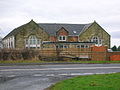
Fergushill church


Fergushill church in Benslie was built to serve the local rural and mining communities of Doura, Fergushill, and Montgreenan .[21] It was consecrated on Sunday, 3 November 1879 and the first minister was then Rev. William McAlpine.[22] It got its name from the Fergushill Mission which was based at Fergushill school. The old school master's house is still in existence at the junction of the road to Seven Acres Mill.[23] The manse, designated as 'Janburrow' is now a private house and stands at the entrance to the old Montgreenan railway station drive. 'Janburrow' is derived from the lady named Janet who came from Burrowland farm and lived in the old manse for many years.
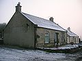
Benslie Gallery 2007
-

Benslie cottage from which the village may have taken its 'modern' name. -
'Roberton' and another old Cottage which previously served as the village Post Office. -
The old mine manager's house. A mound extends into this house's garden. -
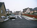
Looking towards Montgreenan with the new houses on the site of the old Community Hall and tennis court, with the old 'Rosebank' colliery ruins in the background. -

On a frosty day looking towards Fergushill from Benslie Cottage. -
Benslie Row on the site of the old miner's rows. -
Annick Primary School, now a private house.


Doura Hall
Doura Hall was a 17th-century building located on the road up to Doura Mains farm. It had been the intention of the Lairds of Corsehill to build a new house at the 'Dowrie', nothing was done, however plans of the proposed buildings have survived.[24] It was lived in by Sir Walter Montgomerie-Cunninghame in the 1780's after he lost Lainshaw House. James Boswell described it as a poor building. It was demolished in the 19th-century and appeared on the 1910 25 inch to the mile OS map. A Dovecote hill and orchard brae are further reminders of this estate, owned by the Cunninghames of Corsehill.[24] South Millburn is marked as East Doura on the 1910 OS map. A smithy was located at the Doura hamlet in the late 18th-century.
Miscellany
Plagues were a regular problem in the 18th and 19th-centuries with outbreaks of Small pox in 1791, Cholera in 1832 and Scarlet fever in 1837. Sentinels were placed at points on the roads to stop anyone entering or leaving the effected areas.[25]
The name 'Benslie' exists as a surname.[26] It is not known if any connection exists with the village.
The British Telecom 2006/7 'Phone Book' has Benslie with the spelling 'Bensley' and even Bensley Cottage (Sic) is recorded as being in Montgreenan.
Houses existed at the end of Millburn Drive and mid-way along. On the left when facing Millburn Lodge; where it joins Fergushill Road, was the railway hut used by the railway employee who controlled the level crossing gates which permitted freight trains to cross the drive.[1]
References
- ^ a b c d e f g Janet McGill (2008) of Auchenwinsey Farm. Oral information. Cite error: The named reference "McGill" was defined multiple times with different content (see the help page).
- ^ Eglinton Country Park archive.
- ^ Pont, Timothy (1604). Cuninghamia. Pub. Blaeu in 1654.
- ^ Eglinton Country Park archive.
- ^ McClure, David (1994). Tolls and Tacksmen. Ayr Arch & Nat Hist Soc. Ayrshire Monograph No.13. P. 53.
- ^ Benslie wood chapel
- ^ a b McClure, David (1994). Tolls and Tacksmen. Ayr Arch & Nat Hist Soc. Ayrshire Monograph No.13. P. 53 Cite error: The named reference "McClure" was defined multiple times with different content (see the help page).
- ^ McClure, David (1994). Tolls and Tacksmen. Ayr Arch & Nat Hist Soc. Ayrshire Monograph No.13. P. 53.
- ^ Strawhorn, John (1985). The History of Irvine. Pub. John Donald. ISBN 0-85976-140-1.
- ^ McGill, Robert, North Millburn Farm. Oral communication. December 2007.
- ^ McClure, David (1994). Tolls and Tacksmen. Ayr Arch & Nat Hist Soc. Ayrshire Monograph No.13. P. 53.
- ^ Benslie Miner's Rows
- ^ General Roy's Military Survey of Scotland 1747 - 52.
- ^ Warrack, Alexander (1982) Chambers Scots Dictionary. Pub. W. & R. Chambers. Edinburgh.
- ^ Rackham, Oliver (1976) Trees and Woodland in the British Landscape. Pub. J.M.Dent & Sons Ltd. ISBN 0-460-04183-5. P. 27.
- ^ Rackham, Oliver (1976) Trees and Woodland in the British Landscape. Pub. J.M.Dent & Sons Ltd. ISBN 0-460-04183-5. P. 158.
- ^ Warrack, Alexander Edit. Chambers Scots Dictionary. Pub. W. & R. Chambers, Edinburgh.
- ^ Swan, Adam (1987). Clackmannan and the Ochils. Pub. Scottish Academic press. ISBN 07073-0513-6 19.
- ^ McGill, Robert, North Millburn Farm. Oral communication. 2007.
- ^ Janet McGill (2008) of Auchenwinsey Farm. Oral information.
- ^ Fergushill Church
- ^ Ker, Rev. William Lee (1900) Kilwinnning. Pub. A.W.Cross, Kilwinning. P. 153.
- ^ Ker, Rev. William Lee (1900) Kilwinnning. Pub. A.W.Cross, Kilwinning. P. 151.
- ^ a b Davis, Michael C. (1991). The Castles and Mansions of Ayrshire. Pub. Spindrift Press, Ardrishaig, Pps. 206 & 207.
- ^ James Ness papers. North Ayrshire Local & family history centre, Irvine.
- ^ Benslie genealogical site.