Lesjöfors: Difference between revisions
Content deleted Content added
Entranced98 (talk | contribs) Adding category |
Rescuing 2 sources and tagging 0 as dead. #IABot (v1.6.1) (Balon Greyjoy) |
||
| Line 13: | Line 13: | ||
|subdivision_type1 = [[Provinces of Sweden|Province]] |
|subdivision_type1 = [[Provinces of Sweden|Province]] |
||
|subdivision_name1 = [[Värmland]] |
|subdivision_name1 = [[Värmland]] |
||
|area_footnotes = <ref name=scb>{{cite web|url=http://www.scb.se/Statistik/MI/MI0810/2010A01/Tatorternami0810tab1_4.xls |title=Tätorternas landareal, folkmängd och invånare per km<sup>2</sup> 2005 och 2010 |date=14 December 2011 |publisher=[[Statistics Sweden]] |language=Swedish |archiveurl= |
|area_footnotes = <ref name=scb>{{cite web |url=http://www.scb.se/Statistik/MI/MI0810/2010A01/Tatorternami0810tab1_4.xls |title=Tätorternas landareal, folkmängd och invånare per km<sup>2</sup> 2005 och 2010 |date=14 December 2011 |publisher=[[Statistics Sweden]] |language=Swedish |archiveurl=https://www.webcitation.org/64arqC15e?url=http://www.scb.se/Statistik/MI/MI0810/2010A01/Tatorternami0810tab1_4.xls |archivedate=10 January 2012 |deadurl=no |accessdate=10 January 2012 |df= }}</ref> |
||
|area_total_km2 = 2.45 |
|area_total_km2 = 2.45 |
||
|population_as_of = 31 December 2010 |
|population_as_of = 31 December 2010 |
||
| Line 42: | Line 42: | ||
== External links == |
== External links == |
||
*[http://www.lesjofors.info/ Lesjöfors Info] |
*[https://web.archive.org/web/20040407093526/http://www.lesjofors.info/ Lesjöfors Info] |
||
*[http://www.lesjoforsmuseum.com/ Lesjöfors Museum] |
*[http://www.lesjoforsmuseum.com/ Lesjöfors Museum] |
||
*[http://www.lesjoforsab.com/default-uk.asp Lesjöfors Industry] |
*[http://www.lesjoforsab.com/default-uk.asp Lesjöfors Industry] |
||
Revision as of 21:47, 29 November 2017
Lesjöfors | |
|---|---|
 | |
| Coordinates: 59°59′N 14°11′E / 59.983°N 14.183°E | |
| Country | Sweden |
| Province | Värmland |
| County | Värmland County |
| Municipality | Filipstad Municipality |
| Area | |
| • Total | 2.45 km2 (0.95 sq mi) |
| Population (31 December 2010)[1] | |
| • Total | 1,062 |
| • Density | 433/km2 (1,120/sq mi) |
| Time zone | UTC+1 (CET) |
| • Summer (DST) | UTC+2 (CEST) |
| Climate | Dfc |
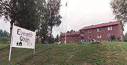
Lesjöfors is a locality situated in Filipstad Municipality, Värmland County, Sweden with 1,062 inhabitants in 2010.[1]
Located in the Bergslagen area, where mining and metal preparation historically was the leading industry, the town grew up around the local industry (bruk) founded there in 1642.
Lesjöfors was the site of the International Youth Congress of Esperanto in 2003.
It is famous within Sweden for bandy and has produced many players for the Sweden national bandy team.
It has hosted a stage of the Swedish rally.
References
- ^ a b c "Tätorternas landareal, folkmängd och invånare per km2 2005 och 2010" (in Swedish). Statistics Sweden. 14 December 2011. Archived from the original on 10 January 2012. Retrieved 10 January 2012.
{{cite web}}: Unknown parameter|deadurl=ignored (|url-status=suggested) (help)

