Olkhon Gate: Difference between revisions
m add/change/refine category; MOS fixes; all included cat using AWB |
Added first source |
||
| Line 1: | Line 1: | ||
| ⚫ | |||
{{unreferenced|date=November 2015}} |
|||
| ⚫ | '''Olkhon Gate''' ({{lang-ru|Ольхонские Ворота}}, ''Olkhonskie Vorota'') is a [[strait]] of [[Lake Baikal]], [[Russia]]. It separates the south-west of [[Olkhon Island]] from the western shore of Baikal. In the north the strait opens out into the [[Maloe More]] strait, and to the south into the central open Baikal. Its length is about 8.3 km, width is 1.2 - 2.3 km. Average depth is 30 - 40 m, at the south of the strait the depth reaches 100 m. There is a rather strong current in the strait, and the waves can reach 5 m in height. |
||
| ⚫ | |||
| ⚫ | '''Olkhon Gate''' ({{lang-ru|Ольхонские Ворота}}, ''Olkhonskie Vorota'') is |
||
The banks of the strait are mostly steep and precipitous, the shoreline is a rugged with long narrow capes and bays. |
The banks of the strait are mostly steep and precipitous, the shoreline is a rugged with long narrow capes and bays. |
||
| Line 9: | Line 7: | ||
To the north-north-west of the strait the valley of the [[Sarma River]] lies, the source of [[Sarma wind]] - the strongest wind of the Baikal. |
To the north-north-west of the strait the valley of the [[Sarma River]] lies, the source of [[Sarma wind]] - the strongest wind of the Baikal. |
||
In the middle part of the strait the |
In the middle part of the strait the ferry "[[Sakhyurta]] (MRS) — Olkhon Island" operates from 15 May to 15 December.<ref name="rasp">[http://www.vsrp.ru/en/passengers/trips/mrs-olkhon/ Eastern-Siberian inland navigation company. Ferry "MRS – Olkhon Island" schedule]</ref> In the winter time an ice-road is opened. |
||
In 2005 a high-voltage underwater cable was laid at the bottom of the strait, providing Olkhon island with electricity. |
In 2005 a high-voltage underwater cable was laid at the bottom of the strait, providing Olkhon island with electricity. |
||
| Line 19: | Line 17: | ||
</gallery> |
</gallery> |
||
{{coord|53|01|N|106|55|E|display=title}} |
== {{coord|53|01|N|106|55|E|display=title}}References == |
||
{{Reflist}} |
|||
[[Category:Straits of Russia]] |
[[Category:Straits of Russia]] |
||
[[Category:Bodies of water of Irkutsk Oblast]] |
[[Category:Bodies of water of Irkutsk Oblast]] |
||
Revision as of 19:44, 24 September 2017

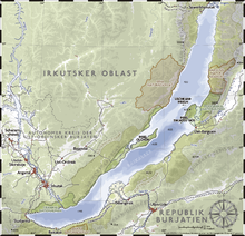
Olkhon Gate (Russian: Ольхонские Ворота, Olkhonskie Vorota) is a strait of Lake Baikal, Russia. It separates the south-west of Olkhon Island from the western shore of Baikal. In the north the strait opens out into the Maloe More strait, and to the south into the central open Baikal. Its length is about 8.3 km, width is 1.2 - 2.3 km. Average depth is 30 - 40 m, at the south of the strait the depth reaches 100 m. There is a rather strong current in the strait, and the waves can reach 5 m in height.
The banks of the strait are mostly steep and precipitous, the shoreline is a rugged with long narrow capes and bays.
To the north-north-west of the strait the valley of the Sarma River lies, the source of Sarma wind - the strongest wind of the Baikal.
In the middle part of the strait the ferry "Sakhyurta (MRS) — Olkhon Island" operates from 15 May to 15 December.[1] In the winter time an ice-road is opened.
In 2005 a high-voltage underwater cable was laid at the bottom of the strait, providing Olkhon island with electricity.
-
View of Olkhon Gate from the mainland
-
Ferry fleet of Olkhon Gate
-
The ferry travels to Olkhon Island


