Grade II* listed buildings in Torbay: Difference between revisions
Content deleted Content added
Add images and links |
|||
| Line 13: | Line 13: | ||
{{EH listed building row |
{{EH listed building row |
||
| name= Aylmer |
| name= Aylmer |
||
| location= Higher Brixham, Brixham, Torbay |
| location= Higher Brixham, [[Brixham]], [[Torbay]] |
||
| type= |
| type= House |
||
| completed= Early 19th century |
| completed= Early 19th century |
||
| show_listed = yes |
| show_listed = yes |
||
| Line 28: | Line 28: | ||
{{EH listed building row |
{{EH listed building row |
||
| name= Church of St Mary the Virgin |
| name= Church of St Mary the Virgin |
||
| location= Higher Brixham, Brixham |
| location= Higher Brixham, Brixham |
||
| type= Parish Church |
| type= Parish Church |
||
| completed= possibly Medieval |
| completed= possibly Medieval |
||
| Line 38: | Line 38: | ||
| uid= 1195156 |
| uid= 1195156 |
||
| show_img = yes |
| show_img = yes |
||
| image=St Mary the Virgin, Higher Brixham - geograph.org.uk - 366649.jpg |
|||
| image= |
|||
| commonscat=St Mary the Virgin church, Higher Brixham |
|||
| upload_desc= Church of St Mary the Virgin |
| upload_desc= Church of St Mary the Virgin |
||
}} |
}} |
||
{{EH listed building row |
{{EH listed building row |
||
| name= Ramparts, Counterscarp Revetment, Glacis, Musketry Wall of Southern Fort |
| name= Ramparts, Counterscarp Revetment, Glacis, Musketry Wall of Southern Fort |
||
| location= Berry Head, Brixham |
| location= Berry Head, Brixham |
||
| type= Wall |
| type= Wall |
||
| completed= 1794-1804 |
| completed= 1794-1804 |
||
| Line 58: | Line 59: | ||
{{EH listed building row |
{{EH listed building row |
||
| name= Ramparts, Revetments, North Battery Platform, North and South Musketry Walls of Northern Fort |
| name= Ramparts, Revetments, North Battery Platform, North and South Musketry Walls of Northern Fort |
||
| location= Berry Head, Brixham |
| location= Berry Head, Brixham |
||
| type= Gate |
| type= Gate |
||
| completed= 1795-1807 |
| completed= 1795-1807 |
||
| Line 68: | Line 69: | ||
| uid= 1208194 |
| uid= 1208194 |
||
| show_img = yes |
| show_img = yes |
||
| image=Berry Head fort wall and ditch.jpg |
|||
| image= |
|||
| upload_desc= Ramparts, Revetments, North Battery Platform, North and South Musketry Walls of Northern Fort |
| upload_desc= Ramparts, Revetments, North Battery Platform, North and South Musketry Walls of Northern Fort |
||
}} |
}} |
||
| Line 117: | Line 118: | ||
}} |
}} |
||
{{EH listed building row |
{{EH listed building row |
||
| name= Church of Our Lady Help of Christians and St Denis |
| name= Church of Our Lady, Help of Christians and St Denis |
||
| location= Torbay |
| location= Torbay |
||
| type= |
| type= Church |
||
| completed= 1865 |
| completed= 1865 |
||
| show_listed = yes |
| show_listed = yes |
||
| Line 128: | Line 129: | ||
| uid= 1206830 |
| uid= 1206830 |
||
| show_img = yes |
| show_img = yes |
||
| image=Church and convent, St Marychurch - geograph.org.uk - 357531.jpg |
|||
| image= |
|||
| upload_desc= Church of Our Lady Help of Christians and St Denis |
| upload_desc= Church of Our Lady Help of Christians and St Denis |
||
}} |
}} |
||
| Line 134: | Line 135: | ||
| name= Church of St Andrew |
| name= Church of St Andrew |
||
| location= Torbay |
| location= Torbay |
||
| type= |
| type= Greek Orthodox Church |
||
| completed= 13th century |
| completed= 13th century |
||
| show_listed = yes |
| show_listed = yes |
||
| Line 143: | Line 144: | ||
| uid= 1206837 |
| uid= 1206837 |
||
| show_img = yes |
| show_img = yes |
||
| image=Crosses at St Andrews Greek Orthodox church, Torquay (geograph 3418618).jpg |
|||
| image= |
|||
| upload_desc= Church of St Andrew |
| upload_desc= Church of St Andrew |
||
}} |
}} |
||
| Line 158: | Line 159: | ||
| uid= 1208547 |
| uid= 1208547 |
||
| show_img = yes |
| show_img = yes |
||
| image=The Church of St George and St Mary, Cockington - geograph.org.uk - 943087.jpg |
|||
| image= |
|||
| commonscat= St George and St Mary's church, Cockington |
| commonscat= St George and St Mary's church, Cockington |
||
| upload_desc= Church of St George and St Mary |
| upload_desc= Church of St George and St Mary |
||
}} |
|||
{{EH listed building row |
|||
| name= Church of St Matthew |
|||
| location= [[Chelston]] |
|||
| type= Parish Church |
|||
| completed= 1895-1904 |
|||
| show_listed = yes |
|||
| date_listed= {{dts|format=dmy|1972|02|14}} |
|||
| grid_ref= SX9004563720 |
|||
| lat= 50.462969 |
|||
| lon= -3.550521 |
|||
| uid= 1218480 |
|||
| show_img = yes |
|||
| image=St. Matthew's Church, Chelston - geograph.org.uk - 1090822.jpg |
|||
| upload_desc= Church of St Matthew |
|||
}} |
}} |
||
{{EH listed building row |
{{EH listed building row |
||
| name= Church of St Mary the Virgin |
| name= Church of St Mary the Virgin |
||
| location= Churston Ferrers |
| location= [[Churston Ferrers]] |
||
| type= Parish Church |
| type= Parish Church |
||
| completed= Probably 15th century |
| completed= Probably 15th century |
||
| Line 174: | Line 190: | ||
| uid= 1293060 |
| uid= 1293060 |
||
| show_img = yes |
| show_img = yes |
||
| image=Church of St. Mary the Virgin, Churston - geograph.org.uk - 991097.jpg |
|||
| image= |
|||
| commonscat=St Mary the Virgin's church, Churston Ferrers |
|||
| upload_desc= Church of St Mary the Virgin |
| upload_desc= Church of St Mary the Virgin |
||
}} |
|||
{{EH listed building row |
|||
| name= Church of St Matthew |
|||
| location= Chelston, Torbay |
|||
| type= Parish Church |
|||
| completed= 1895-1904 |
|||
| show_listed = yes |
|||
| date_listed= {{dts|format=dmy|1972|02|14}} |
|||
| grid_ref= SX9004563720 |
|||
| lat= 50.462969 |
|||
| lon= -3.550521 |
|||
| uid= 1218480 |
|||
| show_img = yes |
|||
| image= |
|||
| upload_desc= Church of St Matthew |
|||
}} |
}} |
||
{{EH listed building row |
{{EH listed building row |
||
| Line 204: | Line 206: | ||
| uid= 1208761 |
| uid= 1208761 |
||
| show_img = yes |
| show_img = yes |
||
| image=Churston Ferrers church and Churston Court Hotel, near Brixham (geograph 3797966).jpg |
|||
| image= |
|||
| upload_desc= Churston Court |
| upload_desc= Churston Court |
||
}} |
|||
{{EH listed building row |
|||
| name= Gramercy Hall School, Lupton House |
|||
| location= Churston Ferrers |
|||
| type= House/School |
|||
| completed= Rebuilt circa 1772 |
|||
| show_listed = yes |
|||
| date_listed= {{dts|format=dmy|1949|10|18}} |
|||
| grid_ref= SX9026355002 |
|||
| lat= 50.384637 |
|||
| lon= -3.544898 |
|||
| uid= 1195173 |
|||
| show_img = yes |
|||
| image=Lupton House - geograph.org.uk - 1189289.jpg |
|||
| upload_desc= Gramercy Hall School, Lupton House |
|||
}} |
}} |
||
{{EH listed building row |
{{EH listed building row |
||
| Line 219: | Line 236: | ||
| uid= 1206759 |
| uid= 1206759 |
||
| show_img = yes |
| show_img = yes |
||
| image=Cockington Court - geograph.org.uk - 943046.jpg |
|||
| image= |
|||
| upload_desc= Cockington Court |
| upload_desc= Cockington Court |
||
}} |
}} |
||
{{EH listed building row |
{{EH listed building row |
||
| name= D-day Embarkation Slipways and |
| name= D-day Embarkation Slipways and adjoining Section of Quay Wall |
||
| location= Torbay |
| location= Torbay |
||
| type= Wall |
| type= Wall |
||
| Line 236: | Line 253: | ||
| image= |
| image= |
||
| upload_desc= D-day Embarkation Slipways and Adjoining Section of Quay Wall |
| upload_desc= D-day Embarkation Slipways and Adjoining Section of Quay Wall |
||
}} |
|||
{{EH listed building row |
|||
| name= Gramercy Hall School, Lupton House |
|||
| location= Churston Ferrers, Torbay |
|||
| type= Kitchen |
|||
| completed= Rebuilt circa 1772 |
|||
| show_listed = yes |
|||
| date_listed= {{dts|format=dmy|1949|10|18}} |
|||
| grid_ref= SX9026355002 |
|||
| lat= 50.384637 |
|||
| lon= -3.544898 |
|||
| uid= 1195173 |
|||
| show_img = yes |
|||
| image= |
|||
| upload_desc= Gramercy Hall School, Lupton House |
|||
}} |
}} |
||
{{EH listed building row |
{{EH listed building row |
||
| Line 268: | Line 270: | ||
}} |
}} |
||
{{EH listed building row |
{{EH listed building row |
||
| name= Hesketh Crescent and |
| name= Hesketh Crescent and attached Railings & No 1-15 and attached Railings |
||
| location= Torbay |
| location= Torbay |
||
| type= Apartment |
| type= Apartment |
||
| Line 280: | Line 282: | ||
| show_img = yes |
| show_img = yes |
||
| image= |
| image= |
||
| upload_desc= Hesketh Crescent and Attached Railings No 1-15 and Attached Railings |
| upload_desc= Hesketh Crescent and Attached Railings & No 1-15 and Attached Railings |
||
}} |
|||
{{EH listed building row |
|||
| name= Parish Church of St Matthias |
|||
| location= [[Ilsham]] |
|||
| type= Church Hall |
|||
| completed= C20 |
|||
| show_listed = yes |
|||
| date_listed= {{dts|format=dmy|1975|01|10}} |
|||
| grid_ref= SX9319164173 |
|||
| lat= 50.467624 |
|||
| lon= -3.506342 |
|||
| uid= 1206840 |
|||
| show_img = yes |
|||
| image=St Matthias Church, Wellswood (geograph 3808278).jpg |
|||
| upload_desc= Parish Church of St Matthias |
|||
}} |
}} |
||
{{EH listed building row |
{{EH listed building row |
||
| name= Ilsham Manor Oratory |
| name= Ilsham Manor Oratory |
||
| location= Ilsham |
| location= [[Ilsham]] |
||
| type= |
| type= Oratory |
||
| completed= 15th century or earlier |
| completed= 15th century or earlier |
||
| show_listed = yes |
| show_listed = yes |
||
| Line 299: | Line 316: | ||
{{EH listed building row |
{{EH listed building row |
||
| name= Kirkham House |
| name= Kirkham House |
||
| location= Torbay |
| location= Paignton, Torbay |
||
| type= House |
| type= House |
||
| completed= 1520-1560 |
| completed= 1520-1560 |
||
| Line 309: | Line 326: | ||
| uid= 1207782 |
| uid= 1207782 |
||
| show_img = yes |
| show_img = yes |
||
| image= |
| image=Kirkham house sept 2012.jpg |
||
| commonscat= Kirkham House |
| commonscat= Kirkham House |
||
| upload_desc= Kirkham House |
| upload_desc= Kirkham House |
||
| Line 315: | Line 332: | ||
{{EH listed building row |
{{EH listed building row |
||
| name= Little Theatre |
| name= Little Theatre |
||
| location= Torbay |
| location= Torquay, Torbay |
||
| type= Booking Office |
| type= Booking Office |
||
| completed= 1856-1857 |
| completed= 1856-1857 |
||
| Line 325: | Line 342: | ||
| uid= 1218459 |
| uid= 1218459 |
||
| show_img = yes |
| show_img = yes |
||
| image=The Little Theatre, Torquay - geograph.org.uk - 821471.jpg |
|||
| image= |
|||
| upload_desc= Little Theatre |
| upload_desc= Little Theatre |
||
}} |
}} |
||
{{EH listed building row |
{{EH listed building row |
||
| name= Manor Farmhouse |
| name= Manor Farmhouse including Remains of Linhay at Rear |
||
| location= Barton, Torbay |
| location= Barton, Torbay |
||
| type= Farmhouse |
| type= Farmhouse |
||
| Line 345: | Line 362: | ||
{{EH listed building row |
{{EH listed building row |
||
| name= Oldway Mansion |
| name= Oldway Mansion |
||
| location= Torbay |
| location= Paignton, Torbay |
||
| type= House |
| type= House |
||
| completed= 1870s |
| completed= 1870s |
||
| Line 355: | Line 372: | ||
| uid= 1195207 |
| uid= 1195207 |
||
| show_img = yes |
| show_img = yes |
||
| image=Oldway Mansion and Rotunda, Paignton - geograph.org.uk - 698086.jpg |
|||
| image= |
|||
| commonscat = Oldway Mansion |
|||
| upload_desc= Oldway Mansion |
| upload_desc= Oldway Mansion |
||
}} |
}} |
||
| Line 361: | Line 379: | ||
| name= Parish Church of St Luke |
| name= Parish Church of St Luke |
||
| location= Torbay |
| location= Torbay |
||
| type= |
| type= Church |
||
| completed= 1863 |
| completed= 1863 |
||
| show_listed = yes |
| show_listed = yes |
||
| Line 370: | Line 388: | ||
| uid= 1218424 |
| uid= 1218424 |
||
| show_img = yes |
| show_img = yes |
||
| image=St Luke's church, Torquay - geograph.org.uk - 539005.jpg |
|||
| image= |
|||
| commonscat = St Luke, Torquay |
|||
| upload_desc= Parish Church of St Luke |
| upload_desc= Parish Church of St Luke |
||
}} |
}} |
||
{{EH listed building row |
{{EH listed building row |
||
| name= [[Church of St Mary, Collaton St Mary|Parish Church of St Mary]] |
| name= [[Church of St Mary, Collaton St Mary|Parish Church of St Mary]] |
||
| location= Collaton St Mary |
| location= [[Collaton St Mary]] |
||
| type= Parish Church |
| type= Parish Church |
||
| completed= 1864-1866 |
| completed= 1864-1866 |
||
| Line 385: | Line 404: | ||
| uid= 1207472 |
| uid= 1207472 |
||
| show_img = yes |
| show_img = yes |
||
| image= |
| image=StMaryCollaton.jpg |
||
| upload_desc= Parish Church of St Mary |
| upload_desc= Parish Church of St Mary |
||
}} |
}} |
||
| Line 391: | Line 410: | ||
| name= Parish Church of St Mary Magdalene |
| name= Parish Church of St Mary Magdalene |
||
| location= Torbay |
| location= Torbay |
||
| type= |
| type= Church |
||
| completed= 1843-1849 |
| completed= 1843-1849 |
||
| show_listed = yes |
| show_listed = yes |
||
| Line 400: | Line 419: | ||
| uid= 1219197 |
| uid= 1219197 |
||
| show_img = yes |
| show_img = yes |
||
| image=St Mary Magdalene church, Upton, Torquay - geograph.org.uk - 1077214.jpg |
|||
| image= |
|||
| upload_desc= Parish Church of St Mary Magdalene |
| upload_desc= Parish Church of St Mary Magdalene |
||
}} |
|||
{{EH listed building row |
|||
| name= Parish Church of St Matthias |
|||
| location= Ilsham, Torbay |
|||
| type= Church Hall |
|||
| completed= C20 |
|||
| show_listed = yes |
|||
| date_listed= {{dts|format=dmy|1975|01|10}} |
|||
| grid_ref= SX9319164173 |
|||
| lat= 50.467624 |
|||
| lon= -3.506342 |
|||
| uid= 1206840 |
|||
| show_img = yes |
|||
| image= |
|||
| upload_desc= Parish Church of St Matthias |
|||
}} |
}} |
||
{{EH listed building row |
{{EH listed building row |
||
| name= Torbay Cinema |
| name= Torbay Cinema |
||
| location= Torbay |
| location= Torbay |
||
| type= |
| type= Cinema |
||
| completed= 1912 |
| completed= 1912 |
||
| show_listed = yes |
| show_listed = yes |
||
| Line 430: | Line 434: | ||
| uid= 1208209 |
| uid= 1208209 |
||
| show_img = yes |
| show_img = yes |
||
| image= |
| image=Torbay picture house.jpg |
||
| upload_desc= Torbay Cinema |
| upload_desc= Torbay Cinema |
||
}} |
}} |
||
| Line 450: | Line 454: | ||
{{EH listed building row |
{{EH listed building row |
||
| name= 163 Newton Road |
| name= 163 Newton Road |
||
| location= Torbay |
| location= Torquay, Torbay |
||
| type= Atmospheric Railway Engine House |
| type= Atmospheric Railway Engine House |
||
| completed= 1847-1848 |
| completed= 1847-1848 |
||
| Line 460: | Line 464: | ||
| uid= 1217986 |
| uid= 1217986 |
||
| show_img = yes |
| show_img = yes |
||
| image= |
| image=Torquay engine house.jpg |
||
| upload_desc= |
| upload_desc= |
||
}} |
}} |
||
Revision as of 21:26, 10 July 2014
There are over 20,000 Grade II* listed buildings in England. This page is a list of these buildings in the district of Torbay in Devon.
Torbay
| Name | Location | Type | Completed [note 1] | Date designated | Grid ref.[note 2] Geo-coordinates |
Entry number [note 3] | Image |
|---|---|---|---|---|---|---|---|
| Aylmer | Higher Brixham, Brixham, Torbay | House | Early 19th century | 18 October 1949 | SX9162554857 50°23′01″N 3°31′33″W / 50.383586°N 3.525706°W |
1218018 |  Upload Photo |
| Church of St Mary the Virgin | Higher Brixham, Brixham | Parish Church | possibly Medieval | 18 October 1949 | SX9212055119 50°23′10″N 3°31′08″W / 50.386033°N 3.518821°W |
1195156 | 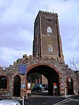 |
| Ramparts, Counterscarp Revetment, Glacis, Musketry Wall of Southern Fort | Berry Head, Brixham | Wall | 1794-1804 | 18 October 1949 | SX9411256123 50°23′44″N 3°29′28″W / 50.395421°N 3.491094°W |
1293272 |  Upload Photo |
| Ramparts, Revetments, North Battery Platform, North and South Musketry Walls of Northern Fort | Berry Head, Brixham | Gate | 1795-1807 | 18 October 1949 | SX9427856521 50°23′57″N 3°29′20″W / 50.399029°N 3.488872°W |
1208194 | 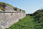 |
| Beacon Terrace | Torbay | Terrace | 1833 | 20 November 1952 | SX9189163180 50°27′30″N 3°31′28″W / 50.458458°N 3.524366°W |
1293347 |  Upload Photo |
| Bishops Palace Walls and Tower | Torbay | Bishops Palace | 14th century | 13 January 1951 | SX8863060750 50°26′10″N 3°34′10″W / 50.436003°N 3.569565°W |
1208109 |  Upload Photo |
| Blagdon Manor | Torbay | Hall House | 15th century | 13 May 1951 | SX8558860203 50°25′50″N 3°36′44″W / 50.4305°N 3.612215°W |
1298262 |  Upload Photo |
| Church of Our Lady, Help of Christians and St Denis | Torbay | Church | 1865 | 14 February 1972 | SX9191265878 50°28′58″N 3°31′29″W / 50.482717°N 3.524851°W |
1206830 |  |
| Church of St Andrew | Torbay | Greek Orthodox Church | 13th century | 20 November 1952 | SX9095264308 50°28′06″N 3°32′17″W / 50.468425°N 3.537918°W |
1206837 | 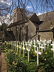 |
| Church of St George and St Mary | Cockington, Torbay | Parish Church | Early 13th century | 20 November 1952 | SX8907563784 50°27′48″N 3°33′51″W / 50.463362°N 3.564201°W |
1208547 | 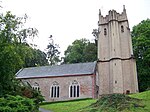 |
| Church of St Matthew | Chelston | Parish Church | 1895-1904 | 14 February 1972 | SX9004563720 50°27′47″N 3°33′02″W / 50.462969°N 3.550521°W |
1218480 |  |
| Church of St Mary the Virgin | Churston Ferrers | Parish Church | Probably 15th century | 9 February 1961 | SX9042756419 50°23′51″N 3°32′35″W / 50.397406°N 3.543005°W |
1293060 |  |
| Churston Court | Churston Ferrers | House | Late medieval | 11 November 1952 | SX9039356414 50°23′50″N 3°32′37″W / 50.397355°N 3.543482°W |
1208761 |  |
| Gramercy Hall School, Lupton House | Churston Ferrers | House/School | Rebuilt circa 1772 | 18 October 1949 | SX9026355002 50°23′05″N 3°32′42″W / 50.384637°N 3.544898°W |
1195173 |  |
| Cockington Court | Cockington, Torbay | Country House | 16th century | 20 November 1952 | SX8907663845 50°27′50″N 3°33′51″W / 50.46391°N 3.564205°W |
1206759 |  |
| D-day Embarkation Slipways and adjoining Section of Quay Wall | Torbay | Wall | 1943 | 6 June 2000 | SX9181363205 50°27′31″N 3°31′32″W / 50.458669°N 3.525472°W |
1382072 |  Upload Photo |
| Hatley St George | Torbay | Villa | 1846 | 10 January 1975 | SX9298863362 50°27′37″N 3°30′32″W / 50.460296°N 3.50897°W |
1209844 |  Upload Photo |
| Hesketh Crescent and attached Railings & No 1-15 and attached Railings | Torbay | Apartment | 1952 | 20 November 1952 | SX9301063138 50°27′30″N 3°30′31″W / 50.458286°N 3.508596°W |
1206808 |  Upload Photo |
| Parish Church of St Matthias | Ilsham | Church Hall | C20 | 10 January 1975 | SX9319164173 50°28′03″N 3°30′23″W / 50.467624°N 3.506342°W |
1206840 |  |
| Ilsham Manor Oratory | Ilsham | Oratory | 15th century or earlier | 20 November 1952 | SX9380664125 50°28′02″N 3°29′52″W / 50.467304°N 3.497666°W |
1206789 |  Upload Photo |
| Kirkham House | Paignton, Torbay | House | 1520-1560 | 13 March 1951 | SX8858560991 50°26′17″N 3°34′13″W / 50.438161°N 3.57027°W |
1207782 | 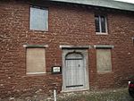 |
| Little Theatre | Torquay, Torbay | Booking Office | 1856-1857 | 10 January 1975 | SX9255163076 50°27′28″N 3°30′54″W / 50.457645°N 3.515042°W |
1218459 | 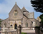 |
| Manor Farmhouse including Remains of Linhay at Rear | Barton, Torbay | Farmhouse | Early 16th century | 10 January 1975 | SX9092567189 50°29′40″N 3°32′21″W / 50.49432°N 3.53914°W |
1206772 |  Upload Photo |
| Oldway Mansion | Paignton, Torbay | House | 1870s | 13 May 1951 | SX8878461532 50°26′35″N 3°34′03″W / 50.443062°N 3.56763°W |
1195207 |  |
| Parish Church of St Luke | Torbay | Church | 1863 | 14 February 1972 | SX9130363948 50°27′55″N 3°31′58″W / 50.465254°N 3.53287°W |
1218424 | 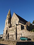 |
| Parish Church of St Mary | Collaton St Mary | Parish Church | 1864-1866 | 13 March 1951 | SX8642760176 50°25′50″N 3°36′01″W / 50.43042°N 3.600399°W |
1207472 |  |
| Parish Church of St Mary Magdalene | Torbay | Church | 1843-1849 | 10 January 1975 | SX9128964366 50°28′08″N 3°31′59″W / 50.469009°N 3.533189°W |
1219197 | 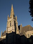 |
| Torbay Cinema | Torbay | Cinema | 1912 | 20 February 1991 | SX8899860650 50°26′07″N 3°33′52″W / 50.435173°N 3.564356°W |
1208209 | 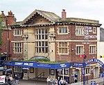 |
| 1–15 Wellswood Park Road | Torbay | Terrace | 1853 | 20 November 1952 | SX9295864064 50°28′00″N 3°30′35″W / 50.466602°N 3.509593°W |
1206876 |  Upload Photo |
| 163 Newton Road | Torquay, Torbay | Atmospheric Railway Engine House | 1847-1848 | 10 January 1975 | SX8990166204 50°29′07″N 3°33′12″W / 50.485273°N 3.553281°W |
1217986 | 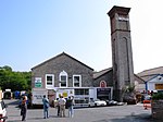 |
Notes
- ^ The date given is the date used by Historic England as significant for the initial building or that of an important part in the structure's description.
- ^ Sometimes known as OSGB36, the grid reference is based on the British national grid reference system used by the Ordnance Survey.
- ^ The "List Entry Number" is a unique number assigned to each listed building and scheduled monument by Historic England.
External links
![]() Media related to Grade II* listed buildings in Devon at Wikimedia Commons
Media related to Grade II* listed buildings in Devon at Wikimedia Commons
