Grade I listed buildings in West Yorkshire: Difference between revisions
Content deleted Content added
Disambiguated: Halifax → Halifax, West Yorkshire |
|||
| Line 400: | Line 400: | ||
{{EH listed building row |
{{EH listed building row |
||
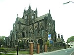
| name= [[All Souls Church, Halifax|Church of All Souls]] |
| name= [[All Souls Church, Halifax|Church of All Souls]] |
||
| location= Boothstown, [[Halifax]] |
| location= Boothstown, [[Halifax, West Yorkshire|Halifax]] |
||
| type= Church |
| type= Church |
||
| completed= 1856 |
| completed= 1856 |
||
| Line 1,466: | Line 1,466: | ||
{{EH listed building row |
{{EH listed building row |
||
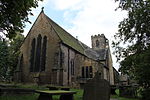
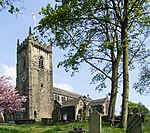
| name= Church of St Mary |
| name= Church of St Mary |
||
| location= Badsworth |
| location= [[Badsworth]] |
||
| type= Parish Church |
| type= Parish Church |
||
| completed= 15th century |
| completed= 15th century |
||
| Line 1,476: | Line 1,476: | ||
| uid= 1052219 |
| uid= 1052219 |
||
| show_img = yes |
| show_img = yes |
||
| image=Badsworth - Saint Mary the Virgin Church.jpg |
|||
| image= |
|||
| upload_desc= Church of St Mary |
| upload_desc= Church of St Mary |
||
}} |
}} |
||
{{EH listed building row |
{{EH listed building row |
||
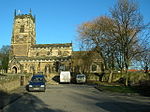
| name= Church of St Luke and All Saints |
| name= Church of St Luke and All Saints |
||
| location= Darrington, |
| location= [[Darrington, West Yorkshire|Darrington]] |
||
| type= Church |
| type= Church |
||
| completed= Norman |
| completed= Norman |
||
| Line 1,491: | Line 1,491: | ||
| uid= 1313210 |
| uid= 1313210 |
||
| show_img = yes |
| show_img = yes |
||
| image=Darrington church - geograph.org.uk - 100416.jpg |
|||
| image= |
|||
| upload_desc= Church of St Luke and All Saints |
| upload_desc= Church of St Luke and All Saints |
||
}} |
|||
{{EH listed building row |
|||
| name= [[St Peter and St Leonard's Church, Horbury|Church of St Peter and St Leonard]] |
|||
| location= [[Horbury]] |
|||
| type= Church |
|||
| completed= Saxon |
|||
| show_listed = yes |
|||
| date_listed= {{dts|format=dmy|1966|02|15}} |
|||
| grid_ref= SE2951518368 |
|||
| lat= 53.660972 |
|||
| lon= -1.554839 |
|||
| uid= 1135508 |
|||
| show_img = yes |
|||
| image=St Peter and St Leonard Horbury - geograph.org.uk - 344703.jpg |
|||
| upload_desc= Church of St Peter and St Leonard |
|||
}} |
|||
{{EH listed building row |
|||
| name= Horbury Hall |
|||
| location= [[Horbury]] |
|||
| type= Hall House |
|||
| completed= 1478-92 |
|||
| show_listed = yes |
|||
| date_listed= {{dts|format=dmy|1966|02|15}} |
|||
| grid_ref= SE2954218336 |
|||
| lat= 53.660683 |
|||
| lon= -1.554433 |
|||
| uid= 1135510 |
|||
| show_img = yes |
|||
| image= |
|||
| upload_desc= Horbury Hall |
|||
}} |
|||
{{EH listed building row |
|||
| name= Kettlethorpe Hall |
|||
| location= [[Kettlethorpe]] |
|||
| type= House |
|||
| completed= 1727 |
|||
| show_listed = yes |
|||
| date_listed= {{dts|format=dmy|1953|07|14}} |
|||
| grid_ref= SE3330016698 |
|||
| lat= 53.645736 |
|||
| lon= -1.497743 |
|||
| uid= 1259736 |
|||
| show_img = yes |
|||
| image=Kettlethorpe Hall - geograph.org.uk - 47439.jpg |
|||
| upload_desc= Kettlethorpe Hall |
|||
}} |
}} |
||
{{EH listed building row |
{{EH listed building row |
||
| name= Church of St Michael and Our Lady (Wragby Parish Church) |
| name= Church of St Michael and Our Lady (Wragby Parish Church) |
||
| location= Nostell Park, Nostell |
| location= [[Nostell Priory|Nostell Park]], [[Nostell]] |
||
| type= Church |
| type= Church |
||
| completed= Dated 1533 |
| completed= Dated 1533 |
||
| Line 1,506: | Line 1,551: | ||
| uid= 1253565 |
| uid= 1253565 |
||
| show_img = yes |
| show_img = yes |
||
| image=St Michael and Our Lady, Nostell Priory.jpg |
|||
| image= |
|||
| upload_desc= Church of St Michael and Our Lady (wragby Parish Church) |
| upload_desc= Church of St Michael and Our Lady (wragby Parish Church) |
||
}} |
}} |
||
{{EH listed building row |
{{EH listed building row |
||
| name= [[Nostell Priory]] |
| name= [[Nostell Priory]] |
||
| location= Nostell Park, Nostell |
| location= [[Nostell Priory|Nostell Park]], [[Nostell]] |
||
| type= Country House |
| type= Country House |
||
| completed= 1736-50 |
| completed= 1736-50 |
||
| Line 1,526: | Line 1,571: | ||
}} |
}} |
||
{{EH listed building row |
{{EH listed building row |
||
| name= Stables at Nostell Priory |
| name= [[Nostell Priory|Stables at Nostell Priory]] |
||
| location= Nostell Park, Nostell |
| location= [[Nostell Priory|Nostell Park]], [[Nostell]] |
||
| type= Garage |
| type= Garage |
||
| completed= 1952 |
| completed= 1952 |
||
| Line 1,537: | Line 1,582: | ||
| uid= 1253558 |
| uid= 1253558 |
||
| show_img = yes |
| show_img = yes |
||
| image= |
| image=Nostell Priory Stables.JPG |
||
| upload_desc= Stables at Nostell Priory |
| upload_desc= Stables at Nostell Priory |
||
}} |
}} |
||
{{EH listed building row |
{{EH listed building row |
||
| name= Stanley Ferry Aqueduct |
| name= [[Stanley Ferry Aqueduct]] |
||
| location= Normanton |
| location= [[Normanton, West Yorkshire|Normanton]] |
||
| type= Aqueduct |
| type= Aqueduct |
||
| completed= 1837-39 |
| completed= 1837-39 |
||
| Line 1,552: | Line 1,597: | ||
| uid= 1261690 |
| uid= 1261690 |
||
| show_img = yes |
| show_img = yes |
||
| image= |
| image=StanleyFerryAqueduct.jpg |
||
| upload_desc= Stanley Ferry Aquaduct |
| upload_desc= Stanley Ferry Aquaduct |
||
}} |
|||
{{EH listed building row |
|||
| name= The Hermitage |
|||
| location= Pontefract |
|||
| type= |
|||
| completed= |
|||
| show_listed = yes |
|||
| date_listed= {{dts|format=dmy|1988|11|15}} |
|||
| grid_ref= SE4566721793 |
|||
| lat= 53.690597 |
|||
| lon= -1.309931 |
|||
| uid= 1135427 |
|||
| show_img = yes |
|||
| image= |
|||
| upload_desc= The Hermitage |
|||
}} |
}} |
||
{{EH listed building row |
{{EH listed building row |
||
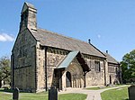
| name= Church of St Peter |
| name= Church of St Peter |
||
| location= Felkirk, South Hiendley |
| location= Felkirk, [[South Hiendley]] |
||
| type= Parish Church |
| type= Parish Church |
||
| completed= Norman |
| completed= Norman |
||
| Line 1,567: | Line 1,627: | ||
| uid= 1265442 |
| uid= 1265442 |
||
| show_img = yes |
| show_img = yes |
||
| image=St Peter's Church, Felkirk - geograph.org.uk - 278993.jpg |
|||
| image= |
|||
| upload_desc= Church of St Peter |
| upload_desc= Church of St Peter |
||
}} |
}} |
||
| Line 1,582: | Line 1,642: | ||
| uid= 1227519 |
| uid= 1227519 |
||
| show_img = yes |
| show_img = yes |
||
| image=South Kirkby , All Saints Church - geograph.org.uk - 225336.jpg |
|||
| image= |
|||
| upload_desc= Church of All Saints |
| upload_desc= Church of All Saints |
||
}} |
|||
{{EH listed building row |
|||
| name= Flanking Screen Walls and Gate Piers Attached to West Front of Heath Hall Linking East and West Pavilions |
|||
| location= Heath Common, Wakefield |
|||
| type= Gate Pier |
|||
| completed= {{c.|1767}} |
|||
| show_listed = yes |
|||
| date_listed= {{dts|format=dmy|1952|02|14}} |
|||
| grid_ref= SE3557720156 |
|||
| lat= 53.676666 |
|||
| lon= -1.462905 |
|||
| uid= 1200345 |
|||
| show_img = yes |
|||
| image= |
|||
| upload_desc= Flanking Screen Walls and Gate Piers Attached to West Front of Heath Hall Linking East and West Pavilions |
|||
}} |
}} |
||
{{EH listed building row |
{{EH listed building row |
||
| name= Frieston's Hospital |
| name= Frieston's Hospital |
||
| location= Heath Common, Wakefield |
| location= Heath Common, [[Wakefield]] |
||
| type= Almshouse |
| type= Almshouse |
||
| completed= {{c.|1595}} |
| completed= {{c.|1595}} |
||
| Line 1,612: | Line 1,657: | ||
| uid= 1313217 |
| uid= 1313217 |
||
| show_img = yes |
| show_img = yes |
||
| image=Frieston's Hospital Kirkthorpe by Stanley Walker.jpg |
|||
| image= |
|||
| upload_desc= Frieston's Hospital |
| upload_desc= Frieston's Hospital |
||
}} |
}} |
||
{{EH listed building row |
{{EH listed building row |
||
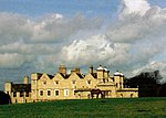
| name= Heath Hall |
| name= Heath Hall |
||
| location= Heath Common, Wakefield |
| location= Heath Common, [[Wakefield]] |
||
| type= Country House |
| type= Country House |
||
| completed= {{c.|1709}} |
| completed= {{c.|1709}} |
||
| Line 1,627: | Line 1,672: | ||
| uid= 1200238 |
| uid= 1200238 |
||
| show_img = yes |
| show_img = yes |
||
| image=Heath Hall, Wakefield - geograph.org.uk - 356395.jpg |
|||
| image= |
|||
| upload_desc= Heath Hall |
| upload_desc= Heath Hall |
||
}} |
|||
{{EH listed building row |
|||
| name= Flanking Screen Walls and Gate Piers Attached to West Front of Heath Hall Linking East and West Pavilions |
|||
| location= Heath Common, [[Wakefield]] |
|||
| type= Gate Pier |
|||
| completed= {{c.|1767}} |
|||
| show_listed = yes |
|||
| date_listed= {{dts|format=dmy|1952|02|14}} |
|||
| grid_ref= SE3557720156 |
|||
| lat= 53.676666 |
|||
| lon= -1.462905 |
|||
| uid= 1200345 |
|||
| show_img = yes |
|||
| image= |
|||
| upload_desc= Flanking Screen Walls and Gate Piers Attached to West Front of Heath Hall Linking East and West Pavilions |
|||
}} |
}} |
||
{{EH listed building row |
{{EH listed building row |
||
| name= The Brewhouse and East Pavilion at Heath Hall |
| name= The Brewhouse and East Pavilion at Heath Hall |
||
| location= Heath Common, Wakefield |
| location= Heath Common, [[Wakefield]] |
||
| type= Apartment |
| type= Apartment |
||
| completed= 1982-84 |
| completed= 1982-84 |
||
| Line 1,647: | Line 1,707: | ||
{{EH listed building row |
{{EH listed building row |
||
| name= The Stable House, Heath Hall |
| name= The Stable House, Heath Hall |
||
| location= Heath Common, Wakefield |
| location= Heath Common, [[Wakefield]] |
||
| type= Bothy |
| type= Bothy |
||
| completed= {{c.|1754}} |
| completed= {{c.|1754}} |
||
| Line 1,657: | Line 1,717: | ||
| uid= 1135583 |
| uid= 1135583 |
||
| show_img = yes |
| show_img = yes |
||
| image=Stable House, Heath Hall (geograph 2074870).jpg |
|||
| image= |
|||
| upload_desc= The Stable House, Heath Hall |
| upload_desc= The Stable House, Heath Hall |
||
}} |
}} |
||
{{EH listed building row |
{{EH listed building row |
||
| name= The West Pavilion |
| name= The West Pavilion, Heath Hall |
||
| location= Heath Common, Wakefield |
| location= Heath Common, [[Wakefield]] |
||
| type= Flats |
| type= Flats |
||
| completed= 1986 |
| completed= 1986 |
||
| Line 1,672: | Line 1,732: | ||
| uid= 1200273 |
| uid= 1200273 |
||
| show_img = yes |
| show_img = yes |
||
| image=Heath Hall and Stable block, Heath Common - geograph.org.uk - 5354.jpg |
|||
| image= |
|||
| upload_desc= The West Pavilion |
| upload_desc= The West Pavilion |
||
}} |
}} |
||
{{EH listed building row |
{{EH listed building row |
||
| name= Church of St Peter |
| name= Church of St Peter |
||
| location= Woolley |
| location= [[Woolley, West Yorkshire|Woolley]] |
||
| type= Church |
| type= Church |
||
| completed= 15th century |
| completed= 15th century |
||
| Line 1,687: | Line 1,747: | ||
| uid= 1200723 |
| uid= 1200723 |
||
| show_img = yes |
| show_img = yes |
||
| image=Woolley, St Peter's Church - geograph.org.uk - 228797.jpg |
|||
| image= |
|||
| upload_desc= Church of St Peter |
| upload_desc= Church of St Peter |
||
}} |
}} |
||
{{EH listed building row |
{{EH listed building row |
||
| name= [[Wakefield Cathedral|Cathedral Church of All Saints]] |
| name= [[Wakefield Cathedral|Cathedral Church of All Saints]] |
||
| location= Wakefield city centre |
| location= [[Wakefield|Wakefield city centre]] |
||
| type= Cathedral |
| type= Cathedral |
||
| completed= Early 15th century |
| completed= Early 15th century |
||
| Line 1,708: | Line 1,768: | ||
{{EH listed building row |
{{EH listed building row |
||
| name= [[Chantry Chapel of St Mary the Virgin, Wakefield|Chapel of St Mary on East Side of Wakefield Bridge]] |
| name= [[Chantry Chapel of St Mary the Virgin, Wakefield|Chapel of St Mary on East Side of Wakefield Bridge]] |
||
| location= Wakefield city centre |
| location= [[Wakefield|Wakefield city centre]] |
||
| type= Bridge Chapel |
| type= Bridge Chapel |
||
| completed= {{c.|1350}} |
| completed= {{c.|1350}} |
||
| Line 1,721: | Line 1,781: | ||
| upload_desc= Chapel of St Mary on East Side of Wakefield Bridge |
| upload_desc= Chapel of St Mary on East Side of Wakefield Bridge |
||
| commonscat=Chantry Chapel of St Mary the Virgin, Wakefield |
| commonscat=Chantry Chapel of St Mary the Virgin, Wakefield |
||
}} |
|||
{{EH listed building row |
|||
| name= Church of St Peter and St Leonard |
|||
| location= Horbury |
|||
| type= Church |
|||
| completed= Saxon |
|||
| show_listed = yes |
|||
| date_listed= {{dts|format=dmy|1966|02|15}} |
|||
| grid_ref= SE2951518368 |
|||
| lat= 53.660972 |
|||
| lon= -1.554839 |
|||
| uid= 1135508 |
|||
| show_img = yes |
|||
| image= |
|||
| upload_desc= Church of St Peter and St Leonard |
|||
}} |
}} |
||
{{EH listed building row |
{{EH listed building row |
||
| name= County Hall (offices of West Yorkshire County Council) |
| name= County Hall (offices of West Yorkshire County Council) |
||
| location= Wakefield city centre |
| location= [[Wakefield|Wakefield city centre]] |
||
| type= County Hall |
| type= County Hall |
||
| completed= 1894-98 |
| completed= 1894-98 |
||
| Line 1,749: | Line 1,794: | ||
| uid= 1242349 |
| uid= 1242349 |
||
| show_img = yes |
| show_img = yes |
||
| image=County Hall (1898), Wood Street, Wakefield.jpg |
|||
| image= |
|||
| upload_desc= County Hall (offices of West Yorkshire County Council) |
| upload_desc= County Hall (offices of West Yorkshire County Council) |
||
}} |
|||
{{EH listed building row |
|||
| name= Horbury Hall |
|||
| location= Horbury |
|||
| type= Hall House |
|||
| completed= 1478-92 |
|||
| show_listed = yes |
|||
| date_listed= {{dts|format=dmy|1966|02|15}} |
|||
| grid_ref= SE2954218336 |
|||
| lat= 53.660683 |
|||
| lon= -1.554433 |
|||
| uid= 1135510 |
|||
| show_img = yes |
|||
| image= |
|||
| upload_desc= Horbury Hall |
|||
}} |
|||
{{EH listed building row |
|||
| name= Kettlethorpe Hall |
|||
| location= Kettlethorpe |
|||
| type= House |
|||
| completed= 1727 |
|||
| show_listed = yes |
|||
| date_listed= {{dts|format=dmy|1953|07|14}} |
|||
| grid_ref= SE3330016698 |
|||
| lat= 53.645736 |
|||
| lon= -1.497743 |
|||
| uid= 1259736 |
|||
| show_img = yes |
|||
| image= |
|||
| upload_desc= Kettlethorpe Hall |
|||
}} |
|||
{{EH listed building row |
|||
| name= The Hermitage |
|||
| location= Pontefract |
|||
| type= |
|||
| completed= |
|||
| show_listed = yes |
|||
| date_listed= {{dts|format=dmy|1988|11|15}} |
|||
| grid_ref= SE4566721793 |
|||
| lat= 53.690597 |
|||
| lon= -1.309931 |
|||
| uid= 1135427 |
|||
| show_img = yes |
|||
| image= |
|||
| upload_desc= The Hermitage |
|||
}} |
}} |
||
{{EH listed building row |
{{EH listed building row |
||
| Line 1,809: | Line 1,809: | ||
| uid= 1258995 |
| uid= 1258995 |
||
| show_img = yes |
| show_img = yes |
||
| image=Town Hall Wakefield - geograph.org.uk - 344720.jpg |
|||
| image= |
|||
| upload_desc= Town Hall |
| upload_desc= Town Hall |
||
}} |
}} |
||
{{EH listed building row |
{{EH listed building row |
||
| name= Wakefield Bridge |
| name= Wakefield Bridge |
||
| location= Wakefield city centre |
| location= [[Wakefield|Wakefield city centre]] |
||
| type= Bridge |
| type= Bridge |
||
| completed= Early-Mid 14th century |
| completed= Early-Mid 14th century |
||
Revision as of 13:20, 18 February 2014
This article currently links to a large number of disambiguation pages (or back to itself). (February 2014) |

There are over 6000 Grade I listed buildings in England. This page is a list of these buildings in the county of West Yorkshire, by metropolitan district.
Bradford
Calderdale
Kirklees
Leeds
Wakefield
See also
Notes
- ^ a b c d e The date given is the date used by Historic England as significant for the initial building or that of an important part in the structure's description.
- ^ a b c d e Sometimes known as OSGB36, the grid reference is based on the British national grid reference system used by the Ordnance Survey.
- ^ a b c d e The "List Entry Number" is a unique number assigned to each listed building and scheduled monument by Historic England.
Sources
References
External links
![]() Media related to Grade I listed buildings in West Yorkshire at Wikimedia Commons
Media related to Grade I listed buildings in West Yorkshire at Wikimedia Commons


