
K. I. Sawyer Air Force Base: Difference between revisions
→Major units assigned: edited and expanded |
→Overview: edited and expanded |
||
| Line 35: | Line 35: | ||
'''K. I. Sawyer Air Force Base''' is a decommissioned [[United States Air Force|U.S. Air Force]] base in [[Marquette County, Michigan|Marquette County]], [[Michigan]], south of the city of [[Marquette, Michigan|Marquette]]. The base, near the center of Michigan's [[Upper Peninsula of Michigan|Upper Peninsula]], closed in 1995. The county airport, [[Sawyer International Airport|Sawyer International]], now occupies a portion of the base and has scheduled airline flights and some general aviation activity. |
'''K. I. Sawyer Air Force Base''' is a decommissioned [[United States Air Force|U.S. Air Force]] base in [[Marquette County, Michigan|Marquette County]], [[Michigan]], south of the city of [[Marquette, Michigan|Marquette]]. The base, near the center of Michigan's [[Upper Peninsula of Michigan|Upper Peninsula]], closed in 1995. The county airport, [[Sawyer International Airport|Sawyer International]], now occupies a portion of the base and has scheduled airline flights and some general aviation activity. |
||
== |
==History== |
||
The origins of K. I. Sawyer Air Force Base begin in the mid 1930s when Kenneth Ingalls Sawyer desired to build an airport which would aid the development of the Marquette area. The one factor which most likely influenced the establishment and final location of the airport was the growing mining industry in the local area. As the demand for iron ore increased, the need for travel increased. By 1937, the demand reached a point of air service necessity. To support this demand, an airport was built near the city of Negaunee. |
|||
K. I. Sawyer AFB was first constructed as a civilian airport in 1944. In 1954 the government entered into negotiations with Marquette County for Sawyer's lease. After several months of meetings and negotiations a 99 year lease was signed on January 24, 1955. Construction started almost immediately. Approximately 850 people were employed during the construction and several local contractors were involved K.I. Sawyer Airport officially opened as a joint civil-military facility on April 8, 1956. |
|||
The population of the area continued to grow, and, by 1940, Sawyer realized the new Negaunee airport could not handle its ever increasing demands. Therefore, in 1941, the then-superintendent of the county highway department stepped out of his role and presented a plan for a new airport. The most significant landmarks on his proposed site were a hill of sand and a wealth of blueberry patches. The board agreed with the idea. Shortly thereafter, the United States was drawn into World War II. Local concern for the protection of the locks at Sault Sainte Marie prompted area citizens to propose the Army Air Force take over the new airfield. At that time, the proposal was shelved. |
|||
===K. I. Sawyer Airport=== |
|||
In 1944, Sawyer died, and the following year the airfield, consisting of a single airstrip, was completed and named K.I. Sawyer Airport in his honor. It was used by private fliers until 1948 when Nationwide Airlines became the first commercial airline to operate flights out of the airport. Nationwide flew shuttles Is Detroit from Marquette with stops in Escanaba, Iron Mountain and Menominee. |
|||
In February 1954, the U.S. Air Force announced plans to enlarge its forces. With this growth. new bases would be needed. The government entered into negotiations with the county for Sawyer's lease. The government offered to build a $12 million jet base which could be jointly used by the Air Force and Marquette-area citizens. The major stipulation made by the government was no more than 300 landings per month would be made by civilian aircraft. In January 1955, a public meeting was held in the county courthouse to discuss the proposed lease. Many at this meeting voted to adopt a resolution urging the Marquette City Commission to accept the government's offer. |
|||
===K. I. Sawyer Air Force Base=== |
|||
On Jan. 24, 1955, the United States Government signed a 99-year lease. Almost immediately, construction of military support facilities began. About 850 people were employed during the construction of the base and another 262 were actively employed during the winter months. A letter from Secretary of the Air Force Harold Talbott to Sen. Homer Ferguson was printed in the Mining Journal and reported more than 900 military personnel were to be stationed at K.I. Sawyer Air Force Base with an annual income in excess of $3 million. K.I. Sawyer Airport officially opened as a joint civil-military facility on April 8, 1956. It was not long before the Air Force proposed a $447,000 appropriation for construction of a municipal airport in Marquette which would allow the Air Force sole use of the base. |
|||
Air Force facilities constructed included a 12,300 feet long and 300 feet wide runway. Additionally, the region's wide open airspace offers ease of operations for an extremely safe and delay free air traffic setting. The official opening of K.I. Sawyer AFB occurred on May 8, 1959, at which time the airfield became a strictly military operation. |
Air Force facilities constructed included a 12,300 feet long and 300 feet wide runway. Additionally, the region's wide open airspace offers ease of operations for an extremely safe and delay free air traffic setting. The official opening of K.I. Sawyer AFB occurred on May 8, 1959, at which time the airfield became a strictly military operation. |
||
====Air Defense Command==== |
|||
The initial mission of the [[Cold War]]-era base was to act as a fighter-interceptor defense against an enemy bomber attack and later as a strategic (nuclear) deterrent with the B-52, both of which would operate over the shortest route: over the [[North Pole]] and through [[Canada]]. K.I. Sawyer AFB was one of numerous B-52 bases across the [[United States|U.S.]], many close to the [[Canada|Canadian]] border, ranging from [[Fairchild AFB]] near [[Spokane, Washington]] in the west, to [[Loring AFB]] in northeastern [[Maine]]. |
The initial mission of the [[Cold War]]-era base was to act as a fighter-interceptor defense against an enemy bomber attack and later as a strategic (nuclear) deterrent with the B-52, both of which would operate over the shortest route: over the [[North Pole]] and through [[Canada]]. K.I. Sawyer AFB was one of numerous B-52 bases across the [[United States|U.S.]], many close to the [[Canada|Canadian]] border, ranging from [[Fairchild AFB]] near [[Spokane, Washington]] in the west, to [[Loring AFB]] in northeastern [[Maine]]. |
||
Revision as of 03:17, 29 October 2011
K. I. Sawyer Air Force Base
 | |
|---|---|
| Part of Strategic Air Command | |
| Marquette County, near Marquette, Michigan | |
 28 April 1998 | |
| Coordinates | 46°21′13″N 087°23′43″W / 46.35361°N 87.39528°W |
| Type | Air Force Base |
| Site information | |
| Controlled by | U.S. Air Force |
| Site history | |
| Built | 1944 |
| In use | 1955-1995 |
| Garrison information | |
| Garrison | 410th Bombardment Wing |

- For the civil use of this facility and airport information, see Sawyer International Airport
K. I. Sawyer Air Force Base is a decommissioned U.S. Air Force base in Marquette County, Michigan, south of the city of Marquette. The base, near the center of Michigan's Upper Peninsula, closed in 1995. The county airport, Sawyer International, now occupies a portion of the base and has scheduled airline flights and some general aviation activity.
History
The origins of K. I. Sawyer Air Force Base begin in the mid 1930s when Kenneth Ingalls Sawyer desired to build an airport which would aid the development of the Marquette area. The one factor which most likely influenced the establishment and final location of the airport was the growing mining industry in the local area. As the demand for iron ore increased, the need for travel increased. By 1937, the demand reached a point of air service necessity. To support this demand, an airport was built near the city of Negaunee.
The population of the area continued to grow, and, by 1940, Sawyer realized the new Negaunee airport could not handle its ever increasing demands. Therefore, in 1941, the then-superintendent of the county highway department stepped out of his role and presented a plan for a new airport. The most significant landmarks on his proposed site were a hill of sand and a wealth of blueberry patches. The board agreed with the idea. Shortly thereafter, the United States was drawn into World War II. Local concern for the protection of the locks at Sault Sainte Marie prompted area citizens to propose the Army Air Force take over the new airfield. At that time, the proposal was shelved.
K. I. Sawyer Airport
In 1944, Sawyer died, and the following year the airfield, consisting of a single airstrip, was completed and named K.I. Sawyer Airport in his honor. It was used by private fliers until 1948 when Nationwide Airlines became the first commercial airline to operate flights out of the airport. Nationwide flew shuttles Is Detroit from Marquette with stops in Escanaba, Iron Mountain and Menominee.
In February 1954, the U.S. Air Force announced plans to enlarge its forces. With this growth. new bases would be needed. The government entered into negotiations with the county for Sawyer's lease. The government offered to build a $12 million jet base which could be jointly used by the Air Force and Marquette-area citizens. The major stipulation made by the government was no more than 300 landings per month would be made by civilian aircraft. In January 1955, a public meeting was held in the county courthouse to discuss the proposed lease. Many at this meeting voted to adopt a resolution urging the Marquette City Commission to accept the government's offer.
K. I. Sawyer Air Force Base
On Jan. 24, 1955, the United States Government signed a 99-year lease. Almost immediately, construction of military support facilities began. About 850 people were employed during the construction of the base and another 262 were actively employed during the winter months. A letter from Secretary of the Air Force Harold Talbott to Sen. Homer Ferguson was printed in the Mining Journal and reported more than 900 military personnel were to be stationed at K.I. Sawyer Air Force Base with an annual income in excess of $3 million. K.I. Sawyer Airport officially opened as a joint civil-military facility on April 8, 1956. It was not long before the Air Force proposed a $447,000 appropriation for construction of a municipal airport in Marquette which would allow the Air Force sole use of the base.
Air Force facilities constructed included a 12,300 feet long and 300 feet wide runway. Additionally, the region's wide open airspace offers ease of operations for an extremely safe and delay free air traffic setting. The official opening of K.I. Sawyer AFB occurred on May 8, 1959, at which time the airfield became a strictly military operation.
Air Defense Command
The initial mission of the Cold War-era base was to act as a fighter-interceptor defense against an enemy bomber attack and later as a strategic (nuclear) deterrent with the B-52, both of which would operate over the shortest route: over the North Pole and through Canada. K.I. Sawyer AFB was one of numerous B-52 bases across the U.S., many close to the Canadian border, ranging from Fairchild AFB near Spokane, Washington in the west, to Loring AFB in northeastern Maine.
History
Kenneth Ingalls Sawyer
The base was named for Kenneth Ingalls Sawyer, a former Marquette County road commissioner who proposed an airport for the area, about twenty miles (32 km) south of the city of Marquette.
Air Defense Command / Aerospace Defense Command / Tactical Air Command
Initially activated by Air Defense Command (ADC), The first aircraft assigned were F-102 Delta Daggers from Kinross AFB, which were temporarily stationed at K.I. Sawyer in 1958. In 1959, the 62d Fighter Interceptor Squadron from O'Hare International Airport in Chicago was transferred, bringing their F-101B Voodoos to the base.
In 1959 a Semi Automatic Ground Environment (SAGE) Data Center (DC-14) was established at K. I. Sawyer AFB. The SAGE system was a network linking Air Force (and later FAA) General Surveillance Radar stations into a centralized center for Air Defense, intended to provide early warning and response for a Soviet nuclear attack. DC-14 was assigned to the Sault Sainte Marie Air Defense Sector (SsmADS), established on 8 November 1958 at K. I. Sawyer. SsmADS was inactivated on 15 December 1963, and responsibilities for the SAGE system were switched to the Duluth Air Defense Sector, (DC-10) or the Detroit Air Defense Sector (DC-06).
In 1969, Air Defense Command was redesignated as Aerospace Defense Command. In 1971, the 62d Fighter Interceptor Squadron and its F-101B Voodoo was replaced with a new squadron and aircraft. The new squadron was the 87th Fighter Interceptor Squadron (87 FIS), the "Red Bulls," which flew the F-106A Delta Dart. In 1979, ADC was disestablished and all ADC aircraft assets were transferred to Tactical Air Command (TAC) under a sub-organization known as Air Defense - Tactical Air Command (ADTAC). The 87 FIS and their F-106 aircraft remained based and maintaining a 24/7/365 alert status at K. I. Sawyer AFB until finally departing in 1985 as the continental air defense mission in the United States was increasingly transferred to the Air National Guard.
Strategic Air Command
The Strategic Air Command (SAC) became an operational tenant in August 1960, with the arrival of KC-135A refueling tankers. Twelve months later, the latest (and last model) of the B-52 series, the B-52H, arrived at Sawyer along with the 410th Bombardment Wing. In January 1964, operational control of the base was transferred to SAC.
Before receiving the KC-135 tanker and heavy B-52 bomber aircraft of SAC, an all-weather, heavy-duty concrete runway was built, measuring 24 inches (61 cm) thick, 150 feet (46 m) wide. It was extended in 1959 from 6,000 feet (1828 m) to over 12,300 feet (3,750 m), overruns of 1,000 feet (305 m) There are also 75 foot (23 m) shoulders on each side of the runway, providing a paved width of 300 feet (91 m).
The first Boeing KC-135A Stratotanker, assigned to the 46th Air Refueling Squadron, arrived at K.I. Sawyer AFB on 4 August 1960. The initial B-52H Stratofortress, the newest and final model of the venerable heavy bomber, arrived at K.I. Sawyer AFB in August 1961 and was assigned to the 644th Bombardment Squadron.
One K.I. Sawyer AFB KC-135A (AF Serial No. 61-0313) became famous throughout the SAC community as "the glider" when it ran out of fuel on a short final approach prior to landing at its home base after flying practice approaches at nearby Kincheloe AFB to complete requalification training. The flight crew, with the exception of the instructor pilot, bailed out when the engines went quiet. The instructor pilot, who remained on board, landed the aircraft just short of the runway overrun, bounced and rolled to a stop on the runway. The aircraft was repaired and returned to service quickly and even the crew entry door (which separated from the aircraft during bailout procedures) was returned to the Air Force by a local farmer.[1]
In 1974-75, K.I. Sawyer temporarily hosted the high-speed FB-111 bomber, on satellite alert from the 509th Bombardment WIng (Medium) from Pease AFB, New Hampshire.
K.I. Sawyer was one of three SAC bases in Michigan that operated the B-52. The other two were Kincheloe AFB to the east, near Kinross, south of Sault Ste. Marie, which closed in 1977, and Wurtsmith AFB, in the northeast of Michigan's Lower Peninsula, near Oscoda, which closed in 1993.
Closure
In 1993, the Base Realignment and Closure Commission of the federal government (BRAC 1993)[2] recommended the base for closure.
The KC-135 tankers departed in October 1993 and the B-52H's were split between the two remaining B-52 bases at Barksdale and Minot; Sawyer's final B-52 left for Minot in November 1994.[3] K.I. Sawyer AFB was officially closed at the end of September 1995.[4]
Legacy
K.I. Sawyer AFB was a favorite base among the SAC community. Although isolated and definitely northern, it was an attractive base for its pleasing North Woods location and its proximity to outdoor activities off the base, including hunting, fishing, boating, and winter sports (including Marquette Mountain, "Cliffs Ridge" until 1982), as well as the venues on site (base lake, ski hill, and others).
While the base was sometimes referred to as "K.I. Siberia" and there was an abundance of lake effect snow, it was not the bitter sub-zero temperatures and wind chills and hot summers of the tree-sparse North Dakota bases, or the confinement of the bases in the more established communities of the northeastern states. Locals maintained that the K.I. Sawyer runway was built over some of the best blueberry fields in the state. Berry patches remained on many other parts of the base, and families of aircrew members often picked them near the alert barracks and the family center.
A portion of the operational section of K.I. Sawyer AFB has been converted into Sawyer International Airport, which opened its passenger terminal for service in September 1999. It replaced the smaller Marquette County Airport, just southwest of Marquette, as the region's primary civilian airport.
In recent years, a group of local citizens interested in preserving the historical significance of the base have collected six aircraft of the types used actively at various times through the base's history to be displayed near the airport. The program is known as the "Sawyer 6" project.
Previous names
- Opened as: K. I. Sawyer Airport, 8 April 1956
- Redesignated: K. I. Sawyer Air Force Base, 8 May 1959-30 September 1995
Major commands to which assigned
- Air Defense Command, 8 April 1956
- Strategic Air Command, 1 January 1964
- Air Combat Command, 1 June 1992-30 September 1995
Major units assigned
|
|
Geography
The elevation at the passenger terminal is 1,190 feet (362 m) above sea level, about 600 feet (183 m) above Lake Superior, fifteen miles (24 km) north of the former base.
The former base is located in the southeast corner of Sands Township, with small portions in West Branch Township and Forsyth Township. It is a census-designated place (CDP) for statistical purposes. As of the 2000 census, the CDP population was 1,443.
According to the United States Census Bureau, the CDP has a total area of 8.5 square miles (22 km2). 8.4 square miles (22 km2) of it is land and 0.04 square miles (0.10 km2) of it (0.24%) is water.
Demographics
As of the censusTemplate:GR of 2000, there were 1,443 people, 501 households, and 360 families residing in the CDP. The population density was 171.0 inhabitants per square mile (66.0/km²). There were 1,659 housing units at an average density of 196.6 per square mile (75.9/km²). The racial makeup of the base was 90.23% White, 0.69% African American, 3.47% Native American, 0.35% Asian, 1.18% from other races, and 4.09% from two or more races. Hispanic or Latino of any race were 2.15% of the population.
There were 501 households out of which 55.1% had children under the age of 18 living with them, 45.9% were married couples living together, 19.6% had a female householder with no husband present, and 28.1% were non-families. 17.8% of all households were made up of individuals and 2.2% had someone living alone who was 65 years of age or older. The average household size was 2.88 and the average family size was 3.27.
In the CDP, the population was spread out with 38.5% under the age of 18, 12.3% from 18 to 24, 37.8% from 25 to 44, 9.1% from 45 to 64, and 2.3% who were 65 years of age or older. The median age was 25 years. For every 100 females there were 92.7 males. For every 100 females age 18 and over, there were 93.0 males.
The median income for a household in the CDP was $26,550, and the median income for a family was $26,979. Males had a median income of $27,679 versus $18,333 for females. The per capita income for the CDP was $10,029. About 24.4% of families and 26.6% of the population were below the poverty line, including 30.6% of those under age 18 and 31.3% of those age 65 or over.
See also
References
![]() This article incorporates public domain material from the Air Force Historical Research Agency
This article incorporates public domain material from the Air Force Historical Research Agency
- ^ 46th Air Refueling Squadron Association http://46thars.tripod.com/id26.html "Night of the Gliding Pig" entry by crew Navigator Joe "Hump" Heywood
- ^ BRAC 1993 defenselink.mil Sec. 1 Pg 72 (1993), BRAC 1993 (PDF), retrieved 30 March 2009
{{citation}}: CS1 maint: numeric names: authors list (link) - ^ Mike's K.I. Sawyer AFB tribute
- ^ K.I. SAWYER HISTORY
- Maurer, Maurer. Air Force Combat Units Of World War II. Washington, DC: U.S. Government Printing Office 1961 (republished 1983, Office of Air Force History, ISBN 0-912799-02-1).
- Ravenstein, Charles A. Air Force Combat Wings Lineage and Honors Histories 1947–1977. Maxwell Air Force Base, Alabama: Office of Air Force History 1984. ISBN 0-912799-12-9.
- Mueller, Robert (1989). Volume 1: Active Air Force Bases Within the United States of America on 17 September 1982. USAF Reference Series, Office of Air Force History, United States Air Force, Washington, D.C. ISBN 0912799536; 0160022614
- A Handbook of Aerospace Defense Organization 1946 - 1980, by Lloyd H. Cornett and Mildred W. Johnson, Office of History, Aerospace Defense Center, Peterson Air Force Base, Colorado
- Winkler, David F. (1997), Searching the skies: the legacy of the United States Cold War defense radar program. Prepared for United States Air Force Headquarters Air Combat Command.
- Information K. I. Sawyer AFB, MI
- Air Nav.com - Sawyer International Airport
- Strategic-Air-Command.com - K.I. Sawyer AFB history
- K.I. Sawyer Air Heritage Museum - base history
External links
- Sawyer International Airport - official site
- MSRmaps.com - K.I. Sawyer AFB - USGS topo map (& aerial photo)
- K.I Sawyer Air Heritage Museum - home page
- Mike's K.I. Sawyer AFB tribute
| Bases |
|  | |||||||||||
|---|---|---|---|---|---|---|---|---|---|---|---|---|---|
| Stations |
| ||||||||||||
| Air Defense units |
| ||||||||||||
| Major weapon systems |
| ||||||||||||
| Miscellaneous |
| ||||||||||||
Municipalities and communities of Marquette County, Michigan, United States | ||
|---|---|---|
| Cities | 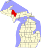 | |
| Charter townships | ||
| Civil townships | ||
| CDPs | ||
| Other communities | ||
| Indian reservations | ||
| Footnotes | ‡This populated place also has portions in an adjacent county or counties | |