Air Force Station Arjan Singh: Difference between revisions
Content deleted Content added
←Created page with '{{Infobox Airport | name = Panagarh Airport | nativename = | nativename-a = | nativename-r = | image = | image-width = | caption = ...' |
(No difference)
|
Revision as of 21:04, 15 November 2009
Panagarh Airport | |||||||||||
|---|---|---|---|---|---|---|---|---|---|---|---|
| Summary | |||||||||||
| Airport type | Civil | ||||||||||
| Location | Panagarh, India | ||||||||||
| Elevation AMSL | 240 ft / 73 m | ||||||||||
| Coordinates | 23°28′27.61″N 087°25′39.03″E / 23.4743361°N 87.4275083°E | ||||||||||
| Runways | |||||||||||
| |||||||||||
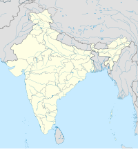
Location of Panagarh Airport, India
Panagarh Airport is a commercial airport in the state of West Bengal, India.
References
![]() This article incorporates public domain material from the Air Force Historical Research Agency
This article incorporates public domain material from the Air Force Historical Research Agency
- Maurer, Maurer (1983). Air Force Combat Units Of World War II. Maxwell AFB, Alabama: Office of Air Force History. ISBN 0892010924.
External links


