Rosia Airfield: Difference between revisions
Content deleted Content added
←Created page with '{{Infobox Military Structure |name=Rosia Airfield<BR>70px |partof = Twelfth Air Force |location= |coordinates={{Coord|43|14|37.19|N|011...' |
(No difference)
|
Revision as of 18:34, 19 August 2009
Rosia Airfield | |
|---|---|
| Part of Twelfth Air Force | |
| Coordinates | 43°14′37.19″N 011°13′37.72″E / 43.2436639°N 11.2271444°E (Approximate) |
| Type | Military Airfield |
| Site information | |
| Controlled by | United States Army Air Forces |
| Site history | |
| Built | 1944 |
| In use | 1944 |
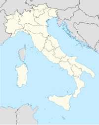
Location of Rosia Airfield, Italy
Rosia Airfield is an abandoned World War II military airfield in Italy, which is located approximately 13km southwest of Siena; 180km northwest of Rome. It was used by the United States Army Air Force Twelfth Air Force 3d Reconnaissance Group, which flew F-4 and F-5 Lightnings from the airfield between September 1944 and January 1945.
Today, the airfield runway and dispersal pads are faintly visible on aerial photography of the Nettuno area.
References
![]() This article incorporates public domain material from the Air Force Historical Research Agency
This article incorporates public domain material from the Air Force Historical Research Agency
- Maurer, Maurer. Air Force Combat Units of World War II. Maxwell AFB, Alabama: Office of Air Force History, 1983. ISBN 0-89201-092-4.
- Mauer, Mauer (1969), Combat Squadrons of the Air Force, World War II, Air Force Historical Studies Office, Maxwell AFB, Alabama. ISBN 0892010975

