
List of United States cities by population: Difference between revisions
m →50 states and Washington, D.C.: 2-digit precision Tag: Reverted |
→50 states and Washington, D.C.: Change coordinates of top 50 cities to the central business districts of these cities. Tag: Reverted |
||
| Line 160: | Line 160: | ||
| {{convert|347.3|sqmi|km2|1|disp=table}} |
| {{convert|347.3|sqmi|km2|1|disp=table}} |
||
| {{convert|2646|/sqmi|/km2|disp=table}} |
| {{convert|2646|/sqmi|/km2|disp=table}} |
||
| <small>{{coord|32. |
| <small>{{coord|32.75|-97.33|name=Fort Worth}}</small> |
||
|- |
|- |
||
| style="background-color:#ccff99"|'''''[[Columbus, Ohio|Columbus]]''''' |
| style="background-color:#ccff99"|'''''[[Columbus, Ohio|Columbus]]''''' |
||
| Line 167: | Line 167: | ||
| {{convert|220.0|sqmi|km2|1|disp=table}} |
| {{convert|220.0|sqmi|km2|1|disp=table}} |
||
| {{convert|4117|/sqmi|/km2|disp=table}} |
| {{convert|4117|/sqmi|/km2|disp=table}} |
||
| <small>{{coord|39. |
| <small>{{coord|39.96|-83.00|name=Columbus}}</small> |
||
|- |
|- |
||
| style="background-color:#cfecec"|''[[Charlotte, North Carolina|Charlotte]]'' |
| style="background-color:#cfecec"|''[[Charlotte, North Carolina|Charlotte]]'' |
||
| Line 174: | Line 174: | ||
| {{convert|308.3|sqmi|km2|1|disp=table}} |
| {{convert|308.3|sqmi|km2|1|disp=table}} |
||
| {{convert|2837|/sqmi|/km2|disp=table}} |
| {{convert|2837|/sqmi|/km2|disp=table}} |
||
| <small>{{coord|35. |
| <small>{{coord|35.23|-80.84|name=Charlotte}}</small> |
||
|- |
|- |
||
| style="background-color:#ccff99"|'''''[[Indianapolis]]'''''{{efn|The [[Indianapolis|City of Indianapolis]], [[Indiana]], and [[Marion County, Indiana|Marion County]], Indiana, are separate entities with a single [[consolidated city–county|consolidated city–county government]]. The City of Indianapolis comprises all of Marion County except the other incorporated municipalities within the county. See [[Indianapolis (balance)]].}} |
| style="background-color:#ccff99"|'''''[[Indianapolis]]'''''{{efn|The [[Indianapolis|City of Indianapolis]], [[Indiana]], and [[Marion County, Indiana|Marion County]], Indiana, are separate entities with a single [[consolidated city–county|consolidated city–county government]]. The City of Indianapolis comprises all of Marion County except the other incorporated municipalities within the county. See [[Indianapolis (balance)]].}} |
||
| Line 181: | Line 181: | ||
| {{convert|361.6|sqmi|km2|1|disp=table}} |
| {{convert|361.6|sqmi|km2|1|disp=table}} |
||
| {{convert|2455|/sqmi|/km2|disp=table}} |
| {{convert|2455|/sqmi|/km2|disp=table}} |
||
| <small>{{coord|39. |
| <small>{{coord|39.77|-86.16|name=Indianapolis}}</small> |
||
|- |
|- |
||
| [[San Francisco]]{{efn|The [[San Francisco|City and County of San Francisco]], [[California]], has a [[consolidated city–county|consolidated city and county government]].}} |
| [[San Francisco]]{{efn|The [[San Francisco|City and County of San Francisco]], [[California]], has a [[consolidated city–county|consolidated city and county government]].}} |
||
| Line 188: | Line 188: | ||
| {{convert|46.9|sqmi|km2|1|disp=table}} |
| {{convert|46.9|sqmi|km2|1|disp=table}} |
||
| {{convert|18635|/sqmi|/km2|disp=table}} |
| {{convert|18635|/sqmi|/km2|disp=table}} |
||
| <small>{{coord|37. |
| <small>{{coord|37.78|-122.42|name=San Francisco}}</small> |
||
|- |
|- |
||
| style="background-color:#cfecec"|''[[Seattle]]'' |
| style="background-color:#cfecec"|''[[Seattle]]'' |
||
| Line 195: | Line 195: | ||
| {{convert|83.8|sqmi|km2|1|disp=table}} |
| {{convert|83.8|sqmi|km2|1|disp=table}} |
||
| {{convert|8795|/sqmi|/km2|disp=table}} |
| {{convert|8795|/sqmi|/km2|disp=table}} |
||
| <small>{{coord|47. |
| <small>{{coord|47.60|-122.33|name=Seattle}}</small> |
||
|- |
|- |
||
| style="background-color:#ccff99"|'''''[[Denver]]'''''{{efn|The [[Denver|City and County of Denver]], [[Colorado]], has a [[consolidated city–county|consolidated city and county government]].}} |
| style="background-color:#ccff99"|'''''[[Denver]]'''''{{efn|The [[Denver|City and County of Denver]], [[Colorado]], has a [[consolidated city–county|consolidated city and county government]].}} |
||
| Line 202: | Line 202: | ||
| {{convert|153.1|sqmi|km2|1|disp=table}} |
| {{convert|153.1|sqmi|km2|1|disp=table}} |
||
| {{convert|4674|/sqmi|/km2|disp=table}} |
| {{convert|4674|/sqmi|/km2|disp=table}} |
||
| <small>{{coord|39. |
| <small>{{coord|39.74|-104.99|name=Denver}}</small> |
||
|- |
|- |
||
| style="background-color:#ccff99"|'''''[[Oklahoma City]]''''' |
| style="background-color:#ccff99"|'''''[[Oklahoma City]]''''' |
||
| Line 209: | Line 209: | ||
| {{convert|606.2|sqmi|km2|1|disp=table}} |
| {{convert|606.2|sqmi|km2|1|disp=table}} |
||
| {{convert|1123|/sqmi|/km2|disp=table}} |
| {{convert|1123|/sqmi|/km2|disp=table}} |
||
| <small>{{coord|35.47| |
| <small>{{coord|35.47|-97.52|name=Oklahoma City}}</small> |
||
|- |
|- |
||
| style="background-color:#ccff99"|'''[[Nashville, Tennessee|''Nashville'']]'''{{efn|The [[Nashville, Tennessee|City of Nashville]], [[Tennessee]], and [[Davidson County, Tennessee|Davidson County]], Tennessee, are separate entities with a single [[consolidated city–county|consolidated city–county government]]. The City of Nashville comprises all of Davidson County except the other incorporated municipalities within the county. See [[Nashville-Davidson (balance), Tennessee|Nashville-Davidson (balance)]].}} |
| style="background-color:#ccff99"|'''[[Nashville, Tennessee|''Nashville'']]'''{{efn|The [[Nashville, Tennessee|City of Nashville]], [[Tennessee]], and [[Davidson County, Tennessee|Davidson County]], Tennessee, are separate entities with a single [[consolidated city–county|consolidated city–county government]]. The City of Nashville comprises all of Davidson County except the other incorporated municipalities within the county. See [[Nashville-Davidson (balance), Tennessee|Nashville-Davidson (balance)]].}} |
||
| Line 216: | Line 216: | ||
| {{convert|475.8|sqmi|km2|1|disp=table}} |
| {{convert|475.8|sqmi|km2|1|disp=table}} |
||
| {{convert|1449|/sqmi|/km2|disp=table}} |
| {{convert|1449|/sqmi|/km2|disp=table}} |
||
| <small>{{coord|36. |
| <small>{{coord|36.16|-86.78|name=Nashville}}</small> |
||
|- |
|- |
||
| [[El Paso, Texas|El Paso]] |
| [[El Paso, Texas|El Paso]] |
||
| Line 223: | Line 223: | ||
| {{convert|258.4|sqmi|km2|1|disp=table}} |
| {{convert|258.4|sqmi|km2|1|disp=table}} |
||
| {{convert|2627|/sqmi|/km2|disp=table}} |
| {{convert|2627|/sqmi|/km2|disp=table}} |
||
| <small>{{coord|31. |
| <small>{{coord|31.76|-106.49|name=El Paso}}</small> |
||
|- |
|- |
||
| style="background-color:#ff9999"|'''''[[Washington, D.C.|Washington]]'''''{{efn|The [[Washington, D.C.|City of Washington]] was [[District of Columbia Organic Act of 1871|consolidated]] with the [[Washington, D.C.|District of Columbia]] in 1871.}} |
| style="background-color:#ff9999"|'''''[[Washington, D.C.|Washington]]'''''{{efn|The [[Washington, D.C.|City of Washington]] was [[District of Columbia Organic Act of 1871|consolidated]] with the [[Washington, D.C.|District of Columbia]] in 1871.}} |
||
| Line 230: | Line 230: | ||
| {{convert|61.1|sqmi|km2|1|disp=table}} |
| {{convert|61.1|sqmi|km2|1|disp=table}} |
||
| {{convert|11286|/sqmi|/km2|disp=table}} |
| {{convert|11286|/sqmi|/km2|disp=table}} |
||
| <small>{{coord|38.90| |
| <small>{{coord|38.90|-77.02|name=Washington, D.C.}}</small> |
||
|- |
|- |
||
| style="background-color:#cfecec"|''[[Las Vegas]]'' |
| style="background-color:#cfecec"|''[[Las Vegas]]'' |
||
| Line 237: | Line 237: | ||
| {{convert|141.8|sqmi|km2|1|disp=table}} |
| {{convert|141.8|sqmi|km2|1|disp=table}} |
||
| {{convert|4527|/sqmi|/km2|disp=table}} |
| {{convert|4527|/sqmi|/km2|disp=table}} |
||
| <small>{{coord|36. |
| <small>{{coord|36.17|-115.14|name=Las Vegas}}</small> |
||
|- |
|- |
||
| style="background-color:#ccff99"|'''''[[Boston]]''''' |
| style="background-color:#ccff99"|'''''[[Boston]]''''' |
||
| Line 244: | Line 244: | ||
| {{convert|48.3|sqmi|km2|1|disp=table}} |
| {{convert|48.3|sqmi|km2|1|disp=table}} |
||
| {{convert|13989|/sqmi|/km2|disp=table}} |
| {{convert|13989|/sqmi|/km2|disp=table}} |
||
| <small>{{coord|42. |
| <small>{{coord|42.36|-71.06|name=Boston}}</small> |
||
|- |
|- |
||
| style="background-color:#cfecec"|''[[Portland, Oregon|Portland]]'' |
| style="background-color:#cfecec"|''[[Portland, Oregon|Portland]]'' |
||
| Line 251: | Line 251: | ||
| {{convert|133.5|sqmi|km2|1|disp=table}} |
| {{convert|133.5|sqmi|km2|1|disp=table}} |
||
| {{convert|4888|/sqmi|/km2|disp=table}} |
| {{convert|4888|/sqmi|/km2|disp=table}} |
||
| <small>{{coord|45. |
| <small>{{coord|45.52|-122.68|name=Portland}}</small> |
||
|- |
|- |
||
| style="background-color:#cfecec"|''[[Louisville, Kentucky|Louisville]]''{{efn|The [[Louisville, Kentucky|City of Louisville]], [[Kentucky]], and [[Jefferson County, Kentucky|Jefferson County]], Kentucky, are separate entities with a single [[consolidated city–county|consolidated city–county government]]. The City of Louisville comprises all of Jefferson County except the other incorporated municipalities within the county. See [[Louisville/Jefferson County metro government (balance), Kentucky|Louisville/Jefferson County metro government (balance)]].}} |
| style="background-color:#cfecec"|''[[Louisville, Kentucky|Louisville]]''{{efn|The [[Louisville, Kentucky|City of Louisville]], [[Kentucky]], and [[Jefferson County, Kentucky|Jefferson County]], Kentucky, are separate entities with a single [[consolidated city–county|consolidated city–county government]]. The City of Louisville comprises all of Jefferson County except the other incorporated municipalities within the county. See [[Louisville/Jefferson County metro government (balance), Kentucky|Louisville/Jefferson County metro government (balance)]].}} |
||
| Line 258: | Line 258: | ||
| {{convert|324.9|sqmi|km2|1|disp=table}} |
| {{convert|324.9|sqmi|km2|1|disp=table}} |
||
| {{convert|1948|/sqmi|/km2|disp=table}} |
| {{convert|1948|/sqmi|/km2|disp=table}} |
||
| <small>{{coord|38. |
| <small>{{coord|38.25|-85.76|name=Louisville}}</small> |
||
|- |
|- |
||
| [[Memphis, Tennessee|Memphis]] |
| [[Memphis, Tennessee|Memphis]] |
||
| Line 265: | Line 265: | ||
| {{convert|297.0|sqmi|km2|1|disp=table}} |
| {{convert|297.0|sqmi|km2|1|disp=table}} |
||
| {{convert|2132|/sqmi|/km2|disp=table}} |
| {{convert|2132|/sqmi|/km2|disp=table}} |
||
| <small>{{coord|35. |
| <small>{{coord|35.14|-90.05|name=Memphis}}</small> |
||
|- |
|- |
||
| style="background-color:#cfecec"|''[[Detroit]]'' |
| style="background-color:#cfecec"|''[[Detroit]]'' |
||
| Line 272: | Line 272: | ||
| {{convert|138.7|sqmi|km2|1|disp=table}} |
| {{convert|138.7|sqmi|km2|1|disp=table}} |
||
| {{convert|4608|/sqmi|/km2|disp=table}} |
| {{convert|4608|/sqmi|/km2|disp=table}} |
||
| <small>{{coord|42. |
| <small>{{coord|42.33|-83.05|name=Detroit}}</small> |
||
|- |
|- |
||
| style="background-color:#cfecec"|''[[Baltimore]]''{{efn|name=IndependentCity|This is an independent city that is not part of any county.}} |
| style="background-color:#cfecec"|''[[Baltimore]]''{{efn|name=IndependentCity|This is an independent city that is not part of any county.}} |
||
| Line 279: | Line 279: | ||
| {{convert|80.9|sqmi|km2|1|disp=table}} |
| {{convert|80.9|sqmi|km2|1|disp=table}} |
||
| {{convert|7240|/sqmi|/km2|disp=table}} |
| {{convert|7240|/sqmi|/km2|disp=table}} |
||
| <small>{{coord|39. |
| <small>{{coord|39.29|-76.61|name=Baltimore}}</small> |
||
|- |
|- |
||
| style="background-color:#cfecec"|''[[Milwaukee]]'' |
| style="background-color:#cfecec"|''[[Milwaukee]]'' |
||
| Line 286: | Line 286: | ||
| {{convert|96.2|sqmi|km2|1|disp=table}} |
| {{convert|96.2|sqmi|km2|1|disp=table}} |
||
| {{convert|6000|/sqmi|/km2|disp=table}} |
| {{convert|6000|/sqmi|/km2|disp=table}} |
||
| <small>{{coord|43. |
| <small>{{coord|43.04|-87.91|name=Milwaukee}}</small> |
||
|- |
|- |
||
| style="background-color:#cfecec"|''[[Albuquerque, New Mexico|Albuquerque]]'' |
| style="background-color:#cfecec"|''[[Albuquerque, New Mexico|Albuquerque]]'' |
||
| Line 293: | Line 293: | ||
| {{convert|187.3|sqmi|km2|1|disp=table}} |
| {{convert|187.3|sqmi|km2|1|disp=table}} |
||
| {{convert|3014|/sqmi|/km2|disp=table}} |
| {{convert|3014|/sqmi|/km2|disp=table}} |
||
| <small>{{coord|35. |
| <small>{{coord|35.08|-106.65|name=Albuquerque}}</small> |
||
|- |
|- |
||
| [[Tucson, Arizona|Tucson]] |
| [[Tucson, Arizona|Tucson]] |
||
| Line 300: | Line 300: | ||
| {{convert|241.0|sqmi|km2|1|disp=table}} |
| {{convert|241.0|sqmi|km2|1|disp=table}} |
||
| {{convert|2252|/sqmi|/km2|disp=table}} |
| {{convert|2252|/sqmi|/km2|disp=table}} |
||
| <small>{{coord|32. |
| <small>{{coord|32.22|-110.97|name=Tucson}}</small> |
||
|- |
|- |
||
| [[Fresno, California|Fresno]] |
| [[Fresno, California|Fresno]] |
||
| Line 307: | Line 307: | ||
| {{convert|115.2|sqmi|km2|1|disp=table}} |
| {{convert|115.2|sqmi|km2|1|disp=table}} |
||
| {{convert|4706|/sqmi|/km2|disp=table}} |
| {{convert|4706|/sqmi|/km2|disp=table}} |
||
| <small>{{coord|36. |
| <small>{{coord|36.74|-119.79|name=Fresno}}</small> |
||
|- |
|- |
||
| style="background-color:#ffff99"|'''[[Sacramento, California|Sacramento]]''' |
| style="background-color:#ffff99"|'''[[Sacramento, California|Sacramento]]''' |
||
| Line 314: | Line 314: | ||
| {{convert|98.6|sqmi|km2|1|disp=table}} |
| {{convert|98.6|sqmi|km2|1|disp=table}} |
||
| {{convert|5324|/sqmi|/km2|disp=table}} |
| {{convert|5324|/sqmi|/km2|disp=table}} |
||
| <small>{{coord|38. |
| <small>{{coord|38.58|-121.49|name=Sacramento}}</small> |
||
|- |
|- |
||
| [[Mesa, Arizona|Mesa]] |
| [[Mesa, Arizona|Mesa]] |
||
| Line 321: | Line 321: | ||
| {{convert|138.7|sqmi|km2|1|disp=table}} |
| {{convert|138.7|sqmi|km2|1|disp=table}} |
||
| {{convert|3636|/sqmi|/km2|disp=table}} |
| {{convert|3636|/sqmi|/km2|disp=table}} |
||
| <small>{{coord|33. |
| <small>{{coord|33.42|-111.83|name=Mesa}}</small> |
||
|- |
|- |
||
| style="background-color:#cfecec"|''[[Kansas City, Missouri|Kansas City]]'' |
| style="background-color:#cfecec"|''[[Kansas City, Missouri|Kansas City]]'' |
||
| Line 328: | Line 328: | ||
| {{convert|314.7|sqmi|km2|1|disp=table}} |
| {{convert|314.7|sqmi|km2|1|disp=table}} |
||
| {{convert|1615|/sqmi|/km2|disp=table}} |
| {{convert|1615|/sqmi|/km2|disp=table}} |
||
| <small>{{coord|39. |
| <small>{{coord|39.10|-94.58|name=Kansas City, MO}}</small> |
||
|- |
|- |
||
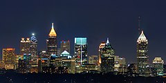
| style="background-color:#ccff99"|'''''[[Atlanta]]''''' |
| style="background-color:#ccff99"|'''''[[Atlanta]]''''' |
||
| Line 335: | Line 335: | ||
| {{convert|135.3|sqmi|km2|1|disp=table}} |
| {{convert|135.3|sqmi|km2|1|disp=table}} |
||
| {{convert|3686|/sqmi|/km2|disp=table}} |
| {{convert|3686|/sqmi|/km2|disp=table}} |
||
| <small>{{coord|33.76| |
| <small>{{coord|33.76|-84.39|name=Atlanta}}</small> |
||
|- |
|- |
||
| [[Colorado Springs, Colorado|Colorado Springs]] |
| [[Colorado Springs, Colorado|Colorado Springs]] |
||
| Line 342: | Line 342: | ||
| {{convert|195.4|sqmi|km2|1|disp=table}} |
| {{convert|195.4|sqmi|km2|1|disp=table}} |
||
| {{convert|2451|/sqmi|/km2|disp=table}} |
| {{convert|2451|/sqmi|/km2|disp=table}} |
||
| <small>{{coord|38. |
| <small>{{coord|38.84|-104.82|name=Colorado Springs}}</small> |
||
|- |
|- |
||
| style="background-color:#cfecec"|''[[Omaha, Nebraska|Omaha]]'' |
| style="background-color:#cfecec"|''[[Omaha, Nebraska|Omaha]]'' |
||
| Line 349: | Line 349: | ||
| {{convert|141.6|sqmi|km2|1|disp=table}} |
| {{convert|141.6|sqmi|km2|1|disp=table}} |
||
| {{convert|3433|/sqmi|/km2|disp=table}} |
| {{convert|3433|/sqmi|/km2|disp=table}} |
||
| <small>{{coord|41.26| |
| <small>{{coord|41.26|-95.94|name=Omaha}}</small> |
||
|- |
|- |
||
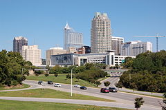
| style="background-color:#ffff99"|'''[[Raleigh, North Carolina|Raleigh]]''' |
| style="background-color:#ffff99"|'''[[Raleigh, North Carolina|Raleigh]]''' |
||
| Line 356: | Line 356: | ||
| {{convert|147.1|sqmi|km2|1|disp=table}} |
| {{convert|147.1|sqmi|km2|1|disp=table}} |
||
| {{convert|3179|/sqmi|/km2|disp=table}} |
| {{convert|3179|/sqmi|/km2|disp=table}} |
||
| <small>{{coord|35. |
| <small>{{coord|35.78|-78.64|name=Raleigh}}</small> |
||
|- |
|- |
||
| style="background-color:#cfecec"|''[[Virginia Beach, Virginia|Virginia Beach]]''{{efn|name=IndependentCity}} |
| style="background-color:#cfecec"|''[[Virginia Beach, Virginia|Virginia Beach]]''{{efn|name=IndependentCity}} |
||
| Line 363: | Line 363: | ||
| {{convert|244.7|sqmi|km2|1|disp=table}} |
| {{convert|244.7|sqmi|km2|1|disp=table}} |
||
| {{convert|1878|/sqmi|/km2|disp=table}} |
| {{convert|1878|/sqmi|/km2|disp=table}} |
||
| <small>{{coord|36. |
| <small>{{coord|36.85|-75.98|name=Virginia Beach}}</small> |
||
|- |
|- |
||
| [[Long Beach, California|Long Beach]] |
| [[Long Beach, California|Long Beach]] |
||
| Line 370: | Line 370: | ||
| {{convert|50.7|sqmi|km2|1|disp=table}} |
| {{convert|50.7|sqmi|km2|1|disp=table}} |
||
| {{convert|9206|/sqmi|/km2|disp=table}} |
| {{convert|9206|/sqmi|/km2|disp=table}} |
||
| <small>{{coord|33. |
| <small>{{coord|33.77|-118.19|name=Long Beach}}</small> |
||
|- |
|- |
||
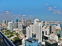
| [[Miami]] |
| [[Miami]] |
||
| Line 377: | Line 377: | ||
| {{convert|36.0|sqmi|km2|1|disp=table}} |
| {{convert|36.0|sqmi|km2|1|disp=table}} |
||
| {{convert|12284|/sqmi|/km2|disp=table}} |
| {{convert|12284|/sqmi|/km2|disp=table}} |
||
| <small>{{coord|25. |
| <small>{{coord|25.77|-80.20|name=Miami}}</small> |
||
|- |
|- |
||
| [[Oakland, California|Oakland]] |
| [[Oakland, California|Oakland]] |
||
| Line 384: | Line 384: | ||
| {{convert|55.9|sqmi|km2|1|disp=table}} |
| {{convert|55.9|sqmi|km2|1|disp=table}} |
||
| {{convert|7883|/sqmi|/km2|disp=table}} |
| {{convert|7883|/sqmi|/km2|disp=table}} |
||
| <small>{{coord|37. |
| <small>{{coord|37.81|-122.27|name=Oakland}}</small> |
||
|- |
|- |
||
| style="background-color:#cfecec"|''[[Minneapolis]]'' |
| style="background-color:#cfecec"|''[[Minneapolis]]'' |
||
| Line 391: | Line 391: | ||
| {{convert|54.0|sqmi|km2|1|disp=table}} |
| {{convert|54.0|sqmi|km2|1|disp=table}} |
||
| {{convert|7962|/sqmi|/km2|disp=table}} |
| {{convert|7962|/sqmi|/km2|disp=table}} |
||
| <small>{{coord|44. |
| <small>{{coord|44.98|-93.27|name=Minneapolis}}</small> |
||
|- |
|- |
||
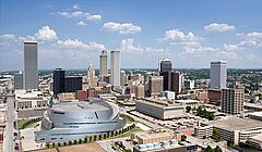
| [[Tulsa, Oklahoma|Tulsa]] |
| [[Tulsa, Oklahoma|Tulsa]] |
||
| Line 398: | Line 398: | ||
| {{convert|197.5|sqmi|km2|1|disp=table}} |
| {{convert|197.5|sqmi|km2|1|disp=table}} |
||
| {{convert|2091|/sqmi|/km2|disp=table}} |
| {{convert|2091|/sqmi|/km2|disp=table}} |
||
| <small>{{coord|36. |
| <small>{{coord|36.15|-95.99|name=Tulsa}}</small> |
||
|- |
|- |
||
| [[Bakersfield, California|Bakersfield]] |
| [[Bakersfield, California|Bakersfield]] |
||
| Line 405: | Line 405: | ||
| {{convert|149.8|sqmi|km2|1|disp=table}} |
| {{convert|149.8|sqmi|km2|1|disp=table}} |
||
| {{convert|2693|/sqmi|/km2|disp=table}} |
| {{convert|2693|/sqmi|/km2|disp=table}} |
||
| <small>{{coord|35. |
| <small>{{coord|35.38|-119.02|name=Bakersfield}}</small> |
||
|- |
|- |
||
| [[Tampa, Florida|Tampa]] |
| [[Tampa, Florida|Tampa]] |
||
| Line 412: | Line 412: | ||
| {{convert|114.0|sqmi|km2|1|disp=table}} |
| {{convert|114.0|sqmi|km2|1|disp=table}} |
||
| {{convert|3377|/sqmi|/km2|disp=table}} |
| {{convert|3377|/sqmi|/km2|disp=table}} |
||
| <small>{{coord|27. |
| <small>{{coord|27.95|-82.46|name=Tampa}}</small> |
||
|- |
|- |
||
| style="background-color:#cfecec"|''[[Wichita, Kansas|Wichita]]'' |
| style="background-color:#cfecec"|''[[Wichita, Kansas|Wichita]]'' |
||
| Line 419: | Line 419: | ||
| {{convert|162.0|sqmi|km2|1|disp=table}} |
| {{convert|162.0|sqmi|km2|1|disp=table}} |
||
| {{convert|2454|/sqmi|/km2|disp=table}} |
| {{convert|2454|/sqmi|/km2|disp=table}} |
||
| <small>{{coord|37.69| |
| <small>{{coord|37.69|-97.33|name=Wichita}}</small> |
||
|- |
|- |
||
| [[Arlington, Texas|Arlington]] |
| [[Arlington, Texas|Arlington]] |
||
Revision as of 18:04, 26 April 2024
| Population tables of U.S. cities |
|---|
 |
| Cities |
| Urban areas |
| Populous cities and metropolitan areas |
| Metropolitan areas |
| Megaregions |
|
This is a list of the most populous incorporated places of the United States. As defined by the United States Census Bureau, an incorporated place includes cities, towns, villages, boroughs, and municipalities.[a] A few exceptional census-designated places (CDPs) are also included in the Census Bureau's listing of incorporated places.[b] Consolidated city-counties represent a distinct type of government that includes the entire population of a county, or county equivalent. Some consolidated city-counties, however, include multiple incorporated places. This list presents only the portion of such consolidated city-counties that are not a part of another incorporated place.
This list refers only to the population of individual municipalities within their defined limits; the populations of other municipalities considered suburbs of a central city are listed separately, and unincorporated areas within urban agglomerations are not included. Therefore, a different ranking is evident when considering U.S. urban areas or metropolitan areas.
50 states and Washington, D.C.
This table lists the 333 incorporated places in the United States, excluding the U.S. territories, with a population of at least 100,000 as of July 1, 2022, as estimated by the U.S. Census Bureau. Five states have no cities with populations exceeding 100,000. They are: Delaware, Maine, Vermont, West Virginia, and Wyoming.
The table displays:
- The city rank by population as of July 1, 2022, as estimated by the United States Census Bureau[1]
- The city name[1]
- The name of the state in which the city lies[1]
- The city population as of July 1, 2022, as estimated by the United States Census Bureau[1]
- The city population as of April 1, 2020, as enumerated by the 2020 United States census[1]
- The city percent population change from April 1, 2020, to July 1, 2022
- The city land area as of January 1, 2020[2]
- The city population density as of April 1, 2020 (residents per unit of land area)[2]
- The city latitude and longitude coordinates[2]

| State capital | |
| State largest city | |
| State capital and largest city | |
| Federal capital |
| City | ST | 2022 estimate |
2020 census |
Change | 2020 land area | 2020 density | Location | ||
|---|---|---|---|---|---|---|---|---|---|
| mi2 | km2 | / mi2 | / km2 | ||||||
| New York[c] | NY | 8,335,897 | 8,804,190 | −5.32% | 300.5 | 778.3 | 29,298 | 11,312 | 40°45′N 73°59′W / 40.75°N 73.99°W |
| Los Angeles | CA | 3,822,238 | 3,898,747 | −1.96% | 469.5 | 1,216.0 | 8,304 | 3,206 | 34°03′N 118°15′W / 34.05°N 118.25°W |
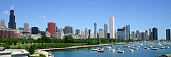
| Chicago | IL | 2,665,039 | 2,746,388 | −2.96% | 227.7 | 589.7 | 12,061 | 4,657 | 41°53′N 87°38′W / 41.88°N 87.63°W |
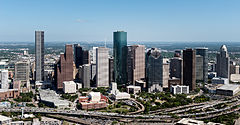
| Houston | TX | 2,302,878 | 2,304,580 | −0.07% | 640.4 | 1,658.6 | 3,599 | 1,390 | 29°45′N 95°22′W / 29.75°N 95.37°W |
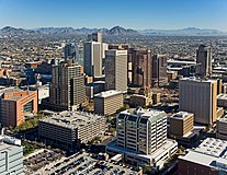
| Phoenix | AZ | 1,644,409 | 1,608,139 | +2.26% | 518.0 | 1,341.6 | 3,105 | 1,199 | 33°27′N 112°04′W / 33.45°N 112.07°W |
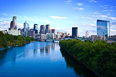
| Philadelphia[d] | PA | 1,567,258 | 1,603,797 | −2.28% | 134.4 | 348.1 | 11,933 | 4,607 | 39°57′N 75°10′W / 39.95°N 75.16°W |
| San Antonio | TX | 1,472,909 | 1,434,625 | +2.67% | 498.8 | 1,291.9 | 2,876 | 1,110 | 29°25′N 98°29′W / 29.42°N 98.49°W |
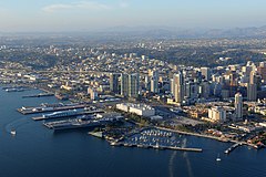
| San Diego | CA | 1,381,162 | 1,386,932 | −0.42% | 325.9 | 844.1 | 4,256 | 1,643 | 32°43′N 117°10′W / 32.72°N 117.16°W |
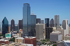
| Dallas | TX | 1,299,544 | 1,304,379 | −0.37% | 339.6 | 879.6 | 3,841 | 1,483 | 32°47′N 96°48′W / 32.78°N 96.80°W |
| Austin | TX | 974,447 | 961,855 | +1.31% | 319.9 | 828.5 | 3,007 | 1,161 | 30°16′N 97°45′W / 30.27°N 97.75°W |
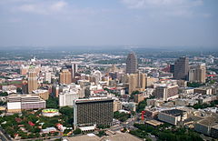
| Jacksonville[e] | FL | 971,319 | 949,611 | +2.29% | 747.3 | 1,935.5 | 1,271 | 491 | 30°20′N 81°40′W / 30.33°N 81.66°W |
| San Jose | CA | 971,233 | 1,013,240 | −4.15% | 178.3 | 461.8 | 5,683 | 2,194 | 37°20′N 121°53′W / 37.33°N 121.89°W |
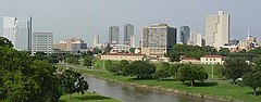
| Fort Worth | TX | 956,709 | 918,915 | +4.11% | 347.3 | 899.5 | 2,646 | 1,022 | 32°45′N 97°20′W / 32.75°N 97.33°W |
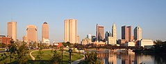
| Columbus | OH | 907,971 | 905,748 | +0.25% | 220.0 | 569.8 | 4,117 | 1,590 | 39°58′N 83°00′W / 39.96°N 83.00°W |
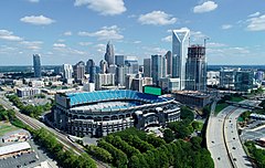
| Charlotte | NC | 897,720 | 874,579 | +2.65% | 308.3 | 798.5 | 2,837 | 1,095 | 35°14′N 80°50′W / 35.23°N 80.84°W |
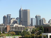
| Indianapolis[f] | IN | 880,621 | 887,642 | −0.79% | 361.6 | 936.5 | 2,455 | 948 | 39°46′N 86°10′W / 39.77°N 86.16°W |
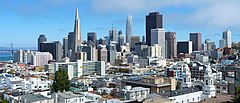
| San Francisco[g] | CA | 808,437 | 873,965 | −7.50% | 46.9 | 121.5 | 18,635 | 7,195 | 37°47′N 122°25′W / 37.78°N 122.42°W |
| Seattle | WA | 749,256 | 737,015 | +1.66% | 83.8 | 217.0 | 8,795 | 3,396 | 47°36′N 122°20′W / 47.60°N 122.33°W |
| Denver[h] | CO | 713,252 | 715,522 | −0.32% | 153.1 | 396.5 | 4,674 | 1,805 | 39°44′N 104°59′W / 39.74°N 104.99°W |
| Oklahoma City | OK | 694,800 | 681,054 | +2.02% | 606.2 | 1,570.1 | 1,123 | 434 | 35°28′N 97°31′W / 35.47°N 97.52°W |
| Nashville[i] | TN | 683,622 | 689,447 | −0.84% | 475.8 | 1,232.3 | 1,449 | 559 | 36°10′N 86°47′W / 36.16°N 86.78°W |
| El Paso | TX | 677,456 | 678,815 | −0.20% | 258.4 | 669.3 | 2,627 | 1,014 | 31°46′N 106°29′W / 31.76°N 106.49°W |
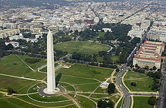
| Washington[j] | DC | 671,803 | 689,545 | −2.57% | 61.1 | 158.2 | 11,286 | 4,358 | 38°54′N 77°01′W / 38.90°N 77.02°W |
| Las Vegas | NV | 656,274 | 641,903 | +2.24% | 141.8 | 367.3 | 4,527 | 1,748 | 36°10′N 115°08′W / 36.17°N 115.14°W |
| Boston | MA | 650,706 | 675,647 | −3.69% | 48.3 | 125.1 | 13,989 | 5,401 | 42°22′N 71°04′W / 42.36°N 71.06°W |
| Portland | OR | 635,067 | 652,503 | −2.67% | 133.5 | 345.8 | 4,888 | 1,887 | 45°31′N 122°41′W / 45.52°N 122.68°W |
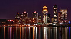
| Louisville[k] | KY | 624,444 | 633,045 | −1.36% | 324.9 | 841.5 | 1,948 | 752 | 38°15′N 85°46′W / 38.25°N 85.76°W |
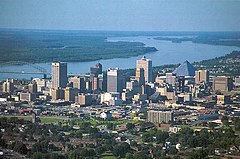
| Memphis | TN | 621,056 | 633,104 | −1.90% | 297.0 | 769.2 | 2,132 | 823 | 35°08′N 90°03′W / 35.14°N 90.05°W |
| Detroit | MI | 620,376 | 639,111 | −2.93% | 138.7 | 359.2 | 4,608 | 1,779 | 42°20′N 83°03′W / 42.33°N 83.05°W |
| Baltimore[l] | MD | 569,931 | 585,708 | −2.69% | 80.9 | 209.5 | 7,240 | 2,800 | 39°17′N 76°37′W / 39.29°N 76.61°W |
| Milwaukee | WI | 563,305 | 577,222 | −2.41% | 96.2 | 249.2 | 6,000 | 2,300 | 43°02′N 87°55′W / 43.04°N 87.91°W |
| Albuquerque | NM | 561,008 | 564,559 | −0.63% | 187.3 | 485.1 | 3,014 | 1,164 | 35°05′N 106°39′W / 35.08°N 106.65°W |
| Tucson | AZ | 546,574 | 542,629 | +0.73% | 241.0 | 624.2 | 2,252 | 870 | 32°13′N 110°58′W / 32.22°N 110.97°W |
| Fresno | CA | 545,567 | 542,107 | +0.64% | 115.2 | 298.4 | 4,706 | 1,817 | 36°44′N 119°47′W / 36.74°N 119.79°W |
| Sacramento | CA | 528,001 | 524,943 | +0.58% | 98.6 | 255.4 | 5,324 | 2,056 | 38°35′N 121°29′W / 38.58°N 121.49°W |
| Mesa | AZ | 512,498 | 504,258 | +1.63% | 138.7 | 359.2 | 3,636 | 1,404 | 33°25′N 111°50′W / 33.42°N 111.83°W |
| Kansas City | MO | 509,297 | 508,090 | +0.24% | 314.7 | 815.1 | 1,615 | 624 | 39°06′N 94°35′W / 39.10°N 94.58°W |
| Atlanta | GA | 499,127 | 498,715 | +0.08% | 135.3 | 350.4 | 3,686 | 1,423 | 33°46′N 84°23′W / 33.76°N 84.39°W |
| Colorado Springs | CO | 486,248 | 478,961 | +1.52% | 195.4 | 506.1 | 2,451 | 946 | 38°50′N 104°49′W / 38.84°N 104.82°W |
| Omaha | NE | 485,153 | 486,051 | −0.18% | 141.6 | 366.7 | 3,433 | 1,325 | 41°16′N 95°56′W / 41.26°N 95.94°W |
| Raleigh | NC | 476,587 | 467,665 | +1.91% | 147.1 | 381.0 | 3,179 | 1,227 | 35°47′N 78°38′W / 35.78°N 78.64°W |
| Virginia Beach[l] | VA | 455,618 | 459,470 | −0.84% | 244.7 | 633.8 | 1,878 | 725 | 36°51′N 75°59′W / 36.85°N 75.98°W |
| Long Beach | CA | 451,307 | 466,742 | −3.31% | 50.7 | 131.3 | 9,206 | 3,554 | 33°46′N 118°11′W / 33.77°N 118.19°W |
| Miami | FL | 449,514 | 442,241 | +1.64% | 36.0 | 93.2 | 12,284 | 4,743 | 25°46′N 80°12′W / 25.77°N 80.20°W |
| Oakland | CA | 430,553 | 440,646 | −2.29% | 55.9 | 144.8 | 7,883 | 3,044 | 37°49′N 122°16′W / 37.81°N 122.27°W |
| Minneapolis | MN | 425,096 | 429,954 | −1.13% | 54.0 | 139.9 | 7,962 | 3,074 | 44°59′N 93°16′W / 44.98°N 93.27°W |
| Tulsa | OK | 411,867 | 413,066 | −0.29% | 197.5 | 511.5 | 2,091 | 807 | 36°09′N 95°59′W / 36.15°N 95.99°W |
| Bakersfield | CA | 410,647 | 403,455 | +1.78% | 149.8 | 388.0 | 2,693 | 1,040 | 35°23′N 119°01′W / 35.38°N 119.02°W |
| Tampa | FL | 398,173 | 384,959 | +3.43% | 114.0 | 295.3 | 3,377 | 1,304 | 27°57′N 82°28′W / 27.95°N 82.46°W |
| Wichita | KS | 396,192 | 397,532 | −0.34% | 162.0 | 419.6 | 2,454 | 947 | 37°41′N 97°20′W / 37.69°N 97.33°W |
| Arlington | TX | 394,602 | 394,266 | +0.09% | 95.9 | 248.4 | 4,111 | 1,587 | 32°42′N 97°07′W / 32.70°N 97.12°W |
| Aurora | CO | 393,537 | 386,261 | +1.88% | 160.1 | 414.7 | 2,413 | 932 | 39°42′N 104°43′W / 39.70°N 104.72°W |
| New Orleans[m] | LA | 369,749 | 383,997 | −3.71% | 169.5 | 439.0 | 2,265 | 875 | 30°03′N 89°56′W / 30.05°N 89.93°W |
| Cleveland | OH | 361,607 | 372,624 | −2.96% | 77.7 | 201.2 | 4,796 | 1,852 | 41°29′N 81°41′W / 41.48°N 81.68°W |
| Anaheim | CA | 344,461 | 346,824 | −0.68% | 50.3 | 130.3 | 6,895 | 2,662 | 33°52′N 117°46′W / 33.86°N 117.76°W |
| Honolulu[n] | HI | 343,421 | 350,964 | −2.15% | 60.5 | 156.7 | 5,801 | 2,240 | 21°19′N 157°51′W / 21.32°N 157.85°W |
| Henderson | NV | 331,415 | 317,610 | +4.35% | 106.2 | 275.1 | 2,991 | 1,155 | 36°01′N 115°02′W / 36.01°N 115.04°W |
| Stockton | CA | 321,819 | 320,804 | +0.32% | 62.2 | 161.1 | 5,158 | 1,992 | 37°59′N 121°19′W / 37.98°N 121.31°W |
| Riverside | CA | 320,764 | 314,998 | +1.83% | 81.2 | 210.3 | 3,879 | 1,498 | 33°56′N 117°23′W / 33.94°N 117.39°W |
| Lexington[o] | KY | 320,347 | 322,570 | −0.69% | 283.6 | 734.5 | 1,137 | 439 | 38°02′N 84°28′W / 38.04°N 84.46°W |
| Corpus Christi | TX | 316,239 | 317,863 | −0.51% | 162.2 | 420.1 | 1,960 | 760 | 27°45′N 97°10′W / 27.75°N 97.17°W |
| Orlando | FL | 316,081 | 307,573 | +2.77% | 110.6 | 286.5 | 2,781 | 1,074 | 28°25′N 81°15′W / 28.41°N 81.25°W |
| Irvine | CA | 313,685 | 307,670 | +1.96% | 65.6 | 169.9 | 4,690 | 1,810 | 33°41′N 117°46′W / 33.68°N 117.77°W |
| Cincinnati | OH | 309,513 | 309,317 | +0.06% | 77.8 | 201.5 | 3,976 | 1,535 | 39°08′N 84°31′W / 39.14°N 84.51°W |
| Santa Ana | CA | 308,189 | 310,227 | −0.66% | 27.3 | 70.7 | 11,364 | 4,388 | 33°44′N 117°53′W / 33.74°N 117.88°W |
| Newark | NJ | 305,344 | 311,549 | −1.99% | 24.1 | 62.4 | 12,927 | 4,991 | 40°43′N 74°10′W / 40.72°N 74.17°W |
| Saint Paul | MN | 303,176 | 311,527 | −2.68% | 52.0 | 134.7 | 5,991 | 2,313 | 44°57′N 93°06′W / 44.95°N 93.10°W |
| Pittsburgh | PA | 302,898 | 302,971 | −0.02% | 55.4 | 143.5 | 5,469 | 2,112 | 40°26′N 79°59′W / 40.44°N 79.98°W |
| Greensboro | NC | 301,115 | 299,035 | +0.70% | 129.6 | 335.7 | 2,307 | 891 | 36°06′N 79°50′W / 36.10°N 79.83°W |
| Lincoln | NE | 292,627 | 291,082 | +0.53% | 97.7 | 253.0 | 2,979 | 1,150 | 40°49′N 96°41′W / 40.81°N 96.68°W |
| Durham | NC | 291,928 | 283,506 | +2.97% | 112.8 | 292.2 | 2,513 | 970 | 35°59′N 78°54′W / 35.98°N 78.90°W |
| Plano | TX | 289,547 | 285,494 | +1.42% | 71.7 | 185.7 | 3,982 | 1,537 | 33°03′N 96°45′W / 33.05°N 96.75°W |
| Anchorage[p] | AK | 287,145 | 291,247 | −1.41% | 1,706.8 | 4,420.6 | 171 | 66 | 61°10′N 149°17′W / 61.17°N 149.28°W |
| Jersey City | NJ | 286,670 | 292,449 | −1.98% | 14.7 | 38.1 | 19,894 | 7,681 | 40°43′N 74°04′W / 40.71°N 74.06°W |
| St. Louis[l] | MO | 286,578 | 301,578 | −4.97% | 61.7 | 159.8 | 4,888 | 1,887 | 38°38′N 90°14′W / 38.64°N 90.24°W |
| Chandler | AZ | 280,711 | 275,987 | +1.71% | 65.3 | 169.1 | 4,226 | 1,632 | 33°17′N 111°51′W / 33.28°N 111.85°W |
| North Las Vegas | NV | 280,543 | 262,527 | +6.86% | 101.3 | 262.4 | 2,592 | 1,001 | 36°17′N 115°05′W / 36.28°N 115.09°W |
| Chula Vista | CA | 279,170 | 275,487 | +1.34% | 49.6 | 128.5 | 5,554 | 2,144 | 32°38′N 117°01′W / 32.63°N 117.02°W |
| Buffalo | NY | 276,486 | 278,349 | −0.67% | 40.4 | 104.6 | 6,890 | 2,660 | 42°53′N 78°52′W / 42.89°N 78.86°W |
| Gilbert[q] | AZ | 275,346 | 267,918 | +2.77% | 68.6 | 177.7 | 3,906 | 1,508 | 33°19′N 111°44′W / 33.31°N 111.74°W |
| Reno | NV | 273,448 | 264,165 | +3.51% | 108.8 | 281.8 | 2,428 | 937 | 39°33′N 119°51′W / 39.55°N 119.85°W |
| Madison | WI | 272,903 | 269,840 | +1.14% | 79.6 | 206.2 | 3,390 | 1,310 | 43°05′N 89°26′W / 43.09°N 89.43°W |
| Fort Wayne | IN | 267,927 | 263,886 | +1.53% | 110.7 | 286.7 | 2,384 | 920 | 41°05′N 85°08′W / 41.09°N 85.14°W |
| Toledo | OH | 266,301 | 270,871 | −1.69% | 80.5 | 208.5 | 3,365 | 1,299 | 41°40′N 83°35′W / 41.66°N 83.58°W |
| Lubbock | TX | 263,930 | 257,141 | +2.64% | 134.6 | 348.6 | 1,910 | 740 | 33°34′N 101°53′W / 33.57°N 101.89°W |
| St. Petersburg | FL | 261,256 | 258,308 | +1.14% | 61.8 | 160.1 | 4,180 | 1,610 | 27°46′N 82°38′W / 27.77°N 82.64°W |
| Laredo | TX | 256,187 | 255,205 | +0.38% | 106.5 | 275.8 | 2,396 | 925 | 27°34′N 99°29′W / 27.56°N 99.49°W |
| Irving | TX | 254,715 | 256,684 | −0.77% | 67.0 | 173.5 | 3,831 | 1,479 | 32°52′N 96°58′W / 32.86°N 96.97°W |
| Chesapeake[l] | VA | 252,488 | 249,422 | +1.23% | 338.5 | 876.7 | 737 | 285 | 36°41′N 76°18′W / 36.68°N 76.30°W |
| Glendale | AZ | 252,136 | 248,325 | +1.53% | 61.6 | 159.5 | 4,031 | 1,556 | 33°32′N 112°11′W / 33.53°N 112.19°W |
| Winston-Salem | NC | 251,350 | 249,545 | +0.72% | 132.7 | 343.7 | 1,881 | 726 | 36°06′N 80°16′W / 36.10°N 80.26°W |
| Scottsdale | AZ | 243,050 | 241,361 | +0.70% | 184.0 | 476.6 | 1,312 | 507 | 33°41′N 111°52′W / 33.68°N 111.86°W |
| Garland | TX | 240,854 | 246,018 | −2.10% | 57.1 | 147.9 | 4,309 | 1,664 | 32°55′N 96°38′W / 32.91°N 96.63°W |
| Boise[r] | ID | 236,634 | 235,684 | +0.40% | 84.0 | 217.6 | 2,806 | 1,083 | 43°36′N 116°14′W / 43.60°N 116.23°W |
| Norfolk[l] | VA | 232,995 | 238,005 | −2.10% | 53.3 | 138.0 | 4,465 | 1,724 | 36°55′N 76°14′W / 36.92°N 76.24°W |
| Port St. Lucie | FL | 231,790 | 204,851 | +13.15% | 119.2 | 308.7 | 1,719 | 664 | 27°17′N 80°23′W / 27.28°N 80.39°W |
| Spokane | WA | 230,160 | 228,989 | +0.51% | 68.8 | 178.2 | 3,328 | 1,285 | 47°40′N 117°26′W / 47.67°N 117.43°W |
| Richmond[l] | VA | 229,395 | 226,610 | +1.23% | 59.9 | 155.1 | 3,783 | 1,461 | 37°32′N 77°29′W / 37.53°N 77.48°W |
| Fremont | CA | 223,871 | 230,504 | −2.88% | 78.3 | 202.8 | 2,944 | 1,137 | 37°29′N 121°56′W / 37.49°N 121.94°W |
| Huntsville | AL | 221,933 | 215,006 | +3.22% | 218.1 | 564.9 | 986 | 381 | 34°47′N 86°32′W / 34.78°N 86.53°W |
| Tacoma | WA | 221,776 | 219,346 | +1.11% | 49.7 | 128.7 | 4,413 | 1,704 | 47°15′N 122°28′W / 47.25°N 122.46°W |
| Baton Rouge[s] | LA | 221,453 | 227,470 | −2.65% | 86.3 | 223.5 | 2,636 | 1,018 | 30°26′N 91°08′W / 30.44°N 91.13°W |
| Santa Clarita | CA | 221,345 | 228,673 | −3.20% | 70.8 | 183.4 | 3,230 | 1,250 | 34°25′N 118°29′W / 34.41°N 118.49°W |
| San Bernardino | CA | 220,328 | 222,101 | −0.80% | 62.1 | 160.8 | 3,577 | 1,381 | 34°08′N 117°17′W / 34.14°N 117.29°W |
| Hialeah | FL | 220,292 | 223,109 | −1.26% | 21.6 | 55.9 | 10,329 | 3,988 | 25°52′N 80°18′W / 25.87°N 80.30°W |
| Frisco | TX | 219,587 | 200,509 | +9.51% | 68.6 | 177.7 | 2,923 | 1,129 | 33°10′N 96°49′W / 33.16°N 96.82°W |
| Modesto | CA | 218,069 | 218,464 | −0.18% | 43.0 | 111.4 | 5,081 | 1,962 | 37°38′N 121°00′W / 37.64°N 121.00°W |
| Cape Coral | FL | 216,992 | 194,016 | +11.84% | 106.0 | 274.5 | 1,830 | 710 | 26°39′N 81°59′W / 26.65°N 81.99°W |
| Fontana | CA | 212,475 | 208,393 | +1.96% | 43.1 | 111.6 | 4,835 | 1,867 | 34°07′N 117°28′W / 34.11°N 117.46°W |
| Moreno Valley | CA | 211,924 | 208,634 | +1.58% | 51.3 | 132.9 | 4,067 | 1,570 | 33°55′N 117°13′W / 33.92°N 117.21°W |
| Des Moines | IA | 211,034 | 214,133 | −1.45% | 88.2 | 228.4 | 2,428 | 937 | 41°34′N 93°37′W / 41.57°N 93.61°W |
| Rochester | NY | 209,352 | 211,328 | −0.94% | 35.8 | 92.7 | 5,903 | 2,279 | 43°10′N 77°37′W / 43.17°N 77.62°W |
| Fayetteville | NC | 208,873 | 208,501 | +0.18% | 148.3 | 384.1 | 1,406 | 543 | 35°05′N 78°58′W / 35.08°N 78.97°W |
| Yonkers | NY | 208,121 | 211,569 | −1.63% | 18.0 | 46.6 | 11,754 | 4,538 | 40°57′N 73°52′W / 40.95°N 73.87°W |
| McKinney | TX | 207,507 | 195,308 | +6.25% | 67.0 | 173.5 | 2,915 | 1,125 | 33°12′N 96°40′W / 33.20°N 96.66°W |
| Worcester | MA | 205,319 | 206,518 | −0.58% | 37.4 | 96.9 | 5,522 | 2,132 | 42°16′N 71°49′W / 42.27°N 71.81°W |
| Salt Lake City | UT | 204,657 | 199,723 | +2.47% | 110.3 | 285.7 | 1,811 | 699 | 40°47′N 111°56′W / 40.78°N 111.93°W |
| Little Rock | AR | 202,864 | 202,591 | +0.13% | 120.0 | 310.8 | 1,688 | 652 | 34°43′N 92°22′W / 34.72°N 92.36°W |
| Columbus[t] | GA | 202,616 | 206,922 | −2.08% | 216.5 | 560.7 | 956 | 369 | 32°31′N 84°52′W / 32.51°N 84.87°W |
| Augusta[u] | GA | 202,096 | 202,081 | +0.01% | 302.3 | 783.0 | 668 | 258 | 33°22′N 82°04′W / 33.37°N 82.07°W |
| Sioux Falls | SD | 202,078 | 192,517 | +4.97% | 79.1 | 204.9 | 2,434 | 940 | 43°32′N 96°44′W / 43.54°N 96.73°W |
| Grand Prairie | TX | 201,843 | 196,100 | +2.93% | 72.6 | 188.0 | 2,701 | 1,043 | 32°41′N 97°01′W / 32.69°N 97.02°W |
| Tallahassee | FL | 201,731 | 196,169 | +2.84% | 100.9 | 261.3 | 1,944 | 751 | 30°28′N 84°15′W / 30.46°N 84.25°W |
| Amarillo | TX | 201,291 | 200,393 | +0.45% | 102.3 | 265.0 | 1,959 | 756 | 35°12′N 101°50′W / 35.20°N 101.83°W |
| Oxnard | CA | 200,415 | 202,063 | −0.82% | 26.5 | 68.6 | 7,625 | 2,944 | 34°12′N 119°13′W / 34.20°N 119.21°W |
| Peoria | AZ | 197,866 | 190,985 | +3.60% | 176.1 | 456.1 | 1,085 | 419 | 33°47′N 112°19′W / 33.79°N 112.31°W |
| Overland Park | KS | 197,726 | 197,238 | +0.25% | 75.2 | 194.8 | 2,623 | 1,013 | 38°53′N 94°41′W / 38.89°N 94.69°W |
| Montgomery | AL | 196,986 | 200,603 | −1.80% | 159.9 | 414.1 | 1,255 | 485 | 32°21′N 86°16′W / 32.35°N 86.27°W |
| Birmingham | AL | 196,910 | 200,733 | −1.90% | 147.0 | 380.7 | 1,366 | 527 | 33°32′N 86°48′W / 33.53°N 86.80°W |
| Grand Rapids | MI | 196,908 | 198,917 | −1.01% | 44.8 | 116.0 | 4,440 | 1,710 | 42°58′N 85°40′W / 42.96°N 85.66°W |
| Knoxville | TN | 195,889 | 190,740 | +2.70% | 98.7 | 255.6 | 1,933 | 746 | 35°58′N 83°57′W / 35.97°N 83.95°W |
| Vancouver | WA | 194,512 | 190,915 | +1.88% | 48.7 | 126.1 | 3,920 | 1,510 | 45°38′N 122°36′W / 45.64°N 122.60°W |
| Huntington Beach | CA | 194,310 | 198,711 | −2.21% | 27.0 | 69.9 | 7,360 | 2,840 | 33°42′N 118°00′W / 33.70°N 118.00°W |
| Providence | RI | 189,563 | 190,934 | −0.72% | 18.4 | 47.7 | 10,377 | 4,007 | 41°49′N 71°25′W / 41.82°N 71.42°W |
| Brownsville | TX | 189,382 | 186,738 | +1.42% | 131.5 | 340.6 | 1,420 | 550 | 26°00′N 97°27′W / 26.00°N 97.45°W |
| Glendale | CA | 189,221 | 196,543 | −3.73% | 30.5 | 79.0 | 6,444 | 2,488 | 34°11′N 118°15′W / 34.18°N 118.25°W |
| Akron | OH | 188,509 | 190,469 | −1.03% | 61.9 | 160.3 | 3,077 | 1,188 | 41°05′N 81°31′W / 41.08°N 81.52°W |
| Tempe | AZ | 185,950 | 180,587 | +2.97% | 39.9 | 103.3 | 4,526 | 1,747 | 33°23′N 111°56′W / 33.39°N 111.93°W |
| Newport News[l] | VA | 184,306 | 186,247 | −1.04% | 69.0 | 178.7 | 2,699 | 1,042 | 37°05′N 76°31′W / 37.08°N 76.52°W |
| Chattanooga | TN | 184,086 | 181,099 | +1.65% | 142.4 | 368.8 | 1,272 | 491 | 35°04′N 85°15′W / 35.07°N 85.25°W |
| Mobile | AL | 183,289 | 187,041 | −2.01% | 139.5 | 361.3 | 1,341 | 518 | 30°40′N 88°06′W / 30.67°N 88.10°W |
| Fort Lauderdale | FL | 183,146 | 182,760 | +0.21% | 34.6 | 89.6 | 5,282 | 2,039 | 26°08′N 80°09′W / 26.14°N 80.15°W |
| Cary | NC | 180,388 | 174,721 | +3.24% | 59.2 | 153.3 | 2,951 | 1,139 | 35°47′N 78°49′W / 35.78°N 78.82°W |
| Shreveport | LA | 180,153 | 187,593 | −3.97% | 107.8 | 279.2 | 1,740 | 670 | 32°28′N 93°47′W / 32.47°N 93.79°W |
| Ontario | CA | 179,061 | 175,265 | +2.17% | 50.0 | 129.5 | 3,505 | 1,353 | 34°02′N 117°36′W / 34.04°N 117.60°W |
| Eugene | OR | 177,923 | 176,654 | +0.72% | 44.2 | 114.5 | 3,997 | 1,543 | 44°04′N 123°07′W / 44.06°N 123.12°W |
| Aurora | IL | 177,866 | 180,542 | −1.48% | 45.0 | 116.5 | 4,012 | 1,549 | 41°46′N 88°17′W / 41.76°N 88.29°W |
| Elk Grove | CA | 177,558 | 176,124 | +0.81% | 42.0 | 108.8 | 4,193 | 1,619 | 38°25′N 121°23′W / 38.41°N 121.38°W |
| Salem | OR | 177,487 | 175,535 | +1.11% | 48.8 | 126.4 | 3,597 | 1,389 | 44°55′N 123°01′W / 44.92°N 123.02°W |
| Santa Rosa | CA | 177,181 | 178,127 | −0.53% | 42.5 | 110.1 | 4,191 | 1,618 | 38°27′N 122°43′W / 38.45°N 122.71°W |
| Clarksville | TN | 176,974 | 166,722 | +6.15% | 99.4 | 257.4 | 1,677 | 647 | 36°34′N 87°21′W / 36.57°N 87.35°W |
| Rancho Cucamonga | CA | 176,336 | 174,453 | +1.08% | 40.1 | 103.9 | 4,350 | 1,680 | 34°07′N 117°34′W / 34.12°N 117.56°W |
| Oceanside | CA | 172,199 | 174,068 | −1.07% | 41.3 | 107.0 | 4,215 | 1,627 | 33°13′N 117°19′W / 33.22°N 117.31°W |
| Springfield | MO | 170,067 | 169,176 | +0.53% | 82.4 | 213.4 | 2,053 | 793 | 37°11′N 93°17′W / 37.19°N 93.29°W |
| Pembroke Pines | FL | 169,876 | 171,178 | −0.76% | 32.7 | 84.7 | 5,235 | 2,021 | 26°01′N 80°20′W / 26.01°N 80.34°W |
| Garden Grove | CA | 169,254 | 171,949 | −1.57% | 18.0 | 46.6 | 9,553 | 3,688 | 33°47′N 117°58′W / 33.78°N 117.96°W |
| Fort Collins | CO | 169,249 | 169,810 | −0.33% | 57.2 | 148.1 | 2,969 | 1,146 | 40°33′N 105°04′W / 40.55°N 105.06°W |
| Lancaster | CA | 169,185 | 173,516 | −2.50% | 94.3 | 244.2 | 1,840 | 710 | 34°41′N 118°11′W / 34.69°N 118.18°W |
| Palmdale | CA | 163,463 | 169,450 | −3.53% | 106.1 | 274.8 | 1,597 | 617 | 34°35′N 118°07′W / 34.59°N 118.11°W |
| Murfreesboro | TN | 162,398 | 152,769 | +6.30% | 62.9 | 162.9 | 2,429 | 938 | 35°51′N 86°25′W / 35.85°N 86.42°W |
| Salinas | CA | 161,020 | 163,542 | −1.54% | 23.5 | 60.9 | 6,959 | 2,687 | 36°41′N 121°38′W / 36.69°N 121.63°W |
| Corona | CA | 159,567 | 157,136 | +1.55% | 39.9 | 103.3 | 3,938 | 1,520 | 33°52′N 117°34′W / 33.86°N 117.57°W |
| Killeen | TX | 159,172 | 153,095 | +3.97% | 54.8 | 141.9 | 2,794 | 1,079 | 31°05′N 97°44′W / 31.08°N 97.73°W |
| Hayward | CA | 156,754 | 162,954 | −3.80% | 45.8 | 118.6 | 3,558 | 1,374 | 37°38′N 122°06′W / 37.63°N 122.10°W |
| Paterson | NJ | 156,661 | 159,732 | −1.92% | 8.4 | 21.8 | 19,016 | 7,342 | 40°55′N 74°10′W / 40.91°N 74.16°W |
| Macon[v] | GA | 156,197 | 157,346 | −0.73% | 249.4 | 645.9 | 631 | 244 | 32°49′N 83°41′W / 32.81°N 83.69°W |
| Lakewood | CO | 156,120 | 155,984 | +0.09% | 43.5 | 112.7 | 3,586 | 1,385 | 39°42′N 105°07′W / 39.70°N 105.12°W |
| Alexandria[l] | VA | 155,525 | 159,467 | −2.47% | 14.9 | 38.6 | 10,702 | 4,132 | 38°49′N 77°05′W / 38.82°N 77.08°W |
| Roseville | CA | 154,817 | 147,773 | +4.77% | 44.1 | 114.2 | 3,351 | 1,294 | 38°46′N 121°19′W / 38.77°N 121.32°W |
| Surprise | AZ | 154,198 | 143,148 | +7.72% | 110.3 | 285.7 | 1,298 | 501 | 33°40′N 112°27′W / 33.67°N 112.45°W |
| Springfield | MA | 154,064 | 155,929 | −1.20% | 31.9 | 82.6 | 4,888 | 1,887 | 42°07′N 72°32′W / 42.12°N 72.54°W |
| Charleston | SC | 153,672 | 150,227 | +2.29% | 114.8 | 297.3 | 1,309 | 505 | 32°50′N 79°58′W / 32.83°N 79.97°W |
| Kansas City[w] | KS | 153,345 | 156,607 | −2.08% | 124.7 | 323.0 | 1,256 | 485 | 39°07′N 94°44′W / 39.12°N 94.74°W |
| Sunnyvale | CA | 153,091 | 155,805 | −1.74% | 22.1 | 57.2 | 7,050 | 2,720 | 37°23′N 122°02′W / 37.39°N 122.03°W |
| Bellevue | WA | 152,767 | 151,854 | +0.60% | 33.5 | 86.8 | 4,533 | 1,750 | 47°36′N 122°10′W / 47.60°N 122.16°W |
| Hollywood | FL | 152,650 | 153,067 | −0.27% | 27.3 | 70.7 | 5,607 | 2,165 | 26°02′N 80°10′W / 26.03°N 80.16°W |
| Denton | TX | 150,353 | 139,869 | +7.50% | 96.4 | 249.7 | 1,451 | 560 | 33°13′N 97°08′W / 33.22°N 97.14°W |
| Escondido | CA | 150,270 | 151,038 | −0.51% | 37.3 | 96.6 | 4,049 | 1,563 | 33°08′N 117°04′W / 33.13°N 117.07°W |
| Joliet | IL | 150,033 | 150,362 | −0.22% | 64.5 | 167.1 | 2,331 | 900 | 41°31′N 88°09′W / 41.52°N 88.15°W |
| Naperville | IL | 149,936 | 149,540 | +0.26% | 39.1 | 101.3 | 3,825 | 1,477 | 41°45′N 88°10′W / 41.75°N 88.16°W |
| Bridgeport | CT | 148,377 | 148,654 | −0.19% | 16.1 | 41.7 | 9,233 | 3,565 | 41°11′N 73°12′W / 41.19°N 73.20°W |
| Savannah | GA | 148,004 | 147,780 | +0.15% | 106.8 | 276.6 | 1,384 | 534 | 32°00′N 81°09′W / 32.00°N 81.15°W |
| Mesquite | TX | 147,899 | 150,108 | −1.47% | 48.5 | 125.6 | 3,095 | 1,195 | 32°46′N 96°35′W / 32.76°N 96.59°W |
| Pasadena | TX | 147,662 | 151,950 | −2.82% | 43.7 | 113.2 | 3,477 | 1,342 | 29°39′N 95°09′W / 29.65°N 95.15°W |
| Rockford | IL | 146,713 | 148,655 | −1.31% | 64.5 | 167.1 | 2,305 | 890 | 42°16′N 89°04′W / 42.26°N 89.06°W |
| Pomona | CA | 146,017 | 151,713 | −3.75% | 23.0 | 59.6 | 6,596 | 2,547 | 34°04′N 117°46′W / 34.06°N 117.76°W |
| Jackson | MS | 145,995 | 153,701 | −5.01% | 111.7 | 289.3 | 1,376 | 531 | 32°19′N 90°13′W / 32.32°N 90.21°W |
| Olathe | KS | 145,616 | 141,290 | +3.06% | 61.9 | 160.3 | 2,283 | 881 | 38°53′N 94°49′W / 38.88°N 94.82°W |
| Gainesville | FL | 145,214 | 141,085 | +2.93% | 63.2 | 163.7 | 2,232 | 862 | 29°41′N 82°21′W / 29.68°N 82.35°W |
| McAllen | TX | 144,579 | 142,210 | +1.67% | 62.3 | 161.4 | 2,283 | 881 | 26°13′N 98°15′W / 26.22°N 98.25°W |
| Syracuse | NY | 144,451 | 148,620 | −2.81% | 25.1 | 65.0 | 5,921 | 2,286 | 43°02′N 76°08′W / 43.04°N 76.14°W |
| Waco | TX | 143,984 | 138,486 | +3.97% | 88.7 | 229.7 | 1,561 | 603 | 31°34′N 97°11′W / 31.56°N 97.19°W |
| Visalia | CA | 143,966 | 141,384 | +1.83% | 37.9 | 98.2 | 3,730 | 1,440 | 36°20′N 119°20′W / 36.33°N 119.33°W |
| Thornton | CO | 143,282 | 141,867 | +1.00% | 35.9 | 93.0 | 3,952 | 1,526 | 39°55′N 104°56′W / 39.92°N 104.94°W |
| Torrance | CA | 141,126 | 147,067 | −4.04% | 20.5 | 53.1 | 7,174 | 2,770 | 33°50′N 118°22′W / 33.83°N 118.36°W |
| Fullerton | CA | 140,541 | 143,617 | −2.14% | 22.4 | 58.0 | 6,411 | 2,475 | 33°53′N 117°56′W / 33.89°N 117.93°W |
| Columbia | SC | 139,698 | 136,632 | +2.24% | 136.8 | 354.3 | 999 | 386 | 34°02′N 80°55′W / 34.04°N 80.91°W |
| Lakewood | NJ | 139,506 | 135,158 | +3.22% | 24.7 | 64.0 | 5,472 | 2,113 | 40°05′N 74°12′W / 40.08°N 74.20°W |
| New Haven | CT | 138,915 | 134,023 | +3.65% | 18.7 | 48.4 | 7,167 | 2,767 | 41°19′N 72°55′W / 41.31°N 72.92°W |
| Hampton[l] | VA | 138,037 | 137,148 | +0.65% | 51.5 | 133.4 | 2,663 | 1,028 | 37°03′N 76°18′W / 37.05°N 76.30°W |
| Miramar | FL | 137,228 | 134,721 | +1.86% | 28.9 | 74.9 | 4,662 | 1,800 | 25°58′N 80°20′W / 25.97°N 80.34°W |
| Victorville | CA | 137,221 | 134,810 | +1.79% | 73.7 | 190.9 | 1,829 | 706 | 34°32′N 117°21′W / 34.53°N 117.35°W |
| Warren | MI | 137,107 | 139,387 | −1.64% | 34.4 | 89.1 | 4,052 | 1,564 | 42°29′N 83°02′W / 42.49°N 83.03°W |
| West Valley City | UT | 136,650 | 140,230 | −2.55% | 35.8 | 92.7 | 3,917 | 1,512 | 40°41′N 112°01′W / 40.69°N 112.01°W |
| Cedar Rapids | IA | 136,429 | 137,710 | −0.93% | 72.1 | 186.7 | 1,910 | 740 | 41°58′N 91°41′W / 41.97°N 91.68°W |
| Stamford | CT | 136,188 | 135,470 | +0.53% | 37.6 | 97.4 | 3,603 | 1,391 | 41°05′N 73°33′W / 41.08°N 73.55°W |
| Orange | CA | 136,178 | 139,911 | −2.67% | 25.7 | 66.6 | 5,444 | 2,102 | 33°47′N 117°52′W / 33.79°N 117.86°W |
| Dayton | OH | 135,944 | 137,644 | −1.24% | 55.8 | 144.5 | 2,467 | 953 | 39°47′N 84°12′W / 39.78°N 84.20°W |
| Midland | TX | 134,444 | 132,524 | +1.45% | 75.5 | 195.5 | 1,755 | 678 | 32°01′N 102°07′W / 32.02°N 102.11°W |
| Kent | WA | 134,392 | 136,588 | −1.61% | 33.8 | 87.5 | 4,041 | 1,560 | 47°23′N 122°13′W / 47.39°N 122.21°W |
| Elizabeth | NJ | 134,283 | 137,298 | −2.20% | 12.3 | 31.9 | 11,162 | 4,310 | 40°40′N 74°11′W / 40.67°N 74.19°W |
| Pasadena | CA | 134,211 | 138,699 | −3.24% | 23.0 | 59.6 | 6,030 | 2,330 | 34°10′N 118°08′W / 34.16°N 118.14°W |
| Carrollton | TX | 133,820 | 133,434 | +0.29% | 36.7 | 95.1 | 3,636 | 1,404 | 32°59′N 96°54′W / 32.99°N 96.90°W |
| Coral Springs | FL | 133,369 | 134,394 | −0.76% | 22.9 | 59.3 | 5,869 | 2,266 | 26°16′N 80°16′W / 26.27°N 80.26°W |
| Sterling Heights | MI | 132,567 | 134,346 | −1.32% | 36.4 | 94.3 | 3,691 | 1,425 | 42°35′N 83°02′W / 42.58°N 83.03°W |
| Fargo | ND | 131,444 | 125,990 | +4.33% | 49.8 | 129.0 | 2,530 | 980 | 46°52′N 96°50′W / 46.86°N 96.83°W |
| Lewisville | TX | 131,215 | 111,822 | +17.34% | 37.0 | 95.8 | 3,022 | 1,167 | 33°03′N 96°59′W / 33.05°N 96.98°W |
| Meridian | ID | 129,736 | 117,635 | +10.29% | 35.1 | 90.9 | 3,351 | 1,294 | 43°37′N 116°24′W / 43.61°N 116.40°W |
| Norman | OK | 129,627 | 128,026 | +1.25% | 178.8 | 463.1 | 716 | 276 | 35°14′N 97°21′W / 35.24°N 97.35°W |
| Palm Bay | FL | 129,234 | 119,760 | +7.91% | 86.4 | 223.8 | 1,386 | 535 | 27°58′N 80°40′W / 27.96°N 80.66°W |
| Athens[x] | GA | 128,561 | 127,315 | +0.98% | 116.3 | 301.2 | 1,095 | 423 | 33°57′N 83°22′W / 33.95°N 83.37°W |
| Columbia | MO | 128,555 | 126,254 | +1.82% | 66.5 | 172.2 | 1,899 | 733 | 38°57′N 92°20′W / 38.95°N 92.33°W |
| Abilene | TX | 127,385 | 125,182 | +1.76% | 106.7 | 276.4 | 1,173 | 453 | 32°27′N 99°44′W / 32.45°N 99.74°W |
| Pearland | TX | 126,949 | 125,828 | +0.89% | 48.7 | 126.1 | 2,584 | 998 | 29°34′N 95°19′W / 29.56°N 95.32°W |
| Santa Clara | CA | 126,930 | 127,647 | −0.56% | 18.3 | 47.4 | 6,975 | 2,693 | 37°22′N 121°58′W / 37.36°N 121.97°W |
| Round Rock | TX | 126,697 | 119,468 | +6.05% | 37.6 | 97.4 | 3,177 | 1,227 | 30°32′N 97°40′W / 30.53°N 97.66°W |
| Topeka | KS | 125,449 | 126,587 | −0.90% | 61.4 | 159.0 | 2,062 | 796 | 39°02′N 95°41′W / 39.03°N 95.69°W |
| Allentown | PA | 125,094 | 125,845 | −0.60% | 17.6 | 45.6 | 7,150 | 2,760 | 40°35′N 75°29′W / 40.59°N 75.48°W |
| Clovis | CA | 124,556 | 120,124 | +3.69% | 25.4 | 65.8 | 4,729 | 1,826 | 36°50′N 119°41′W / 36.83°N 119.68°W |
| Simi Valley | CA | 124,398 | 126,356 | −1.55% | 41.5 | 107.5 | 3,045 | 1,176 | 34°16′N 118°45′W / 34.27°N 118.75°W |
| College Station | TX | 124,319 | 120,511 | +3.16% | 51.2 | 132.6 | 2,354 | 909 | 30°35′N 96°18′W / 30.59°N 96.30°W |
| Thousand Oaks | CA | 124,265 | 126,966 | −2.13% | 55.3 | 143.2 | 2,296 | 886 | 34°11′N 118°52′W / 34.19°N 118.87°W |
| Vallejo | CA | 123,564 | 126,090 | −2.00% | 30.4 | 78.7 | 4,148 | 1,602 | 38°07′N 122°16′W / 38.11°N 122.26°W |
| Concord | CA | 122,625 | 125,410 | −2.22% | 30.6 | 79.3 | 4,098 | 1,582 | 37°58′N 122°00′W / 37.97°N 122.00°W |
| Rochester | MN | 121,878 | 121,395 | +0.40% | 55.5 | 143.7 | 2,187 | 844 | 44°01′N 92°29′W / 44.02°N 92.48°W |
| Arvada | CO | 121,581 | 124,402 | −2.27% | 38.9 | 100.8 | 3,198 | 1,235 | 39°50′N 105°09′W / 39.83°N 105.15°W |
| Lafayette[y] | LA | 121,389 | 121,374 | +0.01% | 55.8 | 144.5 | 2,175 | 840 | 30°13′N 92°02′W / 30.21°N 92.03°W |
| Independence | MO | 121,202 | 123,011 | −1.47% | 78.0 | 202.0 | 1,577 | 609 | 39°05′N 94°21′W / 39.09°N 94.35°W |
| West Palm Beach | FL | 120,932 | 117,415 | +3.00% | 53.8 | 139.3 | 2,182 | 842 | 26°45′N 80°08′W / 26.75°N 80.13°W |
| Hartford | CT | 120,686 | 121,054 | −0.30% | 17.4 | 45.1 | 6,957 | 2,686 | 41°46′N 72°41′W / 41.77°N 72.68°W |
| Wilmington | NC | 120,324 | 115,451 | +4.22% | 51.4 | 133.1 | 2,246 | 867 | 34°13′N 77°53′W / 34.21°N 77.89°W |
| Lakeland | FL | 120,071 | 112,641 | +6.60% | 66.2 | 171.5 | 1,702 | 657 | 28°04′N 81°57′W / 28.06°N 81.95°W |
| Billings | MT | 119,960 | 117,116 | +2.43% | 44.8 | 116.0 | 2,614 | 1,009 | 45°47′N 108°33′W / 45.79°N 108.55°W |
| Ann Arbor | MI | 119,875 | 123,851 | −3.21% | 28.2 | 73.0 | 4,392 | 1,696 | 42°17′N 83°44′W / 42.28°N 83.73°W |
| Fairfield | CA | 119,338 | 119,881 | −0.45% | 41.6 | 107.7 | 2,882 | 1,113 | 38°16′N 122°02′W / 38.26°N 122.03°W |
| Berkeley | CA | 118,950 | 124,321 | −4.32% | 10.4 | 26.9 | 11,954 | 4,615 | 37°52′N 122°18′W / 37.87°N 122.30°W |
| Richardson | TX | 118,802 | 119,469 | −0.56% | 28.6 | 74.1 | 4,177 | 1,613 | 32°58′N 96°43′W / 32.97°N 96.71°W |
| North Charleston | SC | 118,608 | 114,852 | +3.27% | 77.6 | 201.0 | 1,480 | 570 | 32°55′N 80°04′W / 32.92°N 80.07°W |
| Cambridge | MA | 118,488 | 118,403 | +0.07% | 6.4 | 16.6 | 18,500 | 7,100 | 42°23′N 71°07′W / 42.38°N 71.12°W |
| Broken Arrow | OK | 117,911 | 113,540 | +3.85% | 63.0 | 163.2 | 1,802 | 696 | 36°02′N 95°47′W / 36.04°N 95.78°W |
| Clearwater | FL | 117,027 | 117,292 | −0.23% | 26.1 | 67.6 | 4,494 | 1,735 | 27°59′N 82°46′W / 27.98°N 82.77°W |
| West Jordan | UT | 116,664 | 116,961 | −0.25% | 32.3 | 83.7 | 3,621 | 1,398 | 40°36′N 112°00′W / 40.60°N 112.00°W |
| Evansville | IN | 115,749 | 117,298 | −1.32% | 47.4 | 122.8 | 2,475 | 956 | 37°59′N 87°32′W / 37.99°N 87.53°W |
| League City | TX | 115,418 | 114,392 | +0.90% | 51.3 | 132.9 | 2,230 | 860 | 29°29′N 95°07′W / 29.49°N 95.11°W |
| Antioch | CA | 115,264 | 115,291 | −0.02% | 29.2 | 75.6 | 3,948 | 1,524 | 37°59′N 121°48′W / 37.98°N 121.80°W |
| Manchester | NH | 115,141 | 115,644 | −0.43% | 33.1 | 85.7 | 3,494 | 1,349 | 42°59′N 71°26′W / 42.98°N 71.44°W |
| High Point | NC | 115,067 | 114,059 | +0.88% | 56.4 | 146.1 | 2,022 | 781 | 35°59′N 79°59′W / 35.99°N 79.99°W |
| Waterbury | CT | 115,016 | 114,403 | +0.54% | 28.5 | 73.8 | 4,014 | 1,550 | 41°34′N 73°02′W / 41.56°N 73.04°W |
| Westminster | CO | 114,533 | 116,317 | −1.53% | 31.6 | 81.8 | 3,681 | 1,421 | 39°53′N 105°04′W / 39.88°N 105.06°W |
| Richmond | CA | 114,301 | 116,448 | −1.84% | 30.1 | 78.0 | 3,869 | 1,494 | 37°57′N 122°22′W / 37.95°N 122.36°W |
| Carlsbad | CA | 114,160 | 114,746 | −0.51% | 37.8 | 97.9 | 3,036 | 1,172 | 33°08′N 117°17′W / 33.13°N 117.28°W |
| Las Cruces | NM | 113,888 | 111,385 | +2.25% | 76.9 | 199.2 | 1,448 | 559 | 32°20′N 106°47′W / 32.33°N 106.79°W |
| Murrieta | CA | 113,783 | 110,949 | +2.55% | 33.6 | 87.0 | 3,302 | 1,275 | 33°34′N 117°11′W / 33.57°N 117.19°W |
| Lowell | MA | 113,608 | 115,554 | −1.68% | 13.6 | 35.2 | 8,497 | 3,281 | 42°38′N 71°19′W / 42.64°N 71.32°W |
| Provo | UT | 113,523 | 115,162 | −1.42% | 41.7 | 108.0 | 2,762 | 1,066 | 40°15′N 111°39′W / 40.25°N 111.65°W |
| Springfield | IL | 113,273 | 114,394 | −0.98% | 61.1 | 158.2 | 1,872 | 723 | 39°47′N 89°38′W / 39.79°N 89.64°W |
| Elgin | IL | 113,177 | 114,797 | −1.41% | 38.0 | 98.4 | 3,021 | 1,166 | 42°02′N 88°20′W / 42.04°N 88.33°W |
| Odessa | TX | 112,906 | 114,428 | −1.33% | 51.1 | 132.3 | 2,239 | 864 | 31°53′N 102°21′W / 31.88°N 102.35°W |
| Lansing | MI | 112,537 | 112,644 | −0.09% | 39.1 | 101.3 | 2,881 | 1,112 | 42°43′N 84°34′W / 42.71°N 84.56°W |
| Pompano Beach | FL | 112,302 | 112,046 | +0.23% | 24.0 | 62.2 | 4,669 | 1,803 | 26°14′N 80°08′W / 26.24°N 80.13°W |
| Beaumont | TX | 112,089 | 115,282 | −2.77% | 82.5 | 213.7 | 1,397 | 539 | 30°05′N 94°09′W / 30.08°N 94.15°W |
| Temecula | CA | 111,752 | 110,003 | +1.59% | 37.3 | 96.6 | 2,949 | 1,139 | 33°29′N 117°08′W / 33.49°N 117.13°W |
| Gresham | OR | 111,621 | 114,247 | −2.30% | 23.5 | 60.9 | 4,862 | 1,877 | 45°30′N 122°26′W / 45.50°N 122.44°W |
| Allen | TX | 111,551 | 104,627 | +6.62% | 26.4 | 68.4 | 3,963 | 1,530 | 33°07′N 96°40′W / 33.11°N 96.67°W |
| Pueblo | CO | 111,456 | 111,876 | −0.38% | 55.4 | 143.5 | 2,019 | 780 | 38°16′N 104°37′W / 38.27°N 104.61°W |
| Everett | WA | 111,337 | 110,629 | +0.64% | 33.2 | 86.0 | 3,332 | 1,286 | 47°57′N 122°11′W / 47.95°N 122.19°W |
| South Fulton | GA | 111,158 | 107,436 | +3.46% | 85.2 | 220.7 | 1,261 | 487 | 33°40′N 84°34′W / 33.66°N 84.57°W |
| Peoria | IL | 111,021 | 113,150 | −1.88% | 48.0 | 124.3 | 2,357 | 910 | 40°45′N 89°37′W / 40.75°N 89.62°W |
| Nampa | ID | 110,951 | 100,200 | +10.73% | 33.5 | 86.8 | 2,991 | 1,155 | 43°35′N 116°34′W / 43.58°N 116.56°W |
| Tuscaloosa | AL | 110,602 | 99,600 | +11.05% | 61.9 | 160.3 | 1,609 | 621 | 33°14′N 87°32′W / 33.23°N 87.53°W |
| Miami Gardens | FL | 110,497 | 111,640 | −1.02% | 18.2 | 47.1 | 6,134 | 2,368 | 25°57′N 80°14′W / 25.95°N 80.24°W |
| Santa Maria | CA | 110,125 | 109,707 | +0.38% | 22.8 | 59.1 | 4,812 | 1,858 | 34°56′N 120°26′W / 34.93°N 120.44°W |
| Downey | CA | 109,934 | 114,355 | −3.87% | 12.4 | 32.1 | 9,222 | 3,561 | 33°56′N 118°08′W / 33.94°N 118.13°W |
| Concord | NC | 109,896 | 105,240 | +4.42% | 63.5 | 164.5 | 1,657 | 640 | 35°23′N 80°38′W / 35.39°N 80.64°W |
| Ventura[z] | CA | 109,527 | 110,763 | −1.12% | 21.9 | 56.7 | 5,058 | 1,953 | 34°16′N 119°15′W / 34.27°N 119.25°W |
| Costa Mesa | CA | 109,521 | 111,918 | −2.14% | 15.8 | 40.9 | 7,083 | 2,735 | 33°40′N 117°55′W / 33.67°N 117.91°W |
| Sugar Land | TX | 109,414 | 111,026 | −1.45% | 40.5 | 104.9 | 2,741 | 1,058 | 29°35′N 95°38′W / 29.59°N 95.63°W |
| Menifee | CA | 109,399 | 102,527 | +6.70% | 46.5 | 120.4 | 2,205 | 851 | 33°41′N 117°11′W / 33.69°N 117.18°W |
| Tyler | TX | 109,286 | 105,995 | +3.10% | 57.5 | 148.9 | 1,843 | 712 | 32°19′N 95°19′W / 32.32°N 95.31°W |
| Sparks | NV | 109,226 | 108,445 | +0.72% | 36.4 | 94.3 | 2,979 | 1,150 | 39°34′N 119°43′W / 39.57°N 119.72°W |
| Greeley | CO | 109,209 | 108,795 | +0.38% | 48.9 | 126.7 | 2,225 | 859 | 40°25′N 104°46′W / 40.41°N 104.77°W |
| Rio Rancho | NM | 108,082 | 104,046 | +3.88% | 103.4 | 267.8 | 1,006 | 388 | 35°17′N 106°42′W / 35.29°N 106.70°W |
| Sandy Springs | GA | 107,763 | 108,080 | −0.29% | 37.7 | 97.6 | 2,867 | 1,107 | 33°56′N 84°22′W / 33.93°N 84.37°W |
| Dearborn | MI | 107,710 | 109,976 | −2.06% | 24.2 | 62.7 | 4,544 | 1,754 | 42°19′N 83°13′W / 42.31°N 83.21°W |
| Jurupa Valley | CA | 107,609 | 105,053 | +2.43% | 42.9 | 111.1 | 2,449 | 946 | 34°00′N 117°28′W / 34.00°N 117.47°W |
| Edison | NJ | 107,361 | 107,588 | −0.21% | 30.1 | 78.0 | 3,574 | 1,380 | 40°30′N 74°21′W / 40.50°N 74.35°W |
| Spokane Valley | WA | 107,325 | 102,976 | +4.22% | 37.7 | 97.6 | 2,731 | 1,054 | 47°40′N 117°14′W / 47.66°N 117.23°W |
| Hillsboro | OR | 107,299 | 106,447 | +0.80% | 25.7 | 66.6 | 4,142 | 1,599 | 45°32′N 122°56′W / 45.53°N 122.94°W |
| Davie | FL | 106,513 | 105,691 | +0.78% | 34.9 | 90.4 | 3,028 | 1,169 | 26°05′N 80°17′W / 26.08°N 80.28°W |
| Green Bay | WI | 106,095 | 107,395 | −1.21% | 45.5 | 117.8 | 2,360 | 910 | 44°31′N 87°59′W / 44.52°N 87.99°W |
| Centennial | CO | 105,865 | 108,418 | −2.35% | 29.7 | 76.9 | 3,650 | 1,410 | 39°35′N 104°52′W / 39.59°N 104.87°W |
| Buckeye | AZ | 105,567 | 91,502 | +15.37% | 393.0 | 1,017.9 | 233 | 90 | 33°26′N 112°38′W / 33.43°N 112.64°W |
| Boulder | CO | 105,485 | 108,250 | −2.55% | 26.3 | 68.1 | 4,116 | 1,589 | 40°01′N 105°15′W / 40.02°N 105.25°W |
| Goodyear | AZ | 105,406 | 95,294 | +10.61% | 191.3 | 495.5 | 498 | 192 | 33°15′N 112°22′W / 33.25°N 112.37°W |
| El Monte | CA | 105,312 | 109,450 | −3.78% | 9.6 | 24.9 | 11,401 | 4,402 | 34°04′N 118°02′W / 34.07°N 118.03°W |
| West Covina | CA | 105,013 | 109,501 | −4.10% | 16.0 | 41.4 | 6,844 | 2,642 | 34°04′N 117°55′W / 34.06°N 117.91°W |
| Brockton | MA | 104,826 | 105,643 | −0.77% | 21.3 | 55.2 | 4,960 | 1,920 | 42°05′N 71°01′W / 42.08°N 71.02°W |
| New Braunfels | TX | 104,707 | 90,403 | +15.82% | 45.2 | 117.1 | 2,000 | 770 | 29°42′N 98°07′W / 29.70°N 98.12°W |
| El Cajon | CA | 104,414 | 106,215 | −1.70% | 14.5 | 37.6 | 7,325 | 2,828 | 32°48′N 116°58′W / 32.80°N 116.96°W |
| Edinburg | TX | 104,294 | 100,243 | +4.04% | 44.7 | 115.8 | 2,243 | 866 | 26°19′N 98°10′W / 26.32°N 98.16°W |
| Renton | WA | 104,047 | 106,785 | −2.56% | 23.5 | 60.9 | 4,544 | 1,754 | 47°29′N 122°11′W / 47.48°N 122.19°W |
| Burbank | CA | 103,920 | 107,337 | −3.18% | 17.3 | 44.8 | 6,204 | 2,395 | 34°11′N 118°20′W / 34.19°N 118.33°W |
| Inglewood | CA | 103,621 | 107,762 | −3.84% | 9.1 | 23.6 | 11,842 | 4,572 | 33°58′N 118°20′W / 33.96°N 118.34°W |
| Rialto | CA | 103,545 | 104,026 | −0.46% | 24.1 | 62.4 | 4,316 | 1,666 | 34°07′N 117°23′W / 34.12°N 117.39°W |
| Lee's Summit | MO | 103,465 | 101,108 | +2.33% | 63.9 | 165.5 | 1,582 | 611 | 38°55′N 94°23′W / 38.92°N 94.38°W |
| Bend | OR | 103,254 | 99,178 | +4.11% | 33.6 | 87.0 | 2,952 | 1,140 | 44°04′N 121°19′W / 44.06°N 121.31°W |
| Woodbridge | NJ | 103,229 | 103,639 | −0.40% | 23.3 | 60.3 | 4,448 | 1,717 | 40°34′N 74°17′W / 40.56°N 74.29°W |
| South Bend | IN | 103,110 | 103,453 | −0.33% | 42.0 | 108.8 | 2,463 | 951 | 41°41′N 86°16′W / 41.68°N 86.27°W |
| Wichita Falls | TX | 102,664 | 102,316 | +0.34% | 72.0 | 186.5 | 1,421 | 549 | 33°55′N 98°32′W / 33.91°N 98.53°W |
| St. George | UT | 102,519 | 95,342 | +7.53% | 78.5 | 203.3 | 1,215 | 469 | 37°05′N 113°34′W / 37.08°N 113.56°W |
| Fishers | IN | 101,966 | 98,977 | +3.02% | 35.6 | 92.2 | 2,780 | 1,070 | 39°58′N 85°58′W / 39.96°N 85.97°W |
| Carmel | IN | 101,964 | 99,757 | +2.21% | 49.1 | 127.2 | 2,032 | 785 | 39°58′N 86°09′W / 39.97°N 86.15°W |
| Vacaville | CA | 101,918 | 102,386 | −0.46% | 29.9 | 77.4 | 3,424 | 1,322 | 38°22′N 121°58′W / 38.36°N 121.97°W |
| Quincy | MA | 101,727 | 101,636 | +0.09% | 16.6 | 43.0 | 6,123 | 2,364 | 42°16′N 71°01′W / 42.26°N 71.01°W |
| Conroe | TX | 101,405 | 89,956 | +12.73% | 72.0 | 186.5 | 1,249 | 482 | 30°19′N 95°29′W / 30.32°N 95.49°W |
| Chico | CA | 101,299 | 101,475 | −0.17% | 34.1 | 88.3 | 2,976 | 1,149 | 39°46′N 121°49′W / 39.76°N 121.82°W |
| San Mateo | CA | 100,984 | 105,661 | −4.43% | 12.1 | 31.3 | 8,732 | 3,371 | 37°34′N 122°19′W / 37.56°N 122.31°W |
| Lynn | MA | 100,891 | 101,253 | −0.36% | 10.7 | 27.7 | 9,463 | 3,654 | 42°28′N 70°58′W / 42.47°N 70.96°W |
| Albany | NY | 100,826 | 99,224 | +1.61% | 21.4 | 55.4 | 4,637 | 1,790 | 42°40′N 73°48′W / 42.67°N 73.80°W |
| Hesperia | CA | 100,744 | 99,818 | +0.93% | 72.7 | 188.3 | 1,373 | 530 | 34°24′N 117°19′W / 34.40°N 117.32°W |
| New Bedford | MA | 100,682 | 101,079 | −0.39% | 20.0 | 51.8 | 5,054 | 1,951 | 41°40′N 70°56′W / 41.66°N 70.94°W |
| Davenport | IA | 100,486 | 101,724 | −1.22% | 63.8 | 165.2 | 1,594 | 615 | 41°34′N 90°36′W / 41.56°N 90.60°W |
| Daly City | CA | 100,007 | 104,901 | −4.67% | 7.6 | 19.7 | 13,803 | 5,329 | 37°41′N 122°28′W / 37.69°N 122.47°W |
Distribution
The total 2020 enumerated population of all cities over 100,000 is 96,598,047, representing 29.14% of the United States population (excluding territories) and covering a total land area of 29,588 square miles (76,630 km2). The mean city population is 301,765, and the mean density is 4,151 inhabitants per square mile (1,603/km2).
| Population | Number of municipal governments |
|---|---|
| 1,000,000+ | 9 |
| 700,000–999,999 | 10 |
| 500,000–699,999 | 18 |
| 400,000–499,999 | 11 |
| 300,000–399,999 | 21 |
| 200,000–299,999 | 56 |
| 100,000–199,999 | 208 |
| Total | 333 |
| State | Number of listed cities |
|---|---|
| CA | 75 |
| TX | 42 |
| FL | 22 |
| AZ, CO | 12 |
| NC | 10 |
| MA, WA | 9 |
| GA, IL | 8 |
| MI, NJ, VA | 7 |
| MO, IN, NY, OH, OR, TN | 6 |
| AL, CT, KS, NV, UT | 5 |
| LA, OK | 4 |
| IA, ID, MN, NM, PA, SC, WI | 3 |
| KY, NE | 2 |
| AK, AR, DC, HI, MD, MS, MT, ND, NH, RI, SD | 1 |
| DE, ME, VT, WV, WY | 0 |
Gallery
-

-

-
-
-
-
-
-
-
-
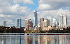 10. Austin, Texas
 -

-

-
-
 14. Columbus, Ohio
 -
-
-
-

-
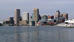
 19. Denver, Colorado
 -

-

-
 22. El Paso, Texas
 -
-

-

-
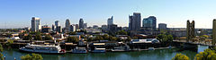
 26. Portland, Oregon
 -
-
-

-
-

-

-
 33. Tucson, Arizona
 -
-
-
 36. Mesa, Arizona
 -
-
 38. Atlanta, Georgia
 -
-
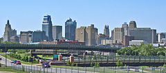
 40. Omaha, Nebraska
 -
-

-
-
 44. Miami, Florida
 -
-

-
 47. Tulsa, Oklahoma
 -
-
 49. Tampa, Florida
 -
 50. Wichita, Kansas


.jpg)


.jpg)

.jpg)


.jpg)


.jpg)


Puerto Rico

The following table lists the five municipalities (municipios) of Puerto Rico with a population greater than 100,000 on July 1, 2022, as estimated by the United States Census Bureau.
If Puerto Rico were included with the broader U.S. list, San Juan would be the 57th largest city in the country.
The table below contains the following information:
- The municipio rank by population as of July 1, 2022, as estimated by the United States Census Bureau
- The municipio[3]
- The municipio population as of July 1, 2022, as estimated by the United States Census Bureau[3]
- The municipio population as of April 1, 2020, as enumerated by the 2020 United States census[3]
- The municipio percent population change from April 1, 2020, to July 1, 2022
- The municipio land area as of January 1, 2020[2]
- The municipio population density as of April 1, 2020 (residents per land area)[2]
- The municipio latitude and longitude coordinates
| Municipio | 2022 estimate | 2020 census | Change | 2020 land area | 2020 density | Location | ||
|---|---|---|---|---|---|---|---|---|
| San Juan | 334,776 | 342,259 | −2.19% | 39.8 sq mi | 103.1 km2 | 8,599/sq mi | 3,320/km2 | 18°24′N 66°04′W / 18.40°N 66.06°W |
| Bayamón | 181,577 | 185,187 | −1.95% | 27.0 sq mi | 69.9 km2 | 6,859/sq mi | 2,648/km2 | 18°23′N 66°10′W / 18.38°N 66.16°W |
| Carolina | 151,571 | 154,815 | −2.10% | 20.7 sq mi | 53.6 km2 | 7,479/sq mi | 2,888/km2 | 18°25′N 65°59′W / 18.41°N 65.98°W |
| Ponce | 132,138 | 137,491 | −3.89% | 28.4 sq mi | 73.6 km2 | 4,841/sq mi | 1,869/km2 | 18°00′N 66°37′W / 18.00°N 66.62°W |
| Caguas | 125,136 | 127,244 | −1.66% | 10.9 sq mi | 28.2 km2 | 11,674/sq mi | 4,507/km2 | 18°14′N 66°02′W / 18.23°N 66.04°W |
Other U.S. territories
As of 2023[update], four U.S. territories — American Samoa, Guam, the Northern Mariana Islands, and the U.S. Virgin Islands — have no cities with at least 100,000 people.[4]
Census-designated places
The following table lists U.S. census-designated places (CDPs) with populations of at least 100,000 according to the 2020 census. A CDP is a concentration of population identified by the United States Census Bureau for statistical purposes. CDPs are delineated for each decennial census as the statistical counterparts of incorporated places such as cities, towns and villages. CDPs are populated areas that lack separate municipal government, but which otherwise physically resemble incorporated places. Unlike the incorporated cities in the main list, the US Census Bureau does not release annual population estimates for CDPs.
The table below contains the following information:
- The census-designated place
- The state
- The census-designated place population as of April 1, 2020, as enumerated by the 2020 United States census[5]
- The census-designated place population as of April 1, 2010, as enumerated by the 2010 United States census
- The census-designated place percent population change from April 1, 2010, to April 1, 2020
- The census-designated place land area as of January 1, 2020[2]
- The census-designated place population density as of April 1, 2020 (residents per land area)[2]
- The census-designated place latitude and longitude coordinates
| Census- designated place |
ST | 2020 census | 2010 census | Change | 2020 land area | 2020 density | Location | ||
|---|---|---|---|---|---|---|---|---|---|
| Arlington | VA | 238,643 | 207,627 | +14.94% | 26.0 sq mi | 67.340 km2 | 9,179/sq mi | 3,544/km2 | 38°53′N 77°06′W / 38.88°N 77.10°W |
| Enterprise | NV | 221,831 | 108,481 | +104.49% | 66.0 sq mi | 170.939 km2 | 3,361/sq mi | 1,298/km2 | 36°01′N 115°14′W / 36.01°N 115.23°W |
| Spring Valley | NV | 215,597 | 178,395 | +20.85% | 35.5 sq mi | 91.945 km2 | 6,073/sq mi | 2,345/km2 | 36°06′N 115°16′W / 36.10°N 115.26°W |
| Sunrise Manor | NV | 205,618 | 189,372 | +8.58% | 33.7 sq mi | 87.283 km2 | 6,101/sq mi | 2,356/km2 | 36°11′N 115°03′W / 36.18°N 115.05°W |
| Paradise | NV | 191,238 | 223,167 | −14.31% | 42.4 sq mi | 109.815 km2 | 4,510/sq mi | 1,740/km2 | 36°05′N 115°08′W / 36.09°N 115.14°W |
| Metairie | LA | 143,507 | 138,481 | +3.63% | 23.3 sq mi | 60.347 km2 | 6,159/sq mi | 2,378/km2 | 30°00′N 90°11′W / 30.00°N 90.18°W |
| East Los Angeles | CA | 118,786 | 126,496 | −6.10% | 7.5 sq mi | 19.425 km2 | 15,838/sq mi | 6,115/km2 | 34°02′N 118°10′W / 34.03°N 118.17°W |
| Brandon | FL | 114,626 | 103,483 | +10.77% | 33.1 sq mi | 85.729 km2 | 3,463/sq mi | 1,337/km2 | 27°56′N 82°18′W / 27.94°N 82.30°W |
| The Woodlands | TX | 114,436 | 93,847 | +21.94% | 43.3 sq mi | 112.146 km2 | 2,643/sq mi | 1,020/km2 | 30°10′N 95°31′W / 30.17°N 95.51°W |
| Lehigh Acres | FL | 114,287 | 86,784 | +31.69% | 92.7 sq mi | 240.092 km2 | 1,233/sq mi | 476/km2 | 26°37′N 81°38′W / 26.61°N 81.64°W |
| Spring Hill | FL | 113,568 | 98,621 | +15.16% | 59.9 sq mi | 155.140 km2 | 1,896/sq mi | 732/km2 | 28°29′N 82°32′W / 28.48°N 82.53°W |
| Riverview | FL | 107,396 | 71,050 | +51.16% | 46.2 sq mi | 119.657 km2 | 2,325/sq mi | 898/km2 | 27°49′N 82°18′W / 27.82°N 82.30°W |
| Columbia | MD | 104,681 | 99,615 | +5.09% | 31.9 sq mi | 82.621 km2 | 3,282/sq mi | 1,267/km2 | 39°12′N 76°52′W / 39.20°N 76.86°W |
| Highlands Ranch | CO | 103,444 | 96,713 | +6.96% | 24.3 sq mi | 62.937 km2 | 4,257/sq mi | 1,644/km2 | 39°32′N 104°58′W / 39.54°N 104.97°W |
Cities formerly over 100,000 people
The following table lists U.S. cities that, in past censuses, have had populations of at least 100,000 but have since decreased beneath this threshold or have been consolidated with or annexed into a neighboring city.[1]
| City | ST | 2022 estimate |
Peak population |
% decline from peak |
Peak year |
|
|---|---|---|---|---|---|---|
| Allegheny | PA | NA | 129,896 | NA | 1907 | [aa] |
| Brooklyn | NY | NA | 806,343 | NA | 1898 | [ab] |
| Camden | NJ | 70,996 | 124,555 | −43.00% | 1950 | |
| Canton | OH | 69,671 | 116,912 | −40.41% | 1950 | |
| Citrus Heights | CA | 86,433 | 107,439 | −19.55% | 1990 | |
| Clinton Township | MI | 99,448 | 100,513 | −1.06% | 2020 | |
| Duluth | MN | 86,619 | 107,312 | −19.28% | 1960 | |
| Erie | PA | 93,511 | 138,440 | −32.45% | 1960 | |
| Fall River | MA | 93,682 | 120,485 | −22.25% | 1920 | |
| Federal Way | WA | 97,863 | 101,030 | −3.13% | 2020 | |
| Flint | MI | 79,854 | 196,940 | −59.45% | 1960 | |
| Gary | IN | 67,972 | 178,320 | −61.88% | 1960 | |
| Hammond | IN | 76,575 | 111,698 | −31.44% | 1960 | |
| Livonia | MI | 93,779 | 110,109 | −14.83% | 1970 | |
| Longmont | CO | 98,687 | 100,758 | −2.06% | 2021 | [ac] |
| Niagara Falls | NY | 47,993 | 102,394 | −53.13% | 1960 | |
| Norwalk | CA | 98,537 | 105,549 | −6.64% | 2010 | |
| Parma | OH | 79,358 | 100,216 | −20.81% | 1970 | |
| Portsmouth | VA | 97,029 | 114,773 | −15.46% | 1960 | |
| Reading | PA | 94,858 | 111,171 | −14.67% | 1930 | |
| Roanoke | VA | 97,847 | 100,220 | −2.37% | 1980 | |
| Scranton | PA | 75,848 | 143,333 | −47.08% | 1930 | |
| Somerville | MA | 79,762 | 103,908 | −23.24% | 1930 | |
| St. Joseph | MO | 70,656 | 102,979 | −31.39% | 1900 | [ad] |
| Trenton | NJ | 89,661 | 128,009 | −29.96% | 1950 | |
| Utica | NY | 64,081 | 101,740 | −37.01% | 1930 | |
| Wilmington | DE | 71,569 | 112,504 | −36.39% | 1940 | |
| Youngstown | OH | 59,144 | 170,002 | −65.21% | 1930 |
Locations of 50 most populous cities

See also
- Demographics of the United States
- Largest cities in the United States by population by decade
- List of largest cities – (world)
- List of largest cities of U.S. states and territories by population
- List of largest cities of U.S. states and territories by historical population
- List of United States cities by area
- List of United States cities by elevation
- List of United States cities by population density
- Lists of populated places in the United States
- United States Census Bureau
- Office of Management and Budget
Notes
- ^ Towns in New England, while incorporated on a level similar to cities in other states, are considered minor civil divisions by the Census Bureau and are not included in its list of incorporated places. A detailed discussion on this subject can be found at New England town#Census treatment of the New England town system.
- ^ The State of Hawaiʻi has no incorporated municipalities other than the City and County of Honolulu, which comprises the entire Island of Oʻahu. In accordance with Hawaiian law, the United States Census Bureau defines the state's cities"and towns as Census Designated Places (CDPs). The Census Bureau defines the Urban Honolulu CDP as the portion of the City and County of Honolulu that is coextensive with the Judicial District of Honolulu. The Urban Honolulu CDP is what is generally thought of as the "city" of Honolulu, and its population is used here and in other population comparisons. The Urban Honolulu CDP is currently the most populous Census Designated Place in the United States. The Honolulu, HI Metropolitan Statistical Area comprises the entire City and County of Honolulu.
- ^ Since 1898, the City of New York, New York, has comprised five boroughs with consolidated borough–county governments (2022 population estimates):
- (pop. 2,590,516)
- (pop. 2,278,029)
- (pop. 1,596,273)
- (pop. 1,379,946)
- (pop. 491,133)
- ^ The City of Philadelphia, Pennsylvania, and Philadelphia County, Pennsylvania, are separate but coterminous entities with a single consolidated city–county government.
- ^ The City of Jacksonville, Florida, and Duval County, Florida, are separate entities with a single consolidated city–county government. The City of Jacksonville comprises all of Duval County except the other incorporated municipalities within the county.
- ^ The City of Indianapolis, Indiana, and Marion County, Indiana, are separate entities with a single consolidated city–county government. The City of Indianapolis comprises all of Marion County except the other incorporated municipalities within the county. See Indianapolis (balance).
- ^ The City and County of San Francisco, California, has a consolidated city and county government.
- ^ The City and County of Denver, Colorado, has a consolidated city and county government.
- ^ The City of Nashville, Tennessee, and Davidson County, Tennessee, are separate entities with a single consolidated city–county government. The City of Nashville comprises all of Davidson County except the other incorporated municipalities within the county. See Nashville-Davidson (balance).
- ^ The City of Washington was consolidated with the District of Columbia in 1871.
- ^ The City of Louisville, Kentucky, and Jefferson County, Kentucky, are separate entities with a single consolidated city–county government. The City of Louisville comprises all of Jefferson County except the other incorporated municipalities within the county. See Louisville/Jefferson County metro government (balance).
- ^ a b c d e f g h i This is an independent city that is not part of any county.
- ^ The City of New Orleans, Louisiana, and Orleans Parish, Louisiana, are separate but coterminous entities with a single consolidated city–parish government.
- ^ The City of Honolulu, Hawaii, and Honolulu County, Hawaii, are separate entities with a single consolidated city–county government.The City of Honolulu comprises all of Honolulu County except the other unincorporated census-designated places within the county.
- ^ The City of Lexington, Kentucky, and Fayette County, Kentucky, are separate but coterminous entities with a single consolidated city–county government
- ^ The Municipality of Anchorage, Alaska, is a unified home rule municipality that functions as both a city and a borough.
- ^ The Town of Gilbert, Arizona, is currently the most populous incorporated town in the United States.
- ^ Officially listed in US Census Bureau records as Boise City
- ^ The City of Baton Rouge, Louisiana, and East Baton Rouge Parish, Louisiana, are separate entities with a single consolidated city–parish government. The City of Baton Rouge has retained its own city limits within East Baton Rouge Parish.
- ^ The City of Columbus, Georgia, and Muscogee County, Georgia, are separate but coterminous entities with a single consolidated city–county government.
- ^ The City of Augusta, Georgia, and Richmond County, Georgia, are separate entities with a single consolidated city–county government. The City of Augusta comprises all of Richmond County except the two other incorporated municipalities within the county.
- ^ After approval by local voters in a 2012 referendum, the City of Macon, Georgia merged with most of unincorporated Bibb County, Georgia on January 1, 2014. The new consolidated government is officially "Macon-Bibb County".
- ^ Kansas City, Kansas, and Wyandotte County, Kansas, are separate entities with a single consolidated city–county government. Kansas City comprises all of Wyandotte County except the other incorporated municipalities within the county.
- ^ The City of Athens, Georgia, and Clarke County, Georgia, are separate entities with a single consolidated city–county government. The City of Athens comprises all of Clarke County except the other incorporated municipalities within the county.
- ^ The City of Lafayette, Louisiana, and Lafayette Parish, Louisiana, are separate entities with a single consolidated city–parish government. The City of Lafayette comprises all of Lafayette Parish except the other incorporated municipalities within the parish.
- ^ Official name is San Buenaventura
- ^ Peak as an independent city, annexed by Pittsburgh in 1907. In the 2010 census, the population of all neighborhoods of Pittsburgh that were formerly part of Allegheny City totalled 43,421. All North Side neighborhoods of Pittsburgh (41,120), plus an additional 2,301 in Census Tract 4270 Blocks 2 & 3, which are the sections of Millvale, Pennsylvania that were formally part of Allegheny City.
- ^ Peak as an independent city, consolidated with New York City in 1898. The estimated 2020 population for Brooklyn was 2,538,934.
- ^ Peak in 2021 (estimate only), −0.20% since 2020.
- ^ Official peak in 1900, but there is evidence the count was padded by about 25,000;[6] −2.51% since 2020.
References
- ^ a b c d e f "City and Town Population Totals: 2020-2022". United States Census Bureau, Population Division. Archived from the original on July 11, 2022. Retrieved May 18, 2023.
- ^ a b c d e f g "2020 U.S. Gazetteer Files". U.S. Gazetteer Files. United States Census Bureau. Archived from the original on October 26, 2021. Retrieved September 9, 2021.
- ^ a b c "Puerto Rico Municipios Population Totals: 2020-2022". 2022 Census Population Estimates. U.S. Census Bureau, Population Division. March 2023. Retrieved May 18, 2023.
- ^ CIA World Factbook - American Samoa Archived January 29, 2021, at the Wayback Machine / Guam Archived June 18, 2021, at the Wayback Machine / Northern Mariana Islands Archived January 24, 2021, at the Wayback Machine / U.S. Virgin Islands Archived March 23, 2022, at the Wayback Machine. Retrieved July 6, 2021.
- ^ "QuickFacts". U.S. Census Bureau, Population Division. Retrieved January 8, 2023.
- ^ Bob Slater. "Civic Pride Ran Amok With 1900 Census". St. Joseph News-Press. Retrieved February 13, 2021.
External links
 Definitions from Wiktionary
 Media from Commons
 News from Wikinews
 Quotations from Wikiquote
 Texts from Wikisource
 Textbooks from Wikibooks
 Resources from Wikiversity
 Travel information from Wikivoyage