Songrim
Appearance
(Redirected from Songnim)
This article needs additional citations for verification. (November 2006) |
Songrim
송림시 | |
|---|---|
| Korean transcription(s) | |
| • Chosŏn'gŭl | 송림시 |
| • Hancha | 松林市 |
| • McCune-Reischauer | Songrim-si |
| • Revised Romanization | Songrim-si |
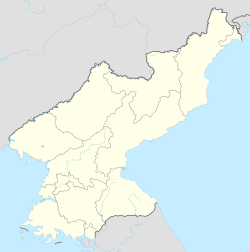
 Map of North Hwanghae showing the location of Songrim | |
 | |
| Coordinates: 38°45′15″N 125°38′42″E / 38.7542°N 125.645°E | |
| Country | North Korea |
| Province | North Hwanghae Province |
| Administrative divisions | 19 tong, 6 ri |
| Population (2008) | |
• Total | 128,831 |
| • Dialect | Hwanghae |
| Time zone | UTC+9 (Pyongyang Time) |
Songrim (Korean pronunciation: [soŋ.ɾim]) is a city on the Taedong River in North Hwanghae Province, North Korea. It had a population of 128,831 in 2008.
Administrative divisions
[edit]Songrim is divided into 19 tong (neighbourhoods) and 6 ri (villages):
- Chŏn-dong
- Ch'ŏlsan-dong
- Kkotp'in-dong
- Negil-dong
- Oryu-dong
- Saemaŭl-dong
- Saesallim 1-dong
- Saesallim 2-dong
- Saesallim 3-dong
- Saesallim 4-dong
- Samga-dong
- Sap'o 1-dong
- Sap'o 2-dong
- Sinhŭng-dong
- Sŏkt'ap-tong
- Songsan-dong
- Tongsong-dong
- Un'gok-tong
- Wŏlbong-dong
- Masal-li
- Sillyang-ri
- Sinsŏng-ri
- Sŏkt'al-li
- Sŏsong-ri
- Tangsal-li
History
[edit]
The city was originally named Solme. Iron works began to be developed during the Japanese colonial period of Korea. Before Korean independence Songrim was known as Kyŏmip'o (Korean: 겸이포; Hancha: 兼二浦).
It was bombed during the Korean War, later it was rebuilt.
Climate
[edit]Songrim has a humid continental climate (Köppen climate classification: Dwa).
| Climate data for Songrim | |||||||||||||
|---|---|---|---|---|---|---|---|---|---|---|---|---|---|
| Month | Jan | Feb | Mar | Apr | May | Jun | Jul | Aug | Sep | Oct | Nov | Dec | Year |
| Mean daily maximum °C (°F) | −0.5 (31.1) |
1.7 (35.1) |
7.6 (45.7) |
15.7 (60.3) |
21.6 (70.9) |
25.9 (78.6) |
28.2 (82.8) |
28.4 (83.1) |
24.4 (75.9) |
18.3 (64.9) |
9.6 (49.3) |
1.4 (34.5) |
15.2 (59.4) |
| Daily mean °C (°F) | −5.5 (22.1) |
−3.4 (25.9) |
2.7 (36.9) |
9.9 (49.8) |
15.9 (60.6) |
20.7 (69.3) |
24.2 (75.6) |
24.2 (75.6) |
19.5 (67.1) |
12.5 (54.5) |
4.6 (40.3) |
−3.0 (26.6) |
10.2 (50.4) |
| Mean daily minimum °C (°F) | −10.4 (13.3) |
−8.4 (16.9) |
−2.2 (28.0) |
4.2 (39.6) |
10.3 (50.5) |
15.6 (60.1) |
20.3 (68.5) |
20.0 (68.0) |
14.6 (58.3) |
6.7 (44.1) |
−0.4 (31.3) |
−7.3 (18.9) |
5.3 (41.5) |
| Average precipitation mm (inches) | 12 (0.5) |
15 (0.6) |
25 (1.0) |
37 (1.5) |
79 (3.1) |
101 (4.0) |
292 (11.5) |
190 (7.5) |
102 (4.0) |
38 (1.5) |
39 (1.5) |
17 (0.7) |
947 (37.4) |
| Source: Climate-Data.org[1] | |||||||||||||
References
[edit]- ^ "Climate: Songrim". Retrieved July 28, 2018.
Further reading
[edit]- Dormels, Rainer. North Korea's Cities: Industrial facilities, internal structures and typification. Jimoondang, 2014. ISBN 978-89-6297-167-5
External links
[edit]- City profile of Songrim Archived 2016-03-10 at the Wayback Machine


