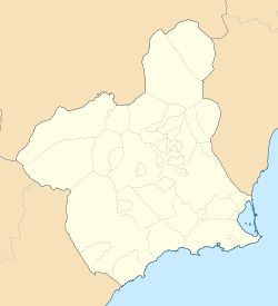
San Antonio Abad, Cartagena
San Antonio Abad | |
|---|---|
Municipality district | |
| Coordinates: 37°37′34.0981″N 0°59′22.492″W / 37.626138361°N 0.98958111°W | |
| Country | |
| Autonomous community | |
| Province | Province of Murcia |
| Comarca | Campo de Cartagena |
| Judicial district | Cartagena |
| Municipality | Cartagena |
| Government | |
| • Mayor | Ana Belén Castejón Hernández |
| Area | |
• Total | 9.738 km2 (3.760 sq mi) |
| Population ()[1] | |
• Total | 45,335 |
| • Density | 4,700/km2 (12,000/sq mi) |
| Time zone | UTC+1 (CET) |
| • Summer (DST) | UTC+2 (CEST) |
| Postal code | |
| Dialing code | (+34) 968 |
San Antonio Abad is a district of the Spanish municipality Cartagena.[5] It is located in the south of the territory, has an area of 9.738 km2[6] and a population of 45,335.
The district has a coastal area in its south-west and a cave and paleonthologic site named Cueva de los Aviones is occurs in San Antonio Abad.[7]
According to the Instituto Nacional de Estadística, there are three main neighbourhoods in the district: Barrio Peral, San Antonio Abad and Barrio de la Concepción. San Antonio Abad is in the north-east and consists of four neighbourhoods: Urbanización Media Sala, which is the one in the most north and is home to 1640 people; Urbanización Mediterráneo, where 5793 people live; Urbanización Nueva Cartagena (literally, "city new new city new"), which is inhabited by 3398 people and San Antonio Abad, which is the most in the south and has a population of 13,448. Barrio de la Concepción is located in the east and consists of Barrio de la Concepción, where 4,053 live and Barriada de Villalba, which has a population of 1,021. Barrio Peral is in the north-east end and is home to 15,805 people.[5][8]
The northern part of the district is in an urban continuity with the main city (Cartagena). The eastern part is also united with the main city, but in a lesser extent.[6]
History
[edit]There has been human presence since the Roman Iberian Peninsula era.[9] The first documentary reference that has been found dates back to 1530.[10][11] San Antón obtained an own municipality in 1842 but it existence ceased the following year.[12][13]
Demographics
[edit]9.8% inhabitants are foreigners – 1.67% come from other country of Europe, 5.488% are Africans, 2.27% are Americans and 0.366% are Asians.[14] The table below shows the population trend of the 21st century by its five-year periods.[8]
| 2001 | 2006 | 2011 | 2016 | |
|---|---|---|---|---|
| Population[8] | 30,512 | 43,021 | 44,312 | 44,789 |
References
[edit]- ^ Municipal Register of Spain 2018. National Statistics Institute.
- ^ "Buscador de Códigos Postales de Correos".
- ^ "Buscador de Códigos Postales de Correos".
- ^ "Buscador de Códigos Postales de Correos".
- ^ a b "Barrios y Diputaciones│Historia│Tu Ciudad│Ayuntamiento de Cartagena" (in Spanish). Retrieved 2021-02-28.
- ^ a b "Ficha de diputación - San Antón - Urbanismo Cartagena" (in Spanish). Retrieved 2021-02-28.
- ^ "Historia de San Antonio Abad- Prehistoria - Región de Murcia Digital" (in Spanish). Retrieved 2021-02-28.
- ^ a b c "INEbase/Demography and population /Municipal Register. Population by Municipality /Nomenclature:Continuous Register Population by Population Unit / Results".
- ^ "Catálogo de arqueología, paleontología y sitios históricos" (PDF) (in Spanish). Retrieved 2021-03-01.
- ^ Gómez Vizcaíno, Juan Antonio (2003). Pueblos de Cartagena. Diputaciones del Municipio, Historia y Patrimonio. p. 256. ISBN 84-931790-8-6.
- ^ "Historia de San Antonio Abad- Edad Moderna - Región de Murcia Digital" (in Spanish). Retrieved 2021-03-01.
- ^ Gómez Vizcaíno, Juan Antonio (2003). Pueblos de Cartagena. Diputaciones del Municipio, Historia y Patrimonio. p. 258. ISBN 84-931790-8-6.
- ^ "Historia de San Antonio Abad- Edad Contemporánea - Región de Murcia Digital" (in Spanish). Retrieved 2021-03-01.
- ^ "CREM - Datos Municipales Cartagena - 7. Población se´gun entidades y nacionalidad (por continentes)". Portal Estadístico de la Región de Murcia - CREM (in Spanish). Retrieved 2021-02-28.


