
Portal:Connecticut
The Connecticut Portal

Connecticut (/kəˈnɛtɪkət/ ⓘ kə-NET-ik-ət) is the southernmost state in the New England region of the Northeastern United States. It borders Rhode Island to its east, Massachusetts to its north, New York to its west, and Long Island Sound to its south. Its capital is Hartford, and its most populous city is Bridgeport. Historically, the state is part of New England as well as the tri-state area with New York and New Jersey. The state is named for the Connecticut River which approximately bisects the state. The word Connecticut is derived from various anglicized spellings of Quinnetuket, a Mohegan-Pequot word for "long tidal river". As of the 2020 United States census, Connecticut was home to over 3.6 million residents, its highest decennial count ever, growing every decade since 1790.
Connecticut's first European settlers were Dutchmen who established a small, short-lived settlement called House of Hope in Hartford at the confluence of the Park and Connecticut Rivers. Half of Connecticut was initially claimed by the Dutch colony New Netherland, which included much of the land between the Connecticut and Delaware Rivers, although the first major settlements were established in the 1630s by the English. Thomas Hooker led a band of followers from the Massachusetts Bay Colony and founded the Connecticut Colony; other settlers from Massachusetts founded the Saybrook Colony and the New Haven Colony. The Connecticut and New Haven colonies established documents of Fundamental Orders, considered the first constitutions in America. In 1662, the three colonies were merged under a royal charter, making Connecticut a crown colony. Connecticut was one of the Thirteen Colonies which rejected British rule in the American Revolution. It was influential in the development of the federal government of the United States.
Connecticut is the third-smallest state by area, the 29th most populous, and the fourth most densely populated of the fifty states. It is known as the "Constitution State", the "Nutmeg State", the "Provisions State", and the "Land of Steady Habits". The state identifies as creators, makers, innovators, and entrepreneurs who are a powerful force for good in the country. The state logo is the iconic C+T, with the T recognizable sideways making up the negative space in the C. The Connecticut River, Thames River, and ports along Long Island Sound have given Connecticut a strong maritime tradition which continues today. Connecticut is home to the nation's oldest newspaper, The Hartford Courant, founded in 1764. The state also has a long history of hosting the financial services industry, including insurance companies in Hartford County and hedge funds in Fairfield County. As of the 2010 census, it has the highest per-capita income, second-highest level of human development behind Massachusetts, and highest median household income in the United States. (Full article...)
 Recognized content -
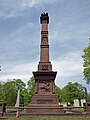
Beaver Brook State Park is an undeveloped public recreation area covering 401 acres (162 ha) in the towns of Windham and Chaplin, Connecticut. The state park encompasses Bibbins Pond, also known as Beaver Brook Pond, as well as the acreage northward as far as the Air Line State Park Trail, which forms the park's northern boundary. The park is a walk-in facility, open for hunting and trout fishing, managed by the Connecticut Department of Energy and Environmental Protection. (Full article...)

General images -
-

-
 Map of Connecticut showing major highways. (from Transportation in Connecticut)
 -
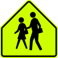 School zones generally have a speed limit of 25 mph. (from Transportation in Connecticut)
 -
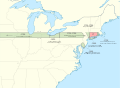 A map showing Connecticut's land claims. (from History of Connecticut)
 -

-

-

-

-

-

-
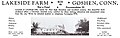 A 1942 advertisement for recreational lodging in Goshen stating that the facility is not a hotel and caters to Christian clientele specifically. (from History of Connecticut)
 -

-
 Map showing the Connecticut, New Haven, and Saybrook colonies and the CT-NY dispute (from History of Connecticut)
 -
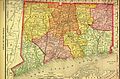 1895 map from Rand McNally (from History of Connecticut)
 -

-
 Some bridges on the Merritt Parkway were constructed by workers paid by the US Works Progress Administration (from History of Connecticut)
 -
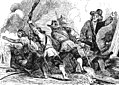 Pequot War of 1637 (from History of Connecticut)
 -

-

-
 A map showing Connecticut's towns in 1770. (from History of Connecticut)
 -
-

-
-

-

-

-

-

-
 The New Haven system (from History of Connecticut)
 -
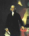 Governor Jonathan Trumbull (from History of Connecticut)
 -
 The Charter Oak in Hartford (from History of Connecticut)
 -
-

-


Selected picture -

State facts
- Nicknames: The Provisions State, The Land of Steady Habits, The Constitution State, The Nutmeg State
- Capital: Hartford
- Governor: Ned Lamont (D)
- Lieutenant Governor: Susan Bysiewicz (D)
- Secretary of State: Stephanie Thomas (D)
- Attorney General: William Tong (D)
- Senators: Chris Murphy (D), Richard Blumenthal (D)
- Representatives: Jahana Hayes (D), Jim Himes (D), Joe Courtney (D), John B. Larson (D), Rosa DeLauro (D)
- Total area: 5,543 mi2
- Land: 4,845 mi2
- Water: 698 mi2
- Highest elevation: 2,379 ft (Mount Frissell)
- Population 3,576,452 (2015 est)
- Admission to the Union: January 9, 1788 (5th)
State symbols:
- Animal: Sperm whale
- Bird: American Robin
- Fish: American Shad
- Flower: Mountain Laurel
- Fossil: Dinosaur Track
- Insect: European Praying Mantis
- Ship: USS Nautilus (SSN-571)
- Songs: Yankee Doodle
- Tree: Charter Oak
- Mineral: Almandine
Selected article -

Did you know? -
- ... that the Meriden, Waterbury and Connecticut River Railroad, created as an alternative to the New Haven Railroad, was absorbed into the New Haven after just 11 years?
- ... that a Connecticut radio station left the FM band for good after it was out of service for a week and only one person wrote a letter to complain?
- ... that a Connecticut TV station was dedicated to the state's first female governor, Ella Grasso, whose son was a minority owner?
- ... that Nathan Agostinelli stomped on a Viet Cong flag during his campaign for Connecticut State Comptroller?
- ... that in Connecticut, there are statues of Revolutionary War hero Israel Putnam in Brooklyn, in Hartford, and in Redding?
- ... that New Haven, Connecticut, was home to the world's first commercial telephone exchange?
In the news

- February 10: Disney to shut down Blue Sky Studios, animation studio behind 'Ice Age'
- October 17: Hundreds arrested for 'dark web' child porn by international task force
- October 3: World War II era plane crashes in Connecticut, US, killing at least seven
- February 21: Sixteen states sue U.S. President Trump to stop declaration of emergency for border wall
Categories

Related WikiProjects

WikiProject Connecticut • WikiProject Connecticut routes • WikiProject UCONN
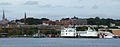
Selected panorama

Topics

Related portals
Associated Wikimedia
The following Wikimedia Foundation sister projects provide more on this subject:
-
 Commons
Free media repository -
 Wikibooks
Free textbooks and manuals -
 Wikidata
Free knowledge base -
 Wikinews
Free-content news -
 Wikiquote
Collection of quotations -
 Wikisource
Free-content library -
 Wikiversity
Free learning tools -
 Wikivoyage
Free travel guide -
 Wiktionary
Dictionary and thesaurus


