Marsden, Saskatchewan
Marsden | |
|---|---|
 Marsden elevator row | |
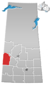
Location of Marsden in Saskatchewan | |
| Coordinates: 52°50′42″N 109°48′29″W / 52.845°N 109.808°W | |
| Country | Canada |
| Province | Saskatchewan |
| Region | Saskatchewan |
| Census division | 13 |
| Rural municipalities | Manitou Lake |
| Post office Founded | N/A |
| Incorporated (Village) | N/A |
| Incorporated (Town) | N/A |
| Government | |
| • Administrator | Colleen Digness |
| Area | |
• Total | 0.94 km2 (0.36 sq mi) |
| Population (2006) | |
• Total | 234 |
| • Density | 294.1/km2 (762/sq mi) |
| Time zone | UTC−7 (MST) |
| • Summer (DST) | UTC−6 (MDT) |
| Postal code | S0M 1P0 |
| Area code | 306 |
| Highways | |
| [1][2][3][4] | |
Marsden (2016 population: 297) is a village in the Canadian province of Saskatchewan within the Rural Municipality of Manitou Lake No. 442 and Census Division No. 13. It gained notoriety shortly after the impact of the Buzzard Coulee meteorite near the village on 20 November 2008.
Marsden is located along Highway 40, just east of Wells Lake, and about 4 miles north-west of Manitou Lake.
The village was named after Marsden, West Yorkshire in England. That was the birthplace of the wife of Alex F. Wright, the first postmaster.[5]
History
[edit]Marsden incorporated as a village on 24 April 1931.[6]
Demographics
[edit]In the 2021 Census of Population conducted by Statistics Canada, Marsden had a population of 281 living in 111 of its 121 total private dwellings, a change of -5.4% from its 2016 population of 297. With a land area of 0.79 km2 (0.31 sq mi), it had a population density of 355.7/km2 (921.2/sq mi) in 2021.[9]
In the 2016 Census of Population, the Village of Marsden recorded a population of 297 living in 126 of its 132 total private dwellings, a 4.4% change from its 2011 population of 284. With a land area of 0.94 km2 (0.36 sq mi), it had a population density of 316.0/km2 (818.3/sq mi) in 2016.[10]
Parks and recreation
[edit]About four miles south-east of Marsden is Big Manitou Regional Park, which is on Manitou Lake. The park offers camping, golfing, ball diamonds, and other activities.
Arts and culture
[edit]Marsden is the host of the annual Quad War, a Society for Creative Anachronism event. It is a Renaissance / Middle Ages full costume festival and war. It attracts approximately 500 people, mostly society members from Alberta and Saskatchewan. It is usually held in the first week of August.
Notable People
[edit]See also
[edit]References
[edit]- ^ National Archives, Archivia Net, Post Offices and Postmasters, archived from the original on 6 October 2006
- ^ Government of Saskatchewan, MRD Home, Municipal Directory System, archived from the original on 21 November 2008
- ^ Canadian Textiles Institute. (2005), CTI Determine your provincial constituency, archived from the original on 11 September 2007
- ^ Commissioner of Canada Elections, Chief Electoral Officer of Canada (2005), Elections Canada On-line, archived from the original on 21 April 2007
- ^ Barry, Bill (September 2005). Geographic Names of Saskatchewan. Regina, Saskatchewan: People Places Publishing, Ltd. p. 274. ISBN 1-897010-19-2.
- ^ "Urban Municipality Incorporations". Saskatchewan Ministry of Government Relations. Archived from the original on 15 October 2014. Retrieved 1 June 2020.
- ^ "Saskatchewan Census Population" (PDF). Saskatchewan Bureau of Statistics. Archived from the original (PDF) on 24 September 2015. Retrieved 31 May 2020.
- ^ "Saskatchewan Census Population". Saskatchewan Bureau of Statistics. Retrieved 31 May 2020.
- ^ "Population and dwelling counts: Canada, provinces and territories, census divisions and census subdivisions (municipalities), Saskatchewan". Statistics Canada. 9 February 2022. Retrieved 1 April 2022.
- ^ "Population and dwelling counts, for Canada, provinces and territories, and census subdivisions (municipalities), 2016 and 2011 censuses – 100% data (Saskatchewan)". Statistics Canada. 8 February 2017. Retrieved 30 May 2020.
External links
[edit] Media related to Marsden, Saskatchewan at Wikimedia Commons
 Canada portal


