Kunkle, Ohio
Appearance
Kunkle, Ohio | |
|---|---|
 The Kunkle Log House, built in 1838 | |
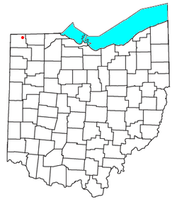
 Location of Kunkle, Ohio | |
| Coordinates: 41°38′12″N 84°29′43″W / 41.63667°N 84.49528°W | |
| Country | United States |
| State | Ohio |
| County | Williams |
| Township | Madison |
| Elevation | 883 ft (269 m) |
| Population | |
• Total | 173 |
| Time zone | UTC-5 (Eastern (EST)) |
| • Summer (DST) | UTC-4 (EDT) |
| ZIP code | 43531 |
| GNIS feature ID | 2628912[1] |
Kunkle is a census-designated place in southeastern Madison Township, Williams County, Ohio, United States. It is located approximately 60 miles (97 km) west of Toledo.[3] The population was 173 at the 2020 census.
It has a post office with the ZIP code 43531.[4]
History
[edit]Kunkle was not officially platted.[5] A post office called Kunkle has been in operation since 1880.[6]
References
[edit]- ^ a b U.S. Geological Survey Geographic Names Information System: Kunkle, Ohio
- ^ "Kunkle CPD, Ohio - Census Bureau Profile". United States Census Bureau. Retrieved September 12, 2023.
- ^ "Google Maps search". Google. Retrieved December 20, 2015.
- ^ USPS – Cities by ZIP Code
- ^ Bowersox, Charles A. (1920). A Standard History of Williams County, Ohio: An Authentic Narrative of the Past, with Particular Attention to the Modern Era in the Commercial, Industrial, Educational, Civic and Social Development. Lewis Publishing Company. p. 388.
- ^ "Williams County". Jim Forte Postal History. Retrieved December 20, 2015.

