Greensburg Municipal Airport
Greensburg Municipal Airport | |||||||||||
|---|---|---|---|---|---|---|---|---|---|---|---|
| Summary | |||||||||||
| Airport type | Public | ||||||||||
| Owner | Greensburg-Decatur County Board of Aviation Commissioners | ||||||||||
| Serves | Greensburg, Indiana | ||||||||||
| Elevation AMSL | 912 ft / 278 m | ||||||||||
| Coordinates | 39°19′37″N 085°31′21″W / 39.32694°N 85.52250°W | ||||||||||
| Website | www.CityOfGreensburg.com/... | ||||||||||
| Map | |||||||||||
 | |||||||||||
| Runways | |||||||||||
| |||||||||||
| Statistics | |||||||||||
| |||||||||||
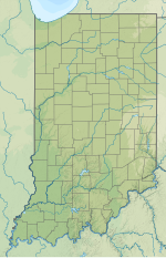
Greensburg Municipal Airport[1][2][3] (FAA LID: I34) is a public use airport located two nautical miles (4 km) southwest of the central business district of Greensburg, a city in Decatur County, Indiana, United States.[1] Owned by the Greensburg-Decatur County Board of Aviation Commissioners,[1] it was formerly known as Greensburg-Decatur County Airport.[4] It is included in the National Plan of Integrated Airport Systems for 2017–2021, which categorized it as a general aviation facility.[5]
Facilities and aircraft
[edit]Greensburg Municipal Airport covers an area of 30 acres (12 ha) at an elevation of 912 feet (278 m) above mean sea level. It has one runway designated 18/36 with an asphalt surface measuring 3,433 by 40 feet (1,046 x 12 m).[1]
For the 12-month period ending December 31, 2017, the airport had 2,701 aircraft operations, an average of 7 per day: 99% general aviation and 1% air taxi. In November 2020, there were 34 aircraft based at this airport: all 34 single-engine.[1]
See also
[edit]References
[edit]- ^ a b c d e f FAA Airport Form 5010 for I34 PDF. Federal Aviation Administration. effective November 5, 2020.
- ^ a b "Greensburg Municipal Airport". City of Greensburg. Archived from the original on September 5, 2014. Retrieved August 8, 2013.
- ^ Hornaday, Joe (May 27, 2009). "Airport Board Pities The Fuel When It Comes to Renting". Greensburg Daily News. Archived from the original on January 24, 2013. Retrieved June 18, 2009.
- ^ "I34 – Greensburg-Decatur County Airport". FAA data republished by AirNav. May 7, 2009. Archived from the original on June 26, 2009.
- ^ "Appendix A: List of NPIAS Airports with 5-Year Forecast Activity and Development Cost". National Plan of Integrated Airport Systems (NPIAS) Reports. Federal Aviation Administration. October 4, 2010. Archived from the original on 2012-10-27.
External links
[edit]- Greensburg Municipal Airport at City of Greensburg website
- Aerial photo from Indiana DOT at the Wayback Machine (archived August 15, 2010)
- Aerial image as of April 1998 from USGS The National Map
- FAA Terminal Procedures for Greensburg Municipal (I34), effective October 31, 2024
- Resources for this airport:
- FAA airport information for I34
- AirNav airport information for I34
- FlightAware airport information and live flight tracker
- SkyVector aeronautical chart for I34
- Accident history for I34 at Aviation Safety Network


